 Antiques (CA)
-
$563.08 CAD

 1907-10 George Philip Large Early London Underground Map
-
$54.00 CAD
 Vintage 1904 LONDON ENGLAND Map 11"x14" ~ Old Antique Original BATTERSEA CHELSEA
-
$49.13 CAD
 Vintage 1902 LONDON ENGLAND Map 11"x14" ~ Old Antique Original KENSINGTON PALACE
-
$63.83 CAD
 Vintage 1892 LONDON ENGLAND Map 22"x14" Old Antique Original HYDE PARK
-
$68.24 CAD
 5 Antique 1920’s/1940's LONDON ENGLAND MAPS/GUIDE BOOKS/ATLAS Paper/Cloth Travel
-
$56.95 CAD
 Vintage 1901 LONDON ENGLAND UK Map 11"x14" ~ Old Antique Original REGENTS PARK
-
$34.13 CAD
 Bartholomews Historical Map Of London Cloth + Geographia LONDON Street Plan
-
$68.74 CAD
 Vintage 1900 ENGLAND & WALES Map 14"x22" Old Antique Original BRITAIN UK LONDON
-
$34.92 CAD
 VINTAGE Geographer's A to Z; Atlas of London and Suburbs with House Numbers
-
$47.91 CAD
 1904 ANTIQUE MAP OF LONDON DOWNTOWN / ENGLAND / VERSO EDINBURGH DUBLIN IRELAND
-
$38.28 CAD
 Vintage 1901 ENGLAND & WALES Map 14"x22" Old Antique Original CARDIFF LONDON
-
$27.29 CAD
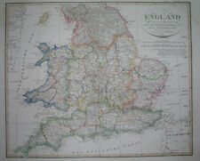
 1830 Original Sidney Hall Map - ENGLAND & WALES - Double-Sheet - Great Detail
-
$38.18 CAD
 Vintage framed Hand Stitched Map Of England And Wales 20.5" x 16.5"
-
$307.14 CAD
 CHRISTOPHER WRENS PLAN FOR REBUILDING LONDON AFTER the CONFLAGRATION of 1666 MAP
-
$77.59 CAD
 Vintage 1900 LONDON ENGLAND Map 11"x14" ~ Old Antique Original BUCKINGHAM PALACE
-
$136.50 CAD
 Antique Johnson's Map Of England and Wales 1863 Civil War Era Old Map
-
$29.17 CAD
 1931 VINTAGE MAP OF ENGLAND CORNWALL MIDLANDS LONDON / WALES / GREAT BRITAIN
-
$46.37 CAD
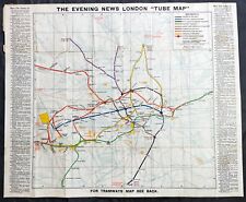
 1888 ANTIQUE MAP LONDON TUBE RAILWAYS ENGLAND DUBLIN IRELAND EDINBURGH SCOTLAND
-
$44.17 CAD
 Vintage 1900 ENGLAND WALES Map 11"x14" ~ Old Antique Original CAMBRIDGE LONDON
-
$16.38 CAD
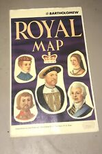 John Bartholomew Royal Map of England United Kingdom Scotland Kings and Queens
-
$57.33 CAD
 Antique Map - South London in 1813
-
$34.34 CAD
 Vintage 1902 ENGLAND & WALES Map 11"x14" ~ Old Antique Original LEEDS LINCOLN
-
$24.50 CAD
 1937 Vintage LONDON Street Map Black & White City Map of London England 9739
-
$63.83 CAD
 Vintage 1900 ENGLAND & WALES Map 14"x22" ~ Old Antique Original UNITED KINGDOM
-
$23.42 CAD
 Vintage 1902 ENGLAND & WALES Map 11"x14" ~ Old Antique Original CAMBRIDGE OXFORD
-
$8.18 CAD
 Vintage 1940 World Atlas City Map of Central London, England World War WWII OLD
-
$604.31 CAD
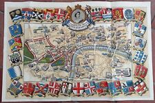 1953 Historic Queen Elizabeth II Royal Coronation Route Map London Pictorial
-
$8.18 CAD
 Vintage 2 Pg 1924 Post WWI B&W City Map London England & Liverpool England L@@K!
-
$156.98 CAD
 1920s England Motor Tour Map Wales Great Britain Driving Car Cars Auto Road Map
-
$120.11 CAD
 1756 Maitland Antique Print of Bridewell Palace, London, England Henry VIII
-
$23.53 CAD
 Vintage 1901 ENGLAND WALES Map 11"x14" ~ Old Antique Original CARDIFF OXFORD
-
$65.51 CAD
 1796 Blondeau Map England Wales London Bristol Oxford Salisbury Manchester
-
$29.01 CAD
 Ordinance Survey 1/4 Inch Map of Great Britain 1946 England South-West Sheet 10
-
$25.53 CAD
 1895 Original Color Map Europe and South America Historic 11 x 14 Map
-
$71.65 CAD
 1823 ORIGINAL MAP UNITED KINGDOM ENGLAND WALES LONDON CAMBRIDGE LANCASTER YORK
-
$23.21 CAD
 Lot of 2 Antique Maps Americana Co 1904 England & Wales And London
-
$38.22 CAD
 1877 Migeon Map - British Isles Great Britain England Scotland Ireland London UK
-
$21.83 CAD
 1863 Cornell Map - British Isles England Wales Scotland Ireland London Dublin UK
-
$5.19 CAD
 Historical Map Of London Map Drawn By Leslie Bullock
-
$43.67 CAD
 1830 Nathan Hale Map England & Wales London Bristol Oxford Salisbury Manchester
-
$27.29 CAD
 1875 Petermann Map - North Sea - Great Britain England Ireland Scotland London
-
$8.18 CAD
 Vintage 1943 Atlas Map World War WWII Era England, Wales & Scotland London Inset
-
$341.26 CAD
 BACON'S LARGE ANTIQUE MAP OF LONDON & SUBURBS c. 1900-1910
-
$13.64 CAD
 1880 Petermann Map England Wales Great Britain London Liverpool Oxford Lands End
-
$21.83 CAD
 1921 Johnston Map Wales Bristol Anglesey Cardiff Pembroke Glamorgan - Dexter Ad
-
$25.94 CAD
 LONDON Vicinity Map 1897 England Original
-
$32.75 CAD
 1846 Bocage & Vuillemin Map British Isles England Wales Scotland Ireland London
-
$27.29 CAD
 1921 Johnston Map England & Wales London Liverpool Bath Cornwall Bristol Dexter
-
$31.26 CAD
 VINTAGE BACON'S ATLAS OF LONDON FIRST PRINT 1959 ENLARGED EDITION RARE
-
$170.62 CAD
 Original c 1870 WH Smith Linen Backed Hand Colored Environs of London Map
-
$65.51 CAD
 1834 Carey Map England & Wales London Bristol Liverpool Oxford Canterbury Bath
-
$32.75 CAD
 1886 Tunison Map England Wales London Salisbury Liverpool Bristol Cardiff Thames
-
$271.64 CAD
 England & Wales 1780s antique map by Carington Bowles - Correct Guide
-
$43.67 CAD
 1874 Colton Map England & Wales London Liverpool Lands End Bristol Cardif Bath
-
$27.29 CAD
 1906 Johnston Map South England & Wales London Thames English Channel Islands UK
-
$21.83 CAD
 LARGE ANTIQUE 1880 ENGLAND WALES COUNTY BOROUGH HANDCOLORED MAP LONDON MARITIME
-
$341.26 CAD
 1828 England & Ireland full color Brue map 26.5" x 21" Rare Antique Original
-
$38.22 CAD
 1830 Nathan Hale Map England Wales London Liverpool Oxford Cornwall Bristol UK
-
$61.43 CAD
 PICTURE MAP OF LONDON. "Geographica" circa 1920. Linen backed.
-
$99.30 CAD
 1891 VICTORIAN MAP STREET PLAN LONDON ALEXANDRA PALACE & PARK FORTISGREEN
-
$34.11 CAD
 A to Z Motorist's Map - Central London - Geographers' - One-Way Streets - Park
-
$341.26 CAD
 Antique Colton's Map Atlas Environs of London 1855 United Kingdom England
-
$34.06 CAD
 1920s Philips Authentic England & Wales Map, United Kingdom Great Britain Roads
-
$40.88 CAD
 1835 Hand Colored Map of Westminster, London Showing the Extent of 1222 In Blue
-
$99.77 CAD
 1891 VICTORIAN MAP STREET PLAN LONDON SHOOTERS HILL ROYAL MILITARY ACADEMY
-
$27.29 CAD
 1707 Pieter Van Der Aa Limited Edition Map England River Thames London 292/400
-
$99.77 CAD
 1891 VICTORIAN MAP STREET PLAN LONDON EPPING FOREST THEYDON BOIS WINDSOR PARK
-
$99.30 CAD
 1891 VICTORIAN MAP STREET PLAN ENVIRONS OF LONDON WOOLWICH BROMLEY STAINES
-
$99.77 CAD
 1891 VICTORIAN MAP STREET PLAN LONDON RAILWAY GREAT NORTHERN WESTERN MIDLAND
-
$99.77 CAD
 1891 VICTORIAN MAP STREET PLAN LONDON BLACKHEATH LEE GREEN MORDEN COLLEGE
-
$99.30 CAD
 1891 VICTORIAN MAP STREET PLAN LONDON STREATHAM HILL HOSPITAL TOOTING COMMON
-
$99.30 CAD
 1891 VICTORIAN MAP STREET PLAN LONDON ALBERT DOCK BECKTON GAS WORKS WOOLWICH
-
$99.77 CAD
 1891 VICTORIAN MAP STREET PLAN LONDON INDEX ~ WEST HAM PECKHAM GREENWICH HOXTON
-
$99.30 CAD
 1891 VICTORIAN MAP STREET PLAN LONDON DUNTS HILL GARRATT COUNTY LUNATIC ASYLUM
-
$150.66 CAD
 c1900 MAP STREET PLAN LONDON GREENWICH ROYAL HOSPITAL OBSERVATORY UNION WORKS
-
$99.30 CAD
 1891 VICTORIAN MAP STREET PLAN LONDON ~ ROYAL BOTANIC GARDENS KEW ZOOLOGICAL
-
$99.77 CAD
 1891 VICTORIAN MAP STREET PLAN LONDON WOOLWOCH ROYAL ARTILLERY BARRACKS DOCKYARD
-
$150.66 CAD
 c1900 MAP STREET PLAN LONDON HAMMERSMITH WORMWOOD SCRUBS INFIRMARY HOLLAND
-
$99.30 CAD
 1891 VICTORIAN MAP STREET PLAN LONDON DULWICH SYDENHAM METROPOLITAN CEMETERY
-
$150.66 CAD
 1896 MAP STREET PLAN LONDON HARLESDEN GREEN KENSAL WORMWOOD SCRUBS CEMETERY
-
$1201.24 CAD
 An Accurate Map of Great Britain, France & Ireland LONDON Laurie & Whittle 1794
-
$150.66 CAD
 1896 MAP STREET PLAN LONDON SHOOTERS HILL WOOLWICH COMMON MILITARY ACADEMY
-
$99.77 CAD
 1891 VICTORIAN MAP STREET PLAN LONDON GREAT ILFORD CITY CEMETERY CLEMENTS
-
$136.49 CAD
 England and Wales original antique MAP C1855 From. Antique Map Shop Over 150
-
$99.30 CAD
 1891 VICTORIAN MAP STREET PLAN LONDON HITHER GREEN MOTTINGHAM LEE CEMETERY
-
$150.66 CAD
 c1900 MAP STREET PLAN LONDON KENNINTON BETHLEHEM LUNATIC ASYLUM LAMBETH
-
$150.66 CAD
 c1900 MAP STREET PLAN LONDON EAST END ST PANCRAS CEMETERY HAMPSTEAD HEATH RAIL
-
$20.46 CAD
 1840 Beautiful Lithography view of Greenwich in London author: C.Studer


