 Antiques (CA)
-
$53.39 CAD

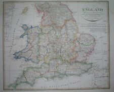
 1897 England Map London Ramsgate Oxford Buckingham Reading Hampstead Richmond
-
$40.41 CAD
 1927 ORIGINAL VINTAGE ITALIAN MAP OF ENGLAND WALES LONDON MANCHESTER LIVERPOOL
-
$566.40 CAD
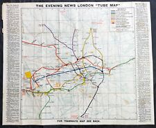 1907-10 George Philip Large Early London Underground Map
-
$64.21 CAD
 Vintage 1892 LONDON ENGLAND Map 22"x14" Old Antique Original HYDE PARK
-
$54.32 CAD
 Vintage 1904 LONDON ENGLAND Map 11"x14" ~ Old Antique Original BATTERSEA CHELSEA
-
$49.42 CAD
 Vintage 1902 LONDON ENGLAND Map 11"x14" ~ Old Antique Original KENSINGTON PALACE
-
$57.29 CAD
 Vintage 1901 LONDON ENGLAND UK Map 11"x14" ~ Old Antique Original REGENTS PARK
-
$46.64 CAD
 1888 ANTIQUE MAP LONDON TUBE RAILWAYS ENGLAND DUBLIN IRELAND EDINBURGH SCOTLAND
-
$34.33 CAD
 Bartholomews Historical Map Of London Cloth + Geographia LONDON Street Plan
-
$69.15 CAD
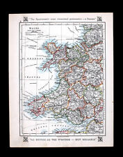
 Vintage 1900 ENGLAND & WALES Map 14"x22" Old Antique Original BRITAIN UK LONDON
-
$50.00 CAD
 1930/40’s Royal Automobile Club Road Map Of England & Wales George Philip London
-
$21.96 CAD
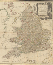
 1830 Original Sidney Hall Map - ENGLAND & WALES - Double-Sheet - Great Detail
-
$38.50 CAD
 Vintage 1901 ENGLAND & WALES Map 14"x22" Old Antique Original CARDIFF LONDON
-
$74.15 CAD
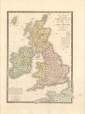
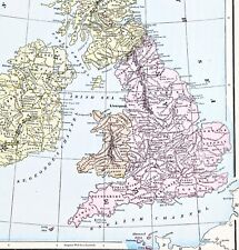 1898 British Isles Historical Map England Ireland Scotland Wales London
-
$48.20 CAD
 1904 ANTIQUE MAP OF LONDON DOWNTOWN / ENGLAND / VERSO EDINBURGH DUBLIN IRELAND
-
$308.95 CAD
 CHRISTOPHER WRENS PLAN FOR REBUILDING LONDON AFTER the CONFLAGRATION of 1666 MAP
-
$33.26 CAD
 Framed W.R. Chambers London & Edinburgh Central Europe In The 18th Century...
-
$38.41 CAD
 Vintage framed Hand Stitched Map Of England And Wales 20.5" x 16.5"
-
$595.22 CAD
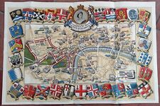 1953 Historic Queen Elizabeth II Royal Coronation Route Map London Pictorial
-
$27.45 CAD
 1921 Johnston Map South England Cornwall Lands End Devon Somerset Dorset Dexter
-
$34.39 CAD
 VINTAGE Geographer's A to Z; Atlas of London and Suburbs with House Numbers
-
$123.45 CAD
 1873 Henry Taunt River Thames Map, Oxford and Cambridge Boat Race Course, London
-
$27.46 CAD
 Philips Clear-Print Popular Map of London 1920 vintage London Liverpool w/ Index
-
$24.17 CAD
 c.1990s AT&T Walks Through Europe Map Set: London, Paris, Madrid, Vienna
-
$34.55 CAD
 Vintage 1902 ENGLAND & WALES Map 11"x14" ~ Old Antique Original LEEDS LINCOLN
-
$22.19 CAD
 1937 Vintage LONDON Street Map Black & White City Map of London England 9739
-
$29.34 CAD
 1931 VINTAGE MAP OF ENGLAND CORNWALL MIDLANDS LONDON / WALES / GREAT BRITAIN
-
$44.43 CAD
 Vintage 1900 ENGLAND WALES Map 11"x14" ~ Old Antique Original CAMBRIDGE LONDON
-
$120.82 CAD
 1756 Maitland Antique Print of Bridewell Palace, London, England Henry VIII
-
$23.67 CAD
 Vintage 1901 ENGLAND WALES Map 11"x14" ~ Old Antique Original CARDIFF OXFORD
-
$64.21 CAD
 Vintage 1900 ENGLAND & WALES Map 14"x22" ~ Old Antique Original UNITED KINGDOM
-
$78.05 CAD
 Vintage 1900 LONDON ENGLAND Map 11"x14" ~ Old Antique Original BUCKINGHAM PALACE
-
$8.22 CAD
 Vintage 1940 World Atlas City Map of Central London, England World War WWII OLD
-
$30.86 CAD
 1873 Henry Taunt River Thames Map, Oxford to London
-
$137.31 CAD
 Antique Johnson's Map Of England and Wales 1863 Civil War Era Old Map
-
$29.18 CAD
 Ordinance Survey 1/4 Inch Map of Great Britain 1946 England South-West Sheet 10
-
$8.22 CAD
 Vintage 2 Pg 1924 Post WWI B&W City Map London England & Liverpool England L@@K!
-
$23.56 CAD
 Vintage 1902 ENGLAND & WALES Map 11"x14" ~ Old Antique Original CAMBRIDGE OXFORD
-
$19.72 CAD
 Vintage 1900 SCOTLAND & ENGLAND Maps ~ Old Antique Original EDINBURGH LONDON UK
-
$157.91 CAD
 1920s England Motor Tour Map Wales Great Britain Driving Car Cars Auto Road Map
-
$308.95 CAD
 1828 Europe Full Color Brue Map 26.5" x 20.8" Rare Antique Original
-
$32.94 CAD
 1911 Stieler Map Ireland Dublin Cork Belfast - Manchester London Plans England
-
$25.68 CAD
 1895 Original Color Map Europe and South America Historic 11 x 14 Map
-
$16.48 CAD
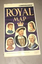 John Bartholomew Royal Map of England United Kingdom Scotland Kings and Queens
-
$24.72 CAD
 1952 -14''x 19.5'' English print Map *Historic Canterbury* design by Estra Clark
-
$16.46 CAD
 1900 Meyers Map England Wales London Liverpool Oxford Newcastle Great Britain
-
$8.22 CAD
 Vintage 1943 Atlas Map World War WWII Era England, Wales & Scotland London Inset
-
$38.45 CAD
 1877 Migeon Map - British Isles Great Britain England Scotland Ireland London UK
-
$72.07 CAD
 1823 ORIGINAL MAP UNITED KINGDOM ENGLAND WALES LONDON CAMBRIDGE LANCASTER YORK
-
$21.96 CAD
 ANTIQUE 1950S GREAT WESTERN RAILWAY ENGLAND MAP LONDON IRELAND BRISTOL OXFORD
-
$13.72 CAD
 1938 McNally Map Netherlands Holland Belgium Luxembourg Amsterdam Brussels Ghent
-
$27.45 CAD
 1875 Petermann Map - North Sea - Great Britain England Ireland Scotland London
-
$27.45 CAD
 1921 Johnston Map NW Scotland Hebrides Isles Skye Loch Ness Inverness Dexter Ad
-
$23.34 CAD
 Lot of 2 Antique Maps Americana Co 1904 England & Wales And London
-
$34.31 CAD
 Vintage London Postal Districts Map Colored Edition
-
$21.96 CAD
 1863 Cornell Map - British Isles England Wales Scotland Ireland London Dublin UK
-
$65.90 CAD
 1796 Blondeau Map England Wales London Bristol Oxford Salisbury Manchester
-
$13.72 CAD
 1880 Petermann Map England Wales Great Britain London Liverpool Oxford Lands End
-
$343.28 CAD
 BACON'S LARGE ANTIQUE MAP OF LONDON & SUBURBS c. 1900-1910
-
$41.04 CAD
 1897 MAP Baedeker - London & Environs England 10.5 x 15" (26.5 x 38 cm)
-
$21.96 CAD
 1921 Johnston Map Wales Bristol Anglesey Cardiff Pembroke Glamorgan - Dexter Ad
-
$27.45 CAD
 1921 Johnston Map England & Wales London Liverpool Bath Cornwall Bristol Dexter
-
$32.94 CAD
 1846 Bocage & Vuillemin Map British Isles England Wales Scotland Ireland London
-
$171.62 CAD
 Original c 1870 WH Smith Linen Backed Hand Colored Environs of London Map
-
$43.93 CAD
 1830 Nathan Hale Map England & Wales London Bristol Oxford Salisbury Manchester
-
$16.46 CAD
 1911 Stieler Map England Wales Great Britain London Liverpool Bristol Cornwall
-
$21.96 CAD
 1892 Petermann Map England Wales London Liverpool Oxford Jersey Guernsey Stieler
-
$32.94 CAD
 1886 Tunison Map England Wales London Salisbury Liverpool Bristol Cardiff Thames
-
$27.45 CAD
 1906 Johnston Map South England & Wales London Thames English Channel Islands UK
-
$34.33 CAD
 Toulon,France Map - Published L. Luffman, London
-
$65.90 CAD
 1834 Carey Map England & Wales London Bristol Liverpool Oxford Canterbury Bath
-
$38.45 CAD
 1830 Nathan Hale Map England Wales London Liverpool Oxford Cornwall Bristol UK
-
$26.09 CAD
 LONDON Vicinity Map 1897 England Original
-
$90.46 CAD
 Warwikum England London Oxford Cambridge Salisbury Map Card Mercator 1651
-
$343.28 CAD
 1828 England & Ireland full color Brue map 26.5" x 21" Rare Antique Original
-
$43.93 CAD
 1874 Colton Map England & Wales London Liverpool Lands End Bristol Cardif Bath
-
$21.96 CAD
 LARGE ANTIQUE 1880 ENGLAND WALES COUNTY BOROUGH HANDCOLORED MAP LONDON MARITIME
-
$61.79 CAD
 Original 1826 Europe - Brue Atlas 26" x 21" huge map - Antique
-
$99.30 CAD
 1891 VICTORIAN MAP STREET PLAN ENVIRONS OF LONDON WOOLWICH BROMLEY STAINES
-
$343.28 CAD
 Antique Colton's Map Atlas Environs of London 1855 United Kingdom England
-
$273.25 CAD
 England & Wales 1780s antique map by Carington Bowles - Correct Guide
-
$61.79 CAD
 PICTURE MAP OF LONDON. "Geographica" circa 1920. Linen backed.
-
$27.45 CAD
 1707 Pieter Van Der Aa Limited Edition Map England River Thames London 292/400
-
$41.12 CAD
 1835 Hand Colored Map of Westminster, London Showing the Extent of 1222 In Blue
-
$99.30 CAD
 1891 VICTORIAN MAP STREET PLAN LONDON ALEXANDRA PALACE & PARK FORTISGREEN
-
$1208.33 CAD
 An Accurate Map of Great Britain, France & Ireland LONDON Laurie & Whittle 1794
-
$34.33 CAD
 Antique Original Atlas Map 1900 ENGLAND & WALES - Fisk & See, Eng.- Ephemera Art
-
$137.30 CAD
 England and Wales original antique MAP C1855 From. Antique Map Shop Over 150
-
$27.41 CAD
 1920s Philips Authentic England & Wales Map, United Kingdom Great Britain Roads
-
$34.31 CAD
 A to Z Motorist's Map - Central London - Geographers' - One-Way Streets - Park
-
$43.93 CAD
 ANTIQUE 1762 ENGLAND WALES VAUGONDY HANDCOLORED DATED MAP LONDON OXFORD COUNTY
-
$99.77 CAD
 1891 VICTORIAN MAP STREET PLAN LONDON RAILWAY GREAT NORTHERN WESTERN MIDLAND
-
$99.77 CAD
 1891 VICTORIAN MAP STREET PLAN LONDON BLACKHEATH LEE GREEN MORDEN COLLEGE
-
$99.77 CAD
 1891 VICTORIAN MAP STREET PLAN LONDON INDEX ~ WEST HAM PECKHAM GREENWICH HOXTON
-
$150.66 CAD
 c1900 MAP STREET PLAN LONDON GREENWICH ROYAL HOSPITAL OBSERVATORY UNION WORKS
-
$5.11 CAD
 Historical Map Of London Map Drawn By Leslie Bullock
-
$57.67 CAD
 Antique Map - South London in 1813
-
$99.77 CAD
 1891 VICTORIAN MAP STREET PLAN LONDON SHOOTERS HILL ROYAL MILITARY ACADEMY
-
$320.48 CAD
 England Channel London Oxford Card Map Carte Prowler Engraving Copperplate 1760


