Antiques (CA)
Antiques (US)
Antiquitäten (DE)
Antiquariato (IT)
Antiques (UK)
Antiquités (FR)
Antiques (CA)
Antiques (AU)
Antiques (CA)
/
Maps, Atlases & Globes
/
Europe Maps
/
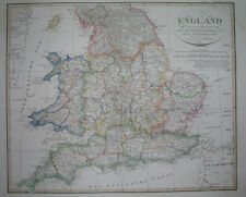
Leicestershire County, Political Map Type Europe Maps
NOTE: When you buy through our links, we may earn a commission.
Learn more*
Best Match
Newest
Ending
Lowest Price
Highest Price
Best Match
Newest
Ending
Lowest Price
Highest Price
S
M
L
XL
Share
Share
Twitter
Facebook
Email
Share
Pinterest
Facebook
Twitter
Email
$71.80 CAD
1823 ORIGINAL MAP UNITED KINGDOM ENGLAND WALES LONDON CAMBRIDGE LANCASTER YORK
Share
Pinterest
Facebook
Twitter
Email
$52.65 CAD
1838 nice ORIGINAL MAP UNITED KINGDOM ENGLAND WALES LONDON CARDIFF MANCHESTER
Share
Pinterest
Facebook
Twitter
Email
$47.18 CAD
1848 nice ORIGINAL MAP UNITED KINGDOM ENGLAND WALES LONDON LIVERPOOL CARDIFF
MORE
City
London (1)
Oxford (2)
Country/Region
England (3)
United Kingdom (3)
Wales (3)
County
Leicestershire
Date Range
1700-1799 (3)
1800-1899 (3)
Format
Atlas Map (3)
Original/Reproduction
Antique Original (3)
Printing Technique
Copper Plate (3)
Type
Political Map
 Antiques (CA)