 Antiques (CA)
-
$132.79 CAD

 1959 TAYLOWE BRITISH MUSEUM 1576 SAXTON'S MAP WARWICKSHIRE LEICESTERSHIRE PRINT
-
$40.23 CAD
 1898 ANTIQUE MAP OF COUNTIES OF LEICESTER LEICESTERSHIRE RUTLAND / ENGLAND
-
$36.92 CAD
 Staunton Harold Leicestershire Derbyshire Derby Engraving Copperplate 1707
-
$75.41 CAD
 Lincolnshire Norfolk Yorkshire England Leicestershire Great Britain Map M 258217
-
$20.50 CAD
 Saxton's Map of Warwickshire & Leicestershire 1576 by Taylowe (1959)
-
$42.49 CAD
 ANTIQUE MAP Of LEICESTERSHIRE Circa 1840 BELVOIR CASTLE Melton Molbray HINCKLEY
-
$27.32 CAD
 1882 Antique COLOR Map / COUNTIES LEICESTER AND RUTLAND, ENGLAND
-
$71.75 CAD
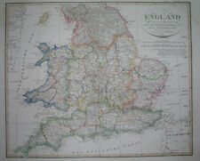 1823 ORIGINAL MAP UNITED KINGDOM ENGLAND WALES LONDON CAMBRIDGE LANCASTER YORK
-
$61.51 CAD
 18th century Leicestershire England Antique Map by Thomas Kitchin
-
$52.61 CAD
 1838 nice ORIGINAL MAP UNITED KINGDOM ENGLAND WALES LONDON CARDIFF MANCHESTER
-
$38.26 CAD
 1814 John Cary Road Map Leicestershire Leicester Melton Mowbray Bosworth England
-
$80.29 CAD
 John Cary 1809 Map of Leicestershire from New and Correct English Atlas
-
$47.14 CAD
 1848 nice ORIGINAL MAP UNITED KINGDOM ENGLAND WALES LONDON LIVERPOOL CARDIFF
-
$75.41 CAD
 Lincolnshire Norfolk Yorkshire England Leicestershire Great Britain Map M 258222
-
$321.72 CAD
 Lincolnshire Norfolk Yorkshire England Leicestershire Great Britain Map Mercator
-
$41.01 CAD
 1846 Antique Map of LEICESTERSHIRE & RUTLANDSHIRE by Slater published by Spigot


