 Antiques (CA)
Africa Maps
Asia Maps
Australia/Oceania Maps
Celestial Maps
Central America/Caribbean Maps
Curiosities Maps
Digital Maps
Europe Maps
Map & Globe Mixed Lots
Map & Globe Reproductions
North America Maps
South America Maps
World & Celestial Globes
World Maps

-
$274.17 CAD

 1867 Kansas Colorado Montana & Dacota Hand Colored Map 13 x 15 Mitchell Antique
-
$95.96 CAD
 HEC Robinson 71 x 96 cm Color Relief Wall Map - 1941 EAST INDIES Spratly Isles
-
$109.65 CAD
 1879 Map Maine United States New England Victorian Geography 1st Edition DWAA9
-
$54.82 CAD
 Map Vignemale Southern France Rare 1914 Lithograph WW1 Topo Mini DWAA20B
-
$47.98 CAD
 1862 Johnson Iowa & Nebraska antique map 17.6" x 14.2" nice color
-
$28.79 CAD
 1899 London ENGLAND Map ORIGINAL River Thames Ipswich RAILROADS Battlefields
-
$80.88 CAD
 1862 Johnson Minnesota & Dakota antique map 17.2" x 14" nice color
-
$94.59 CAD
 1878 California Mitchell antique map 22.9" x 15.1" - San Francisco inset
-
$38.38 CAD
 ORIGINAL 1890 Spain Portugal Map Madrid Lisbon Seville Cadiz Barcelona Algrave
-
$28.79 CAD
 1897 RUSSIA Map Moscow ORIGINAL Poland Finland Ukraine Odessa RAILROADS ANTIQUE
-
$27.42 CAD
 Original 1884 Physical & Economic Map of The British Isles by Drioux & Leroy
-
$23.30 CAD
 Original 1903 Physical Map of Africa by Dodd Mead & Company. Antique
-
$53.30 CAD
 1897 Greece Map ORIGINAL Crete Hydra Laconia Arcadia Larissa Piraeus Railways
-
$54.82 CAD
 Map Cite De Carcassonne Southern France Rare 1914 Lithograph WW1 Street DWAA20B
-
$109.65 CAD
 1879 Map West Central States Group Victorian Atlas Geography 1st Edition DWAA9
-
$205.63 CAD
 Original Circa 1850 Map Of Oregon Boundary Lithograph By A. Hoen & Co.
-
$239.90 CAD
 1875 Map Yellowstone Montana Captain William Ludlow US Army Corps Engineers
-
$20.56 CAD
 Australia & New Zealand - Original 1874 Hydro-Orographic Map by Meyers.
-
$143.94 CAD
 1860 Wisconsin & Michigan Mitchell antique map 15.3" x 12.7" rare 1st edition
-
$135.71 CAD
 1878 Colorado Montana Dakota & Wyoming Mitchell antique map 22.9" x 15.1"
-
$65.80 CAD
 1899 Central Italy Map ORIGINAL Foggia Tuscany Sicily Rome Naples RAILROADS
-
$12.95 CAD
 Preu MICHELIN Map 140 Carte Touristique de la PROVENCE 1950's France
-
$239.90 CAD
 1845 antique map of Africa by A.K. Johnston ~ 25.8" x 21.2" Huge Pastel color
-
$53.30 CAD
 1897 NORTHERN ITALY Map ORIGINAL Milan Genoa Florence Alps Como RAILROADS
-
$685.43 CAD
 1845 North America map by A.K. Johnston 25.8" x 21.2" Antique Republic of Texas
-
$16.26 CAD
 1920 Color Maps by John Bartholomew of Physical Europe Map
-
$30.16 CAD
 Union of South Africa - Western - Large Original 1926 Map by George Philip.
-
$19.88 CAD
 1931 BAEDEKER MAP - Italy GRADO AQUILEIA City Plan + Railroads
-
$109.65 CAD
 Map Cannes LA Croisette Southern France Rare 1914 Lithograph WW1 Era WHBS
-
$109.65 CAD
 1879 North Central States Group US Victorian Atlas Geography 1st Edition DWAA9
-
$130.23 CAD
 1886 Malte-Brun Ancient Asia Map
-
$54.82 CAD
 Map Of Original 13 Colonies 1871 Victorian Lithograph History Swinton DWAA12
-
$21.93 CAD
 Asia - Original 1903 Physical Map by Dodd Mead & Company. Antique
-
$16.45 CAD
 1900 Times Map - Physical Alps Switzerland Austria Italy Geneva Vienna Innsbruck
-
$514.07 CAD
 1862 Johnson California Southwest Territory antique map 26.1" x 18.7" nice color
-
$12.34 CAD
 1921 South America Map National Geographic Tattered Wall Map 26x37" 1920's
-
$28.83 CAD
 1897 BAEDEKER MAP - WALES between Bangor & Tremadog
-
$39.59 CAD
 1897 England and Wales Map Cornwall Dorsey Cardiff Portsmouth Hastings Bristol
-
$137.07 CAD
 Map Bordeaux Southern France Rare 1914 Lithograph WW1 Era WHBS
-
$109.65 CAD
 1879 Map Asia Desert Arctic Peninsula Belt Victorian Geography 1st Edition DWAA9
-
$39.59 CAD
 1897 Sicily Central Italy Map ORIGINAL Salerno Messina Palermo Potenza Rome
-
$13.69 CAD
 1898 Century Map Switzerland Geneva Zurich Lucerne Bern Basel Lake of Constance
-
$39.59 CAD
 OLD 1899 Southern England Wales Map London Cornwall STEAMSHIPS RAILWAYS PORTS
-
$31.52 CAD
 1898 ORIGINAL MAP WORLD AMERICA ASIA AUSTRALIA EUROPE AFRICA sea currents OCEANS
-
$651.15 CAD
 1845 World Hemispheres map by A.K. Johnston ~ 25.8" x 21.2" Antique Pastel Color
-
$20.56 CAD
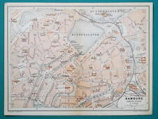 1897 BAEDEKER MAP - Germany HAMBURG City Plan + Railroads
-
$38.38 CAD
 1899 GERMAN EMPIRE Map ORIGINAL Berlin STEAMSHIP Routes Railways Battlefields
-
$274.17 CAD
 1845 Palestine map by A.K. Johnston ~ 25.8" x 21.2" Antique Pastel Color Huge
-
$68.53 CAD
 Map St Beal And Bagneres Southern France Rare 1914 Lithograph WW1 Era WHBS
-
$204.26 CAD
 1878 Texas antique map 22.8" x 15.1" nice color - Galveston Indian Territory NM
-
$39.59 CAD
 1899 Scotland Map ORIGINAL Glasgow Aberdeen Shetland STEAMSHIP ROUTES
-
$15.00 CAD
 Antique map. THE WORLD PHYSICAL MAP. Circa 1885
-
$130.23 CAD
 1862 Johnson Dakota Nebraska Kansas Colorado antique map 17.4" x14.2" nice color
-
$16.26 CAD
 1920 Color Maps Physical Indian Empire + Farther India and the East Indies Map
-
$21.93 CAD
 Europe - Original 1903 Dated Physical Map by Dodd Mead & Company. Antique
-
$171.36 CAD
 1877 F. V. Hayden Parts of Western Wyoming and Southeastern Idaho Map
-
$178.20 CAD
 1884 ANTIQUE MAP Indian Removal CHEROKEE NATION 32" Arkansas Kansas Missouri
-
$27.40 CAD
 Original 1902 DOUBLE-HEMISPHERE WORLD MAP South Pole Explorations Mountains Seas
-
$68.53 CAD
 Map Toulouse Garonne Southern France Rare 1914 Lithograph WW1 Era WHBS
-
$239.90 CAD
 1845 Ireland map by A.K. Johnston ~ 25.8" x 21.2" Antique Pastel Color Huge
-
$68.53 CAD
 Map Lourdes To Mont Perdu Southern France Rare 1914 Lithograph WW1 Era WHBS
-
$61.69 CAD
 1878 United States map 22.8" x 15.1" nice color - Island of New Foundland inset
-
$21.92 CAD
 1900 Meyers Physical World Map Mountains Rivers Europe Asia America Africa
-
$53.46 CAD
 1878 Western Hemisphere Mitchell antique map 15.1" x 12.1" - nice color
-
$16.45 CAD
 1897 BAEDEKER MAP - Germany Hamburg & Environs
-
$53.46 CAD
 1878 Maine Mitchell antique map 15.1" x 12.1" - nice color
-
$61.69 CAD
 1878 Georgia Alabama Mitchell antique map 22.7" x 15.1" Atlanta Savannah insets
-
$26.03 CAD
 Original 1899 Map NORTH POLE Arctic Explorers Nansen Johansen Franklin McClure
-
$19.00 CAD
 1920 Color Maps Physical New Zealand & Tasmania, Old New Testament Palestine Map
-
$46.61 CAD
 1899 North Italy Map ORIGINAL Venice Genoa STEAMSHIP ROUTES Provinces RAILWAYS
-
$61.69 CAD
 1862 Johnson's Missouri and Kansas Map Johnson & Ward Antique
-
$47.82 CAD
 1899 Northern France Map ORIGINAL Provinces STEAMSHIPS Railways Townships Ports
-
$53.46 CAD
 1878 Oregon Washington MT ID Mitchell antique map 15.1" x 12.3" - nice color
-
$342.71 CAD
 1849 Traveler's Map of West Prussia on Cloth, Handtke, Druck & Verlag, Flemming
-
$35.26 CAD
 1897 BAEDEKER MAP - Germany HAMBURG & ALTONA Good for Genealogy
-
$19.00 CAD
 1920 Color Maps Eastern Provinces of Canada and Physical North America Map
-
$10.00 CAD
 Antique map. EUROPE. PHYSICAL MAP OF EUROPE. Circa 1885
-
$27.42 CAD
 Mähren Und Schlesien Map Wagner Böhmen Prag 1905 30+22’ Kytka
-
$53.30 CAD
 1897 North France Map ORIGINAL Paris Cherbourg Le Havre Brest Dunkirk Roubaix
-
$50.72 CAD
 1899 Central France Map ORIGINAL Paris Dijon Versailles RAILWAYS PROVINCES
-
$102.81 CAD
 1856 Wisconsin & MN Survey Antique Map Lithograph - Ackerman NY ~ 21.5" x 18.7"
-
$61.69 CAD
 1862 Johnson's New York Map Johnson & Ward Illustrated Family Atlas Antique
-
$68.53 CAD
 Map Central Bordeaux Southern France Rare 1914 Lithograph WW1 Era WHBS
-
$102.80 CAD
 1885 ANTIQUE MAP 21.75" Eskimo Tribes NORTH EAST AMERICA CANADA Nunavut Dr. Boas
-
$16.45 CAD
 1887 MAP BAEDEKER - AUSTRIA Vienna & Environs + Plan of Laxenburg Castle & Park
-
$28.79 CAD
 1899 Northern England Wales Map Liverpool Sheffield STEAMSHIPS RAILWAYS PORTS
-
$26.05 CAD
 Switzerland - Original 1915 Physical Map by Kartographia Winterthur SA. Antique
-
$122.01 CAD
 1878 Boston Mitchell antique map / plan 23" x 15.1" - nice color - harbor inset
-
$47.98 CAD
 1863 China by Johnson Ward antique map 17.4" x 13.8" Amoy & Canton insets
-
$102.81 CAD
 1862 Johnson Virginia PA DE MD antique map 26.6" x 18.1" nice color - Richmond
-
$204.26 CAD
 Antique Print Solar System Theory of the Seasons Rand McNally illustration 1890s
-
$47.98 CAD
 Russia Russland Staraya Russa Antique Map Scale 1:126000
-
$16.45 CAD
 AUSTRIA Salzburg & Environs Lofer Kuchl Mondsee Inzell - 1910 MAP Baedeker
-
$75.40 CAD
 1862 Johnson Kentucky & Tennessee antique map 24.7" x 17.9" nice color
-
$376.98 CAD
 1862 Johnson Texas antique map 25.6" x 18.6" nice color - Galveston, Sabine Lake
-
$349.57 CAD
 1860 Washington & Oregon Mitchell antique map 15.4" x 12.6" rare 1st edition
-
$16.45 CAD
 GERMANY Pyrmont Hameln Town Plan - 1912 MAP 4 x 6" (10 x 15,5 cm)
-
$204.26 CAD
 Antique Print National Debts Foreign Countries United States 1890 Illustration
-
$109.65 CAD
 1879 Map Australia Colonies And Oceania Victorian Geography 1st Edition DWAA9
-
$95.95 CAD
 Map Corsica Island Southern France Rare 1914 Lithograph WW1 Era WHBS


