 Antiques (CA)
Africa Maps
Asia Maps
Australia/Oceania Maps
Celestial Maps
Central America/Caribbean Maps
Curiosities Maps
Digital Maps
Europe Maps
Map & Globe Mixed Lots
Map & Globe Reproductions
North America Maps
South America Maps
World & Celestial Globes
World Maps

-
$1217.64 CAD

 1929 OFFICIAL REAL ESTATE ATLAS CITY OF DETROIT HEARNE BROTHERS LARGE RARE BOOK
-
$239.83 CAD
 Original 1920 Schuyler County Illinois IL Atlas by Kenyon Co Plat Book
-
$274.10 CAD
 Original 1923 Boone County Illinois IL Atlas by Ogle & Co Plat Book
-
$217.97 CAD
 World Atlas by WESTERMANN, Historical-geo- and economic atlas of the WORLD, 1928
-
$274.16 CAD
 La Salle County Illinois Antique ATLAS & Plat Book Hand Colored Maps 1929
-
$34.27 CAD
 The Official Maps of New England L. Crocker Topographer, National Survey Co.
-
$16.26 CAD
 1920 Color Maps of Railways of Great Britain and Geological Rainfall & Tides Map
-
$308.44 CAD
 RARE 1929 Paved Road Atlas George F. Cram Co. USA Canada Maps Item-Tribune Vtg
-
$342.71 CAD
 ANTIQUE NORDIC WORLD ATLAS "NORDISK VÄRLDSATLAS". 1926
-
$61.62 CAD
 Rare Rochester NY + Suburbs Large Planning District Map Book Atlas 1922 ?racist?
-
$259.09 CAD
 Vintage 1929 Dekalb County Illinois Atlas and Plat Book Surveys Public Records
-
$16.26 CAD
 1920 Color Maps by John Bartholomew of Physical Europe Map
-
$137.09 CAD
 1920 Crawford COUNTY IOWA ATLAS PLAT BOOK Anderson Publishing Panama Canal info
-
$16.26 CAD
 1920 Comparative Atlas by John Bartholomew Color Maps of Astronomical Geography
-
$82.18 CAD
 Vintage THE TIMES GAZETTEER OF THE WORLD Edinburgh Geographical 1922 Bartholomew
-
$16.26 CAD
 1920 Comparative Atlas by John Bartholomew Color Maps of Jan & July Temps Map
-
$95.96 CAD
 ANTIQUE Maps EUROPE historical ATLAS coinage BATTLES Literature GAZETTEER 1920s
-
$36.64 CAD
 1928 Map Philadelphia 36 Ward Moore Morris Tasker Dickinson Point Breeze Watkins
-
$16.26 CAD
 1920 Color Maps Physical Indian Empire + Farther India and the East Indies Map
-
$137.09 CAD
 1920s PRESIDENTIAL WALL ATLAS 6 Sides World Leaders First Ladies Radio Stations
-
$6.69 CAD
 EASTERN HEMISPHERE Rand Mcnally & Co 1927 Map Print 14" x 11" Premier Edition
-
$19.00 CAD
 1920 Color Maps Physical Dominion of Canada and Political North America Map
-
$102.75 CAD
 Original 1923 Boone County Illinois IL Atlas by Ogle & Co Plat Book
-
$19.00 CAD
 1920 Color Maps Physical New Zealand & Tasmania, Old New Testament Palestine Map
-
$19.00 CAD
 1920 Color Maps Eastern Provinces of Canada and Physical North America Map
-
$34.96 CAD
 Antique Vintage 1920s Denver Colorado City Street Map from Atlas 1921
-
$19.00 CAD
 1920 Color Maps Physical/Political Italy Yugo Slavia and Balkans 2X pages Map
-
$16.26 CAD
 1920 Color Maps Political Features of France (no explanation of the colors!) Map
-
$13.64 CAD
 1923 Original Antique Hammond Map: Cuba and on reverse Porto Rico
-
$19.00 CAD
 1920 Color Maps Physical/Political Features Russia Finland Sweden Norway Denmark
-
$19.00 CAD
 1920 Color Maps Political England & Wales + Physical Scotland 2X pages Map
-
$21.87 CAD
 Antique map, KANSAS in 1921, Great Shape. Ready to be Framed. 11” By 9”
-
$20.56 CAD
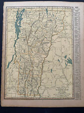
 OFFICIAL MAPS OF NEW ENGLAND - National Survey Co Chester VT - 96 pgs complete
-
$27.42 CAD
 1925 Rand McNally Atlas of America NEWYORK /21"x29" Adjoining New Jersey Towns
-
$37.22 CAD
 1927 Pictorial Map ~ FLANDRE - ARTOIS - PICARDIE PROV., FRANCE - JP Pinchon
-
$44.18 CAD
 1928 Map Philadelphia 36 Ward Lanier Park Tasker Morris Dickson St Gabriel's
-
$6.69 CAD
 ASIA CHINA Rand Mcnally & Co 1927 Map Print 14"x11" Premier Edition
-
$109.67 CAD
 Atlas of Marshall County Iowa 1924 Book plus Hammond's Atlas of the World 1914
-
$19.00 CAD
 1920 Color Maps Density of Population Greater Britain Map
-
$19.00 CAD
 1920 Color Maps Physical Africa and British South Africa Map
-
$37.22 CAD
 1927 Pictorial Map ~ AUNIS - SAINTONGE - POITOU Prov., FRANCE by JP Pinchon
-
$822.50 CAD
 1929 V.4 Brooklyn 260 maps! CONEY ISLAND SHEEPSHEAD FLATLANDS CANARSIE MIDWOOD
-
$343.01 CAD
 MAP 1922 CRAM’S HOME LIBRARY ATLAS WWI SYNOPSIS
-
$1233.75 CAD
 1929 Hyde Atlas V.1 200 Maps Brooklyn HEIGHTS CROWN PROSPECT PARK SLOPE DUMBO ++
-
$19.00 CAD
 1920 Color Maps Physical Features of Ireland and Scotland Map
-
$6.69 CAD
 WYOMING / WISCONSIN, Rand Mcnally & Co 1927 Map Print 14" x 11" Premier Edition
-
$19.00 CAD
 1920 Color Maps Political United States and Physical South America Map
-
$40.73 CAD
 1928 Map Philly Schuylkill East Railroad Grays Ferry Wharton Dupont De Nemours
-
$959.58 CAD
 1929 V2 Brooklyn ~400 MAPS ALL WILLIAMSBURG Greenpoint East New York Brownsville
-
$19.00 CAD
 1920 Color Maps Political South America + Mexico Central America West Indies Map
-
$411.24 CAD
 1929 V.3 Brooklyn 200+ MAPS BAY RIDGE BENSONHURST FLATBUSH BORO PARK KENSINGTON
-
$541.49 CAD
 Vintage 1927 FRANKLIN MASSACHUSETTS Sanborn Insurance MAPS Atlas - DEAN College
-
$6.69 CAD
 S. CAROLINA / R. ISLAND Rand Mcnally & Co 1927 Map Print 14" x 11" Prem. Edition
-
$16.26 CAD
 1920 Maps by John Bartholomew of Jan/July Rainfall &Winds Races & Religion Map
-
$28.35 CAD
 Old 1927 Pictorial Map ~ CHAMPAGNE Province, FRANCE Illustrated by J.P. Pinchon
-
$56.93 CAD
 1928 Map Philadelphia RARE -26 36 & 48 Ward Index Hand Colored Schuylkill River
-
$37.22 CAD
 Old 1927 Pictorial Map ~ BRETAGNE Province, FRANCE ~ Illustrated by J.P. Pinchon
-
$6.69 CAD
 MEXICO YUKON Rand Mcnally & Co 1927 Map Print 14"x11" Premier Edition
-
$16.26 CAD
 1920 Color Maps Physical Features of Switzerland and the Alps Map
-
$37.22 CAD
 1927 Pictorial Map ~ ORLEANAIS - BERRY Prov., FRANCE Illus. by J.P. Pinchon
-
$37.22 CAD
 1927 Pictorial Map ~ MAINE - ANJOU - TOURAINE Prov., FRANCE by J.P. Pinchon
-
$19.00 CAD
 1920 Color Maps Physical Australasia + Oceania Map
-
$19.00 CAD
 1920 Color Maps Physical Features Asia + North & South Polar Regions Map
-
$16.26 CAD
 1920 Maps by John Bartholomew of Density Population & Commercial Development Map
-
$6.69 CAD
 BRITISH COLUMBIA ALBERTARand Mcnally & Co 1927 Map Print 14"x11" Premier Edition
-
$37.22 CAD
 Vtg Lot 1923 WAUPACA Co. WISCONSIN Illustrations, Land Owners, Homes & Buildings
-
$40.78 CAD
 Antique 1920s Buffalo NY Chicago IL City Street Maps from Atlas 1921
-
$19.00 CAD
 1920 Color Maps Political Australia + Oceania + Victoria New South Wales Map
-
$37.22 CAD
 Old 1927 Pictorial Map ~ ALGERIE Prov., FRANCE / AFRICA ~ J.P. Pinchon / ALGERIA
-
$6.69 CAD
 CONNECTICUT Rand Mcnally & Co. 1927 Map Print 14" x 11", Premier Edition
-
$6.69 CAD
 BRITISH ISLES Rand Mcnally & Co 1927 Map Print 14"x11" Premier Edition
-
$6.69 CAD
 ARGENTINA CHILE BOLIVIA Rand Mcnally & Co 1927 Map Print 14"x11" Premier Edition
-
$6.69 CAD
 PENNSYLVANIA OREGON Rand Mcnally & Co 1927 Map Print 14"x11" Premier Edition
-
$6.69 CAD
 VERMONT / VIRGINIA Rand Mcnally & Co 1927 Map Print 14" x 11" Premier Edition
-
$6.69 CAD
 NEW ZEALAND ONTARIO Rand Mcnally & Co 1927 Map Print 14"x11" Premier Edition
-
$6.69 CAD
 WASHINGTON&W. VIRGINIA, Rand Mcnally & Co 1927 Map Print 14" x 11" Prem. Edition
-
$6.69 CAD
 SWITZERLAND CENTRAL EUR Rand Mcnally & Co 1927 Map Print 14"x11" Premier Edition
-
$6.69 CAD
 ONTARIO QUEBEC Rand Mcnally & Co 1927 Map Print 14"x11" Premier Edition
-
$6.69 CAD
 MAINE MARYLAND Rand Mcnally & Co. 1927 Map Print 14" x 11", Premier Edition
-
$6.69 CAD
 DENMARK IRISH FREESTATERand Mcnally & Co 1927 Map Print 14"x11" Premier Edition
-
$6.69 CAD
 EGYPT TUNISIA ALGERIA Rand Mcnally&Co. 1927 Map Print 14"x11" Premier Edition
-
$41.11 CAD
 Elkton Wilmington Maryland Delaware 1920 Geologic Atlas USGS Folio W/ All Map US
-
$34.26 CAD
 1928 Map Philadelphia 48 Ward St. Edmond Church Smith Playground McKean Snyder
-
$753.97 CAD
 (41) Philadelphia Atlas 1929 Complete Book
-
$6.69 CAD
 ALABAMA Rand Mcnally & Co. 1927 Map Print 14" x 11", original Premier Edition
-
$6.69 CAD
 NORTH DAKOTA N CAROLINA Rand Mcnally & Co 1927 Map Print 14"x11" Premier Edition
-
$37.22 CAD
 Old 1927 Pictorial Map ~ CORCE Prov., FRANCE Illus. by J.P. Pinchon / CORSICA
-
$6.69 CAD
 AUSTRALIA/OCEANIA Rand Mcnally & Co. 1927 Map Print 14" x 11", Premier Edition
-
$6.69 CAD
 WESTERN HEMISPHERE Rand Mcnally & Co 1927 Map Print 14" x 11" Premier Edition
-
$6.69 CAD
 ETHIOPIA/S. AFRICA Rand Mcnally & Co. 1927 Map Print 14" x 11", Premier Edition
-
$37.22 CAD
 1927 Pictorial Map ~ ALGERIE Prov., FRANCE / AFRICA ~ J.P. Pinchon / ALGERIA
-
$19.12 CAD
 Antique map of Idaho in 1921, Great Shape. Ready to be Framed. 11” By 9”
-
$26.01 CAD
 x3 Antique Framed Maps, Roman Empire, 1648 After Fall Of Westphalia, 1924
-
$34.76 CAD
 1920's Cherokee County Iowa Topographical Map Anderson Publishing JDS
-
$62.99 CAD
 Old Vintage 1920 Atlas & Plat Book Map ~ WOODFORD COUNTY, ILLINOIS Free S&H
-
$54.82 CAD
 Raton Brilliant New Mexico Colorado 1922 Geologic Atlas USGS Folio W/ All Map US
-
$137.07 CAD
 Fairfield Gettysburg 1929 Geologic Atlas USGS Folio W/ All Map US
-
$60.32 CAD
 New World Atlas and Gazetteer
-
$54.82 CAD
 Syracuse Lakin Kansas 1920 Geologic Atlas USGS Folio W/ All Map US
-
$54.82 CAD
 Hot Springs Arkansas 1923 Geologic Atlas USGS Folio W/ All Map US


