 Antiques (CA)
-
$23.30 CAD

 Original Physical & Economic Map of the Americas in 1910 by Meyers. German
-
$40.34 CAD
 1912 ORIGINAL ANTIQUE MAP OF CANADA BRITISH NORTH AMERICA GREENLAND ALASKA
-
$23.30 CAD
 Original 1913 Dated Map of The Dominion of Canada & Newfoundland by L. L. Poates
-
$27.35 CAD
 CENTURY ATLAS MAP PLATE #59 CANADA & NEWFOUNDLAND 1911 ANTIQUE ORIGINAL
-
$20.49 CAD
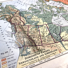 Dominion of Canada Newfoundland and Greenland Physical and Political Map 7 x 10"


