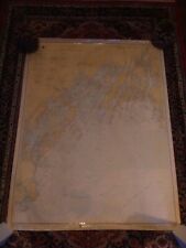
 Antiques (CA)
-
$205.28 CAD

 1952 US ARMY LAKE SURVEY CHARTS OF NEW YORK CANALS Erie Canal Champlain Seneca
-
$80.74 CAD
 RI Mass 1973 nautical Noaa chart narragansett bay  36 by 48 navigation map
-
$29.42 CAD
 Lot of 50+ VTG Lake Erie Fishing/Nautical Maps Chart Poster 29” x 23” See Pics
-
$21.35 CAD
 Vintage 28 x 45 Nautical Map Port of Cairns 1970s
-
$53.37 CAD
 Approaches to New York and Long Island Sound Nautical chart 17x11” map 1:400,000
-
$12.99 CAD
 1916 MAP U.S. NAVY HYDROGRAPHIC OFFICE- GREAT BAHAMA BANK No 26c - 28"x40"
-
$12.99 CAD
 1918 MAP U.S. NAVY HYDROGRAPHIC OFFICE U.S. GULF COAST No 1112 - 30"x44"
-
$67.86 CAD
 1864 Coast Survey Chart, St. George's River and Muscle Ridge Channel Maine Map
-
$9.99 CAD
 1917 MAP U.S. NAVY HYDROGRAPHIC OFFICE IRELAND WEST COAST No 4437 - 49"x27"
-
$34.21 CAD
 Vintage Nautical Chart 12339 East River- Tallman Island to Queensboro Bridge.
-
$34.20 CAD
 Nautical Map Long Island Sound Laminated 16” X 35” Great for framing!
-
$34.21 CAD
 Vintage Nautical Chart 116-Sc Tr. Long Island Sound. Watch Hill to New Haven
-
$9.99 CAD
 ANTIQUE 1919 MAP U.S. NAVY HYDROGRAPHIC OFFICE ENGLISH CHANNEL No 4431 - 48"x30"
-
$54.74 CAD
 Recreational Chart Book 400 Detroit River, Lake St. Clair & St. Clair River
-
$34.05 CAD
 1989 Upper Mississippi River Navigation Charts U.S. Army Corps of Engineers
-
$21.35 CAD
 Vintage 31 x 44 NOAA Nautical Map Suisun Bay 1980s
-
$34.21 CAD
 Vintage Nautical Chart 12342 Harlem River New York. NOAA 1982 22" x 44"
-
$16.23 CAD
 Nautical Chart Florida 1997 St. Lucie To Ft. Myers Lake Okeechobee
-
$27.36 CAD
 Vintage Hydrographic Chart Phoenix Islands South Pacific Ocean 1943 WW2
-
$26.81 CAD
 1859 Virginia and North Carolina Coast Survey Sketch D Section No. IV Progress
-
$9.99 CAD
 ANTIQUE 1919 MAP U.S. NAVY HYDROGRAPHIC OFFICE LE HAVRE FRANCE No 4343 - 42"x29"
-
$9.99 CAD
 1917 MAP U.S. NAVY HYDROGRAPHIC OFFICE ENGLISH CHANNEL WESTER No 4434 - 27"x42"
-
$9.99 CAD
 1917 MAP U.S. NAVY HYDROGRAPHIC OFFICE ENGLISH CHANNEL MIDDLE No 4433 - 28"x41"
-
$34.20 CAD
 Nautical Map Hawaiian Islands North Pacific Ocean 1975 #19008 large 41" x 58"
-
$12.99 CAD
 1906 ADMIRAL LIVERPOOL JOHN BANKS & SONS - BRITISH CHANNEL No 1179 - 26"x60"
-
$12.99 CAD
 1916 MAP U.S. NAVY HYDROGRAPHIC OFFICE BAY OF BISCAY No 4321 - 36"x29"
-
$20.51 CAD
 Laminated Placemat Nautical Double Sided Chart Key Biscayne to Key West
-
$9.99 CAD
 1919 MAP U.S. NAVY HYDROGRAPHIC OFFICE IRELAND SOUTH COAST No 4716 - 50"x30"
-
$362.65 CAD
 1853 MAURY'S STORM and RAIN NAVIGATIONAL CHART ~ THE NORTH ATLANTIC ~ SERIES E
-
$25.99 CAD
 1971 Nautical Charts Palm Shores to West Palm Beach to Miami 845-SC and 847-SC
-
$225.80 CAD
 ORIGINAL ANTIQUE MAP NAUTICAL CHART Point Conception to Point Sur California
-
$21.35 CAD
 Vintage 28 x 44 Nautical Map Suisun Bay West Coast USA 1980s
-
$34.21 CAD
 Vintage Nautical Chart 12346 Hudson River Yonkers Piermont. NOAA 1984 24.5" x48
-
$17.23 CAD
 1856 Papeete Island of Tahiti Tidal Observations U.S. Coast Survey Moon Phases
-
$12.99 CAD
 1916 MAP U.S. NAVY HYDROGRAPHIC OFFICE- BRITISH ISLANDS No 4430 - 28"x42"
-
$5.47 CAD
 Chart of the Alaska Coast - 1593 - de Corneille - Navigational Map - 13”x9.75”
-
$23.25 CAD
 Florida Soundings in Fathoms at mean low water Place mat Map Mercator projection
-
$5.47 CAD
 Chart of the New World - 1526 - Juan Vespucci - Navigational Map - 13”x9.75”
-
$21.35 CAD
 Vintage 41 x 28 Nautical Map Port Moresly to Cape Deliverance 1970s
-
$82.11 CAD
 GREAT CIRCLE SAILING NORTH PACIFIC Bering Sea 1935 Nautical Chart U.S. Navy 1282
-
$20.53 CAD
 Vintage 1960’s South Florida & Miami Area Fishing Charts 6 Maps Tackle Pub.
-
$34.20 CAD
 Nautical Map Mexico & Central America 1940 US Navy large 33" x 48" H.O. 1007
-
$2531.73 CAD
 Antique 1926 Map of Nantucket by Tony Sarg
-
$34.21 CAD
 NOAA Nautical Chart 12364. New Haven Harbor Entrance, Port Jefferson Throgs 1987
-
$34.21 CAD
 1986 Straits Of Florida & Approaches Chart Marine Soundings In Fathoms.43X36”
-
$27.36 CAD
 VTG Hydrographic Chart Enderbury Island to Christmas Island Pacific Ocean 1940s
-
$13.55 CAD
 Vintage Vancouver Canada Washington Nautical Chart Map 1983 Haro Strait
-
$20.53 CAD
 Vintage 1960-1961 Lake Winnipesaukee Navigation Chart
-
$34.20 CAD
 Nautical Map Fiji Islands Kandavu Island & Passage 1949 # H.O.2858 33" x 48"
-
$34.20 CAD
 Nautical Map New Guinea Banda Sea to Solomon Island 1969 #630 large 36" x 54"
-
$13.69 CAD
 1948 BUXTON NC Nautical Navigation Geological Survey Topographic Map NOAA r.1983
-
$34.20 CAD
 Nautical Map Prince of Whales Channel & Approaches # 74292 1972 US Navy 36"x 53"
-
$41.04 CAD
 Lot of 4 Vintage Nautical Charts Maps - Sandy Hook, Chesapeake Bay
-
$23.26 CAD
 NAUTICAL NAVIGATIONAL CHART # 11485 - TOLOMATO RIVER TO PALM SHORES - FLORIDA
-
$34.21 CAD
 Vintage Nautical Chart 12343 Hudson River- New York to Wappinger Creek. NOAA
-
$34.21 CAD
 Vintage Nautical Chart 12348 Hudson River Coxsackie to Troy. NOAA 1985 22" x 44"
-
$34.20 CAD
 Nautical Tracking Chart #5405-44M 1963 large 36" x 54"
-
$34.14 CAD
 Nautical Chart Florida 1964 St. Lucie Inlet to Ft Myers + Lake Okeechobee
-
$30.00 CAD
 Antique Nautical Chart - Ca.1916 New York Bay & Harbour Map #11
-
$47.88 CAD
 1955 West Indies Haiti Nautical Chart Map Ft Liberte to Ile Tortuga 465 Map
-
$47.90 CAD
 1947 Tidal Current Charts Long Island Sound & Block Island Sound 6 Pgs/12 Charts
-
$24.63 CAD
 Vintage Anacortes, Wash., Harbor Nautical Chart USCGS 1/40000, 1938
-
$34.14 CAD
 BBA Chart Kit, Florida West Coast and the Keys Region 8, 10th Edition
-
$61.58 CAD
 Vintage Nautical Charts Maine Casco Bay • Large 46"x36"
-
$47.90 CAD
 1974 Nautical Chart Map Portsmouth NH to Boston Rockport Ipswich Hull VG++ Vtg
-
$34.21 CAD
 Chart Kit BBA Chesapeake & Delaware Bays Region 4
-
$16.23 CAD
 Nautical Chart Florida 1995 Palm Shores To West Palm Beach
-
$34.21 CAD
 Vintage Nautical Chart 12347 Hudson River- Wappinger Creek to Hudson. NOAA 1985
-
$41.04 CAD
 Rare Vintage 1949 United States US Navy Military North Pacific Pilot Chart Map
-
$62.88 CAD
 Old Antique 1855 M. F. MAURY Hydrography Map / Chart ~ GULF STREAM and DRIFT
-
$32.78 CAD
 NOAA Nautical Chart-Map Year 1980 33" x 33” 14835
-
$44.57 CAD
 NOAA Nautical Chart of Lake Huron # 14913 Lake Michigan Grand Traverse Bay
-
$24.63 CAD
 Vintage NOAA Cape Cod Canal Nautical Chart 19th Edition 1977
-
$27.36 CAD
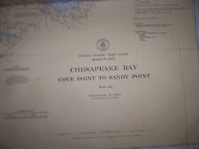 VINTAGE NAUTICAL CHART MD CHESAPEAKE BAY Cove Pt to Sandy Pt
-
$68.41 CAD
 2 Vintage Waterproof Loran-C Overprinted Course Plotter Chart Map California
-
$32.84 CAD
 C&GS Coastal Map - Chesapeake Bay - Mobjack Bay To York River #494 18th Ed. 1973
-
$61.57 CAD
 Rare Vintage 1945 United States US Navy Military North Atlantic Pilot Chart Map
-
$13.62 CAD
 Five Vintage Seamanship/Navigation Booklets
-
$47.87 CAD
 Vintage 1983 NOAA Bay De Noc Area Nautical Sound Chart Map LORAN-C ~ 48” x 36”
-
$27.36 CAD
 Vintage Hydrographic Chart Corinto Harbor West Nicaragua Central America WW2
-
$27.37 CAD
 Nautical Chart Catalog 2 Pacific Coast Hawaii Guam April 1979
-
$27.36 CAD
 Hydrographic Chart Caroline Islands Kusaie or Ualan Island N. Pacific Ocean WW2
-
$34.14 CAD
 Vtg Army Core of Engineers Org Chart of Personnel at Headquarters V 1959
-
$15.81 CAD
 LARGE 23" X 17" Togiak Bristol Bay Alaska Nautical navigation chart maps Atlas
-
$34.20 CAD
 Vintage Nautica Chart 837-SC, August 1971, SC Intracoastal Waterway.
-
$71.15 CAD
 1897 Chart showing Light Stations in Long Island Sound - Darrow & Comstock Ad.
-
$37.76 CAD
 1859 Coast Survey Chart St. Mary's River Cornfield Harbor Pt. Lookout Maryland
-
$21.90 CAD
 NAUTICAL NAVIGATIONAL CHART # 11425 - CHARLOTTE HARBOR TO TAMPA BAY - FL
-
$54.70 CAD
 Nautical Chart Long Island Sound #216 N Shore 1937- 28 3/16 x 36 5/8" Vintage
-
$30.11 CAD
 C&GS Coastal Map - New Jersey/Delaware- Cape May To Fenwick #12244 28th Ed. 1975
-
$951.11 CAD
 Antique 1909 Geo W Eldridge’s Chart D Massachusettes Bay
-
$327.07 CAD
 1853 MAURY S PILOT CHART OF THE SOUTH ATLANTIC ~ SHEET NO. 2, SERIES C ~ SCARCE
-
$27.37 CAD
 C&GS Coastal Map. Chesapeake Bay - Rappahannok River Ent. - #573 14th Ed. 1973
-
$16.42 CAD
 NAVIGATIONAL CHART / MAP PALM SHORES TO WEST PALM BEACH FL. # 11472
-
$43.09 CAD
 NOAA NAUTICAL CHART #11438 11441 11439 11434 Florida Key West Harbor Tortugas
-
$123.10 CAD
 NOAA HAVANA to TAMPA Nautical Chart Map Loran C Overprinted 11420 1927 Data 1985
-
$13.69 CAD
 Marine Chart, Laminated Michigan NW Lower Peninsula, 11x17, West Marine
-
$41.06 CAD
 C&GS Coastal Map - Chesapeake Bay Entrance #1222, 1973, 37th Edition 35”X 45”
-
$21.35 CAD
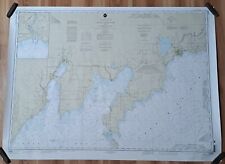
 Vintage 36 x 48 NOAA Nautical Map Chesapeake Bay Aproaches To Baltimore 1980s
-
$57.41 CAD
 Massachusetts Geodetic Survey Map x 2 USC & GS Essex County WPA Vintage


