 Antiques (CA)
-
$274.17 CAD

 1867 Kansas Colorado Montana & Dacota Hand Colored Map 13 x 15 Mitchell Antique
-
$109.65 CAD
 1879 Map Maine United States New England Victorian Geography 1st Edition DWAA9
-
$174.02 CAD
 Original 1864 PENNSYLVANIA NJ Antique hand colored JOHNSON's MAP 26.5 X 18"
-
$109.65 CAD
 1879 Map West Central States Group Victorian Atlas Geography 1st Edition DWAA9
-
$272.80 CAD
 Rare 1934 De Soto Expedition Route Map Swanton Artifact Antique Native American
-
$47.98 CAD
 1862 Johnson Iowa & Nebraska antique map 17.6" x 14.2" nice color
-
$149.42 CAD
 1849 Louisiana & New Orleans by Mitchell antique map ~17.4" x 13.8" Hand colored
-
$239.90 CAD
 1832 Hand-Colored Map of Mississippi, Louisiana and the Arkansas Territory, NOLA
-
$61.69 CAD
 1867 Town of Yorktown New York antique map ~ rare ~ 17.1" x 14.1" hand color
-
$80.88 CAD
 1862 Johnson Minnesota & Dakota antique map 17.2" x 14" nice color
-
$109.67 CAD
 1867 Town of Stamford Connecticut antique map ~ rare ~ 26.6" x 22.5" hand color
-
$94.59 CAD
 1878 California Mitchell antique map 22.9" x 15.1" - San Francisco inset
-
$143.94 CAD
 1849 Mississippi by Mitchell antique map ~17.4" x 13.8" Hand colored
-
$205.63 CAD
 Original Circa 1850 Map Of Oregon Boundary Lithograph By A. Hoen & Co.
-
$164.50 CAD
 1865 Tennessee & Kentucky by Johnson Ward - beautiful antique map 26.5" x 18"
-
$164.50 CAD
 1865 Wisconsin & Michigan by Johnson Ward - beautiful antique map 26.5" x 18"
-
$143.94 CAD
 1860 Wisconsin & Michigan Mitchell antique map 15.3" x 12.7" rare 1st edition
-
$561.98 CAD
 1826 MAP of the UNITED STATES Oregon Territory Mexico Texas no Canada America
-
$274.17 CAD
 "A Map of Long Island" NY Historic Wall Map Wall Art Decorative Wood Piece
-
$41.13 CAD
 1876 Lake Zurich & J. Roberston Residence, Illinois antique map ~ 17.6" x 14.3"
-
$13.71 CAD
 Sacramento Delta San Joaquin Atlas Map Spiralbound CA Water Resou 1995 Book Rare
-
$123.38 CAD
 1849 Kentucky by Mitchell antique map ~17.4" x 13.8" Hand colored Lexington
-
$239.90 CAD
 1875 Map Yellowstone Montana Captain William Ludlow US Army Corps Engineers
-
$34.26 CAD
 RARE Rand McNally New York 1962 Pocket Reference Map
-
$135.71 CAD
 1878 Colorado Montana Dakota & Wyoming Mitchell antique map 22.9" x 15.1"
-
$30.09 CAD
 COPY 1863 Lloyds Military Map Border & Southern States territory held by Rebels
-
$308.44 CAD
 1843 Rare Original Map of United States, Mexico and Cuba
-
$34.27 CAD
 1876 Henderson & Mercer Illinois county map antique ~ 17.3" x 13.8" hand color
-
$109.65 CAD
 1879 North Central States Group US Victorian Atlas Geography 1st Edition DWAA9
-
$164.50 CAD
 1865 Iowa & Nebraska by Johnson Ward - beautiful antique map 26.5" x 18"
-
$231.52 CAD
 Original 1864 WISCONSIN MICHIGAN-) Antique hand colored JOHNSON's MAP 26.5 X 18"
-
$86.99 CAD
 Original 1864 INDIANA :-) Antique hand colored JOHNSON's MAP 26.5 X 18"
-
$514.07 CAD
 1862 Johnson California Southwest Territory antique map 26.1" x 18.7" nice color
-
$41.13 CAD
 1867 Town of Lewisboro New York antique map ~ rare ~ 17.1" x 13.9" hand color
-
$17.81 CAD
 Vintage 1940s COLORADO Highway Road Map - Chevron RPM Gasoline Service Station
-
$47.98 CAD
 1876 James Gaines Edgar Ill & more farm residences map antique ~ 17.6" x 14.3"
-
$75.40 CAD
 1867 Town of Huntington Connecticut antique map rare ~ 17.3" x 13.8" hand color
-
$34.27 CAD
 1876 Fayette & Effingham Illinois county map antique ~17.3" x 13.8" hand color
-
$463.05 CAD
 Original 1866 - TEXAS - Antique hand colored:-) JOHNSON's MAP 26.5 X 18"
-
$329.00 CAD
 CIVIL WAR 1862-63 "Map of the Battle-Grounds in the Vicinity of Richmond, VA."
-
$376.98 CAD
 1867 Town of Greenwich Connecticut antique map ~ rare ~ 17.1" x 13.8" hand color
-
$34.27 CAD
 1876 Fulton & McDonough Illinois county map antique ~17.3" x 13.8" hand color
-
$178.20 CAD
 1884 ANTIQUE MAP Indian Removal CHEROKEE NATION 32" Arkansas Kansas Missouri
-
$150.79 CAD
 1867 Town of Poundridge New York antique map ~ rare ~ 17.3" x 14.1" hand color
-
$47.98 CAD
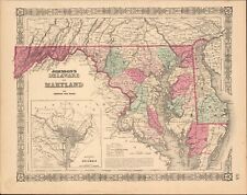 1865 Maryland Delaware & DC by Johnson Ward - beautiful antique map 18" x 14.2"
-
$130.23 CAD
 1862 Johnson Dakota Nebraska Kansas Colorado antique map 17.4" x14.2" nice color
-
$15.41 CAD
 Vintage 1950 New Hampshire Vermont Highway Road Map Guide Cities Service Station
-
$171.36 CAD
 1883 General Sherman Route Map Fort Ellis Montana to Fort Hope British Columbia
-
$171.36 CAD
 1877 F. V. Hayden Parts of Western Wyoming and Southeastern Idaho Map
-
$27.42 CAD
 1889 South & North Dakota Tunison antique map ~13.8" x 11.5" vibrant color
-
$34.26 CAD
 1885 Antique Atlas Map / PHYSICAL MAP OF THE UNITED STATES
-
$54.83 CAD
 1876 Kendall Grundy Cook Illinois county map antique ~ 28.2" x 17.6" hand color
-
$27.40 CAD
 United States Hammond Map In Its Original Package
-
$61.69 CAD
 1878 Georgia Alabama Mitchell antique map 22.7" x 15.1" Atlanta Savannah insets
-
$34.27 CAD
 1876 Bureau & Henry Illinois county map antique ~ 17.3" x 13.8" hand color
-
$61.69 CAD
 1867 Town of North Castle New York antique map ~ rare ~ 17.2" x 14" hand color
-
$102.81 CAD
 1867 Town of Danbury Connecticut antique map ~ rare ~ 16.9" x 13.7" hand color
-
$53.46 CAD
 1878 Western Hemisphere Mitchell antique map 15.1" x 12.1" - nice color
-
$53.46 CAD
 1878 Maine Mitchell antique map 15.1" x 12.1" - nice color
-
$102.81 CAD
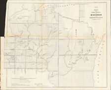 1856 Wisconsin & MN Survey Antique Map Lithograph - Ackerman NY ~ 21.5" x 18.7"
-
$61.69 CAD
 1878 United States map 22.8" x 15.1" nice color - Island of New Foundland inset
-
$239.90 CAD
 1840 Maine antique map by Greenleaf ~ 14.25" x 11.9" scarce 1st edition
-
$68.54 CAD
 1864 Dakota Montana Nebraska Kansas CO by Johnson Ward antique map 17.3" x 13.8"
-
$685.43 CAD
 1840 United States antique map by Greenleaf - 14.2" x 12" scarce 1st edition
-
$34.27 CAD
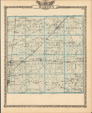 1876 Marion & Clinton Illinois county map antique ~17.3" x 13.8" hand color
-
$53.46 CAD
 1878 Oregon Washington MT ID Mitchell antique map 15.1" x 12.3" - nice color
-
$34.27 CAD
 1876 Johnson Pope & Massac county Ill map antique ~ 17.3" x 13.8" hand colored
-
$124.73 CAD
 JASPER COUNTY IOWA PLAT BOOK 1887 MAPS SURVEY RECORDS FOOTE HOOD 1985 NEWTON IA
-
$122.01 CAD
 1878 Boston Mitchell antique map / plan 23" x 15.1" - nice color - harbor inset
-
$61.69 CAD
 1862 Johnson's Missouri and Kansas Map Johnson & Ward Antique
-
$204.26 CAD
 1878 Texas antique map 22.8" x 15.1" nice color - Galveston Indian Territory NM
-
$9.53 CAD
 Vintage Hammonds 1911 Atlas Map Of Louisiana
-
$41.13 CAD
 1876 John Van Horn Residence, Putnam Co Illinois antique map ~ 17.6" x 14.3"
-
$34.27 CAD
 1708 Antique Map North American Reproduction British American Colonies Vtg
-
$82.24 CAD
 1867 Town of Bedford New York antique map ~ rare ~ 17.5" x 14.5" hand color
-
$75.40 CAD
 1862 Johnson Kentucky & Tennessee antique map 24.7" x 17.9" nice color
-
$272.80 CAD
 1867 Town of Fairfield Connecticut antique map ~ rare ~ 17.3" x 13.8" hand color
-
$68.54 CAD
 1867 Town of Bridgeport Connecticut antique map ~ rare ~ 17" x 13.8" hand color
-
$2741.70 CAD
 1840 Oregon Territory antique map by Greenleaf - 14.25" x 12" scarce 1st edition
-
$34.27 CAD
 1876 Woodford & Peoria Illinois county map antique ~ 17.3" x 13.8" hand color
-
$685.43 CAD
 1840 North America antique map by Greenleaf - 14.2" x 12" scarce 1st edition
-
$20.52 CAD
 Vtg 1980's Kroll's Map of Alaska Cities Towns Highways Airports 37 4/2" x 43"
-
$102.81 CAD
 1862 Johnson Virginia PA DE MD antique map 26.6" x 18.1" nice color - Richmond
-
$61.69 CAD
 1862 Johnson's New York Map Johnson & Ward Illustrated Family Atlas Antique
-
$41.13 CAD
 1876 Elizabeth Hiltabrand Residence, Putnam Co Ill antique map ~ 17.6" x 14.3"
-
$9.53 CAD
 Vintage Hammonds 1911 Atlas Map Of Michigan
-
$34.27 CAD
 1876 Eddy Stock Farm & Residence, Lake Co Ill antique map ~ 17.6" x 14.3" towns
-
$226.19 CAD
 1867 Town of Newtown Connecticut antique map ~ rare ~ 16.8" x 14.2" hand color
-
$239.90 CAD
 1840 Delaware MD map by Greenleaf ~ 14.25" x 11.9" scarce 1st edition Antique
-
$205.63 CAD
 1867 Town of Norwalk Connecticut antique map ~ rare ~ 17.2" x 13.8" hand color
-
$34.27 CAD
 1876 Edwards Wabash Wayne county map antique ~ 17.3" x 13.8" hand colored
-
$27.42 CAD
 1889 Georgia & South Carolina Tunison antique map ~13.8" x 11" vibrant color
-
$41.13 CAD
 1876 United States Agriculture & Vitality map antique ~ 17.3" x 13.8" hand color
-
$109.67 CAD
 1867 Town of Bedford New York antique map ~ rare ~ 17.2" x 14" hand color
-
$54.82 CAD
 Map Of Original 13 Colonies 1871 Victorian Lithograph History Swinton DWAA12
-
$34.27 CAD
 1876 Gallatin Hardin Saline Ill county map antique ~ 17.3" x 13.8" hand colored
-
$61.69 CAD
 1878 Kentucky & Tennessee Mitchell antique map 15.1" x 12" - nice color
-
$135.71 CAD
 1867 Town of Trumbull Connecticut antique map ~ rare ~ 17.3" x 14" hand color
-
$174.02 CAD
 Original 1866 MAINE Antique hand colored JOHNSON's MAP 26.5 X 18"
-
$109.65 CAD
 1879 Map New England USA Victorian Atlas Harpers Geography 1st Edition DWAA9


