 Antiques (CA)
-
$54.89 CAD

 Map of Europe Poster Reproduction Super High Quality Print 24"x18"
-
$28.85 CAD
 1897 RUSSIA Map Moscow ORIGINAL Poland Finland Ukraine Odessa RAILROADS ANTIQUE
-
$24.73 CAD
 1937 VINTAGE PHYSICAL MAP OF EUROPE GERMANY POLAND FRANCE ITALY GREAT BRITAIN
-
$26.02 CAD
 1930 ORIGINAL ANTIQUE PHYSICAL MAP OF EUROPE GERMANY AUSTRIA HUNGARY TURKEY
-
$27.74 CAD
 1896 ANTIQUE PHYSICAL MAP OF CENTRAL EUROPE GERMANY POLAND RIVERS MOUNTAINS
-
$21.98 CAD
 Europe - Original 1903 Dated Physical Map by Dodd Mead & Company. Antique
-
$54.94 CAD
 1839 Stieler Physical Map Europe River Basins Mountain Ranges Rhine Danube Seine
-
$24.73 CAD
 1900 ORIGINAL ANTIQUE MAP PHYSICAL EUROPE POLAND RUSSIA GERMANY AUSTRIA HUNGARY
-
$137.38 CAD
 1767 Europe's Lakes, Rivers & Mountains antique map by Clouet ~ 22.7" x 16.6"
-
$21.97 CAD
 1911 Stieler Map Russia St. Petersburg Kliew Smolensk Moscow Poland Warsaw Wilna
-
$61.82 CAD
 1795 Guthrie Poland Showing Claims 10.1" x 8.4" Authentic & original antique map
-
$274.77 CAD
 1845 Europe map by A.K. Johnston ~ 25.8" x 21.2" Antique Pastel Color Huge
-
$32.96 CAD
 1892 Stieler Map Balkans Greece Italy Turkey Romania Bulgaria Serbia Bosnia
-
$16.14 CAD
 1966 POLAND + CZECHOSLOVAKIA Atlas Map, vintage World Book Atlas, full color
-
$21.98 CAD
 1911 Stieler Map Sweden Norway Finland Russia Poland St. Petersburg Moscow Plan
-
$21.98 CAD
 1887 Andrees Map - Germany Austria Poland Holland Population & Physical Relief
-
$157.99 CAD
 1767 Kingdom of Poland antique map by Clouet ~ 22.8" x 17.1" hand color
-
$48.08 CAD
 1868 Russia in Europe + Poland by Mackenzie 14.3" x 10.7" authentic antique map
-
$61.82 CAD
 1780 Europe by Raynal / Bonne 14.1" x 9.75" authentic antique map
-
$137.38 CAD
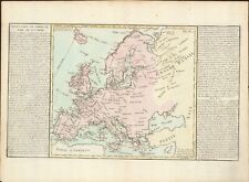 1767 Europe's Islands Capes & Seaports antique map by Clouet ~ 23" x 16.8"
-
$10.00 CAD
 Antique map. CENTRAL EUROPE, GERMANY. PHYSICAL MAP OF CENTRAL EUROPE. Circa 1905
-
$16.47 CAD
 1835 Map x 2 - Europe Political & Physical - Austria Italy Spain Britain
-
$16.47 CAD
 1895 Johnston Map - Physical Europe & Political England & Wales London Liverpool
-
$34.35 CAD
 1901 Tunison Europe & South America antique map ~ 22.8" x 14.6" nice color
-
$27.46 CAD
 1843 Woodbridge Map Europe France Spain Germany Italy Sweden Norway Austria UK
-
$27.46 CAD
 1843 Woodbridge Physical Map Europe France Spain Germany Italy Sweden Austria UK
-
$103.04 CAD
 1820 Europe Iberia to Russia antique map by Lavoisne ~ 21.8" x 17.4" hand color
-
$136.01 CAD
 1840 Europe map by Greenleaf 14.2" x 11.9" scarce 1st edition antique
-
$43.95 CAD
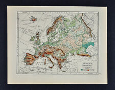
 c 1860 Ansart Map Physical Europe Continental Divide River Basins Alps Pyrenees
-
$103.04 CAD
 1820 Europe Barbarian Incursion antique map by Lavoisne 21.8" x 17.6" hand color
-
$103.04 CAD
 1876 Europe antique map ~ 27.5" x 19.5" hand colored - large - ships
-
$2472.93 CAD
 1716 H. Moll Map of Moscovy Russia, Poland VERY RARE


