 Antiques (CA)
-
$24.02 CAD

 1939 Antique Pittsburgh Pennsylvania Street Map City Map of Pittsburgh 1415
-
$273.69 CAD
 Antique Color Poster Map of Snyder Union Counties Pennsylvania 28" X 39" Bright!
-
$27.71 CAD
 1914 Antique PENNSYLVANIA State Map Vintage Map of Pennsylvania Wall Decor 1013
-
$22.11 CAD
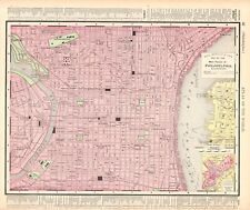
 1939 Antique PHILADELPHIA Pennsylvania Street Map City Map of Philadelphia 9053
-
$24.09 CAD
 1937 McNally Map Texas Austin Houston Dallas San Antonio El Paso Galveston Waco
-
$62.88 CAD
 Old 1897 Map ~ PENNSYLVANIA~ Authentic Atlas Map (XXL22x29) Free S&H #007
-
$35.51 CAD
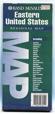
 Rand-McNally regional state map: EASTERN UNITED STATES © 2004 - paper
-
$62.88 CAD
 1921 - 20" x 28" Map ~ PHILADELPHIA & VICINITY ~ Vintage Original Free S&H
-
$54.73 CAD
 1881 McNally Railroad Map Pennsylvania Philadelphia Pittsburgh Erie Harrisburg
-
$27.37 CAD
 Antique 1895 Map of Philadelphia & Pennsylvania Published by Rand, McNally & Co.
-
$27.36 CAD
 Original 1883 Map NORTHWESTERN PENNSYLVANIA Butler Erie Clearfield Warren Mercer
-
$13.67 CAD
 c 1930 Rand McNally Map Pittsburgh Plan Downtown Point Ohio River Pennsylvania
-
$34.12 CAD
 Rand-McNally state map: PENNSYLVANIA - c.1993 - paper - highway
-
$44.54 CAD
 From 1895 Rand McNally Atlas of The World-Map of Pennsylvania & Philadelphia.
-
$13.34 CAD
 Rand, McNally & Co Antique 1904 Map Of Pennsylvania 7x6
-
$22.11 CAD
 1941 Antique PENNSYLVANIA Map State Map of PENNSYLVANIA Gallery Wall Art 9780
-
$13.67 CAD
 c1970 McNally Cosmo Map - Pennsylvania - Pittsburgh Philadelphia Erie Allentown
-
$54.73 CAD
 Original 1913 Large-Format Streetcar Map PHILADELPHIA Coal Docks Ferry Slips RRs
-
$37.15 CAD
 **1921 - 20" x 14" B&W Map ~ PITTSBURGH & VICINITY ~ Free S&H
-
$17.72 CAD
 1911 Antique Rand McNally Map of PENNSYLVANIA w/copy History/Demographics
-
$34.21 CAD
 1942 Antique Map of Central Pittsburgh, Second Largest City and Port of Entry of
-
$16.41 CAD
 1937 McNally Map Washington Seattle Tacoma Olympia Spokane Port Angeles Townsend
-
$12.66 CAD
 Rand, McNally & Co Antique 1899 Map Of Pennsylvania 7x6
-
$16.41 CAD
 1937 McNally Map Vermont Montpelier Burlington Rutland Lake Champlain Craftsbury
-
$12.66 CAD
 Rand, McNally & Co Antique 1899 Map Of Pennsylvania 7x6
-
$16.41 CAD
 1937 McNally Map Pennsylvania Philadelphia Pittsburgh Erie Harrisburg Allentown
-
$29.44 CAD
 1884 Map ~ CENTRAL PHILADELPHIA - LEAGUE ISLAND NAVY YARD ~ (10x13) -#P295
-
$24.32 CAD
 Antique 1900 Map of Pennsylvania By Rand McNally & Co - Philadelphia On Reverse
-
$30.18 CAD
 1895 Antique PHILADELPHIA Street Map Rand McNally City Map of Philadelphia 859
-
$16.42 CAD
 Rand-McNally city Paper Map phoenix AZ ©1996 Index - Street - 45"x36"
-
$34.21 CAD
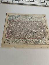
 1942 Antique Map of Pennsylvania
-
$20.51 CAD
 RAND MCNALLY COMMERCIAL ATLAS MAP PAGE STATE OF PENNSYLVANIA 1911 VINTAGE LARGE
-
$12.25 CAD
 Antique Color Map 1913 State of New Jersey or Pennsylvania
-
$16.41 CAD
 1882 McNally Map - Pennsylvania New Jersey Maryland Philadelphia Washington DC
-
$43.78 CAD
 1881 McNally Railroad Map Kentucky Tennessee Louisville Lexington Nashville TN
-
$34.14 CAD
 1895 Antique Map of Philadelphia PA Vintage Atlas Page Pennsylvania
-
$41.04 CAD
 Pennsylvania ORIGINAL Antique State Map from Rand McNally 1899 Atlas 28" x 21.5"
-
$27.36 CAD
 1892 PENNSYLVANIA Map w/ Colored Counties, Reverse NEW JERSEY, Dated, 14" x10.5"
-
$32.68 CAD
 Rand-McNally regional state map: EASTERN UNITED STATES © 1993 -BAD-
-
$75.27 CAD
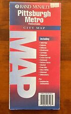 Rand-McNally city map: PITTSBURGH METRO Pennsylvania 1995 -Index- 1¼ yards
-
$13.67 CAD
 1871 McNally Map Pennsylvania New Jersey Maryland Delaware Washington DC
-
$28.30 CAD
 Old 1901 Atlas Map ~ CENTRAL PHILADELPHIA ~ (11x14) -#061
-
$37.99 CAD
 Rand-McNally regional map: PHILADELPHIA & Vicinity Pennsylvania © 1997 -Index-
-
$16.41 CAD
 PENNSYLVANIA - 1895 Antique State Map with County & City Lists
-
$17.78 CAD
 1935 OREGON & PENNSYLVANIA 2-Sided Large Color Map 11" X 14"
-
$16.41 CAD
 PENNSYLVANIA 1895 Antique State Map with County & City Lists
-
$19.46 CAD
 PA 1895 DATED PHILADELPHIA PENNSYLVANIA MAP. Railroads Antique Late 19th Century
-
$28.30 CAD
 4pcs 1882 (Lg 15"x21") R. McNally Atlas Map ~ PENNSYLVANIA in 4 Maps ~ Free S&H
-
$16.42 CAD
 Antique 1901 Rand McNally Map of Pennsylvania & 1895 Map of Philadelphia. VG.
-
$35.25 CAD
 Rand-McNally regional map: PHILADELPHIA & VICINITY © 1993 Delaware Valley - Love
-
$35.57 CAD
 Rand-McNally regional state map: EASTERN UNITED STATES © 1993
-
$65.67 CAD
 1892 Rand McNally Railroad Map Pennsylvania Philadelphia Pittsburgh Erie 21x27"
-
$32.84 CAD
 1901 Map PHILADELPHIA, U.S. Naval Asylum, Independence Hall ~ PA on Reverse
-
$13.67 CAD
 1884 Rand McNally Map - Pennsylvania - Philadelphia Pittsburgh Erie Allentown
-
$102.62 CAD
 New Jersey b/w Pennsylvania FRAMED Original Antique Map Rand McNally 1894 Atlas
-
$16.42 CAD
 1884 McNally Map Pennsylvania Pittsburgh Philadelphia Erie Allentown Harrisburg
-
$29.44 CAD
 Old 1909 Rand McNally Atlas Map ~ PENNSYLVANIA - ERIE - PHILADELPHIA ~ Free S&H
-
$21.90 CAD
 1885 McNally Map - Pennsylvania - Philadelphia Pittsburgh Erie Harrisburg - PA
-
$16.42 CAD
 vintage 1939 atlas map of Oregon and Pennsylvania 2 sided 11x14 ready to frame
-
$32.01 CAD
 1888 R McNally Folded Atlas Map~ PENNSYLVANIA ~ (XL25x38) Free S&H ~Inv#178
-
$68.41 CAD
 Large Format 1905 COLOR Rand McNally Map Atlas Page 62-67 Pennsylvania
-
$62.88 CAD
 Old 1895 X-Large 28"x22" Rand McNally Atlas Map ~ PHILADELPHIA, PA ~ Free S&H
-
$13.67 CAD
 1912 Pittsburgh and Vicinity Map, Rand-McNally New Library Atlas of the World
-
$20.53 CAD
 1895 Rand McNally Map of Pennsylvania 11 X 14
-
$41.06 CAD
 Rand-McNally City Map: PHILADELPHIA Pennsylvania 1996 Street Index
-
$38.96 CAD
 PA ANTIQUE 1891 DATED PHILADELPHIA PENNSYLVANIA Map PIERS on the DELAWARE RIVER
-
$27.36 CAD
 Vintage 1983 STILL NEW Rand McNally PITTSBURGH, PA METRO Map & Vicinity
-
$68.36 CAD
 1889 Philadelphia Map w/ Docks, Port Inset, Rand McNally Standard World Atlas


