 Antiques (CA)
-
$75.40 CAD

 France Geological & Physical Map Paris Marseilles 1902 Belin map
-
$53.30 CAD
 1897 North France Map ORIGINAL Paris Cherbourg Le Havre Brest Dunkirk Roubaix
-
$24.66 CAD
 1804 Copper Engraving Hand Colored Map Netherlands France Darton & Harvey
-
$50.72 CAD
 1899 Central France Map ORIGINAL Paris Dijon Versailles RAILWAYS PROVINCES
-
$39.65 CAD
 FRANCE In The Year 1570 To Illustrate St. Bartholomew Eve MAP Normandy Champagne
-
$47.82 CAD
 1899 Northern France Map ORIGINAL Provinces STEAMSHIPS Railways Townships Ports
-
$21.92 CAD
 1885 Drioux Map France Physical Mountains Volcano Geology French Alps Mont Blanc
-
$27.42 CAD
 1864 France Holland Belgium by Johnson Ward beautiful antique map 24.8" x 17"
-
$13.69 CAD
 1900 Times Map France Switzerland Pyrenees Allps Mt. Blanc Paris French Riviera
-
$41.13 CAD
 1876 Holland & France antique map ~ 19.6" x 14.2" hand colored
-
$274.17 CAD
 1845 Europe map by A.K. Johnston ~ 25.8" x 21.2" Antique Pastel Color Huge
-
$89.11 CAD
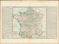 1767 General France antique map by Clouet ~ 23" x 17.1" - hand color
-
$102.81 CAD
 1767 General map of France antique map by Clouet ~ 22.9" x 16.6" - hand color
-
$82.11 CAD
 1873 German lang. France Paris Brussels Holland Historical 1800s Antique Map
-
$54.82 CAD
 1877 Migeon Map France Physical Rhine Seine Loire Rhone Garonne River Basin Alps
-
$82.25 CAD
 1880 Migeon Map France Hypsometric Physical Elevations Alsps Pyrenees Mont Blanc
-
$89.11 CAD
 1767 "Commercante" France antique map by Clouet ~ 22.7" x 17.1" - hand color
-
$102.81 CAD
 1767 Ecclesiastical France antique map by Clouet ~ 22.6" x 16.6" - hand color
-
$41.13 CAD
 1856 Black's France & Corsica map 17.2" x 12.6" - beautiful antique with color
-
$13.69 CAD
 1872 Vuillemin Map Physical France Mountains Rivers
-
$47.98 CAD
 1856 Black's France & Corsica 21.8" x 17.2" - beautiful antique with color
-
$108.30 CAD
 1849 France Paris & Corsica by Mitchell antique map ~ 17.4" x 13.8" hand colored
-
$89.11 CAD
 1767 Mineralogical France antique map by Clouet ~ 22.8" x 16.7" - hand color
-
$582.61 CAD
 Carte pittoresque & maritime de l’Europe: indiquant la division des Etats, les r
-
$16.44 CAD
 1885 Cortambert Map - Physical France - Seine Rhone River Basin Pyrenees Alps
-
$16.44 CAD
 1835 Map x 2 - Europe Political & Physical - Austria Italy Spain Britain
-
$13.69 CAD
 1876 Map of France Paris Marseille Laon Rheims Chartres Le Havre Riviera Tours
-
$102.81 CAD
 1767 Governments of France antique map by Clouet ~ 22.6" x 16.8" - hand color
-
$27.40 CAD
 1880 Migeon Map - NE France - Paris Belfort Reims Nancy
-
$43.85 CAD
 c 1860 Ansart Map Physical Europe Continental Divide River Basins Alps Pyrenees
-
$32.89 CAD
 1885 Stanford Map Rain & Rivers British Isles England Scotland Ireland Antique
-
$27.40 CAD
 1843 Woodbridge Map Europe France Spain Germany Italy Sweden Norway Austria UK
-
$239.90 CAD
 1845 France map by A.K. Johnston ~ 25.8" x 21.2" Antique Pastel Color Huge
-
$21.92 CAD
 1875 Lange Map - France - Paris Marseilles Toulouse Bordeaux Nantes Lyon Tours
-
$21.92 CAD
 1885 Drioux Map - Seine River Basin & Loire Basin - Paris Tours St. Denis France
-
$13.69 CAD
 1880 Migeon Map Physical France Saut du Doubs Waterfall
-
$13.69 CAD
 1882 Drioux Map - Physical France Alps Riviera Corsica
-
$27.40 CAD
 1843 Woodbridge Physical Map Europe France Spain Germany Italy Sweden Austria UK
-
$32.89 CAD
 1877 Migeon Map Physical France French Alps Pyrenees Region Elevantions Mt Blanc
-
$24.68 CAD
 c 1885 Hartleben Map - France - Paris Corsica Le Tour Lyon Marseille Bordeaux
-
$102.81 CAD
 1849 Europe by Mitchell antique map ~ 17.4" x 13.8" hand colored
-
$171.36 CAD
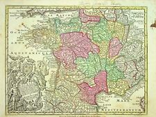 1762 France by M. Seutter - Gallia Concinata ad Magnum authentic antique map
-
$54.83 CAD
 1876 France & German empire map antique ~ 17.3" x 13.8" hand color Warner Beers
-
$89.11 CAD
 1767 Provinces of France antique map by Clouet ~ 22.1" x 16.2" - hand color
-
$47.98 CAD
 1856 Black's Central Europe 24.4" x 17.3" - beautiful antique with color
-
$135.71 CAD
 1840 France map by Greenleaf 14.2" x 11.9" scarce 1st edition antique
-
$38.37 CAD
1877 Migeon Map Physical France French Alps Pyrenees
-
$82.51 CAD
 1889 MAP ~ FRANCE ~ PHYSICAL BRITTANY GUIENNE CHAMPAGNE ENVIRONS OF PARIS
-
$12.27 CAD
 Original 1911 Century Atlas Travel Map of Central Europe. ANTIQUE COLLECTIBLE
-
$1096.68 CAD
 Original Antique 16th C Map Of France Abraham Ortelius Atlas 1573 Galliae Regni
-
$21.93 CAD
1885 Drioux Map France Physical River Basins Seine Rhone Loire Garonne Var Orne


