 Antiques (CA)
-
$81.22 CAD

 A CHARTE OF LONG BAY IN YE CAROLINAS... Drawn By Michelle Minah © 1973 J. North
-
$92.24 CAD
 LARGE 2001 RALEIGH NORTH CAROLINA Map Zebulon Wake Forest Holly Springs
-
$19.27 CAD
 Map Of Original 13 Colonies 1871 Victorian Lithograph History Swinton DWAA12
-
$14.45 CAD
 Map War Of Secession East Coast 1871 Victorian Woodcut Print History DWAA12
-
$8.26 CAD
 1897 Map of United States & Mexico Original antique print
-
$8.26 CAD
 1897 Map Western part of United States Original antique print USA
-
$14.45 CAD
 Map Revolutionary War South Colonies 1871 Victorian Woodcut Print History DWAA12
-
$8.26 CAD
 1897 Map East part of United States Original antique print
-
$41.15 CAD
 1972 Great Smoky Mountains National Park & Vicinity Topographic Map
-
$27.46 CAD
 Clarksville South, Virginia- NC 1968 Photoinspected 1988 Original USGS Topo Map
-
$61.95 CAD
 1865/1877 Coast & Geodetic Survey Map #7 Triangulation North Carolina
-
$55.05 CAD
 Mount Mitchell North Carolina Tennessee Valley Authority TVA 1946 Map Mt Pisgah
-
$55.05 CAD
 Charlotte North Carolina Mountain Island Lake Old Map 1969 Topographical Survey
-
$46.81 CAD
 North Carolina - Tennessee - Mount Mitchell Quadrangle (1900 survey) Original...
-
$15.20 CAD
 USGS Topographic Map 1985 Survey 30"x60" NC, SC Charlotte 35080-A1-PL-100
-
$19.78 CAD
 USGS Topographic Map 1986 Survey 30"x60" NC, SC Whiteville 34078-A1-PL-100
-
$8.26 CAD
 1897 Map North part of United States Original antique print USA
-
$55.05 CAD
 Craggy Pinnacle North Carolina Tennessee Valley Authority TVA 1947 Map BlueRidge
-
$9980.71 CAD
 Original 1848 Blunt Blueback Nautical Chart US East Coast Block Island to Cuba
-
$19.27 CAD
 Map Sherman's Army Virginia Operations 1871 Victorian Lithograph History DWAA12
-
$55.05 CAD
 Barnardsville North Carolina Tennessee Valley Authority TVA 1946 Map Buncombe Co
-
$55.05 CAD
 Linville Falls Pisgah NC North Carolina Tennessee Valley Authority TVA 1956 Map
-
$55.05 CAD
 Micaville Pisgah North Carolina Tennessee Valley Authority TVA Map Yancey County
-
$55.05 CAD
 Spruce Pine Pisgah Forest North Carolina Tennessee Valley Authority TVA 1960 Map
-
$55.05 CAD
 Newland Blue Ridge Mountains North Carolina Tennessee Valley Authority TVA Map
-
$27.46 CAD
 Macedonia, Georgia - North Carolina 1966 Original Vintage USGS Topo Map
-
$51.75 CAD
 USGS State Index for Topographic Maps NORTH CAROLINA double-sided 40 x 56 inches
-
$27.53 CAD
 Big Ridge NC 1946 Geological Survey Map 27x22 Nantahala National Forest TVA
-
$15.20 CAD
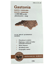 USGS Topographic Map 1986 Survey 30"x60" NC, SC Gastonia 35081-A1-PL-100
-
$15.20 CAD
 USGS Topographic Map 1985 Survey 30"x60" NC Salisbury 35080-E1-TM-100
-
$15.20 CAD
 USGS Topographic Map 1982 Survey 30"x60" NC Elizabethtown 34078-E1-TM-100
-
$15.20 CAD
 USGS Topographic Map 1986 Survey 30"x60" SC, NC Lancaster 34080-E1-PL-100
-
$24.09 CAD
 North Carolina North America Map 1935 United States 14 x 11" Coast LGAD99
-
$27.53 CAD
 Cruso NC 1946 Geological Survey Map 27x22 Pisgah National Forest TVA
-
$41.30 CAD
 Cape Fear River, North Carolina, Above Willmington - Shoals and Jetties 1889
-
$27.52 CAD
 VTG Guilford County North Carolina Historical Documentation Poster Map 34"x23"
-
$27.53 CAD
 Dunsmore Mountain NC 1946 Geological Survey Map 27x22 Pisgah National Forest TVA
-
$13.75 CAD
 Antique Map "Williamston Sheet, North Carolina"
-
$15.20 CAD
 USGS Topographic Map 1986 Survey 30"x60" NC Hendersonville 35082-A1-TM-100
-
$15.20 CAD
 USGS Topographic Map 1983 Survey 30"x60" NC, SC Laurinburg 34079-E1-TM-100
-
$82.32 CAD
 1903 Antique Map North Carolina Craven County New Bern Ayden Dover 32 X 38 #9931
-
$27.53 CAD
 Pisgah Forest NC 1946 Geological Survey Map 27x22 Pisgah National Forest TVA
-
$41.30 CAD
 Lockwoods Folly River, North Carolina, 1895
-
$30.97 CAD
 1892 ANTIQUE MAP Mississippi, Louisiana, North Carolina, South Carolina
-
$55.04 CAD
 1951 Fayetteville North Carolina Topo Map Fort Bragg NC Army Corps Engineers
-
$41.27 CAD
 1950 Point Of Marsh Pamlico Sound Hunting Quarters North Carolina Topo Map NC
-
$61.95 CAD
 1843/1877 Coast & Geodetic Survey Map #6 Triangulation Rehoboth Bay to Back Bay
-
$68.80 CAD
 1968 Original Vintage USGS Topographical Map - John H. Kerr Dam VA & NC
-
$39.92 CAD
 1895 Antique MITCHELL Color Map of MARYLAND VIRGINIA NORTH & SOUTH CAROLINA
-
$75.72 CAD
 Cape Fear River, N.C., Below Wilmington, Ocean Bar, 1893
-
$54.93 CAD
 1909 Antique Color Map Scotland County North Carolina Laurinburg 23 X 30 #0359
-
$60.57 CAD
 CAPE FEAR RIVER Map North Carolina Mercator Projection
-
$61.95 CAD
 1877 Coast & Geodetic Survey Map #8 Triangulation Maryland to Georgia
-
$61.95 CAD
 1877 Coast & Geodetic Survey Map #5 Triangulation New York City to Cape Henopen
-
$48.18 CAD
 Railroad Jetty at Macon Point, North Carolina 1889
-
$48.18 CAD
 Map of the Upper Portion of Scuppernong River, North Carolina 1878
-
$137.67 CAD
 "Williamston Sheet North Carolina" U.S. Geological Map 1902
-
$68.76 CAD
 1969 Original Vintage USGS Topographical Map - Belews Creek, North Carolina ,NC
-
$48.18 CAD
 Progress Map, Trent River, North Carolina - Foy's Flats, 1889


