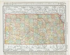
 Antiques (CA)
-
$27.52 CAD

 1895 Nebraska Map Antique ORIGINAL 11" Counties Cities
-
$32.19 CAD
 Rand-McNally city map: LINCOLN GRAND ISLAND KEARNEY Nebraska 1992 w/ University
-
$19.08 CAD
 1899 Color Map States of Kansas & Nebraska Very Clean Detailed Near Mint Map
-
$13.42 CAD
 Rand, McNally & Co Antique 1904 Map Of Nebraska 7x6
-
$12.73 CAD
 Rand, McNally & Co Antique 1900 Map Of Nebraska 7x6
-
$17.19 CAD
 1938 McNally Map Nebraska Omaha Lincoln Hastings Blair North Platte Red Cloud NE
-
$28.47 CAD
 1887 Map ~ NEBRASKA FRONTIER ~ Authentic Atlas Map (14x20) ~Free S&H #097
-
$11.70 CAD
 Rand, McNally & Co Antique 1900 Map Of Nebraska 7x6
-
$29.24 CAD
 Rand-McNally state map: NEBRASKA ©1998 - paper - highway - unused
-
$35.79 CAD
 1890 Nebraska Map, Double Page, Railroad Lines, 21.75" x 14" Colored Counties
-
$34.40 CAD
 1893 COLORADO Map w/ Colored Counties, Reverse NEBRASKA, Dated Map 14" x 10.5"
-
$17.83 CAD
 1911 Antique Rand McNally Map of NEBRASKA w/copy History/Demographics
-
$63.26 CAD
 Old 1897 Map ~ NEBRASKA ~ Authentic Atlas Map (XXL22x29) Free S&H -#033
-
$7.56 CAD
 RAND MCNALLY ATLAS MAP PAGE IOWA & NEBRASKA 1898 VINTAGE
-
$34.35 CAD
 Antique State of Kansas Map 1899 Atlas State of Nebraska flip multicolored
-
$55.05 CAD
 1881 McNally Railroad Map Nebraska Omaha Lincoln North Platte Dakota Sioux City
-
$27.53 CAD
 1914 Rand-McNally Railroad Map - 20-1/2 x 28 - Nebraska
-
$68.82 CAD
 Large Format 1905 COLOR Rand McNally Map Atlas Page 226&227 Railroads Nebraska
-
$27.46 CAD
 1901 Rand McNally Pocket Folding Map of Nebraska with Railroad Depots Antique
-
$12.32 CAD
 Antique Color Map 1913 State of Nebraska or Kansas
-
$217.21 CAD
 1895 MAP OF NEBRASKA Rand McNally Co Color Lithograph Engraving Large Doublepage
-
$28.47 CAD
 Nice 1888 R McNally Atlas Map ~ NEBRASKA FRONTIER ~(LG14x20) ~Free S&H ~Inv#191
-
$29.61 CAD
 Old 1909 Rand McNally Atlas Map ~ NEBRASKA ~ Free S&H
-
$27.53 CAD
 1885 McNally Map Nebraska Lincoln Omaha Kearney North Platte Grand Island NE
-
$27.53 CAD
 1884 McNally Map Nebraska Omaha Lincoln Beatrice Hastings Norfolk Grand Island
-
$41.29 CAD
 Nebraska b/w Omaha ORIGINAL Antique Map Rand McNally 1899 Atlas 28" x 21.5"
-
$26.78 CAD
 NE Antique DATED 1902 NEBRASKA Map. McNally Turn of 20th Century. Railroads.
-
$63.26 CAD
 1897 X-Large 28"x22" Rand McNally Atlas Map ~ NEBRASKA ~ Free S&H (AS-IS)
-
$30.41 CAD
 Rand-McNally state map: NEBRASKA © 1998 - paper - highway - road -
-
$26.16 CAD
 1907 Map NEBRASKA, Colored Counties, Lincoln, Omaha ~ Kansas on Reverse
-
$17.88 CAD
 1935 NEVADA & NEBRASKA - 2-Sided Color Map 11" X 14"
-
$63.26 CAD
 Old 1895 X-Large 28"x22" Rand McNally Atlas Map ~ NEBRASKA ~ Free S&H
-
$16.52 CAD
 vintage 1939 atlas map of Nevada & Nebraska 11x14 inches ready to frame
-
$206.48 CAD
 VTG 1900's RAND MCNALLY RAILROAD MAP of NEBRASKA - Book w/fabric Fold Out Map


