 Antiques (CA)
-
$28.73 CAD

 Vintage 1992 Natical Chart Map Of New York, Lake Ontario, Mexico Bay, North Pond
-
$54.72 CAD
 Oyster and Huntington Bays 1778 Published by an Act of Parliament Repro.
-
$84.81 CAD
 Original 1950s Nautical Chart Map,Hudson River,Fort Washington,New York Jersey
-
$38.30 CAD
 Vintage Nautical Marine Map New York Harbor 1970s. Sam Epstein original owner
-
$41.04 CAD
 Vintage - NOAA 1993 35th Ed Nautical Map - Approaches to New York 12300 Unfolded
-
$34.20 CAD
 1960s Lake Erie Educational Map For Training Purposes Only
-
$34.19 CAD
 1976 Nautical Chart East River New York USA Vintage Map Sailing Coastal Sea
-
$32.82 CAD
 Vintage 1982 Nautical Hudson Map - East Rivers Governors Island to 67th Street
-
$205.19 CAD
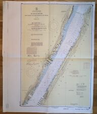
 Hudson and East Rivers Nautical Map #745 - Governors Island to 67th - 1944
-
$47.88 CAD
 1853 Little Sodus Bay US coast Survey map Cayuga New York 19"x 15" Nautical
-
$116.28 CAD
 Hudson & East Rivers Nautical Map Governors Island to 67th Vintage 1975 New York
-
$19.15 CAD
 1960s battles of the Civil War Facsimile printed on Parchment like paper
-
$34.20 CAD
 1960s Martha's Vinyard Educational Map For Training Purposes Only
-
$176.47 CAD
 SALE! GENUINE ANTIQUE 1893 color lithographed map East End LONG ISLAND NEW YORK
-
$136.78 CAD
 1928 Costal Color Tidal Current Chart,New York Harbor Staten Coney Long Island
-
$116.28 CAD
 Vintage 1967 Map NEW YORK CITY EAST RIVER, Tallman Island to Queensboro Bridge


