 Antiques (CA)
-
$82.24 CAD

 Massive Lot Of US Geological Maps USGS Topography Vintage Minnesota
-
$116.52 CAD
 1887 Original Antique Mitchell Maps: Minnesota & Dakota TY and Nebraska (Scarce)
-
$29.61 CAD
 1894 Antique ST PAUL Street Map George Cram Vintage Map of St Paul Minnesota 497
-
$53.30 CAD
 MINNESOTA Map 1912 ORIGINAL Counties Population Minneapolis St Paul Duluth
-
$23.30 CAD
 1893 MINNESOTA Map, Color Counties, Historical Points, 14" x 10.5"
-
$32.89 CAD
 1919 Auto Road Map Minnesota Minneapolis St Paul Cloud Duluth Hibbing Ely Hwy 61
-
$1369.48 CAD
 Antique 1855 Colton Hand Colored Pocket Map MINNESOTA Proposed Pacific RR Route
-
$24.68 CAD
 1953 VINTAGE MAP OF MICHIGAN / VERSO MINNESOTA
-
$24.62 CAD
 Antique 1896 ST PAUL MINNESOTA Map 14"x11" ~ Old Antique Original DAYTONS BLUFF
-
$28.57 CAD
 Vintage 1902 MINNESOTA Map 11"x14" Old Antique Original BEMIDJI DULUTH WADENA MN
-
$24.68 CAD
 Original 1896 Copper-Plate Map of Minnesota by A. J. Johnson. Antique
-
$39.47 CAD
 Vintage 1902 MINNESOTA Map 14"x22" Old Antique Original RED WING WACOUTA WINONA
-
$114.53 CAD
 Old Authentic 1862 Johnson Atlas Map DAKOTA TERRITORY - MINNESOTA (14x18)
-
$51.82 CAD
 1930s Antique Animated MINNESOTA State Map RARE Picture Map BLU 1372
-
$27.76 CAD
 1906 Antique MINNEAPOLIS Street Map City Map of St Paul Minnesota 1609
-
$684.05 CAD
 Antique 1930 Standard ATLAS Polk County Minnesota Plat MAPS Large hardcover BOOK
-
$19.88 CAD
 1912 Plat Map Part of White Earth Indian Reservation Clearwater County Minnesota
-
$39.43 CAD
 Vintage 1902 MINNESOTA Map 14"x22" ~ Old Antique Original BECKER ELK RIVER MORA
-
$29.56 CAD
 Vintage 1901 ST PAUL MINNESOTA Map 14"x11" ~ Old Antique Original HIGHLAND PARK
-
$19.69 CAD
 Antique Small Minnesota Map 1911 Map of Minnesota Wall Decor smap 1539
-
$27.68 CAD
 1943 VINTAGE WWII MAP OF MICHIGAN / MINNESOTA
-
$29.56 CAD
 Vintage 1902 MINNEAPOLIS MINNESOTA Map 11"x14" Old Antique Original HENNEPIN CTY
-
$80.88 CAD
 1862 Johnson Minnesota & Dakota antique map 17.2" x 14" nice color
-
$28.35 CAD
 1897 Century Atlas Map ~ MINNESOTA ~ (12x18) ~ Free S&H #256
-
$34.49 CAD
 Vintage 1898 ST PAUL MINNESOTA Map 14"x11" ~ Old Antique Original MN LAKE PHALEN
-
$178.20 CAD
 1954. A Literary Map of Minnesota. Informational, pictorial. RARE 23 x 29 inches
-
$54.82 CAD
 MINNESOTA COUNTY MAP BOOK PRINT COMMUNICATIONS COUNTY MINNESOTA 1990
-
$19.88 CAD
 1912 Plat Map Leon Township Clearwater County Minnesota Beard Clearbrook
-
$83.84 CAD
 1855 Hermann Meyer Antique Print Saint Anthony Falls Mississippi River Minnesota
-
$33.93 CAD
 1901 Antique DULUTH Minnesota Street Map George Cram Atlas Map of Duluth 9343
-
$24.06 CAD
 1895 Antique MINNEAPOLIS Street Map of Minneapolis Minnesota City Map 1209
-
$38.38 CAD
 1879 Map West Central States Group Victorian Atlas Geography 1st Edition DWAA9
-
$8.23 CAD
 1897 Map of United States & Mexico Original antique print
-
$38.38 CAD
 1919 Auto Road Map Minnesota Minneapolis St Paul Cloud Duluth Grand Portage Ely
-
$61.48 CAD
 HTF! 1978 Hap's Atlas Street Guide St Paul Minneapolis metropolitan area spiral
-
$62.99 CAD
 Old 1909 Plat Map ~ AMBOY Twp., COTTONWOOD Co., MINNESOTA ~Free S&H
-
$33.50 CAD
 Vintage 1901 MINNESOTA Map 11"x14" ~ Old Antique Original MINNEAPOLIS ST PAUL MN
-
$19.88 CAD
 1912 Plat Map Holst Township Clearwater County Minnesota Lake peterson
-
$67.06 CAD
 1850 H. Meyer Antique Print Lake Itasca, Minnesota Source of Mississippi River
-
$44.36 CAD
 Vintage 1900 MINNEAPOLIS MINNESOTA Map 11"x14" Old Antique Original UNION DEPOT
-
$62.99 CAD
 Rare Original 1874 Plat Map ~ CITY of DULUTH, ST. LOUIS CO., MINNESOTA (LG14x17)
-
$62.99 CAD
 1864 Atlas Map ~ DAKOTA TERRITORY - MINNESOTA ~ Indian Nations Hunting Grounds
-
$19.88 CAD
 1912 Map State of Minnesota Original Color 15" x 23"
-
$13.69 CAD
 VINTAGE LAND ATLAS & PLAT BOOK 1996 AITKIN COUNTY MINNESOTA ROCKFORD MAP
-
$19.88 CAD
 1912 Plat Map Itasca Township Clearwater County Minnesota Mallard Gill Lake
-
$34.26 CAD
 Original 1900 Electric Railroad Map DULUTH Minnesota Zenith Park St. Louis Bay
-
$29.56 CAD
 Vintage 1902 MINNESOTA Map 11"x14" Old Antique Original STILLWATER TAYLORS FALLS
-
$59.17 CAD
 Vintage 1900 ST PAUL MINNESOTA Map 14"x11" ~ Old Antique Original COMO PARK
-
$23.52 CAD
 Vintage 1891 ST PAUL MINNESOTA Map 14"x11" Old Antique Original COMO PARK ZOO
-
$34.26 CAD
 1880 Antique Atlas Map / ILLINOIS, WISCONSIN, IOWA, MISSOURI, MINNESOTA
-
$8.23 CAD
 1897 Map East part of United States Original antique print
-
$27.35 CAD
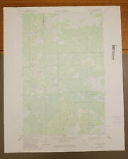
 Waskish, Minnesota Original Vintage 1973 USGS Topo Map 27" x 19 1/2"
-
$62.99 CAD
 1914 Map GARDEN CITY Twp, LAKE CRYSTAL - LOON LAKE - BLUE EARTH Co, MINNESOTA
-
$62.99 CAD
 1912 Map ~ DANE PRAIRIE Twp. w/ BUSE Twp. on Reverse OTTER TAIL Co., MINNESOTA
-
$34.49 CAD
 Vintage 1899 ST PAUL MINNESOTA Map 14"x11" ~ Old Antique Original CATHEDRAL HILL
-
$19.88 CAD
 1912 Plat Map Part of White Earth Indian Reservation Clearwater County Minnesota
-
$24.51 CAD
 Vintage 1891 ST PAUL MINNESOTA Map 14"x11" ~ Old Antique Original COMO PARK ZOO
-
$37.22 CAD
 1889 Railroad Map ~ MINNESOTA ~ Authentic McNally Atlas Map (14x20) #012
-
$22.15 CAD
 1888 Tiny MINNESOTA State Map MINIATURE Vintage Map of Minnesota 1553
-
$17.82 CAD
 1943 Vintage Map - The United States on March 4, 1861 - The Civil War
-
$19.88 CAD
 1912 Plat Map City of Mallard Itasca Township Clearwater County Minnesota
-
$29.54 CAD
 Antique 1902 ST PAUL MINNESOTA Map 14"x11" ~ Old Antique Original CATHEDRAL HILL
-
$20.55 CAD
 Original 1889 Streetcar Maps MINNEAPOLIS & ST. PAUL Minnesota State University
-
$19.88 CAD
 1912 Plat Map Town of Gonvick Pine Lake Township Clearwater County Minnesota
-
$27.35 CAD
 1960 Minnesota Land of 10,000 Lakes Folding Road Map Color Pictures City Index
-
$28.35 CAD
 Old Antique 1897 Atlas Map ~ MINNESOTA ~ (11x14) ~ Free S&H #331
-
$27.40 CAD
 1884 Minnesota Geology Atlas Print - Congregational Church Winona - Limestone
-
$62.99 CAD
 Old 1909 Plat Map ~ STORDEN Twp., COTTONWOOD Co., MINNESOTA ~Free S&H
-
$62.99 CAD
 Original 1874 Plat Map ~ SWIFT, CHIPPEWA & LAC QUI PARLE CO., MINNESOTA ~(14x17)
-
$342.70 CAD
 THE FARMER ATLAS AND FARMERS DIRECTORY MILLE LACS COUNTY MINNESOTA 1914
-
$62.99 CAD
 1874 Plat Map OWATONNA, NORTHFIELD, MANTORVILLE, KASSON Twps., MINNESOTA
-
$32.89 CAD
 1901 Minnesota Geological Map Clay County Dilworth Barnesville Hawley Glyndon MN
-
$46.06 CAD
 Original 1885 Antique Map MINNESOTA Duluth Rochester Bloomington Mankato Winona
-
$19.88 CAD
 1912 Plat Map Part of White Earth Indian Reservation Clearwater County Minnesota
-
$62.99 CAD
 1910 Plat Atlas Map ~ TWIN VALLEY, NORMAN Co., MINNESOTA ~ Free S&H
-
$62.99 CAD
 1914 Map LE RAY Twp., MADISON LAKE - ALICE LAKE - BLUE EARTH Co., MINNESOTA
-
$27.35 CAD
 Mulligan Lake, Minnesota Original Vintage 1984 USGS Topo Map 27" x 22"
-
$8.21 CAD
 Vintage Pre World War WWII 1936 Atlas City Map St Louis, MO & St. Paul, MN L@@K!
-
$19.88 CAD
 1912 Plat Map Town of Clearbrook Leon Township Clearwater County Minnesota
-
$68.53 CAD
 OFFICIAL COUNTY PLAT BOOK & FARMER'S DIRECTORY OF COTTONWOOD MINNESOTA 1950
-
$24.62 CAD
 Vintage 1903 MINNESOTA Map 11"x14" Old Antique Original CANNON FALLS ROCHESTER
-
$38.37 CAD
 1901 Winchell & Grant Minnesota Geological Map Akeley Lake Gunflint City Geology
-
$27.35 CAD
 Madelia, Minnesota Original Vintage 1965 USGS Topo Map 27" x 22"
-
$959.58 CAD
 Hanging Plat Map 1909 Minnesota Red Lake County B4 Pennington County Existed
-
$27.35 CAD
 Brookston, Minnesota Original Vintage 1953 USGS Topo Map 27" x 22"
-
$38.37 CAD
 1901 Minnesota Geological Map Rice County Northfield Faribault Limestone Geology
-
$19.88 CAD
 1912 Plat Map Town of Leonard Murray Ebro Clearwater County Minnesota
-
$25.63 CAD
 1895 Original Color Map Wisconsin and Minnesota Historic 11 x 14 Map
-
$19.88 CAD
 1912 Plat Map Hangaard Township Clearwater County Minnesota Red Lake Indian Res
-
$27.35 CAD
 Sanborn, Minnesota Original Vintage 1967 USGS Topo Map 27" x 22"
-
$32.90 CAD
 Minneapolis, MN - Original 1903 Dated City Map by Dodd Mead & Company. Antique
-
$17.75 CAD
 Antique 1909 Map:Minnesota showing Native-American Reservations and on rev. Iowa
-
$102.81 CAD
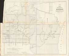 1856 Wisconsin & MN Survey Antique Map Lithograph - Ackerman NY ~ 21.5" x 18.7"
-
$27.35 CAD
 Goodridge, Minnesota Original Vintage 1972 USGS Topo Map 27" x 19 1/2"
-
$19.88 CAD
 1912 Plat Map Part of Red Lake Indian Reservation Clearwater County MN 150N 36W
-
$10.95 CAD
 Vintage 2001 DODGE County Minnesota Rural Resident Directory Plat Book
-
$10.95 CAD
 Vintage 2002 BLUE EARTH County, Minnesota Rural Resident Directory Plat Book
-
$10.95 CAD
 Vintage 1983 RICE County, Minnesota Rural Resident Directory Plat Book
-
$67.01 CAD
 1916 UNITED STATES Map ORIGINAL LARGE Wisconsin Indiana Pennsylvania Delaware
-
$22.15 CAD
 1892 Antique MINNESOTA Map State Map of Minnesota Gallery Wall Art 8299


