 Antiques (CA)
-
$54.55 CAD

 Geological Map Of The British Islands 4th Edition Sir William Pugh 32” x 25”
-
$341.26 CAD
 1857 Huge 4-Panel Color Map . ENGLAND & WALES . Stanford - Original Antique Rare
-
$340.58 CAD
 Antique Map-South England and counties-London-Sussex-Kent-Wales-Sanson-ca. 1720
-
$203.05 CAD
 England Wales York Cornwall Kent Norfolk Cumberland London 1807 Cary folio map
-
$30.81 CAD
 1888 ORIGINAL ANTIQUE MAP OF SOUTHERN ENGLAND AND WALES / LONDON CORNWALL
-
$33.96 CAD
 OLD 1855 ENGLAND WALES SCOTLAND IRELAND Map Dublin London Aberdeen Orkney
-
$32.76 CAD
 1853 British Isles Map ORIGINAL England Wales Scotland Ireland London Dublin
-
$39.26 CAD
 Vintage 1901 ENGLAND & WALES UK Map 14"x22" Old Antique Original LONDON CARDIFF
-
$50.00 CAD
 1930/40’s Royal Automobile Club Road Map Of England & Wales George Philip London
-
$68.74 CAD
 Vintage 1900 ENGLAND & WALES Map 14"x22" Old Antique Original BRITAIN UK LONDON
-
$51.87 CAD
 ENGLAND WALES Map 1889 ORIGINAL London Dover Railways Counties Townships G. CRAM
-
$38.28 CAD
 Vintage 1901 ENGLAND & WALES Map 14"x22" Old Antique Original CARDIFF LONDON
-
$39.42 CAD
 OLD 1899 Southern England Wales Map London Cornwall STEAMSHIPS RAILWAYS PORTS
-
$87.02 CAD
 London to St. David's Pembrokeshire Wales 1775 Bowen engraved road map travel
-
$75.42 CAD
 England Wales Liverpool London Yorkshire Cornwall Sussex c. 1846-9 Mitchell map
-
$98.62 CAD
 British Isles England Wales Scotland Ireland London Dublin 1842 Tardieu map
-
$27.29 CAD
 1830 Original Sidney Hall Map - ENGLAND & WALES - Double-Sheet - Great Detail
-
$38.18 CAD
 Vintage framed Hand Stitched Map Of England And Wales 20.5" x 16.5"
-
$30.81 CAD
 1912 ANTIQUE MAP OF CENTRAL ENGLAND WALES LONDON / VERSO BIRMINGHAM NEWCASTLE
-
$33.98 CAD
 1912 ANTIQUE MAP OF ENGLAND LONDON / WALES CORNWALL DEVON SOMERSET SUSSEX
-
$27.29 CAD
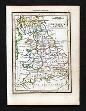 1832 Murphy Map Britannia Antiqua Britain England Wales Roman Londinum London UK
-
$24.57 CAD
 CA 1935 VINTAGE MAP OF GREAT BRITAIN ENGLAND WALES SCOTLAND IRELAND
-
$38.21 CAD
 1902 Johnston Oxford Map England Wales pre Norman Conquest Forts Battles London
-
$29.17 CAD
 1931 VINTAGE MAP OF ENGLAND CORNWALL MIDLANDS LONDON / WALES / GREAT BRITAIN
-
$34.13 CAD
 1854 England & Wales by A.C. Black beautiful antique map 21.8" x 17.4
-
$44.17 CAD
 Vintage 1900 ENGLAND WALES Map 11"x14" ~ Old Antique Original CAMBRIDGE LONDON
-
$34.11 CAD
 Original 1834 Map ENGLAND & WALES Yorkshire Devon Oxford London Liverpool Exeter
-
$136.50 CAD
 1767 Europe's Lakes, Rivers & Mountains antique map by Clouet ~ 22.7" x 16.6"
-
$1689.25 CAD
 1560 Sebastian Munster Antique Map of England Wales Parts Scotland, Ireland, 1st
-
$136.50 CAD
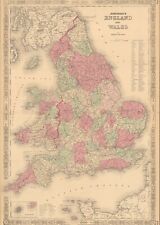
 Antique Johnson's Map Of England and Wales 1863 Civil War Era Old Map
-
$110.23 CAD
 England U.K. Wales Scotland Cornwall Derby London Suffolk c.1840 map 2 SHEETS
-
$34.34 CAD
 Vintage 1902 ENGLAND & WALES Map 11"x14" ~ Old Antique Original LEEDS LINCOLN
-
$13.64 CAD
 1892 Crowell Kirkpatrick Map - England & Wales London Liverpool Bristol Cornwall
-
$42.90 CAD
 1955 VINTAGE MAP OF UNITED KINGDOM GREAT BRITAIN ENGLAND / SCALE 1:2,500,000
-
$42.90 CAD
 1955 VINTAGE MAP OF SOUTHERN ENGLAND LONDON / WALES / SCALE 1:850,000
-
$49.09 CAD
 Vintage 1900 ENGLAND WALES Map 11"x14" ~ Old Antique Original UNITED KINGDOM
-
$14.95 CAD
 Antique 1880 Ireland-England-Scotland book plate Map 9 x 12-suitable to frame
-
$38.21 CAD
 1838 Gilbert Antique Map England & Wales London Liverpool Oxford Great Britain
-
$63.83 CAD
 Vintage 1900 ENGLAND & WALES Map 14"x22" ~ Old Antique Original UNITED KINGDOM
-
$25.87 CAD
 1942 Antique MAP of ENGLAND & WALES Map Vintage England Atlas Map 8955
-
$23.42 CAD
 Vintage 1902 ENGLAND & WALES Map 11"x14" ~ Old Antique Original CAMBRIDGE OXFORD
-
$13.64 CAD
 1888 Mitchell Map Europe France Germany Austria Hungary Italy Greece Sweden
-
$13.64 CAD
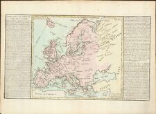
 1892 Map of Europe in 912 Franks Saxony Cordoba Spain Italy Hungary Germany UK
-
$27.30 CAD
 1864 England & Wales by Johnson Ward beautiful antique map 25.8" x 17.6"
-
$40.17 CAD
 1897 ANTIQUE DATED MAP OF SOUTHERN ENGLAND AND WALES / LONDON INSET MAP
-
$21.84 CAD
 Southern England & Wales - Original 1897 Map by The Century Company. Antique
-
$23.21 CAD
 Southern England & Wales - Original 1902 Map by The Century Company. Antique
-
$27.30 CAD
 1860 Europe antique map by Mitchell 15.3" x 12.3" - hand colored
-
$27.29 CAD
 1921 Johnston Map Netherlands Belgium Luxemburg Holland Amsterdam Brussels Ghent
-
$13.64 CAD
 1902 Century Map - South England Wales London Plan Stonehenge Cornwall Bristol
-
$23.53 CAD
 Vintage 1901 ENGLAND WALES Map 11"x14" ~ Old Antique Original CARDIFF OXFORD
-
$27.29 CAD
 1880 Migeon Map - British Isles - England Wales Scotland London Great Britain UK
-
$13.64 CAD
 1835 Levasseur Map - British Isles - Great Britain & Ireland - England Scotland
-
$54.59 CAD
 1810 Delalain Map British Isles Great Britain England Wales Scotland Ireland
-
$13.64 CAD
 1892 Map England Wales Dec. 9, 1643 King & Parliament Districts London Original
-
$27.29 CAD
 1921 Johnston Physical Map British Isles Great Britain England Ireland Scotland
-
$13.64 CAD
 1892 Map England Wales London Oxford Durham York Cardiff Cornwall - Original
-
$70.97 CAD
 1818 D'Anville Map British Isles Roman Period Londinium Hadrians Wall England
-
$71.65 CAD
 1823 ORIGINAL MAP UNITED KINGDOM ENGLAND WALES LONDON CAMBRIDGE LANCASTER YORK
-
$17.06 CAD
 England Wales United Kingdom 1935 Map Scotland London Europe 14 x 11" LGAD99
-
$23.21 CAD
 Lot of 2 Antique Maps Americana Co 1904 England & Wales And London
-
$43.67 CAD
 1834 Carey Map British Isles England Wales Scotland Ireland London Britain UK
-
$65.51 CAD
 1796 Blondeau Map England Wales London Bristol Oxford Salisbury Manchester
-
$38.21 CAD
 1902 Johnston Oxford Map England Wales Anglia Sacra Church Divisions Edward I UK
-
$43.67 CAD
 1844 Smith Map British Isles Great Britain England Scotland Ireland London Wales
-
$136.50 CAD
 1767 Europe's Islands Capes & Seaports antique map by Clouet ~ 23" x 16.8"
-
$38.21 CAD
 1902 Johnston Oxford Map Roman Britain Roads Hadrian's Wall Ptolemy England UK
-
$13.64 CAD
 c1925 Taschen Atlas Map British Isles England Scotland Ireland London Dublin UK
-
$109.20 CAD
 1839 Allan Bell Atlas Map - British Isles Great Britain Ireland Scotland England
-
$34.13 CAD
 1860 England & Wales antique map by Mitchell 15.3" x 12.3"
-
$38.22 CAD
 1801 Wilkinson Map Dioceses England Wales London Canterbury Gloucester York UK
-
$32.75 CAD
 1880 Spruner Map - British Isles 12 Century to the Reformation - England Ireland
-
$21.83 CAD
 1863 Cornell Map - British Isles England Wales Scotland Ireland London Dublin UK
-
$13.64 CAD
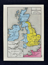 1880 Labberton Map British Islands Saxon Period England Ireland Scotland Scotia
-
$43.67 CAD
 1812 Malte Brun Lapie Map - England Wales London Oxford Liverpool Great Britain
-
$21.83 CAD
 1875 Lange Physical Map - British Isles - England Wales Scotland Ireland London
-
$27.29 CAD
 1849 Houze Map Great Britain 1281-1400 England Ireland Scotland London Edward
-
$13.64 CAD
 1917 McNally Map - England Wales London Liverpool Manchester Bristol Cardiff UK
-
$32.75 CAD
 1869 Chambers Map England Wales London Liverpool Cardiff New Castle Land's End
-
$27.29 CAD
 1849 Houze Map Great Britain 1603-1849 England Ireland Scotland London Dublin
-
$8.18 CAD
 Vintage 1943 Atlas Map World War WWII Era England, Wales & Scotland London Inset
-
$38.21 CAD
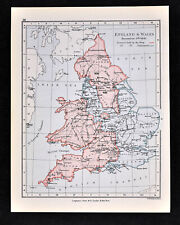
 1902 Johnston Oxford England Wales Parliamentary Map down to Reform Bill 1832 UK
-
$13.64 CAD
 1892 Map England Wales Nov. 1644 King & Parliament Districts London - Original
-
$54.59 CAD
 1845 Stieler Map England Wales London Liverpool Canterbury Cardiff Manchester UK
-
$238.88 CAD
 1845 England Wales map by A.K Johnston ~ 25.8" x 21.2" Antique Pastel Color Huge
-
$163.81 CAD
 1812 Darton Union Atlas Map United Kingdom England Scotland Ireland London UK
-
$43.67 CAD
 1819 Wilkinson Map Ancient England Anglo-Saxon Era Battlefields London Britain
-
$47.78 CAD
 1856 ORIGINAL MAP UNITED KINGDOM GREAT BRITAIN IRELAND ENGLAND SCOTLAND WALES
-
$13.64 CAD
 1892 Map British Isles Industry Iron Minerals Agriculture Commerce Iron England
-
$65.51 CAD
 1847 Stieler Map British Isles England Scotland Ireland London United Kingdom UK
-
$43.67 CAD
 1800 Wilkinson Map Ancient Britannica England Scotland Ireland Wales Roman Era
-
$21.83 CAD
 1857 Morse x 2 England Map & Print of Birmingham View - London Liverpool Oxford
-
$27.29 CAD
 1830 Nathan Hale Map - England & Wales - London Liverpool Cornwall Dover Bristol
-
$13.64 CAD
 1880 Petermann Map England Wales Great Britain London Liverpool Oxford Lands End
-
$38.21 CAD
 1847 Flemming Map England Wales London Cornwall Bristol Liverpool Manchester UK
-
$27.29 CAD
 1849 Houze Map Great Britain 1100-1280 England Ireland Scotland Isle Man London
-
$27.29 CAD
 1876 Bartholomew Map - England & Wales - London Liverpool Bristol Cornwall Dover
-
$21.83 CAD
 1921 Johnston Map Wales Bristol Anglesey Cardiff Pembroke Glamorgan - Dexter Ad
-
$13.64 CAD
 GERMAN ATLAS MAP PAGE PLATE OF SOUTH ENGLAND WALES LONDON PRE WWI EARLY 1900s
-
$32.76 CAD
 2 x England Maps 1922: British Isles / England Wales Times Atlas - Bartholomew


