 Antiques (CA)
-
$54.55 CAD

 Geological Map Of The British Islands 4th Edition Sir William Pugh 32” x 25”
-
$32.62 CAD
 1877 London United Kingdom - Vintage City Map ORIGINAL 11.5 x 9.5" - C12-9
-
$15.34 CAD
![1950s Wonderful Britain map, Places to visit, London Kent, 26x20cm [26763]](https://i.ebayimg.com/thumbs/images/g/VV4AAOSwhTRk4NU2/s-l225.jpg) 1950s Wonderful Britain map, Places to visit, London Kent, 26x20cm [26763]
1950s Wonderful Britain map, Places to visit, London Kent, 26x20cm [26763]
-
$33.99 CAD
 1900 London England City Vintage Geography Map ORIGINAL 11.5 x 9.5" C12-9
-
$34.13 CAD
 Bartholomews Historical Map Of London Cloth + Geographia LONDON Street Plan
-
$38.18 CAD
 Vintage framed Hand Stitched Map Of England And Wales 20.5" x 16.5"
-
$27.29 CAD
 Bartholomew's Historical Map Of London Cloth - Vintage 1960's
-
$28.93 CAD
 Vintage Tourist Map of Great Britain and Northern Ireland United Kingdom 1960
-
$68.18 CAD
 Bartholomew's Town Plan of London, Wartime Printing, Antique Fold-Out Map
-
$16.38 CAD
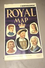 John Bartholomew Royal Map of England United Kingdom Scotland Kings and Queens
-
$24.50 CAD
 1937 Vintage LONDON Street Map Black & White City Map of London England 9739
-
$131.04 CAD
 Nautical Chart Australia Southern Portion Tasmania Pacific Admiralty 1972
-
$47.76 CAD
 Vintage 1949 Map Of British Isles/London 4.5"Brass Plate/3.25" London Beer Stein
-
$43.68 CAD
 1949 Decorative Map of The British Isles (33”x26.5”) Great Condition
-
$33.99 CAD
 1885 - London United Kingdom - Vintage Geography Map ORIGINAL 11.5 x 9.5" - C11
-
$51.74 CAD
 1896 London United Kingdom - Vintage Large City Map ORIGINAL 14.5 x 9.5" - C12-9
-
$28.00 CAD
 Vest Pocket Street Plan of Central London with Index to Streets (ca 1955)
-
$32.62 CAD
 1899 London United Kingdom - Vintage City Map ORIGINAL 11.5 x 9.5" - C11-9
-
$27.29 CAD
 1970's Johnston & Bacon Southern England & Wales No 1-Highway Road Map Fold-out
-
$33.99 CAD
 1934 London United Kingdom - Vintage Geography Map ORIGINAL 11.5 x 9.5" - C11-9
-
$51.74 CAD
 1896 London United Kingdom - Vintage Large City Map ORIGINAL 14.5 x 9.5" - C12-9
-
$47.78 CAD
 MAP OF LONDON, ca. 1920, plate 25 from "The Times Survey Atlas of the World."
-
$39.98 CAD
 1975 large NAUTICAL MAP england ENTRANCE river THAMES north forland orfordness
-
$16.64 CAD
 1935 CITY OF LONDON ENGLAND - City Map 11" X 14"
-
$16.37 CAD
 British Isles and Northern Ireland map National Geographic Vintage Pilgrim 1937
-
$32.23 CAD
 Vintage The Practical Motorist Road Map Of Great Britain 1964
-
$30.03 CAD
 Vintage The Tower of London 1972 Birds Eye Aerial View Map Royal Palace Val Biro
-
$17.73 CAD
 Vintage LONDON BIG BEN MAP 1985 Geographia Ltd. Import From London, England.
-
$16.04 CAD
 1966 BRITISH ISLES Atlas Map, vintage World Book Atlas, color, Ireland England
-
$54.53 CAD
 Vintage The Tower of London 1972 Birds Eye Aerial View Map Royal Palace Val Biro
-
$40.88 CAD
 Vintage LONDON BIG BEN MAP 1985 Geographia Ltd. Import From London, England
-
$23.19 CAD
 Vintage London Big Ben Map 1970s Geographia Ltd. Made In London, England
-
$20.14 CAD
 Cintage Practical Mororist Holiday And Touring Map Of Great Britain 1964
-
$34.11 CAD
 A to Z Motorist's Map - Central London - Geographers' - One-Way Streets - Park
-
$12.29 CAD
 Vintage Britian British Airways Road Map, London, Orkney, Shetland Islands Maps
-
$10.22 CAD
 Map England 1611 May 1964 Vintage National Geographic 19x25 Great Britain
-
$13.65 CAD
 British Tourist Authority London Britian Foldout Pocket Street Map incl/Theaters
-
$34.11 CAD
 30 Miles Round London "Geographia" District Road Map 3/6 Paper:6/6 Cloth
-
$2.59 CAD
 A-Z LARGE SCALE COLOURED LONDON MAP AND STREET PLAN


