 Antiques (CA)
-
$39.76 CAD

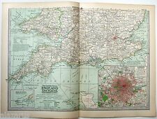
 OLD 1899 Southern England Wales Map London Cornwall STEAMSHIPS RAILWAYS PORTS
-
$39.76 CAD
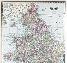
 1897 England and Wales Map Cornwall Dorsey Cardiff Portsmouth Hastings Bristol
-
$30.15 CAD
 1910 ORIGINAL VINTAGE MAP - England, Wales - C10-3
-
$11.69 CAD
 GASKELL'S ATLAS MAP PAGES OF EUROPE - ENGLAND/WALES - ROMAN EMPIRE 1888
-
$24.78 CAD
 England & Wales - Original 1905 Geological Map by Meyers Geologische Karte
-
$23.40 CAD
 England & Wales - Original 1903 Map by Dodd Mead & Company. Antique
-
$28.91 CAD
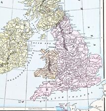 1898 British Isles Historical Map England Ireland Scotland Wales London
-
$27.53 CAD
 Lot of 7 Vintage Ordnance Survey ENGLAND & WALES 1" Maps
-
$24.78 CAD
 Western England & Wales - Original 1909 Map by John Bartholomew. Antique
-
$20.65 CAD
 Vintage Map of England & Wales on May 1, 1643 by Longmans Green 1905
-
$20.65 CAD
 Vintage Map of England & Wales 1660-1892 by Longmans Green 1914. Antique
-
$23.40 CAD
 England & Wales - Original 1891 Map by Hunt & Eaton. Antique
-
$52.31 CAD
 ENGLAND WALES Map 1889 ORIGINAL London Dover Railways Counties Townships G. CRAM
-
$30.15 CAD
 1903 ENGLAND WALES Vintage Map York North Sea London German Original COLOR C10-8
-
$30.15 CAD
 1900 ENGLAND WALES Vintage Map York North Sea London German Original COLOR C10-9
-
$30.15 CAD
 1895 ENGLAND WALES Vintage Geological Map North Sea German Original COLOR C10-8
-
$30.29 CAD
 Merionethshire, Montgomery & Radnor, Wales. Original 1922 Ordnance Survey Map
-
$11.69 CAD
 CRAM'S ATLAS MAP PAGES OF EUROPE - ENGLAND & WALES 1890 VINTAGE
-
$22.03 CAD
 Southern England & Wales - Original 1902 Map by The Century Company. Antique
-
$23.40 CAD
 Northern England & Wales - Original 1902 Map by The Century Company. Antique
-
$26.16 CAD
 Eastern England & Wales - Original 1909 Map by John Bartholomew. Antique
-
$30.29 CAD
 Pembrokeshire Carmarthenshire Cardigan - Large Original 1922 Ordnance Survey Map
-
$28.91 CAD
 1899 Northern England Wales Map Liverpool Sheffield STEAMSHIPS RAILWAYS PORTS
-
$12.42 CAD
 England Wales Cymru Original Map From 1890
-
$20.65 CAD
 Vintage Longmans Map of England in the Years 584 and 626 AD
-
$26.16 CAD
 Northern Part of England & Wales - Original 1896 Map by Velhagen & Klasing
-
$19.27 CAD
 Vintage Longmans Map of England & France in the Year 1259
-
$13.70 CAD
 1923 Orginial Antique Hammond Map of Netherlands & Belgium on rev. British Isles
-
$137.67 CAD
 1873 Mitchell's Atlas County Map of England and Wales Authentic Hand-colored
-
$38.55 CAD
 1879 Map British Isles England Scotland Victorian Geography 1st Edition DWAA9
-
$23.40 CAD
 Great Britain - Original 1905 Map by Meyers. German Language Map. Antique
-
$13.75 CAD
 GERMAN ATLAS MAP PAGE PLATE OF SOUTH ENGLAND WALES LONDON PRE WWI EARLY 1900s
-
$17.70 CAD
 1903 Country Maps of Ireland and England & Wales Highly Detailed 10.5x13.5
-
$27.53 CAD
 England & Wales - Original 1895 Map by W & A.K. Johnston. Antique
-
$22.03 CAD
 Southern England & Wales - Original 1897 Map by The Century Company. Antique
-
$23.40 CAD
 Northern England & Wales - Original 1897 Map by The Century Company, Antique
-
$23.40 CAD
 Southern England & Wales - Original 1902 Map by The Century Company. Antique
-
$20.65 CAD
 Vintage Map of England & Wales on November 23, 1644 by Longmans Green 1905
-
$43.89 CAD
 1897 MAP Baedeker - England & Wales Railways 15 x 16" (38 x 41 cm)
-
$17.83 CAD
 1915 Original Map of Germany (Western Section) and on reverse British Isles
-
$19.27 CAD
Vintage Map of England & Wales on May 1, 1643 by Longmans Green 1905
-
$20.65 CAD
 Vintage Map of England & Wales on December 9, 1643 by Longmans Green 1905
-
$24.09 CAD
 England Wales United Kingdom 1935 Map Scotland London Europe 14 x 11" LGAD99
-
$48.18 CAD
 Repro Map of Warwickshire by Johannes Janssonius (c.1614) Reprint Used VG
-
$15.00 CAD
 Antique map. GEOLOGICAL MAP OF ENGLAND & WALES. Circa 1905
-
$13.62 CAD
 CENTURY ATLAS MAP PAGE PLATE NO.76 ENGLAND AND WALES NORTHERN PART 1911 VINTAGE
-
$17.88 CAD
 ENGLAND & WALES - EUROPE - 1902 Antique Color Map
-
$20.64 CAD
 Original 1887 William Bradley Map ENGLAND & WALES Canals Railroads County Towns
-
$14.03 CAD
 1900 - England Great Britain Wales South Card Carte Map Lithography
-
$240.91 CAD
 1845 England Wales map by A.K Johnston ~ 25.8" x 21.2" Antique Pastel Color Huge
-
$20.64 CAD
 Original 1897 Map Northern ENGLAND & WALES York Liverpool Manchester Derby Leeds
-
$13.62 CAD
 CENTURY ATLAS MAP PAGE PLATE NO.75 ENGLAND AND WALES SOUTHERN PART 1911 VINTAGE
-
$24.78 CAD
 Ordnance Survey Wales 1959 Map
-
$13.75 CAD
 Original 1884 Bartholomew Map ENGLAND & WALES Railways Cornwall York Irish Sea
-
$16.86 CAD
 Map England And Wales Europe 1938 Atlas Print English Channel Irish Sea DWU7
-
$41.29 CAD
 Original 1890 Antique Map ENGLAND & WALES Engraved by Adam & Charles Black
-
$24.78 CAD
 Ordnance Survey Aberystwyth 1966 Map
-
$33.04 CAD
 2 x England Maps 1922: British Isles / England Wales Times Atlas - Bartholomew
-
$24.78 CAD
 Ordnance Survey Merionethshire 1953 Map
-
$10.31 CAD
 CRAM'S ATLAS MAP PAGE ENGLAND WALES EUROPE 1899 VINTAGE
-
$13.75 CAD
 Original 1896 BATHY-OROGRAPHICAL Map BRITISH ISLES Ocean Depths Mountain Heights
-
$34.42 CAD
 vintage Bartholomew's reduced ordnance survey sheet 11 north Wales
-
$68.14 CAD
 Antique Map-GREAT BRITAIN-ENGLAND-WALES-NORTHERN PART-Andree-1904
-
$34.42 CAD
 Antique Original Atlas Map 1900 ENGLAND & WALES - Fisk & See, Eng.- Ephemera Art
-
$68.14 CAD
 Antique Map-GREAT BRITAIN-ENGLAND-WALES-SOUTHERN PART-Andree-1904
-
$150.66 CAD
 1897 ANTIQUE MAP ENGLAND & WALES SOUTH LONDON BIRMINGHAM READING CARMARTHEN
-
$151.70 CAD
 1897 ANTIQUE MAP ENGLAND & WALES PARLIAMENTARY REPRESENTATION YORK BOROUGHS
-
$150.66 CAD
 1897 ANTIQUE MAP ENGLAND & WALES NORTHERN RAILWAYS LIVERPOOL MANCHESTER CARLISLE
-
$150.66 CAD
 1897 ANTIQUE MAP ENGLAND & WALES AVERAGE TEMPERATURE CENTRAL PLAIN JULY NOVEMBER
-
$28.91 CAD
 1861Johnson's England and Wales (Original AntiqueMap, Hand Colored)
-
$150.66 CAD
 1897 ANTIQUE VICTORIAN MAP ENGLAND & WALES DENSITY OF POPULATION LONDON GLASGOW
-
$30.15 CAD
1895 GREAT BRITAIN Vintage Map Isles North Sea London Original COLOR C12-3


