 Antiques (CA)
-
$57.58 CAD

 Vintage 1960’s Rand McNally “Vinland” Map Circa 1440 Including American Lands
-
$271.48 CAD
 1926 Harvard University Vintage US History Linen Wall Map Albert Bushnell Hart
-
$205.63 CAD
 1835 Map-South East Asia-Dutch East Indies-Spice Islands-US made
-
$99.09 CAD
 1879 George Philip Large Antique Twin hemisphere World Map Polar Maps, Mountains
-
$15.00 CAD
 Vintage 1959 Canada Department Of Mines And Technical Surveys Map
-
$651.15 CAD
 1845 World Hemispheres map by A.K. Johnston ~ 25.8" x 21.2" Antique Pastel Color
-
$31.52 CAD
 1898 ORIGINAL MAP WORLD AMERICA ASIA AUSTRALIA EUROPE AFRICA sea currents OCEANS
-
$15.00 CAD
 Antique map. THE WORLD PHYSICAL MAP. Circa 1885
-
$27.40 CAD
 Original 1902 DOUBLE-HEMISPHERE WORLD MAP South Pole Explorations Mountains Seas
-
$21.92 CAD
 1900 Meyers Physical World Map Mountains Rivers Europe Asia America Africa
-
$20.56 CAD
 Vintage Hammond International Map of the World Colorful Wall Map 33 x 50" C5
-
$204.26 CAD
 Antique Print Solar System Theory of the Seasons Rand McNally illustration 1890s
-
$32.90 CAD
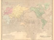
 1891 Isothermal Curves and Zones of Physical Climate Map - Hunt & Eaton
-
$27.40 CAD
 1873 Guyot Physical Map Nature Animals Trees Latitudes Jungle to Arctic Antique
-
$204.26 CAD
 Antique Print National Debts Foreign Countries United States 1890 Illustration
-
$204.26 CAD
 Antique Illustration North Polar Regions Map Asia Russia Arctic Pacific Ocean
-
$10.00 CAD
 Vintage 1937 American Geographical Society Poster Wall World Map
-
$9.60 CAD
 General Whitman's Adventures of Famed Explorers Book & Map by George Elrick,1965
-
$15.00 CAD
 Antique map. THE WORLD PHYSICAL MAP. c 1905
-
$102.81 CAD
 World Hemispheres rare 1860 Mitchell antique map 15.2" x 12.5" hand color
-
$34.27 CAD
 1863 Eastern Hemisphere by Johnson Ward beautiful antique map 17.2" x 14"
-
$89.11 CAD
 1860 World Mercator Projection Mitchell antique map 23.6" x 15.4" hand color
-
$16.45 CAD
 Passages of the Windward Islands Coast & Geodetic Survey Report 1890.
-
$171.36 CAD
 1833 World Projection antique German map by K.F.V. Hoffman - 15" x 11
-
$445.53 CAD
 1845 Chart of World map by A.K. Johnston ~ 25.8" x 21.2" Antique Pastel Mercator
-
$43.87 CAD
 1770 Gulf Stream Benjamin Franklin Map Coast & Geodetic Survey Report 1890.
-
$16.45 CAD
 Gulf Stream Currents Section A Daily Chart Coast & Geodetic Survey Report 1890.
-
$16.45 CAD
 Gulf Stream Currents Section A Chart Coast & Geodetic Survey Report 1890.
-
$174.78 CAD
 Nova Totivs Terrarvm Orbis Geographica Tabvla Foiled World Map 14 X 12
-
$9.94 CAD
 *RARE* 1959 COLOR TOPOGRAPHIC MAP w/ LEGEND
-
$16.45 CAD
 Harbor of Loanda Map Coast & Geodetic Survey Report 1890.
-
$43.87 CAD
 1685 World Map Coast & Geodetic Survey Report 1890.
-
$16.45 CAD
 Route of the Hartford & Pensacola Map Coast & Geodetic Survey Report 1890.
-
$38.38 CAD
 Gulf Stream Currents Cuba Map Coast & Geodetic Survey Report 1890.
-
$32.90 CAD
 Gulf Stream Currents Variation in Flow Map Coast & Geodetic Survey Report 1890.
-
$32.90 CAD
 1787 Gulf Stream Governor Pownall Map Coast & Geodetic Survey Report 1890.
-
$38.38 CAD
 Gulf Stream Map Sandy Hook to the Bahamas Coast & Geodetic Survey Report 1890.
-
$35.64 CAD
 1799 Gulf Stream Jonathan Williams Map Coast & Geodetic Survey Report 1890.


