 Antiques (CA)
-
$273.58 CAD

 Territory Of The Northern Plains Tribes Framed
-
$50.61 CAD
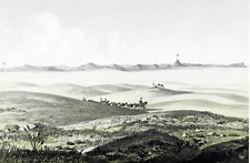
 1855 Eastern Montana Missouri River Basin ORIGINAL LITHOGRAPH Landscape View
-
$50.61 CAD
 1855 Montana Rocky Mountains ORIGINAL LITHOGRAPH Lewis Clark Pass RARE
-
$46.51 CAD
 1897 WYOMING IDAHO Map ORIGINAL Montana YELLOWSTONE Missoula Cheyenne Boise
-
$39.51 CAD
 1855 Cadotte's Pass Montana Rocky Mountains ORIGINAL LITHOGRAPH Landscape View
-
$39.51 CAD
 1855 Montana Gros Ventres Indians LITHOGRAPH ORIGINAL Native Americans
-
$51.98 CAD
 1855 Montana Native Americans Gov Stevens LITHOGRAPH ORIGINAL Washington Terr.
-
$17.63 CAD
 USGS Geological Survey Map: Montana Custer Battlefield 1891 - Reprint
-
$20.37 CAD
 1978 Deerlodge National Forest, Montana, USDA Forest Service Visitors Map
-
$17.63 CAD
 USGS Geologic Map: Tepee Creek Quadrangle, Montana - Wyoming
-
$39.51 CAD
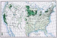 OLD 1900 United States Map ORIGINAL LARGE Farming Agriculture Barley Grain
-
$19.08 CAD
 1940s Vintage MONTANA Map Antique Map of Montana State Map Wall Art Decor
-
$16.35 CAD
 Vintage MONTANA Map Wall Art Decor Original State Helena Billings Missoula
-
$48.56 CAD
 1891 MONTANA MAP WYOMING IDAHO ANTIQUE FULL COLOR RAILROADS RIVERS MOUNTAINS VTG
-
$177.82 CAD
 1903 Map Absaroka Division of Yellowstone Forest Reserve Montana See description
-
$41.08 CAD
 1898 Map of the State of MONTANA Hand Colored Lithograph 10.75 x 7.25
-
$17.63 CAD
 USGS Geologic Map: Toston, Radersburg, Part of Devils Fence Quadrangles, Montana
-
$24.62 CAD
 Montana Idaho & Wyoming - Original 1891 Map by Hunt & Eaton. Antique
-
$19.36 CAD
 USGS Geologic Map: Bentonite Black Hills District, Montana, Wyoming South Dakota
-
$17.71 CAD
 Vintage MONTANA Map Railroad Wall Art Decor Old Original Antique DATED 1921
-
$170.99 CAD
 1883 General Sherman Route Map Fort Ellis Montana to Fort Hope British Columbia
-
$17.63 CAD
 USGS Geologic Map: Tepee Creek Quadrangle, Montana, Wyoming
-
$135.43 CAD
 1878 Colorado Montana Dakota & Wyoming Mitchell antique map 22.9" x 15.1"
-
$53.35 CAD
 1878 Western Hemisphere Mitchell antique map 15.1" x 12.1" - nice color
-
$239.39 CAD
 1875 Map Yellowstone Montana Captain William Ludlow US Army Corps Engineers
-
$17.63 CAD
 USGS Geologic Map: West Yellowstone Quadrangle, Montana, Wyoming, Idaho
-
$53.35 CAD
 1878 Oregon Washington MT ID Mitchell antique map 15.1" x 12.3" - nice color
-
$102.60 CAD
 1906 FLATHEAD RIVER KINTLA LAKES 30min USGS TOPO MAP 16x20" antique MONTANA
-
$129.96 CAD
 1913 SOUTH GLACIER NATIONAL PARK two 30min USGS TOPO MAPS 16x20" antique MONTANA
-
$56.06 CAD
 Montana Map Lithograph 1909 Hammond Art Print United States LGADMap
-
$136.79 CAD
 1903/11 BLACKFOOT INDIAN RESERVATION two USGS TOPO MAPS 30min 16x20" old MONTANA
-
$102.60 CAD
 1904/14 NORTH GLACIER NATIONAL PARK 30min USGS TOPO MAP 16x20" antique MONTANA
-
$68.38 CAD
 Large Format 1905 COLOR Rand McNally Map Atlas Page 239 Railroads Montana
-
$17.63 CAD
 USGS Geologic Map: Mammoth, Part of Gardiner Quadrangle, Wyoming, Montana
-
$17.63 CAD
 USGS Geologic Map: Eastern Part of the Three Forks Basin, Montana
-
$17.63 CAD
 USGS Geologic Map: Upper Red Rock Lake Quad, Southwestern Montana, Idaho
-
$23.26 CAD
 Western USA - Original 1928 German Map by Meyers. Vintage
-
$15.05 CAD
 Map SAYPO Choteau Montana Unequal Hardness Topo USGS PP No 60 ca 1913 7.5"x10"
-
$13.67 CAD
 MONARCH STANDARD ATLAS MAP PAGE PLATE OF MONTANA & SOUTH DAKOTA 1906 VINTAGE
-
$13.53 CAD
 CENTURY ATLAS MAP PAGE PLATE NO. 49 MONTANA 1911 VINTAGE
-
$177.82 CAD
 Original 1874 Mitchell Map WASHINGTON OREGON IDAHO TRAIL Wagon Roads Gold Mines
-
$17.63 CAD
 USGS Geologic Map: Strip Along Centennial Fault, Southwestern Montana, Idaho
-
$12.30 CAD
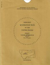 USGS Geologic Map: Vaughn Quadrangle, Montana
-
$17.71 CAD
 1911 Antique Rand McNally Map of MONTANA w/copy History/Demographics
-
$17.63 CAD
 USGS Geologic Map: Aeromagnetic Map Boulder Batholith Area, Montana
-
$17.63 CAD
 USGS Geologic Map: Northern Part of Ruby Range, Montana
-
$17.63 CAD
 USGS Geologic Map: Mystic Lake Quadrangle, Montana
-
$17.63 CAD
 USGS Geologic Map: Coeur D'Alene District, Montana, Idaho
-
$17.63 CAD
 USGS Geologic Map: Henrys Lake Quadrangle, Idaho and Montana
-
$17.63 CAD
 USGS Geologic Map: Wallace 1 x 2 Quadrangle, Montana and Idaho
-
$136.79 CAD
 1944 / 1954 Elk Basin Wyoming Montana Topographical U.S. Geological Survey Map
-
$17.63 CAD
 USGS Geologic Map: Northwestern Montana, Northern Idaho - Aeromagnetic
-
$17.63 CAD
 USGS Geologic Map: Mount Douglas Quadrangle, Montana
-
$102.60 CAD
 1908 REPORT: To Establish A Permanent National Bison Range ~ WITH MAP ~ Montana
-
$17.63 CAD
 USGS Geologic Map: Bozeman Pass Quadrangle, Montana
-
$16.76 CAD
 USGS Geologic Map: Lower Red Rock Lake Quadrangle, Montana, Idaho
-
$17.63 CAD
 USGS Geologic Map: Townsend and Duck Creek Pass Quadrangles, Montana
-
$17.63 CAD
 USGS Geologic Map: Central Part of Little Belt Mountains, Montana
-
$17.63 CAD
 USGS Geologic Map: Kelly Iron Deposit, Madison County, Montana
-
$34.19 CAD
 1941 Map NORTHWESTERN US & CANADA Washington Oregon British Columbia Alberta
-
$17.71 CAD
 Montana Vintage Pictorial Map (Small/Index Card size)
-
$17.63 CAD
 USGS Geologic Map: Bannack-Grayling Area, Beaverhead County, Montana
-
$136.73 CAD
 1914 Glacier Park Map Chief Mtn Quadrangle 1903 Topograph Survey Montana 7.5 Min
-
$17.63 CAD
 USGS Geologic Map: Aeromagnetic Map of Montana
-
$17.63 CAD
 USGS Geologic Map: Madison Roadless Area, Montana
-
$17.63 CAD
 USGS Geologic Map: Carter Creek Iron Deposits, Montana
-
$17.63 CAD
 USGS Geologic Map: Strip Along the Centennial Fault, Montana and Idaho
-
$17.63 CAD
 USGS Geologic Map: Kelly Iron Deposit, Madison County, Montana
-
$17.63 CAD
 USGS Geologic Map: Sphinx Mountain, Cameron, Cliff Lake, Hebgen Dam Quad Montana
-
$17.63 CAD
 USGS Geologic Map: Pine Hill Quadrangle, Montana
-
$17.63 CAD
 USGS Geologic Map: Pintlar Lake Quadrangle, Montana
-
$17.63 CAD
 Geologic Map: West Part of the Greenhorn Range, Montana
-
$17.63 CAD
 USGS Geologic Map: Banded Upper Zone, Stillwater Complex, Montana
-
$17.63 CAD
 USGS Geologic Map: Tower Junction and part of Mount Wallace Quadrangle, Wyoming
-
$17.63 CAD
 Geologic Map: Hardin 1 x 2 Quadrangle, Southeastern Montana
-
$17.63 CAD
 Geologic Map: Ekalaka 1 x 2 Quadrangle, Southeastern Montana
-
$17.63 CAD
 Geologic Map: Wallace 1 x 2 Quadrangle, Montana and Idaho
-
$17.63 CAD
 USGS Geologic Map: Mount Wood Quadrangle, Montana
-
$17.63 CAD
 USGS Geologic Map: Fort Ellis Quadrangle, Montana
-
$17.63 CAD
 USGS Geologic Map: Maxey Ridge Quadrangle, Montana
-
$17.63 CAD
 USGS Geologic Map: Southwest Part Cooke City Quadrangle, Montana, Wyoming
-
$57.45 CAD
 Original 1885 Antique Map IDAHO MONTANA WYOMING Boise Great Falls Helena Casper
-
$125.85 CAD
 Authentic 1889 Color Map COLORADO & MONTANA Vintage Rare 2-Sided Large Detailed
-
$13.67 CAD
 1950 Montana Official Highway Map
-
$13.67 CAD
 1949 Montana Official Highway Map
-
$273.59 CAD
 Glacier Waterton Peace Park Pictorial Map 1939 Original
-
$68.38 CAD
 1893 GEOLOGICAL MAP of THREE FORKS MONTANA by A.C. PEALE / Paleontology Geology
-
$7.20 CAD
 Atlas Of North America - NATIONAL GEOGRAPHIC


