 Antiques (CA)
-
$253.07 CAD

 1913 Directory Of Salem Massachusetts With Folded Map Henry M Meek Publishing Co
-
$786.57 CAD
 Antique 'NEWBURYPORT Mass in 1876' EDWIN WHITEFIELD Birds Eye View PHOTOGRAPH
-
$120.37 CAD
 Antique New England Map New Belgium Original 1849 Pease Litho of Lucini 1634 Map
-
$68.38 CAD
 Pair antique maps Lawrence Massachusetts North South Side Merrimack River B22
-
$49.25 CAD
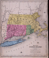
 Original 1882 Antique Map MASSACHUSETTS CONNECTICUT RHODE ISLAND Boston Stamford
-
$24.62 CAD
 Massachusetts, Connecticut & Rhode Island - Original 1882 Map by Phillips & Hunt
-
$30.09 CAD
 Boston, Massachusetts & Vicinity - Original 1907 Dated Map by Dodd Mead & Co
-
$54.65 CAD
 Latest Map and Index of Boston City MA Walker Lithograph Co. Early 1900's Foldup
-
$16.01 CAD
 1943 Vintage Map - The Thirteen Colonies - New York City Boston Charleston
-
$27.36 CAD
 Eastern Massachusetts - Original 1902 Map by The Century Company. Antique
-
$116.28 CAD
 1903 Original Halifax Plympton Map,Pembroke,Hanson,MA Mass,Old,Massachusetts
-
$102.60 CAD
 1903 Original Abington Whitman Map,MA Mass,Old,Bedford St,Wales North,Wales
-
$149.11 CAD
 BEVERLY, MA ~ 1893 Map ~ Pub. by E.A. Jones, 79 Milk St., Boston
-
$21.89 CAD
 Map Of Original 13 Colonies 1871 Victorian Lithograph History Swinton DWAA12
-
$43.77 CAD
 1879 Map New England USA Victorian Atlas Harpers Geography 1st Edition DWAA9
-
$103.95 CAD
 1873 Mitchell's Map of Massachusetts, CT, R.I., Authentic Hand-Colored Antique
-
$27.29 CAD
 CENTURY ATLAS MAP PLATE #9 MASSACHUSETTS MARTHA'S VINEYARD USA 1911 ANTIQUE ORIG
-
$27.36 CAD
 USGS Maps 2 sizes c-z maps mostly NY, Vermont, Mass
-
$54.65 CAD
 Antique 1898 COLOR Rand McNally Atlas Map of State of Maine & New Hampshire
-
$68.33 CAD
 Antique 1910 Topography Map Boston Bay Harbor Massachusetts
-
$121.75 CAD
 1878 Boston Mitchell antique map / plan 23" x 15.1" - nice color - harbor inset
-
$37.14 CAD
 1854 Map LONG ISLAND, CONNECTICUT, MASACHUSETTS, RI ~ Hand Colored (9x11)-#010
-
$24.62 CAD
 Massachusetts, Connecticut & Rhode Island - Original 1891 Map by Hunt & Eaton
-
$102.60 CAD
 MASSACHUSETTS & RHODE ISLAND Antique hand colored authentic map 1857
-
$50.00 CAD
 1909 Bullard Antique Map World + New England Canada + Gazetteer Key
-
$39.67 CAD
 1908 Original Map Sheffield,New Marlborough,Sandisfield,Barrington,Mass MA Old
-
$23.24 CAD
 1945 War Department Map ROCKPORT Massachusetts Cape Ann Gloucester Lighthouses
-
$43.09 CAD
 1891 MASSACHUSETTS MAP ANTIQUE FULL COLOR RAILROAD MOUNTAIN VICTORIAN ERA BOSTON
-
$88.85 CAD
 Antique Map-BOSTON-USA-Karl Baedeker-Wagner & Debes-1904
-
$24.62 CAD
 Map Oxford Massachusetts CT RI USGS 1979 Topographic Geo 1:24000 27x22" 3 TOPO12
-
$24.62 CAD
 Map Uxbridge Massachusetts RI USGS 1979 Topographic Geo 1:24000 27x22" TOPO12
-
$43.77 CAD
 1879 Map Massachusetts Boston US Victorian Atlas Geography 1st Edition DWAA9
-
$68.38 CAD
 Original 1871 Map ESSEX NORFOLK COUNTIES Massachusetts Marblehead Rockport Dover
-
$166.89 CAD
 Rare 1800's Vintage Massachusetts Trigonometrical Survey Plan Map Triangles
-
$27.35 CAD
 Original 1901 Streetcar Map BOSTON Massachusetts Railroads Bridges Ferries
-
$68.38 CAD
 1879 Original Map Towns Carver Mattapoisett Bryantville, Marion Ma Mass
-
$21.89 CAD
 Old Framed Historical 1888 MASSACHUSETTS Map, Color, Detailed, RR, Great Gift
-
$27.35 CAD
 Original 1900 Street Map SPRINGFIELD CHICOPEE Massachusetts Railroads Bridges
-
$32.83 CAD
 United States - Original Map c1906 by G Philip & Son. Antique
-
$19.66 CAD
 USGS Topographic Map 1987 Survey 30"x60" Attleboro, MA and RI 41071-H3-TM-025
-
$16.42 CAD
 Map Webster Mass CT RI Geological Topographic Survey 1982 24 x 38" DWX6A
-
$20.52 CAD
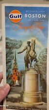 Vintage Antique 1966 Metropolitan Boston And Cape Cod Tourguide Map Gulf Mass
-
$54.70 CAD
 1879 Original Map Towns of Plymouth County Ma Mass Walker Atlas
-
$121.75 CAD
 1903 Original Hanover Map,MA Mass Atlas,Four Corners,Broadway,Old,Massachusetts
-
$39.40 CAD
 Large Original 1898 Antique Map MASSACHUSETTS Boston Lowell Quincy Lynn Medford
-
$68.38 CAD
 Large Format 1905 COLOR Rand McNally Map Atlas Page Business District New York
-
$41.04 CAD
 1899 United States - 1902 Massachusetts / Rhode Island / Connecticut Atlas Maps
-
$23.26 CAD
 Northeastern USA - Original 1931 German Language Map by Meyers. Vintage
-
$813.93 CAD
 Antique 1876 'Birds Eye View of CLINTON MASSACHUSETTS' OH Bailey Lithograph
-
$22.42 CAD
 Boston Massachusetts Map Lithograph 1909 Hammond Art Print United States LGADMap
-
$29.42 CAD
 1889 Map ~ BOSTON, MA ~ (12x17) ~ Good Condition ~ Free S&H-#042
-
$19.66 CAD
 USGS Topographic Map 1987 Survey 30x60 MA Great Barrington 42073-B3-TM-025
-
$15.10 CAD
 USGS Topographic Map 1984 Survey 30"x60" RI, MA Providence 41071-E1-TM-100
-
$67.70 CAD
 1878 NICE ORIGINAL MAP CANADA MONTREAL TORONTO GREAT LAKES ALASKA GREENLAND
-
$24.62 CAD
 Authentic 1900 Map ~ THE COAST of NEW ENGLAND ~ Settlements in the New Colonies
-
$62.86 CAD
 1877 Map ~ NEBRASKA & KANSAS FRONTIER ~ Authentic Mitchell Map ~ Free S&H -#038
-
$62.86 CAD
 1897 Map ~ BOSTON, MASSACHUSETTS - Authentic Atlas Map (XXL22x29) Free S&H #003
-
$341.97 CAD
 1841 Edward Hitchcock GEOLOGICAL MAP OF MASSACHUSETTS Lovely Original Hand Color
-
$17.09 CAD
 VTG 1935 Where to Stay in Boson A Street Map Boston Chamber of Commerce 26 x 17
-
$49.18 CAD
 Antique US Geological Survey Map, MA-NH, NEWBURYPORT Sheet, Linen Backed
-
$54.72 CAD
 Authentic 1900 Large, Detailed Color Map ~ US America Eastern State East ~ Rare
-
$61.56 CAD
 Franklin County MA Massachusetts antique 1871 map original paper folder - eb-257
-
$13.67 CAD
 CRAM'S ATLAS MAP PAGE MASSACHUSETTS RHODE ISLAND VERMON NH 1899 VINTAGE
-
$75.22 CAD
 1888 Maps (2 plates) of BROOKLINE, MASS - Removed from a big Atlas
-
$15.10 CAD
 USGS Topographic Map 1984 Survey 30"x60" MA Rockport 42070-F5-TM-025
-
$177.82 CAD
 Original 1874 Mitchell Street Map BOSTON Brookline Dorchester Charlestown Wards
-
$61.54 CAD
 1933 Blue Hills Reservation Map Roads Paths and Trails 22" x 15" Original Print
-
$19.66 CAD
 USGS Topographic Map 1984 Survey 30"x60" MA Gloucester 42070-E1-TM-100
-
$34.20 CAD
 1875 Everett Massachusetts B&W Reproduction Map Unframed 17” X 11”
-
$19.66 CAD
 USGS Topographic Map 1994 Survey 30"x60" MA New Bedford 41070-E1-TM-100
-
$75.24 CAD
 Boston Massachusetts 1907 huge old city plan map railroads Faneuil Hall museums
-
$16.40 CAD
 1949 Antique Map Massachusetts Boston Cape Cod Plymouth Springfield Worcester
-
$13.49 CAD
 1888 Color County Map 5 New England States see title page picture
-
$62.86 CAD
 1877 Map MASSACHUSETTS, CONNECTICUT, RHODE ISLAND ~ Authentic Mitchell Map -#039
-
$21.34 CAD
 BOSTON Town Center Plan Massachusetts - 1909 MAP Baedeker 6 x 8" (15 x 20 cm)
-
$25.31 CAD
 1873 HUNTINGTON Mass GRANBY MA Norwich Knightville MA LITHOGRAPH MAP BEERS ATLAS
-
$28.29 CAD
 1884 Map ~ MASSACHUSETTS ~ Authentic McNally Atlas Map (15x21) Free S&H -#037
-
$33.77 CAD
 MASSACHUSETTS Map: 1907 (dated) Cities, Counties, Towns, Topography, Railroads
-
$123.10 CAD
 1885 Large Color Print of Map of Boston, Nicely Matted
-
$54.72 CAD
 Grafton ,Saundersville ,Massachusetts 1870 F.W. Beers detailed township map
-
$18.96 CAD
 1903 State Map of Massachusetts Rhode Island Connecticut Detailed 21.5" x 13.5
-
$82.06 CAD
 1879 Original Map Towns Kingston Halifax Rocky Nook Seaside Ma Mass Walker Atlas
-
$29.42 CAD
 1889 Map ~ BOSTON - MASSACHUSETTS - RHODE ISLAND ~ (XL17x23) Free S&H -#001
-
$17.71 CAD
 1911 Antique Rand McNally Map of MASSACHUSETTS w/copy History/Demographics
-
$25.74 CAD
 Vintage Southern New England Map Massachusetts Rhode Island Connecticut ca 1887
-
$109.42 CAD
 Original 1871 Map MIDDLESEX COUNTY Massachusetts Cambridge Framingham Winchester
-
$15.99 CAD
 USGS Topographic Map 1986 Survey 30"x60" NH, VT, MA Keene 42072-E1-TM-100
-
$39.88 CAD
 1898 Map of the State of MASSACHUSETTS Hand Colored Lithograph 13.5 x 10.75
-
$16.42 CAD
 Map Fitchburg Massachusetts Geological Topographic Survey 1988 24 x 38" DWX6A
-
$11.61 CAD
 CRAM'S ATLAS MAP PAGE OF NEW YORK STATE WITH VERMONT NH MASSACHUSETTS 1890
-
$28.29 CAD
 1861 Map MASSACHUSETTS CONNECTICUT RI Authentic Johnson Atlas Map (18x26) ~#012
-
$27.36 CAD
 3 Maps Massachusetts Bicentennial Comm~Sights & Attractions~Large Folding c1976
-
$20.52 CAD
 ORIGINAL 1883 Cram Atlas Map MA, CT, RI, NH, VT 5 States Hand Colored
-
$30.78 CAD
 1892 Antique Map NEW YORK CITY (Northern Part) & BOSTON, MASSACHUSETTS
-
$24.62 CAD
 Authentic 1900 Map ~ BOSTON with its Environs in 1775-1776 ~ Original Detailed
-
$16.42 CAD
 Map Ayer Massachusetts Geological Topographic Survey 1988 24 x 38" DWX6A
-
$21.34 CAD
 BOSTON & Environs Massachusetts - 1909 MAP Baedeker 6 x 8" (15 x 20 cm)
-
$54.70 CAD
 1879 Original Map Towns of Abington North Abington Ma Mass Walker Atlas
-
$54.70 CAD
 vtg USGS MAP Snipatuit Pond Carver Middleborough Rochester Wareham Plymouth MA
-
$24.62 CAD
 Map Blackstone Massachusetts RI USGS 1979 Topographic Geo 1:24000 27x22" TOPO12


