 Antiques (CA)
-
$274.17 CAD

 1867 Kansas Colorado Montana & Dacota Hand Colored Map 13 x 15 Mitchell Antique
-
$50.71 CAD
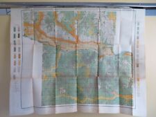
 Vintage 1949 Topographic Map - Eureka, Kansas - 20.5" x 17"
-
$149.42 CAD
 Atlas Gallup Map and Supply Co. Kansas CIty Map of Every State --Rare
-
$109.65 CAD
 1879 Map West Central States Group Victorian Atlas Geography 1st Edition DWAA9
-
$30.36 CAD
 KANSAS Map: Genuine 1908 (dated) County Town Railroads Topography Reservations
-
$20.55 CAD
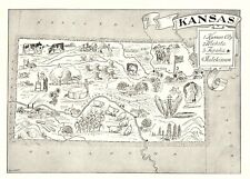
 KANSAS Ruth Taylor VINTAGE ORIG Cartoon Map 1935 Litho JAYHAWKS Exc Cond TOPEKA
-
$30.84 CAD
 1909 Analysis of the System United States Land Surveys Original Color
-
$26.90 CAD
 1943 VINTAGE WWII MAP OF KENTUCKY / KANSAS
-
$24.68 CAD
 1953 VINTAGE MAP OF KENTUCKY / VERSO KANSAS
-
$20.55 CAD
 USGS Planimetric Map Joplin Missouri Kansas 1986
-
$26.59 CAD
 Vintage 1903 KANSAS Map 14"x11" Old Antique Original KANSAS CITY SALINA TOPEKA
-
$27.58 CAD
 Vintage 1903 KANSAS Map 14"x11" Old Antique Original HUTCHINSON KINGMAN WICHITA
-
$8.23 CAD
 1897 Map of United States & Mexico Original antique print
-
$46.60 CAD
 Antique 1922 Topographic Map - Norton, Kansas - 19.75" x 16.5"
-
$50.71 CAD
 Vintage 1925 Topographic Map - Ellis, Kansas - 19.75" x 16.5"
-
$50.71 CAD
 Vintage 1944 Topographic Map - Russell, Kansas - 20.75" x 17"
-
$27.40 CAD
 c1930 Hammond Railroad Map Kansas Topeka Lawrence Wichita Dodge City Atchison RR
-
$32.89 CAD
 1887 Everts Kansas Map Sherman & Cheyenne County Wano Voltaire Eustis Bird City
-
$38.38 CAD
 1919 Auto Road Map Kansas Topeka Lawrence Wichita Dodge City Great Bend Winfield
-
$54.70 CAD
 1911 Antique Color Map Shawnee County Kansas Topeka Rossville Elmont 34X28 #0500
-
$8.23 CAD
 1897 Map Western part of United States Original antique print USA
-
$62.99 CAD
 1887 Plat Map ~ CARBONDALE - QUENEMO, KANSAS ~ HALSTEAD - SEDGWICK on Reverse
-
$8.23 CAD
 1897 Map East part of United States Original antique print
-
$49.30 CAD
 Vintage 1901 KANSAS Map 22"x14" ~ Old Antique Original SALINA TOPEKA WICHITA KS
-
$29.20 CAD
 1891 KANSAS MAP ANTIQUE FULL COLOR RAILROADS RIVERS MOUNTAINS MISSOURI RIVER
-
$62.99 CAD
 1887 Plat Map ~ BROWNS GROVE - FT LENARD, KANSAS ~ PAWNEE Co. on Reverse
-
$26.66 CAD
 ANTIQUE 1902 DATED KANSAS Map. Marked RAILROADs. Business Atlas Map.
-
$17.82 CAD
 1943 Vintage Map - The United States on March 4, 1861 - The Civil War
-
$45.22 CAD
 Antique 1922 Topographic Map - Beloit, Kansas - 19.75" x 16.5"
-
$50.71 CAD
 Vintage 1925 Topographic Map - Anthony, Kansas - 19.5" x 16.25"
-
$46.60 CAD
 Antique 1921 Topographic Map - Larned, Kansas - 19.75" x 16.5"
-
$50.71 CAD
 Vintage 1941 Topographic Map - Ellsworth, Kansas - 20" x 16.5"
-
$61.85 CAD
 Original 1887 Plat Map ~ COLUMBUS, KANSAS ~ CHEROKEE Co. on Reverse
-
$68.47 CAD
 1900 Map - City of Edmon, Norton County, Kansas and Township 5 So Range 23 West
-
$32.89 CAD
 1887 Everts Kansas Map Oskaloosa Jefferson County Neutral Lea Walk Cherokee CO
-
$28.35 CAD
 Vintage 1908 Atlas Map ~ KANSAS ~ Old Authentic ~ Free S&H
-
$44.36 CAD
 Vintage 1901 KANSAS Map 22"x14" Old Antique Original SALINA TOPEKA WICHITA KS
-
$27.40 CAD
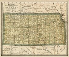
 1883 Antique Map / STATE OF KANSAS
-
$49.34 CAD
 Vintage 1945 Topographic Map - Pratt, Kansas - 20.75" x 17"
-
$49.34 CAD
 Vintage 1949 Topographic Map - Fredonia, Kansas - 20.5" x 17"
-
$178.20 CAD
 1884 ANTIQUE MAP Indian Removal CHEROKEE NATION 32" Arkansas Kansas Missouri
-
$61.85 CAD
 Original 1887 Plat Map ~ JERRFESON Co., KANSAS ~ MERIDEN - WINCHESTER on Reverse
-
$150.00 CAD
 Rand McNally Kansas Railroad System 1900 Pocket Map
-
$68.27 CAD
 Antique Map 1906 Riley County Kansas Manhattan Fort Riley Stockdale 33X38 #21141
-
$130.23 CAD
 1862 Johnson Dakota Nebraska Kansas Colorado antique map 17.4" x14.2" nice color
-
$61.85 CAD
 Old 1932 Colorful Pictorial Map ~ KANSAS - NEBRASKA by BERTA & ELMER HADER
-
$30.84 CAD
 1909 Plat Map Fancy Creek Township Riley County Kansas Original Color
-
$28.35 CAD
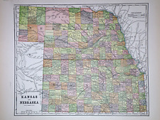 Old 1896 Fisk & Co. Atlas Map ~ KANSAS - NEBRASKA ~(11x14) ~Free S&H ~#230
-
$64.43 CAD
 OLD 1889 KANSAS Map ORIGINAL Dodge City Topeka Railways Counties Townships
-
$31.46 CAD
 1900 Map - Norton County, Kansas - Township 5 S. Range 25 W & S. Range 24 West
-
$24.06 CAD
 1907 Antique KANSAS CITY Street Map of Kansas City Missouri & Kansas 952
-
$49.34 CAD
 1886 Tunison Map Iowa Des Moines Cedar Rapids Council Bluffs Waterloo Fort Dodge
-
$68.54 CAD
 1864 Dakota Montana Nebraska Kansas CO by Johnson Ward antique map 17.3" x 13.8"
-
$22.26 CAD
 Vintage 1937 Two-Sided Color Map of Iowa & Kansas 11" x 14"
-
$27.35 CAD
 CENTURY ATLAS MAP PLATE #32 "KANSAS" WICHITA KANSAS CITY MIDWEST 1911 ANTIQUE KS
-
$62.99 CAD
 Original 1887 Plat Map ~ BELMONT - VINING - HANOVER - CLIFTON - ASHERVILLE
-
$62.99 CAD
 1887 Plat Map ~ OLATHE, KANSAS / SPRING HILL - ALTIMONT - MONTANA on Reverse
-
$62.99 CAD
 1887 Plat Map ~ SALINE Co. CITY of SALINA, KANSAS ~ DELPHOS - TESCOTT on Reverse
-
$13.69 CAD
 c1890 Encyclopedia Britannica Map - Kansas - Topeka Wichita Lawrence Leavenworth
-
$62.99 CAD
 1904 Plat Map ~ PLAINVILLE Twp. ROOKS Co., KANSAS Genealogy Ancestry History
-
$61.69 CAD
 1862 Johnson's Missouri and Kansas Map Johnson & Ward Antique
-
$39.43 CAD
 Vintage 1902 KANSAS Map 22"x14" ~ Old Antique Original FORT LEAVENWORTH TROY KS
-
$34.49 CAD
 Vintage 1901 KANSAS Map 14"x11" ~ Old Antique Original KANSAS CITY OVERLAND PARK
-
$30.84 CAD
 1909 Plat Map City of Riley Riley County Kansas Original Color
-
$62.99 CAD
 1887 Plat Map ~ OSBORNE Co. OSBORNE - BETHANY, KANSAS ~ DOWNS Twp. on Reverse
-
$28.35 CAD
 1938 Colorful Pictorial Map ~ KANSAS by Norman Reeves for 1939 World's Fair
-
$16.44 CAD
 1937 Cram Map Kansas City Missouri River Stockyards Railroads The Parade Park MO
-
$62.99 CAD
 1904 Plat Map ~ LANARK Tsp. ROOKS Co. KANSAS ~ Genealogy Ancestry Land Title
-
$67.01 CAD
 1916 UNITED STATES Map ORIGINAL LARGE Wisconsin Indiana Pennsylvania Delaware
-
$34.13 CAD
 Antique Map 1902 Wichita Kansas Area Oatville Derby Andover Douglass #13180
-
$53.30 CAD
 1916 UNITED STATES Map ORIGINAL Rainfall Colorado Montana Michigan Wisconsin
-
$27.40 CAD
 Canvas Reproduction Vintage Pictorial Map of Kansas Print Ruth Taylor 1935
-
$54.77 CAD
 1900 Map - Norton County, Kansas - Township 5 South Range 21 West and 22 West
-
$30.15 CAD
 USGS Planimetric Topo Map PLAINVILLE Kansas 1985 39099-A1-PL-100
-
$27.40 CAD
 Original 1897 Map KANSAS Wichita Topeka Abilene Dodge Leavenworth Railroads
-
$30.84 CAD
 1909 Plat Map Sherman Township Riley County Kansas Original Color
-
$30.84 CAD
 1909 Plat Map Bala Township Riley County Kansas Original Color
-
$62.99 CAD
 1887 Plat Map ~ BONNER SPRINGS - LEWIS - BELPRE - OFFERFE, KANSAS
-
$62.99 CAD
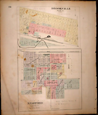 1887 Plat Map ~ BROOKVILLE - STAFFORD, KANSAS ~ MACKSVILLE - CASSADAY on Reverse
-
$24.06 CAD
 1950s Vintage KANSAS State Map Animated Map of Kansas Picture Map BW 6828
-
$62.99 CAD
 Original 1887 Plat Map OSAGE MISSION, KANSAS ~ ERIE - THAYER - URBANA on Reverse
-
$31.46 CAD
 USGS Topographic Map KANSAS CITY Missouri 1983 39094-A1-TM-100
-
$41.06 CAD
 1900 Map - City of Lenora, Kansas Norton County, Kansas - Historical Print
-
$28.35 CAD
 Old 1892 ~ KANSAS Map ~ Authentic Atlas Map (11x14) Free S&H #P216
-
$62.99 CAD
 Original 1887 Large 24" x 30" Colored Plat Map ~ EL DORADO, KANSAS ~Free S&H
-
$28.35 CAD
 Antique Gaskell's Railroad & County Atlas Map ~ KANSAS ~ Free S&H
-
$61.85 CAD
 Original 1887 Large 26" x 32" Colored Plat Map ~ WINFIELD, KANSAS ~Free S&H
-
$37.22 CAD
 Old 1884 KANSAS FRONTIER ~ Authentic Atlas Map (11x14) ~Free S&H -#P142
-
$28.35 CAD
 Vintage 1912 Atlas Map ~ KANSAS ~ Old & Authentic ~ Free S&H
-
$62.99 CAD
 Old Antique 1887 Plat Map ~ OLATHE - SHAWNEE - DE SOTO, KANSAS ~ Free S&H
-
$23.37 CAD
 1895 Antique Kansas State Map Atlas Map of Kansas Gallery Wall Decor 766
-
$31.46 CAD
 1900 Map - Norton County, Kansas - Township 3 S. Range 25 W & S. Range 24 West
-
$31.46 CAD
 1900 Map - Norton County, Kansas - Township 4 S. Range 23 W & S. Range 22 West
-
$28.35 CAD
 (Lg14x22) 1904 Cram's Atlas Map ~ KANSAS ~Free S&H ~ Inv#45
-
$62.99 CAD
 Old 1887 Plat Map ~ REPUBLIC Co., KANSAS - SCANDIA - CUBA - MYSTIC on Reverse
-
$38.37 CAD
 1887 Everts Kansas Map - Town Plans - Clay Center Valley Center Argonia Goddard
-
$10.91 CAD
 Miami Miami Beach Map by Texaco / Circa 1977 / Free Domestic Shipping
-
$13.71 CAD
 Vtg 1978 Kentucky & Kansas Map Rand McNally Atlas Vibrant Colors
-
$49.34 CAD
 Vintage 1925 Topographic Map - Hutchinson, Kansas - 19.75" x 16.5"
-
$174.02 CAD
 Original 1865 MISSOURI & KANSAS:-) Antique hand colored JOHNSON's MAP 26.5 X 18"


