 Antiques (CA)
-
$35.44 CAD

 1924 HISTORY OF EUROPE Vintage Geographical Map Color ORIGINAL C12-3
-
$67.23 CAD
 W & A K Johnston’s Cycling and Touring Map of Ireland Southern Sheet Dublin Envi
-
$53.23 CAD
 1918 ENGLAND & WALES Vintage Large Geographical Map ORIG. 12.5 x 10.5" C13-1
-
$53.23 CAD
 1923 EUROPE 9th Century Vintage Large Geographical Map ORIG. 12.5 x 10.5" C13-1
-
$547.39 CAD
 RARE original political 1918 MAP OF THE IRISH REPUBLIC in color wb
-
$16.42 CAD
 DUBLIN plan 1894 IRELAND ORIGINAL Map Baile Átha Cliath Éire
-
$21.92 CAD
 Ballinasloe Roscommon antique road map Ireland c1782 Taylor & Skinner 235/236
-
$21.92 CAD
 Antrim Down antique road map C1782 Northern Ireland Taylor & Skinner map 281/282
-
$37.98 CAD
 Vintage Color Map ~ BRITISH ISLES ~ ENGLAND IRELAND SCOTLAND WALES Printed 1883
-
$26.69 CAD
 Historical Map of Ireland by L.G. Bullock Color Map 1962 printing
-
$43.63 CAD
 IRELAND Southern Part - c. 1835 Original Map 11 x 16"
-
$14.99 CAD
 Antique 1880 Ireland-England-Scotland book plate Map 9 x 12-suitable to frame
-
$43.79 CAD
 1879 Map British Isles England Scotland Victorian Geography 1st Edition DWAA9
-
$53.23 CAD
 1901 IRELAND Vintage Large Geographical Map Dublin ORIGINAL 12.5 x 10.5" C13-1
-
$65.00 CAD
 British Isles Ireland United Kingdom England Scotland 1824 Vivien two sheet map
-
$1149.54 CAD
 EYLAND MAN (...) IRELAND IN ENGELAND. ENGRAVING. GERHARD H.VAN KEULEN.CIRCA 1750
-
$21.92 CAD
 Derry Colerain Northern Ireland antique road map C1782 Taylor & Skinner 271/272
-
$21.92 CAD
 Ballynahinch Dromore antique road map Northern Ireland C1782 map 283/284
-
$21.92 CAD
 Sligo Westport Ireland antique road map C1782 Taylor & Skinner 223/224
-
$21.92 CAD
 Lanesborough Ballymahon Strokestown Ireland antique coach road C 1782 map 67/68
-
$21.92 CAD
 Newtown Butler Clogher Northern Ireland antique road map C 1782 no 258 coloured
-
$21.90 CAD
 IRELAND 1841 MAP - 8 x 10.5" (20 x 26 cm) Engraving Intaglio
-
$30.41 CAD
 Vintage Color Map ~ EUROPE ~ Printed 1883
-
$82.11 CAD
 1937 National Geographic Modern Pilgrims Map Of British Isles, old maps.
-
$80.91 CAD
 1892 MAP ROMAN EMPIRE SPAIN FRANCE BRITAIN IRELAND GERMANY GREECE SYRIA ITALY
-
$97.75 CAD
 1912 LARGE ANTIQUE MAP ~ IRELAND SOUTHERN ~ ENVIRONSCORK DUBLIN
-
$97.75 CAD
 1912 LARGE ANTIQUE MAP ~ IRELAND NORTH ~ ENVIRONS BELFAST
-
$376.34 CAD
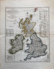 1804 Map: the United Kingdom of Great Britain and Ireland, by I. G. L. Weidner.


