 Antiques (CA)
-
$39.92 CAD

 1876 OHIO Plat Map MILFORD Township DEFIANCE County LARGE ORIGINAL
-
$60.57 CAD
 1876 Plat Map WASHINGTON GEORGETOWN Ohio DEFIANCE County LARGE ORIGINAL
-
$52.31 CAD
 1899 Southern Illinois Map ORIGINAL Chicago Springfield Belleville Mattoon
-
$53.52 CAD
 1880 United States Map Barley Farming Agriculture Wisconsin California Oregon
-
$275.32 CAD
 Ogle County Illinois Antique ATLAS & Plat Book Hand Colored Maps 1893
-
$275.32 CAD
 La Salle County Illinois Antique ATLAS & Plat Book Hand Colored Maps 1929
-
$28.91 CAD
 1905 Upper Peninsula Michigan Map ORIGINAL Menominee Isle Royale Dickinson
-
$38.55 CAD
 1889 OHIO Map ORIGINAL Dayton Akron Cleveland Sandusky Columbus Cincinnati
-
$39.76 CAD
 1899 WISCONSIN Map ORIGINAL Green Bay Madison Superior Milwaukee ATLAS MAP
-
$82.59 CAD
 1940 Michigan Highway Map Lapeer County Imlay City Deerfield North Branch Dryden
-
$38.55 CAD
 UNITED STATES Map 1889 Inter Colonial Wars ORIGINAL Spanish Florida Rebellions
-
$688.33 CAD
 1845 North America map by A.K. Johnston 25.8" x 21.2" Antique Republic of Texas
-
$48.18 CAD
 1856 Black's North America - Map 17.3" x 12.5" - Antique
-
$38.55 CAD
 1879 North Central States Group US Victorian Atlas Geography 1st Edition DWAA9
-
$53.52 CAD
 VINTAGE 1934 Map INDIANA County Township Railroads Indianapolis South Bend
-
$75.72 CAD
 OLD 1867 OHIO Map ORIGINAL INDIANA Cleveland Columbus Toledo Dayton Cincinnati
-
$68.82 CAD
 Civil War Map Kentucky Louisville Frankfort Cincinnati Ohio Indiana Illinois KY
-
$25.15 CAD
 Plat Map IL 1957 Randolph Township Advertisement McLean County
-
$53.52 CAD
 1897 Southern Illinois Map ORIGINAL Chicago Springfield Belleville Mattoon
-
$27.52 CAD
 1902 Century Map - Wisconsin Madison Milwaukee Green Bay Oshkosh Portage Duluth
-
$39.76 CAD
 1876 OHIO MAP Defiance County PLATS Delaware Township Railroads LARGE
-
$61.95 CAD
 1878 United States map 22.8" x 15.1" nice color - Island of New Foundland inset
-
$34.40 CAD
 1940 Michigan Highway Map Ionia County Portland Belding Muir Saranac Lyons Palo
-
$53.52 CAD
 1875 KENTUCKY TENNESSEE Map ORIGINAL OHIO WEST VIRGINIA INDIANA Maryland
-
$41.29 CAD
 1876 Indiana Atlas County Map Randolph & Wayne Richmond
-
$53.52 CAD
 1880 UNITED STATES Map ORIGINAL Farming Oats Agricultural Texas Colorado Florida
-
$68.82 CAD
 1940 Michigan Highway Map Gladwin County Beaverton Billings Butman Rhodes Secord
-
$68.82 CAD
 Civil War Map Missouri Illinois St. Louis Jefferson City Columbia Alton Vandalia
-
$33.04 CAD
 United States - Original Map c1906 by G Philip & Son. Antique
-
$53.52 CAD
 1900 United States Map ORIGINAL Oat Farming Production Agriculture Texas Iowa
-
$25.76 CAD
 Plat Map Illinois 1957 Dry Grove Township Advertise McLean County Bloomington
-
$25.12 CAD
 Plat Map Illinois 1957 Dawson Township Advertisement McLean County Heyworth
-
$37.86 CAD
 1910 Ohio Highway Road Map Marion County Morral Waldo Prospect La Rue Caledonia
-
$37.86 CAD
 1910 Ohio Highway Road Map Adams County West Union Manchester Serpent Mound OH
-
$27.53 CAD
 West Point Civil War Map Gettysburg Campaign General Situation June 1, 1863 PA
-
$34.40 CAD
 1902 Century Atlas Map x 2 - Ohio - Cincinnati Cleveland Columbus Toledo Akron
-
$17.21 CAD
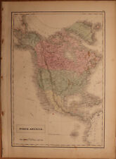
 1917 McNally Map - North America - United States Canada Mexico Alaska Cuba
-
$82.59 CAD
 1910 Ohio Highway Road Map Hamilton County Cincinnati Harrison Norwood Wyoming
-
$27.11 CAD
 Plat Map Illinois 1957 Dale Township Advertisement McLean County Bloomington
-
$25.37 CAD
 Plat Map IL 1957 Towanda Township Advertisement McLean County
-
$37.86 CAD
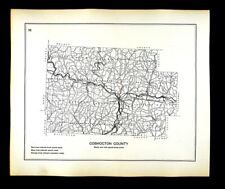 1910 Ohio Highway Road Map Coshocton County Warsaw West Lafayette Blissfield OH
-
$68.82 CAD
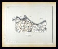 1910 Ohio Highway Road Map Erie County Sandusky Cedar Point Huron Vermilion OH
-
$27.52 CAD
 1902 Century Map - North America United States Canada Mexico Cuba Alaska Iceland
-
$24.13 CAD
 Plat Map Illinois 1957 Downs Township Advertisement McLean County IL
-
$82.59 CAD
 1910 Ohio Highway Road Map Cuyahoga County Cleveland Chagrin Falls Brecksville
-
$103.25 CAD
 1860 US Canada Mexico C. America Mitchell antique map 15.3" x 12.5" hand color
-
$37.86 CAD
 1910 Ohio Highway Road Map Hocking County Logan Carbon Hill Rockbridge Gore OH
-
$68.82 CAD
 Large Format 1905 COLOR Rand McNally Map Atlas Page 14&15 East Of Chicago
-
$37.86 CAD
 1910 Ohio Highway Road Map Williams County Bryan Montpelier Pioneer Edon Stryker
-
$37.86 CAD
 1910 Ohio Highway Road Map Ashtabula County Conneaut Geneva Jefferson Kingsvill
-
$82.59 CAD
 1910 Ohio Highway Road Map Franklin County Columbus State University Groveport
-
$19.08 CAD
 1885 Antique Color Map North Central States Eastern Section WI IL IN KY MI OH
-
$28.07 CAD
 Plat Map IL 1957 Empire Township Advertisement McLean County
-
$37.86 CAD
 1910 Ohio Highway Road Map Seneca County Tiffin Fostoria Bloomville Republic OH
-
$12.73 CAD
 1889 Arbuckle Map of INDIANA
-
$37.86 CAD
 1910 Ohio Highway Road Map Huron County New London Norwalk Bellevue Monroeville
-
$41.29 CAD
 Civil War Military Map - Ohio West Virginia Pennsylvania - Charleston Columbus
-
$37.86 CAD
 1910 Ohio Highway Road Map Defiance County Hicksville Sherwood Ney Mark Center
-
$34.42 CAD
 1902 Century Atlas Map x 2 - Illinois - Chicago Springfield Bloomington Urbana
-
$68.82 CAD
 Civil War Map Louisiana Mississippi Alexandria Vicksburg Natchez Jackson Monroe
-
$41.29 CAD
 NATURAL ADVANCE GEOGRAPHY REDWAY AND HINMAN 1901 ATLAS MAP UNITED STATES WORLD


