 Antiques (CA)
-
$68.53 CAD

 Lot 2 Antique Maps Oregon Gaskell's Atlas of the World 1893 ca 1900 Color
-
$198.77 CAD
 Vintage 1901 UNITED STATES of AMERICA Map 22x14 Antique Map In 30x24 Frame
-
$54.23 CAD
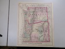
 Vintage 1885 WASHINGTON TERRITORY Map 13"x11" ~ Old Antique Original OLYMPIA WA
-
$28.57 CAD
 Vintage 1896 INDIAN NATIONS Map 14"x11" Old Antique Original TRIBES
-
$50.10 CAD
 Old 1882 (Lg 15"x21") Rand McNally Atlas Map ~ TERRITORY of IDAHO ~ Free S&H
-
$53.30 CAD
 1880 United States Map Barley Farming Agriculture Wisconsin California Oregon
-
$29.56 CAD
 Vintage 1894 INDIAN NATIONS Map 14"x11" ~ Old Antique Original TRIBES
-
$28.35 CAD
 Vintage 1903 Atlas Map ~ IDAHO ~ Old & Authentic ~ Free S&H
-
$43.85 CAD
 1919 Auto Road Map Oregon Salem Portland Eugene Astoria Tillamook Crater Lake OR
-
$28.35 CAD
 Old 1901 Cram's Atlas Railroad & Street Map ~ TACOMA, WASHINGTON - WRIGHT PARK
-
$16.44 CAD
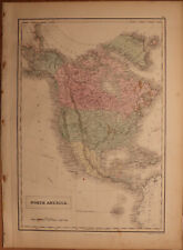
 1896 Mathews Antique Map North America United States Canada Mexico Alaska
-
$53.30 CAD
 1899 OREGON Map ORIGINAL Portland Eugene Salem Medford Port Orford Coos Bay
-
$108.57 CAD
 1919 Auto Road Map United States National Highways & Airplane Routes Washington
-
$329.00 CAD
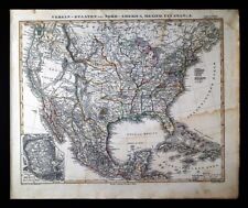 1848 Stieler Stulpnagel Map United States Mexico Texas Missouri Oregon Territory
-
$58.95 CAD
 1897 Oregon Map ORIGINAL Roseburg Klamath Pendleton Ashland RAILROADS TOWNSHIPS
-
$274.17 CAD
 1843 Stulpnagel Map North South America United States Texas California Brazil SA
-
$34.26 CAD
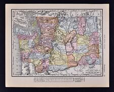
 1875 Antique COLOR Gray’s Atlas Map / OREGON and WASHINGTON
-
$62.99 CAD
 1911 Plat Map ~ APPLE VALLEY ORCHARDS Twps., LINCOLN Co., WASHINGTON STATE
-
$62.99 CAD
 1911 Plat Map ~ Twp., 24N-31E - LINCOLN Co., WASHINGTON - COMMONWEALTH REALTY Co
-
$29.56 CAD
 Vintage 1892 INDIAN NATIONS Map 14"x11" ~ Old Antique Original TRIBES
-
$62.99 CAD
 1911 Plat Map Twp. 27N-33E - LINCOLN Co., WASHINGTON ~ SHERMAN - CORBELLS RAVINE
-
$16.44 CAD
 1937 Map Portland Oregon City Plan Washington Park Mt. Tabor Willamette River OR
-
$62.99 CAD
 1911 Plat Map Twp. 22N-35E - LINCOLN Co. WASHINGTON - DOWNS - GREAT NORTHERN RR
-
$13.69 CAD
 1917 Poates Map - Oregon - Salem Portland Eugene Astoria Klamath Falls Dalles OR
-
$21.92 CAD
 1896 Johnson Map Idaho Boise City McKenzie Challis Moscow Bitter Root Mountains
-
$47.98 CAD
 1856 Black's North America - Map 17.3" x 12.5" - Antique
-
$61.85 CAD
 Old 1911 Plat Map ~ Twp. 21N-31E - LINCOLN Co., WASHINGTON - JACK LAKE
-
$13.69 CAD
 1927 Hammond Map Oregon Salem Portland Astoria Eugene Crater Lake Mount Hood OR
-
$32.90 CAD
 United States - Original Map c1906 by G Philip & Son. Antique
-
$356.42 CAD
 1847 Stieler Map United States Texas Missouri Oregon Territory Mexico Canada
-
$274.17 CAD
 1847 Stulpnagel Map N America United States Texas California Oregon Territory
-
$53.30 CAD
 1900 United States Map ORIGINAL Oat Farming Production Agriculture Texas Iowa
-
$28.35 CAD
 1885 Crams Atlas County & Railroad Map WASHINGTON TERRITORY - INDIAN RESERVATION
-
$32.89 CAD
 c1930 Hammond Railroad Map - Idaho Boise Twin Falls Pocatello Salmon Lesiston ID
-
$62.99 CAD
 1911 Plat Map ~ Twp. 21N-38E - LINCOLN Co., WASHINGTON ~ COLVILLE LAKE - ODESSA
-
$13.69 CAD
 c1905 Hammond Map - Oregon Salem Eugene Astoria La Grande Klamath Falls Portland
-
$61.69 CAD
 1878 United States map 22.8" x 15.1" nice color - Island of New Foundland inset
-
$62.99 CAD
 1911 Plat Map Twp., 24N-34E - LINCOLN Co., WASHINGTON ~ FLORENCE & TWIN LAKE
-
$108.57 CAD
 1926 Clason Auto Road Map & Distance Chart United States Transcontinental Trails
-
$53.30 CAD
 1880 UNITED STATES Map ORIGINAL Farming Oats Agricultural Texas Colorado Florida
-
$13.69 CAD
 c1970 McNally Cosmo Map - Oregon - Portland Eugene Salem Klamath Falls Coos Bay
-
$27.40 CAD
 1883 Antique Map / STATE OF WASHINGTON / 10.5x14.5 inches
-
$62.99 CAD
 1911 Plat Map ~ Twp. 21N-37E - LINCOLN Co., WASHINGTON ~ RACE TRACK - HIST. ASSN
-
$19.19 CAD
 1937 Rand McNally Map Idaho Boise Caldwell Pocatello Wallace Dubois Rigby Arco
-
$13.69 CAD
 1900 McNally Map - United States - Texas California New York Florida Colorado US
-
$54.82 CAD
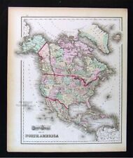 1874 Gray Map - North America United States Canada Mexico Alaska - South America
-
$13.69 CAD
 1917 Poates Map - Washington - Olympia Seattle Port Townsend Tacoma Bellingham
-
$13.69 CAD
 1917 McNally Map - Idaho Boise Caldwell Pocatello Wallace Moscow Lewiston Weiser
-
$13.71 CAD
 Vintage Rand McNally 15.5" x 11" Road Atlas 1998 United States Canada Mexico Map
-
$16.44 CAD
 1900 McNally Map Montana Idaho Billings Helena Butte Boise Bitter Root Mountains
-
$62.99 CAD
 1911 Plat Map ~Twp. 27N-31E - LINCOLN Co, WASHINGTON ~ WILLIAM HARRIS LANDOWNER
-
$13.69 CAD
 1888 Antique Map Page Northwestern USA States WA OR ID MT WY @ 11x8.5"
-
$21.92 CAD
 c 1890 Cram Map - Oregon Salem Astoria Eugene Portland Klamath Falls Empire City
-
$43.85 CAD
 1885 Hardesty Map Oregon Salem Eugene Astoria Columbia River Walla Walla Klamath
-
$62.99 CAD
 1911 Plat Map REARDAN Twp. LINCOLN Co, WASHINGTON ~ SPOKANE INDIAN RESERVATION
-
$62.99 CAD
 1911 Plat Map ~ HARRINGTON Twp., 26N-37E - LINCOLN Co., WASHINGTON ~ Coal Creek
-
$685.43 CAD
 1840 North America antique map by Greenleaf - 14.2" x 12" scarce 1st edition
-
$21.92 CAD
 1891 McNally Map - Oregon Salem Eugene Astoria Klamath Empire City Mountains OR
-
$21.92 CAD
 1911 McNally Index Map - Washington - Seattle Spokane Olympia Tacoma Mt. Rainer
-
$13.69 CAD
 1884 Rand McNally Atlas 2 Charts States Area Sq Miles & Accessed Property Value
-
$62.99 CAD
 1911 Plat Map ~ Twp. 22N-34E - LINCOLN Co. WASHINGTON LAMONA - GREAT NORTHERN RR
-
$13.69 CAD
 1917 McNally Map - Washington - Seattle Olympia Tacoma Spokane Mt. Rainier Adams
-
$62.99 CAD
 1911 Plat Map ~ IRBY - IRBYDALE - EDWALL Twps., LINCOLN Co., WASHINGTON
-
$38.37 CAD
 c 1889 Cowperthwait Map - United States - Indian Territory & Oklahoma Lands Rush
-
$21.92 CAD
 1885 McNally Map Washington Seattle Olympia Tacoma Spokane Astoria Yakima Oyster
-
$21.92 CAD
 c. 1920 Hammond Washington Map Elevation Railroads Seattle Tacoma Olympia
-
$31.53 CAD
 1882 Antique Color Map - WESTERN U.S. STATES - Rare Authentic 135-Year-Old Map
-
$82.25 CAD
 1914 Railroad Map, Routes to the Northwest, Chicago, Great Northern Railway
-
$31.46 CAD
 USGS Topographic Map VALE Oregon Idaho 1993 43117-E1-TM-100
-
$54.82 CAD
 1904 George Cram Railroad Map Idaho Boise Caldwell Pocatello Wallace Moscow RR
-
$43.85 CAD
 1881 Andrees Map United States Indian Territory Oklahoma Dakota Texas Mexico
-
$23.30 CAD
 Western USA - Original 1928 German Map by Meyers. Vintage
-
$16.44 CAD
 1937 McNally Map Seattle Washington Steamship Docks Pike Place Elliot Bay WA
-
$130.23 CAD
 1857 Large Color Map - WESTERN UNITED STATES - Edward Stanford - Original & Rare
-
$62.99 CAD
 Old 1895 X-Large 28"x22" Rand McNally Atlas Map ~ OREGON ~ Free S&H
-
$54.82 CAD
 1869 Chambers Map United States West Dakota California Colorado Oregon Utah et
-
$38.37 CAD
 1882 Watson Map Washington Oregon Idaho Montana Seattle Eugene Boise Olympia
-
$27.40 CAD
 1885 McNally Map Oregon Salem Portland Eugene Klamath Falls Jackson Canyon City
-
$34.26 CAD
 1880 Antique Map / OREGON, KANSAS, CALIFORNIA, and the WESTERN TERRITORIES
-
$38.37 CAD
 1881 Rand McNally Railroad Map Washington Seattle Olympia Spokane Walla Walla WA
-
$28.35 CAD
 Old Antique 1897 Railroad & County Map ~ UTAH - GREAT AMERICAN DESERT ~ Vintage
-
$62.99 CAD
 1911 Plat Map ~ Twp. 22N-33E - LINCOLN Co. WASHINGTON ~ DUCK & PACIFIC LAKES
-
$65.80 CAD
 1881 McNally Railroad Map Oregon Salem Portland Eugene Astoria Klamath Falls
-
$13.69 CAD
 1917 Poates Map - Washington - Seattle Tacoma Bellingham Olympia Mt. Rainer - WA
-
$38.37 CAD
 1911 Stieler Map United States Washington Oregon Montana Wyoming California NV
-
$62.99 CAD
 1911 Plat Map ~ Twp. 22N-36E - LINCOLN Co., WASHINGTON ~ MOHLER - MOROCCO
-
$62.99 CAD
 1911 Plat Map ~ Twp. 27N-32E ~ LINCOLN Co., WASHINGTON ~ BROADAX & CORBELL DRAW
-
$62.99 CAD
 1911 Plat Map Twp., 24N-36E - LINCOLN Co., WASHINGTON ~ ADRIAN KLOSTER LANDOWNER
-
$13.69 CAD
 c1949 Britannica Map Washington Seattle Tacoma Yakima Spokane Townsend Olympia
-
$13.71 CAD
 1917 McNally Map - North America - United States Canada Mexico Alaska Cuba
-
$32.89 CAD
 1937 US Air Commerce Map American Operated Airline Route Distances United States
-
$9.60 CAD
 What did our National Parks System look like in 1958 ? Original Map US & Canada
-
$28.35 CAD
 Vintage 1950 Atlas Map ~ WASHINGTON - OLYMPIA ~ Old & Authentic ~ Free S&H
-
$47.98 CAD
 1901 United States Flags of the Union antique map ~ 23" x 14.6" - nice color
-
$34.27 CAD
 1895 Antique MITCHELL Color Map of USA United States of America ~ Large Original
-
$21.92 CAD
 1875 Lange Physical Map - North America - United States Canada Mexico Alaska
-
$38.37 CAD
 1881 US Coast Survey Map - United States Chart of Magnetic Stations - Geodetric
-
$13.69 CAD
 1900 Mathews-Northrup Handy Map - Oregon - Salem Portland Eugene Klamath Falls
-
$143.80 CAD
 Old Map Railway Map of Japan (ncluding Manchuria Korea Sakhalin 53028568839 nonh
-
$51.41 CAD
 Vintage 1884 United States Geological Survey Group Map 31"x19" W J McGee Torn


