 Antiques (CA)
-
$171.36 CAD

 PIETER SCHENK / VALK / JANSSEN Hand Colored Map of Rhodes Greece ca1702 vgc
-
$42.67 CAD
 1847 Vuillemin Antique Map The Turkish Empire in Europe from Greece to Austria
-
$39.71 CAD
 GREECE Environs of Athens Piraeus Kalivia Menidi - 1911 MAP
-
$26.18 CAD
 Ancient Greece Ionians Dorians Barbarian Peoples 1910 Antique Color Map Wall Art
-
$34.27 CAD
 1876 Turkey in Europe & Greece antique map ~ 19.6" x 14.2" hand colored
-
$53.30 CAD
 1897 Greece Map ORIGINAL Crete Hydra Laconia Arcadia Larissa Piraeus Railways
-
$21.92 CAD
 1911 Stieler Map Balkans Macedonia Serbia Bosnia Albania Montenegro Dalmatia
-
$47.98 CAD
 1860 Austrian Empire Italian States & more antique map by Mitchell 15.3" x 12.3"
-
$21.93 CAD
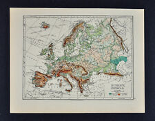
 Europe - Original 1903 Dated Physical Map by Dodd Mead & Company. Antique
-
$137.07 CAD
 Antique Map - Joseph Roux - Harbour Plan - Port of Saint Antoine - Lemnos - F5
-
$95.96 CAD
 1820 Ancient Greece antique map by Lavoisne ~ 21.8" x 17.5" hand colored
-
$27.42 CAD
 1864 Austria Turkey Greece by Johnson Ward beautiful antique map 26" x 17.8"
-
$54.82 CAD
 1839 Stieler Physical Map Europe River Basins Mountain Ranges Rhine Danube Seine
-
$21.92 CAD
 1911 Stieler Map Balkans Romania Bulgaria Constantinople Black Sea Turkey Varna
-
$43.85 CAD
 c 1860 Ansart Map Physical Europe Continental Divide River Basins Alps Pyrenees
-
$27.40 CAD
 1843 Woodbridge Map Europe France Spain Germany Italy Sweden Norway Austria UK
-
$137.09 CAD
 1767 Europe's Lakes, Rivers & Mountains antique map by Clouet ~ 22.7" x 16.6"
-
$239.90 CAD
 1845 Greece map by A.K. Johnston ~ 25.8" x 21.2" Antique Pastel Color Huge
-
$274.17 CAD
 1845 Europe map by A.K. Johnston ~ 25.8" x 21.2" Antique Pastel Color Huge
-
$137.09 CAD
 1767 Europe's Islands Capes & Seaports antique map by Clouet ~ 23" x 16.8"
-
$16.44 CAD
 1835 Map x 2 - Europe Political & Physical - Austria Italy Spain Britain
-
$26.18 CAD
 Reference Ancient Greece Northern Macedonia Thessaly 1910's Antique Map Wall Art
-
$16.44 CAD
 1895 Johnston Map - Physical Europe & Political England & Wales London Liverpool
-
$34.27 CAD
 1901 Tunison Europe & South America antique map ~ 22.8" x 14.6" nice color
-
$53.46 CAD
 1849 Greece by Mitchell antique map ~ 17.4" x 13.8" hand colored
-
$41.13 CAD
 1856 Black's Hellas or Greece map 17.2" x 12.6" - beautiful antique with color
-
$27.40 CAD
 1843 Woodbridge Physical Map Europe France Spain Germany Italy Sweden Austria UK
-
$102.81 CAD
 1849 Europe by Mitchell antique map ~ 17.4" x 13.8" hand colored
-
$27.40 CAD
 1864 Delamarche Map - Physical Europe France Spain Germany Italy Britain Russia
-
$20.56 CAD
 1884 Physical Map of Europe Harper and Brothers Copyright 1875 Ephemera
-
$19.88 CAD
 Antique Maps - Athens Metropolitan Area M ap- 1911
-
$102.81 CAD
 1820 Europe Iberia to Russia antique map by Lavoisne ~ 21.8" x 17.4" hand color
-
$89.11 CAD
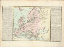
 1767 Europe antique map by Clouet ~ 23.1" x 17.1" - hand color
-
$171.36 CAD
 1840 Greece map by Greenleaf 14.2" x 11.9" scarce 1st edition - pastel color
-
$61.69 CAD
 GREECE THESSALONIKI SALONICA ROAD MUNICIPALITY & PHYSICAL MAP 1950's
-
$102.81 CAD
 1876 Europe antique map ~ 27.5" x 19.5" hand colored - large - ships
-
$102.81 CAD
 1820 Europe Barbarian Incursion antique map by Lavoisne 21.8" x 17.6" hand color
-
$13.64 CAD
 Vintage Athinai & Attiki Road Map Plan - Tourist Information
-
$1062.41 CAD
 Original Antique Abraham Ortelius Map 16th C Map Of Greece 1573 Graeciae Regni
-
$47.98 CAD
 1867 Johnson's Map of Austria, Turkey in Europe and Greece - original
-
$13.71 CAD
 1897 Greece, Crete and Samos by The Century Co,
-
$81.04 CAD
 c1889 MAP ~ THE BALKAN PENINSULA PHYSICAL ~ GREECE TURKEY BULGARIA


