 Antiques (CA)
-
$102.64 CAD

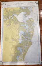 1960 Vintage Nautical Map Atlantic City to Cape May NJ Shore C.&G.S. 38”x24
-
$143.68 CAD
 Antique Colonial NY Map New York Province North America Land Grants Pease 1849
-
$32.09 CAD
 1951 Metropolitan New Jersey New York Highways Port Authority Holland Tunnel
-
$54.73 CAD
 5 Vintage Maps of Monmouth County New Jersey
-
$20.46 CAD
 c.1950s Hackney's Restaurant Atlantic City Pictorial Map Brochure NJ Vintage VG+
-
$47.83 CAD
 04/03. Antique 1915 Mendenhall's Guide and New Jersey Cloth Backed Folding Map
-
$5.46 CAD
 Appalachian Trail Map AT Section NY 13 NJ 1 2 3 Foldable Vintage 1988 Hiking
-
$92.37 CAD
 1900’s Map Of Atlantic City Showing Location Of Hotels Booklet On The Silverton
-
$35.51 CAD
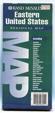
 Rand-McNally regional state map: EASTERN UNITED STATES © 2004 - paper
-
$81.97 CAD
 Antique 1901 Map Salem New Jersey area Woodstown Paulsboro Elmer 23"X27" #21081
-
$30.09 CAD
 USGS Planimetric Topo Map SCRANTON Pennsylvania New Jersey 1986 41075-A1-PL-100
-
$19.08 CAD
 Vintage New Jersey map vintage 1950 Collier's Encyclopedia / Rand McNally
-
$36.05 CAD
 Rand-McNally city street map: NEW YORK CITY © 1997 -index- Manhattan Brooklyn +
-
$7.51 CAD
 THE NATIONAL GEOGRAPHIC MAP CLOSE UP USA NEW YORK NEW JERSEY PENNSYLVANIA 1977
-
$164.22 CAD
 1847 Williams Map New Jersey Trenton Newark Princeton Camden Philadelphia NYC
-
$22.58 CAD
 1986 Trucker’s Wilmapco Region Original Vintage Map For DE, MD, NJ, PA
-
$29.35 CAD
 USGS NOAA Topographic-Bathymetric Map NEWARK - New Jersey - New York -1986- 100K
-
$32.68 CAD
 Rand-McNally regional state map: EASTERN UNITED STATES © 1993 -BAD-
-
$53.37 CAD
 Antique paper soil map New Jersey 1901 Salem sheet #3 US Dept of Agriculture
-
$40.78 CAD
 Antique 1901 Map Salem New Jersey Swedesboro Penns Grove Woodstown #17091
-
$17.78 CAD
 USGS Index to Topographic Maps of New Jersey May 1978 Geological Survey
-
$273.69 CAD
 Antique 1927 MAP OF ATLANTIC CITY NJ Seeler Co. 34x22 DOLPH & STEWART
-
$37.99 CAD
 Rand-McNally regional map: PHILADELPHIA & Vicinity Pennsylvania © 1997 -Index-
-
$36.94 CAD
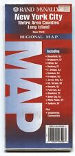 Rand-McNally regional map: NEW YORK CITY ©1994 Metro Area Counties - Long Island
-
$24.63 CAD
 1907 Antique Map of NEW JERSEY , railroads, towns, 1 fold, cream color, (inv219)
-
$35.57 CAD
 Rand-McNally regional state map: EASTERN UNITED STATES © 1993
-
$68.43 CAD
 Original Antique 1868 RAILROAD Map Virgina WV Maryland Delaware NJ BATTLEFIELDS
-
$34.21 CAD
 Original City PLAN OF LOTS in NEW JERSEY --Antique Collectable
-
$32.16 CAD
 USGS NOAA Topographic-Bathymetric Map LONG ISLAND WEST -NY NJ CT- 1984 -100K-
-
$35.25 CAD
 Rand-McNally regional map: PHILADELPHIA & VICINITY © 1993 Delaware Valley - Love
-
$68.43 CAD
 USGS NOAA Topographic-Bathymetric Map TRENTON NJ PA NY 1986 40074-A1-TB-100
-
$32.09 CAD
 USGS Topographic Map ATLANTIC CITY - New Jersey - 1984 - 100K -
-
$10.95 CAD
 1940's CHESTER-BRIDGEPORT FERRY Map Delaware River New Jersey Pennsylvania
-
$29.35 CAD
 USGS Topographic Map CAPE MAY - New Jersey - 1981 - 100K -
-
$41.06 CAD
 1930 Car Auto Roads Between Canada & USA Atlantic Sheet Map Large Color
-
$273.70 CAD
 antique Maps palisades interstate parkW Welch NY & NJ T Roosevelt F Vorhees
-
$2.72 CAD
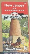 1961 Esso Travel Map of New Jersey
-
$41.06 CAD
 1870 antique Map of Great Meadows Warren County NJ G Cook
-
$1300.06 CAD
 HUGE 1836 CAPE MAY - NEW JERSEY MAP ROADS DELWARE BAY 100% AUTHENTIC
-
$17.78 CAD
 1983 AAA New Jersey Pennsylvania Map
-
$20.53 CAD
 1895 Rand McNally Map of New Jersey 11 X 14
-
$27.36 CAD
 Vintage Early 1900s? New Jersey C. S. Hammond & Co Folding Paper on Canvas Map
-
$136.85 CAD
 1936 5 map set Inland waterway New York to Key West, Coast & Geodetic Survey
-
$65.69 CAD
 THE ORANGES NEW JERSEY ESSEX COUNTY 1889 LARGE ANTIQUE REPRO. MAP BADWIN
-
$34.14 CAD
 Rare Antique Original Vintage Asher & Adams PA & New Jersey Atlas Map Art Print
-
$68.36 CAD
 1863 US Coast Survey Atlantic Coast Cape Sable to Sandy Hook Map Chart
-
$54.67 CAD
 1908 The Empire Group ' A Survey of New York, Pennsylvania, New Jersey' Map
-
$68.43 CAD
 Examination of Woodbury Creek, New Jersey, 1912 - Includes Maps


