 Antiques (CA)
-
$43.36 CAD

 1891 MINNESOTA MAP ANTIQUE FULL COLOR RAILROAD MOUNTAIN VICTORIAN ERA SUPERIOR
-
$20.64 CAD
 Vintage 1994 Morrison County & Little Falls Minnesota Map And Business Guide
-
$64.36 CAD
 Rand-McNally city map: ROCHESTER MINNESOTA © 1993 -Index - LOCAL Series
-
$64.36 CAD
 Rand-McNally city map: ROCHESTER MINNESOTA © 1993 -Index -
-
$103.25 CAD
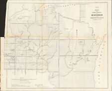 1856 Wisconsin & MN Survey Antique Map Lithograph - Ackerman NY ~ 21.5" x 18.7"
-
$27.46 CAD
 1960 Minnesota Land of 10,000 Lakes Folding Road Map Color Pictures City Index
-
$34.28 CAD
 Antique Map 1906 Minnesota Blue Earth Mankato Amboy Mapleton Good Thunder #13001
-
$25.32 CAD
 Alexis USA Universal GPS Grid Road Map: MINNESOTA
-
$130.78 CAD
 1950s Grand Rapids Itasca County Minnesota Pictorial Cartoon Map Vintage Orig.
-
$28.08 CAD
 USGS BLM edition topo map Wisconsin Minnesota -PORT WING- 1981 - mineral - 100K
-
$28.68 CAD
 USGS BLM edition topo map SANDSTONE -Minnesota Wisconsin- 1981 - mineral - 100K
-
$25.15 CAD
 USGS Planimetric Map NEW ULM - Minnesota - 1986 - 100K -
-
$27.20 CAD
 USGS Topographic Map Minnesota - WILLMAR - 1986 - 100K -
-
$48.17 CAD
 Official Highway MAP 1959 Welcome to Minnesota MN
-
$23.69 CAD
 USGS Topographic Map WHEATON - Minnesota North & South Dakota - 1985 - 100K -
-
$23.40 CAD
 USGS Topographic Map North Dakota Minnesota - FARGO - 1989 - 250K -
-
$24.56 CAD
 USGS Planimetric Map WHEATON - Minnesota South North Dakota - 1985 - 100K -
-
$20.64 CAD
 Vintage 70s GREEN LAKE Kandiyohi County MINNESOTA Survey Blueprint Map 33" x 21"
-
$68.56 CAD
 Antique Map 1906 Crookston Minnesota area Kittson Beltrami Climax 34X32" #21139
-
$20.64 CAD
 Vintag 60s MEDICINE LAKE Hennepin County MINNESOTA Survey Blueprint Map 34"x 22"
-
$13.75 CAD
 MAP OF PIEZOMETRIC CONTOURS FOR JORDAN SANDSTONE Minnesota Twin Cities Geology
-
$20.64 CAD
 Vtg 60s HOWARD LAKE Wright County MINNESOTA Survey Blueprint Map 22x17
-
$20.64 CAD
 Vtg 50s NORTH LONG LAKE Crow Wing County MINNESOTA Survey Blueprint Map 33x 21
-
$68.56 CAD
 Antique Map 1906 Blue Earth County Minnesota Mankato Good Thunder 34X31" #21138
-
$117.70 CAD
 1932 Geologic Map of Minnesota, 2 Piece Paper on Cloth Folding Map, Very Fine
-
$20.58 CAD
 Vintage Original 1951 Monson Lake Swift County Minnesota Survey Map
-
$13.75 CAD
 MAP OF JORDAN SANDSTONE & GEOLOGIC CROSS SECTIONS Minnesota Geology Twin Cities
-
$105.26 CAD
 c.1950s Emily and Outing Vacationaland Minnesota Pictorial Cartoon Map Witkus
-
$24.86 CAD
 USGS Topographic Planimetric Map THIEF RIVER FALLS - Minnesota - 1985 - 100K -
-
$23.69 CAD
 USGS Topographic Map THIEF RIVER FALLS - Minnesota - 1992 - 100K -
-
$23.69 CAD
 USGS Topographic Planimetric Map Minnesota - WILLMAR - 1986 - 100K -
-
$130.78 CAD
 1959 Little Crow Lake Region of Minnesota Pictorial Cartoon Map Vintage Original
-
$20.58 CAD
 Vintage Original 1949 Lake Simon Pope County Minnesota Survey Map
-
$34.28 CAD
 Antique Map 1906 Crookston Minnesota Area Benoit E Grand Forks Climax #13210
-
$17.88 CAD
 USGS Index to Topographic Maps of Minnesota May 1980 Geological Survey
-
$41.16 CAD
 Antique 1903 Map Marshall Minnesota area Ghent Green Valley 17"X21.5" #21042
-
$27.46 CAD
 Vintage Superior Nat. Forest Map, Minnesota. Have 1984 (1), 1994 (1), 1997 (2).
-
$130.78 CAD
 c.1950s Little Crow Lake Region of Minnesota Pictorial Cartoon Map Vintage Orig.
-
$39.79 CAD
 Official Highway MAP 1959 Welcome to Minnesota MN
-
$45.29 CAD
 MAP of Minneapolis folding MAP Hudson Map Company Minneapolis Minnesota
-
$27.52 CAD
 USDA Forest Service Topo Map CHIPPEWA NATIONAL FOREST, Minnesota VTG 1961
-
$61.95 CAD
 Original 1903 Color Folding Soil Survey Map Marshall Minnesota Lyons Sodus
-
$61.95 CAD
 Folded Color Map Topography Minnesota Anoka Quadrangle Osseo Minneapolis 1915
-
$30.27 CAD
 Geologic Survey Maps- Groundwater -1954 & Mineral Resources - 1956 For Minnesota
-
$20.58 CAD
 Vtg 1974 Duluth Map Published By Traveler Publications Folding Pamphlet
-
$13.75 CAD
 1957 Minnesota Official Highway Map
-
$41.30 CAD
 Vintage Shopping And Services Map 1980
-
$130.78 CAD
 Agreement with Red Lake & Pembina Bands of Chippewa Indians of MN., 1902
-
$68.83 CAD
 Examination of Red River of the North, Minnesota & North Dakota, 1912 - With Map
-
$32.98 CAD
 Minnesota Nobles County Map Westside Township 1914 L15#38
-
$10.96 CAD
 Minnesota Sterns County Map or Engravings *Special Purchase Dbl Pg/Sd1874 K15#41
-
$10.96 CAD
 Minnesota Waseca County Map or Wilton *Special Purchase Reverses 1874 K15#24
-
$10.96 CAD
 Minnesota Benton County Map & Engravings *Special Purchase Reverses 1874 K15#29
-
$32.98 CAD
 Minnesota Nobles County Map Ellsworth Brewster Rushmore 1914 Double Page L15#28
-
$10.96 CAD
 Minnesota Ankoa County Map or Sauk Rapids *Special Purchase Reverses 1874 K15#10
-
$10.96 CAD
 Minnesota Le Sueur or Reverses or New Ulm. *Special Purchase 1874 K15#08
-
$10.96 CAD
 Minnesota Le Sueur or Reverses or New Ulm. *Special Purchase 1874 K15#09
-
$10.96 CAD
 Minnesota City of Peter or Engravings Reverses *Special Purchase 1874 K15#07
-
$21.97 CAD
 Minnesota State Map 1914 Double Page L15#26
-
$32.98 CAD
 Minnesota Nobles County Map Summit Lake Township 1914 L15#45
-
$10.96 CAD
 Minnesota Sterns County Maps or Engravings Special Purchase Dbl Sd1874 K15#46
-
$32.98 CAD
 Minnesota Nobles County Map Ransom Township 1914 L15#48
-
$32.98 CAD
 Minnesota Nobles County Map Hersey Township 1914 L15#51
-
$32.98 CAD
 Minnesota Nobles County Map Olney Township 1914 L15#42
-
$32.98 CAD
 Minnesota Nobles County Map Bloom Township 1914 L15#44
-
$44.00 CAD
 Minnesota Nobles County Map Leota Township 1914 L15#36
-
$44.00 CAD
 Minnesota Nobles County Map Worthington Township 1914 L15#32
-
$32.98 CAD
 Minnesota Nobles County Map Lorain Township 1914 L15#50


