 Antiques (CA)
-
$54.77 CAD

 Map of Europe Poster Reproduction Super High Quality Print 24"x18"
-
$109.65 CAD
 1879 Map Europe Spain France Italy England Victorian Geography 1st Edition DWAA9
-
$137.09 CAD
 1889 Map of Scotland Cert. Antique Physical Features 31.5 Eng Miles to 1" Scale
-
$109.65 CAD
 1879 Map British Isles England Scotland Victorian Geography 1st Edition DWAA9
-
$28.79 CAD
 1899 London ENGLAND Map ORIGINAL River Thames Ipswich RAILROADS Battlefields
-
$40.34 CAD
 1922 PHYSICAL MAP OF GREAT BRITAIN SCOTLAND WALES IRELAND MOUNTAINS RIVERS
-
$24.68 CAD
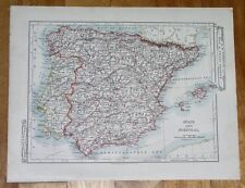 1907 ANTIQUE MAP OF SPAIN AND PORTUGAL BALEARIC ISLANDS MAJORCA ENGLAND PHYSICAL
-
$95.96 CAD
 Eighteenth Century Hand-Col. Map of London & Environs, 1787 - PRICE REDUCED
-
$35.23 CAD
 1908 ANTIQUE PHYSICAL MAP OF UNITED KINGDOM GREAT BRITAIN ENGLANSCOTLAND IRELAND
-
$39.59 CAD
 OLD 1899 Southern England Wales Map London Cornwall STEAMSHIPS RAILWAYS PORTS
-
$39.59 CAD
 1897 England and Wales Map Cornwall Dorsey Cardiff Portsmouth Hastings Bristol
-
$21.93 CAD
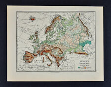
 Europe - Original 1903 Dated Physical Map by Dodd Mead & Company. Antique
-
$5.47 CAD
 VTG 1964 National Geographic Shakespeare's Great Britain Ireland England Map
-
$51.41 CAD
 England County & Physical Map Wales London c. 1863 Dufour & Dyonnet folio map
-
$54.82 CAD
 1839 Stieler Physical Map Europe River Basins Mountain Ranges Rhine Danube Seine
-
$16.11 CAD
 1966 SCOTLAND + NORTHERN ENGLAND Atlas Map, vintage World Book Atlas, full color
-
$28.79 CAD
 1899 Northern England Wales Map Liverpool Sheffield STEAMSHIPS RAILWAYS PORTS
-
$34.27 CAD
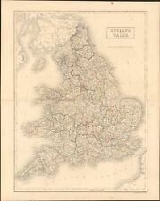 1854 England & Wales by A.C. Black beautiful antique map 21.8" x 17.4
-
$89.11 CAD
 1767 British Isles / England antique map by Clouet ~ 22.7" x 16.7" - hand color
-
$13.54 CAD
 Middlesex England 1892 Antique Map RS Peale 9th Edition Encyclopedia Britannica
-
$137.09 CAD
 1767 Europe's Lakes, Rivers & Mountains antique map by Clouet ~ 22.7" x 16.6"
-
$27.42 CAD
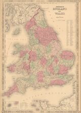 1864 England & Wales by Johnson Ward beautiful antique map 25.8" x 17.6"
-
$27.42 CAD
 1860 Europe antique map by Mitchell 15.3" x 12.3" - hand colored
-
$27.40 CAD
 1921 Johnston Map Netherlands Belgium Luxemburg Holland Amsterdam Brussels Ghent
-
$274.17 CAD
 1845 Europe map by A.K. Johnston ~ 25.8" x 21.2" Antique Pastel Color Huge
-
$16.44 CAD
 GREAT BRITAIN (ENGLAND and SCOTLAND) & IRELAND - 1947 Post War PHYSICAL Map
-
$13.54 CAD
 Monmouth England 1892 Antique Map R.S. Peale 9th Edition Encyclopedia Britannica
-
$27.40 CAD
 1921 Johnston Physical Map British Isles Great Britain England Ireland Scotland
-
$11.62 CAD
 VTG 1964 National Geographic Shakespeare's Great Britain Ireland England Map
-
$27.40 CAD
 1875 Lange Map - British Isles - England Wales Scotland Ireland London Dublin UK
-
$43.85 CAD
 c 1860 Ansart Map Physical Europe Continental Divide River Basins Alps Pyrenees
-
$32.89 CAD
 1885 Stanford Map Rain & Rivers British Isles England Scotland Ireland Antique
-
$21.92 CAD
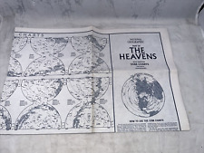 National Geographic August 1970 Map The Heavens w/ Monthly Star Chart 2 Hemisphe
-
$137.09 CAD
 1767 Europe's Islands Capes & Seaports antique map by Clouet ~ 23" x 16.8"
-
$34.27 CAD
 1860 England & Wales antique map by Mitchell 15.3" x 12.3"
-
$21.92 CAD
 1875 Lange Physical Map - British Isles - England Wales Scotland Ireland London
-
$16.44 CAD
 1835 Map x 2 - Europe Political & Physical - Austria Italy Spain Britain
-
$16.44 CAD
 1895 Johnston Map - Physical Europe & Political England & Wales London Liverpool
-
$27.40 CAD
 1843 Woodbridge Map Europe France Spain Germany Italy Sweden Norway Austria UK
-
$27.40 CAD
 1864 Delamarche Map - Physical Europe France Spain Germany Italy Britain Russia
-
$34.27 CAD
 1901 Tunison Europe & South America antique map ~ 22.8" x 14.6" nice color
-
$16.44 CAD
 British Isles and Northern Ireland map National Geographic Vintage Pilgrim 1937
-
$239.90 CAD
 1845 England Wales map by A.K Johnston ~ 25.8" x 21.2" Antique Pastel Color Huge
-
$34.27 CAD
 1901 Tunison England Ireland Scotland antique map ~ 23" x 14.6" nice color
-
$27.40 CAD
 1843 Woodbridge Physical Map Europe France Spain Germany Italy Sweden Austria UK
-
$135.71 CAD
 1840 Europe map by Greenleaf 14.2" x 11.9" scarce 1st edition antique
-
$102.81 CAD
 1849 Europe by Mitchell antique map ~ 17.4" x 13.8" hand colored
-
$325.00 CAD
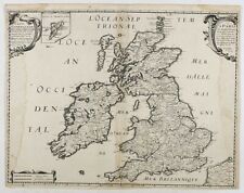 TAVERNIER, M. (1642) Carte Generale des Royaume d'Angleterre Escosse et Irlande
-
$102.81 CAD
 1820 Europe Iberia to Russia antique map by Lavoisne ~ 21.8" x 17.4" hand color
-
$89.11 CAD
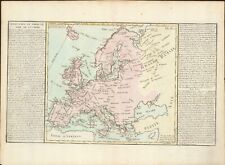
 1767 Europe antique map by Clouet ~ 23.1" x 17.1" - hand color
-
$89.11 CAD
 1849 England & London by Mitchell antique map ~ 17.4" x 13.8" hand colored
-
$135.71 CAD
 1840 British Isles map by Greenleaf 14.2" x 11.9" scarce 1st edition antique
-
$102.81 CAD
 1876 Europe antique map ~ 27.5" x 19.5" hand colored - large - ships
-
$34.27 CAD
 1856 Black's Europe map 17.2" x 12.6" beautiful antique with color
-
$116.52 CAD
 1856 Black's England & Wales double map 34.4" x 23.7" - beautiful antique color
-
$298.85 CAD
 1744 Antique Map of United Kingdom, England, Ireland, Scotland
-
$13.69 CAD
 VTG 1964 National Geographic Shakespeare's Great Britain Ireland England Map
-
$102.81 CAD
 1820 Europe Barbarian Incursion antique map by Lavoisne 21.8" x 17.6" hand color
-
$13.69 CAD
 Original 1896 BATHY-OROGRAPHICAL Map BRITISH ISLES Ocean Depths Mountain Heights
-
$10.27 CAD
 Map England 1611 May 1964 Vintage National Geographic 19x25 Great Britain
-
$150.66 CAD
 1939 SURVEY MAP ENGLAND & WALES LAND HEIGHTS PHYSICAL PENNINE CHAIN DARTMOOR
-
$41.13 CAD
 BARTHOLOMEWS NEW REDUCED SURVEY LAKE DISTRICT MAP CLOTH ENGLAND CIRCA. 1900
-
$27.42 CAD
 VTG 1964 National Geographic Shakespeare's Great Britain Ireland England Map
-
$27.42 CAD
 VTG 1964 National Geographic Shakespeare's Great Britain Ireland England Map
-
$267.32 CAD
 1780 Kingdoms of England Scotland & Ireland antique map by Bonne/Lattre - framed


