 Antiques (CA)
Africa Maps
Asia Maps
Australia/Oceania Maps
Celestial Maps
Central America/Caribbean Maps
Curiosities Maps
Digital Maps
Europe Maps
Map & Globe Mixed Lots
Map & Globe Reproductions
North America Maps
South America Maps
World & Celestial Globes
World Maps

-
$137.00 CAD

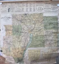 Original Linen Backed Ontario County New York Map Geneva Canandaigua
-
$137.06 CAD
 ORIGINAL County Map of England and Wales, 1878, Clerks Office,US
-
$34.25 CAD
 ✨Vintage 1975 Bi-Centennial Historical Map Of Rutherford County NC- 20”x14”✨
-
$479.73 CAD
 Map UNITED COUNTIES LEEDS & GRENVILLE by Walling 1861 Rare Canada Map 5ft x 5ft
-
$100.06 CAD
 1860 Hunterdon County New Jersey Wall Map w/ Homeowner Names and Plots Outlined
-
$54.81 CAD
 WOODSTOCK 1969 FESTIVAL Planimetric Map LAKE HUNTINGTON QUADRANGLE 28”X23”
-
$49.33 CAD
 ANTIQUE 1869 HAMDEN NEW YORK HAND COLORED ENGRAVING MAP ON ARCHIVAL FABRIC 12X15
-
$31.48 CAD
 African Continental Cloth Map 24"x53" Flags Classroom Wall Hanging 1950s Africa
-
$13.71 CAD
 Vintage Soviet Wall Map Southern Hemisphere 1981 in folder
-
$41.12 CAD
 Metsker Maps Spokane Washington 1949
-
$4111.95 CAD
 Antique Original 1860 Farm Line Map of Alexandria Township Hunterdon County
-
$123.29 CAD
 Chambers County Alabama Indian Territory Map 1832 RP 24x30" FREE SHIPPING!
-
$135.69 CAD
 BOOK OF MORMON "A Proposed Map" 1998 Travel Poster 26" X 28" MINT CONDITION
-
$109.65 CAD
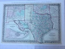 S.A Mitchell`s 1876 County Map of TEXAS~New Mexico Forts~Trails~Rails~23X34
-
$97.45 CAD
 Vintage 33.5"x21.5" Germany Deutschland 100% Baumwolle Map Print Fabric Wall Art
-
$68.53 CAD
 55 Vintage 1960s Michigan County Wall Maps DNR 22 Different Counties
-
$22.26 CAD
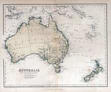
 map of Australia full Poster print world globe art New Zealand
-
$68.46 CAD
 VINTAGE ASBURY PARK, NEW JERSEY STREET MAP 18”x22” Wall Map MONMOUTH COUNTY, NJ
-
$68.53 CAD
 Vintage 1967 Yosemite Portion of Madera County Cartoon Map
-
$1317.00 CAD
 RARE 1791 Map UNITED STATES FRENCH POSSESSION ORIGINAL 18th century map
-
$69.90 CAD
 1887 County and Township Map of Utah and Nevada
-
$475.62 CAD
 1852 Antique Wall Map Monroe County New York with Original Rollers. Linen Backed
-
$35.64 CAD
 Talbot County Realtors map 1875 printed as 17" X 22"
-
$17.80 CAD
 USSR School POSTER WALL MAP Feudal RUS' 12th Century 1.4 m=56" Vintage Soviet
-
$68.46 CAD
 OFFICIAL MAP and GUIDE OF MONMOUTH COUNTY, NJ., 1989, 36" X 27" , RARE MAP.
-
$35.63 CAD
 Australia new zealand Vintage Map Print poster paper for glass frame 900mm
-
$8.00 CAD
 Vintage Hammond World Superior Wall Map 50" x 33"
-
$249.46 CAD
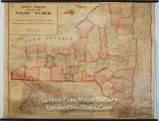 1911 Cram's Superior Map New York, Wall Map, School Map, Original Rollers Rare
-
$74.56 CAD
 Map Of The County Of Norfolk Canada West George Tremaine 1856 Ontario
-
$274.12 CAD
 Territory Of The Northern Plains Tribes Framed
-
$753.86 CAD
 Map UNITED COUNTIES LEEDS & GRENVILLE by Walling 1861 Rare Canada Map 5ft x 5ft
-
$93.20 CAD
 Framed 1868 Outline Map of Montgomery Co.,NY Published by Stranahan & Nichols
-
$12.27 CAD
 Historical Map Of Roosevelt County, Montana 35x23 1988
-
$135.69 CAD
 2 Vintage Maps, Reg Manning Cartoon Map Arizona, Historical Map Putman County
-
$43.85 CAD
 1990 1 1 Lithuania map 1:600 000
-
$21.83 CAD
 world map atlas globe earth compass art print photo rustic old vintage poster
-
$21.92 CAD
 Wisconsin Walworth County Highway Dept. Map May 1949, Revised 1977~16" × 18 3/4"
-
$61.68 CAD
 1915 DODGE COUNTY Minnesota WALL MAP Mantorville Kasson Hayfield BANK Advertsing
-
$54.76 CAD
 VINTAGE BINGHAMTON NY CITY BROOME COUNTY NEW YORK STREET / HIGHWAY MAP
-
$64.42 CAD
 1947 Wall Map Coconino County Bright Angle Arizona quadrangle Original of 1906
-
$31.17 CAD
 world map atlas globe earth compass art print photo
-
$205.60 CAD
 Lithograph Map Orbis Terrarum Descriptio Duobis Planis Hemisphaeriis 1632
-
$13.71 CAD
 INDONESIA MAP WITH PLACES LIST 1974 SOVIET EDITION IN RUSSIAN SCALE 1:7 MLN
-
$35.63 CAD
map of Australia Poster print world globe art New Zealand
-
$35.63 CAD
 Australia Vintage Map Print poster paper for glass frame 900mm
-
$47.96 CAD
 Map of USSR 1981 СССР Vintage Russian Soviet Union Original 100%
-
$68.53 CAD
 antique Ohman Rare 1920s Wall map USA Bamby Bread Co Advertising 3’x29” Vintage
-
$219.29 CAD
 1959 The New Wall Map Of Southeast Asia 東南亞新掛圖 Malaya airlines routes Hong Kong
-
$109.65 CAD
 Ride the Roads to Romance along the Golden Coast Vintage Original Map
-
$68.52 CAD
 1988 Champion map of lake county Corporation MCMLXXXV11 poster size 42" x 58"
-
$45.22 CAD
 1919 - 1940 Urbana Illinois IL 34" Historical Political Campaign County 1988 Map
-
$69.42 CAD
 North Korea Country Map
-
$41.12 CAD
 1964 LARGE COLOR WALL MAP of WORCESTER COUNTY MARYLAND Eastern Shore OCEAN CITY
-
$2535.70 CAD
 Antique John Speed British England Hampshire Map Hand-Colored litho engraving
-
$25.64 CAD
 Brazos county, Texas Old Wall Map Reprint Of Land Owners 1800s 22 1/8" x 17 1/8"
-
$822.39 CAD
 E.M. Woodford SMITH'S MAP OF HARTFORD COUNTY CONNECTICUT 1855 Good 59x46
-
$27.34 CAD
 Jackson County Wisconsin Rockford/Marathon Wall Map 1946
-
$890.92 CAD
 Original 17th Century South East England Warwicum Et Al Mercator Map 22” X 20”
-
$34.27 CAD
 1983 LARGE COLOR WALL MAP of WICOMICO COUNTY MARYLAND Eastern Shore NANTICOKE
-
$68.53 CAD
 ANTIQUE 1855 J. H. COLTON NO. 22 PENNSYLVANIA COUNTY MAP FRAMED & MATTED
-
$72.63 CAD
 Chadwicks 1912 Genesee County Cloth Wall Plat Map, 50 x 38 Inches, Davison,Flint
-
$47.96 CAD
 1878 Antique NEW JERSEY Town Map/BRIGHTON, WALL TOWNSHIP, MONMOUTH COUNTY
-
$4797.27 CAD
 Henry Francis Walling MAP OF MIDDLESEX COUNTY MASSACHUSETTS 1856 Excellent 58x60
-
$106.90 CAD
 Philadelphia County, Pennsylvania - 36" x 48" Paper Wall Map
-
$308.38 CAD
 Antique Map Principal Roman Camps Forts Walls between England & Scotland 1805 by
-
$1096.52 CAD
 1917 Marion County Kansas Platt Map Ownership by section. Original!! 49 x 37
-
$479.73 CAD
 1646 original COMITATUS NORTHANTONENSIS NORTHAMTON SHIRE map by Blaeu, Amsterdam
-
$137.05 CAD
 ANTIQUE PLAT MAP TAYLOR COUNTY WISCONSIN 32" X 32" 1916 ORIGINAL OLD ADS MEDFORD
-
$41.11 CAD
 Iowa Lee County Des Moines & Jackson Township 9 Maps Lot 36x24 Rathburn Regional
-
$21.88 CAD
 Iowa Sac County Map Wall Lake Township c.1920 W8#57
-
$45.23 CAD
 ANTIQUE Map HERTFORDSHIRE England St. ALBAN'S ABBEY Fullarton Gray 8.5 x 10.5
-
$32.84 CAD
 Illinois, Ford County Map, Township of Wall 1901 J3#54
-
$32.84 CAD
 Iowa Wright County Map Wall Lake Township 1912 K12#21
-
$61.68 CAD
 Wooden Patriotic Map Of America, 19”X13”
-
$82.23 CAD
 Large Original Colored Wall Map Of Buena Vista County Iowa C. 1900
-
$479.71 CAD
 ANTIQUE WALL MAP OF MONROE COUNTY NEW YORK GILLETTES 1858
-
$1850.38 CAD
 E.M. Woodford MAP OF WINCHESTER, LITCHFIELD COUNTY CT 1852 Very Good 47x37
-
$21.83 CAD
world map atlas globe earth compass art print photo vintage poster


