 Antiques (CA)
-
$85.99 CAD

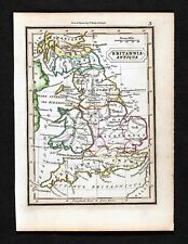
 1747 Roman Britain Original Antique Map by Richard Seale
-
$143.71 CAD
 1780 Bonne - UNITED KINGDOM Ireland hand coloured engraved map
-
$61.95 CAD
 Vintage Saxton’s Map of England and Wales 1579 -High Quality Old Map / Poster
-
$41.30 CAD
 1684 COPPER ENGRAVING A. M. MALLET MAP OF WALES
-
$137.67 CAD
 WALES CAERNARVONSHIRE 23.5” BLAEU 1640 ANTIQUE ORIGINAL COPPER ENGRAVED MAP.
-
$34.25 CAD
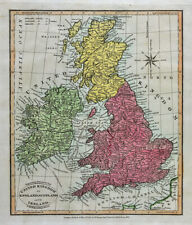
 OLD 1855 ENGLAND WALES SCOTLAND IRELAND Map Dublin London Aberdeen Orkney
-
$71.93 CAD
 1683 Manesson Mallet Antique Map Ilse D'Albion, Roman Britain, England, Scotland
-
$28.91 CAD
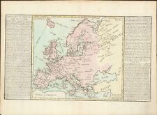
 1843 Europe Map Prussia Germany Iceland Ireland POLITICAL Russia Moscow Austria
-
$33.04 CAD
 1853 British Isles Map ORIGINAL England Wales Scotland Ireland London Dublin
-
$68.80 CAD
 1683 Manesson Mallet Antique Map Royaume D'Angleterre, England, Wales, Scotland
-
$34.40 CAD
 1832 Murphy Map Britannia Antiqua Britain England Wales Roman Londinum London UK
-
$41.29 CAD
 1831 Lewis Map Carnarvonshire Caernarfonshire Carnarvon Bangor Pwllheli Wales UK
-
$137.67 CAD
 1767 Europe's Lakes, Rivers & Mountains antique map by Clouet ~ 22.7" x 16.6"
-
$50.94 CAD
 1853 Europe Map ORIGINAL Turkey Russia Prussia Iceland Sardinia England Sweden
-
$344.16 CAD
 1798 Johann Probst Map Europe France England Germany Spain Holland Italy Sweden
-
$411.62 CAD
 John Speed Map Merionethshire circa 1676 Wales UK
-
$75.06 CAD
 1683 Manesson Mallet Antique Map Heptarchie Des Saxons, Saxon Britain, England
-
$68.80 CAD
 1683 Manesson Mallet Antique Map Royaume D'Angleterre, England, Scotland, Wales
-
$48.17 CAD
 1814 John Cary Road Map Somerset Bristol Taunton Glastonbury Wells Bath England
-
$34.40 CAD
 Original 1834 Map ENGLAND & WALES Yorkshire Devon Oxford London Liverpool Exeter
-
$343.47 CAD
 Antique Map-South England and counties-London-Sussex-Kent-Wales-Sanson-ca. 1720
-
$68.80 CAD
 1683 Manesson Mallet Antique Map Principaute de Galles, Wales
-
$165.20 CAD
 KINGDOM OF ENGLAND 1683 ALAIN MANESSON MALLET ANTIQUE MAP FRENCH EDITION
-
$41.29 CAD
 1831 Lewis Map Flintshire Flint Asaph Mold Caerwys Hawarden Salop County Wales
-
$1032.49 CAD
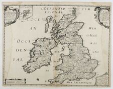
 BRITISH ISLES 1678 NICOLAS SANSON/HUBERT JAILLOT ANTIQUE WALL MAP 1ST EDITION
-
$34.40 CAD
 1831 Lewis Map Flintshire Flint St Asaph Mold Caerwys Holywell Hawarden Wales
-
$165.20 CAD
 KINGDOM OF ENGLAND 1683 ALAIN MANESSON MALLET ANTIQUE MAP FRENCH EDITION
-
$34.40 CAD
 1831 Lewis Map Herefordshire Hereford Leominster Malvern Ledbury England UK
-
$743.39 CAD
 WALES BRITAIN 1575 MAP ORTELIUS GENUINE OLD BRITISH ANTIQUE PRINT 16th ENGRAVING
-
$309.75 CAD
 1785 Johann Probst Map Great Britain England Scotland Wales Ireland London UK
-
$206.50 CAD
 1812 Darton Union Atlas Map United Kingdom England Scotland Ireland London UK
-
$172.08 CAD
 1812 Darton Union Atlas Map England Wales London Liverpool Oxford Nottingham UK
-
$1032.49 CAD
 BRITISH ISLES DATED 1677 GIACOMO ROSSI LARGE ANTIQUE MAP 17TH CENTURY
-
$34.40 CAD
 Original 1821 Map BRITISH ISLES England Scotland Ireland Wales Printed in Boston
-
$123.83 CAD
 England and Wales old map by Rollos 1773
-
$68.82 CAD
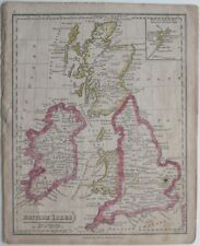
 1810 Delalain Map British Isles Great Britain England Wales Scotland Ireland
-
$55.05 CAD
 1844 Smith Map British Isles Great Britain England Scotland Ireland London Wales
-
$289.10 CAD
 BRITISH ISLES IRELAND 1701 NICOLAS DE FER ANTIQUE ENGRAVED MAP 18TH CENTURY
-
$89.47 CAD
 1818 D'Anville Map British Isles Roman Period Londinium Hadrians Wall England
-
$82.59 CAD
 1847 Stieler Map British Isles England Scotland Ireland London United Kingdom UK
-
$55.05 CAD
 1834 Carey Map British Isles England Wales Scotland Ireland London Britain UK
-
$72.26 CAD
 1823 ORIGINAL MAP UNITED KINGDOM ENGLAND WALES LONDON CAMBRIDGE LANCASTER YORK
-
$52.99 CAD
 1838 nice ORIGINAL MAP UNITED KINGDOM ENGLAND WALES LONDON CARDIFF MANCHESTER
-
$137.67 CAD
 1767 Europe's Islands Capes & Seaports antique map by Clouet ~ 23" x 16.8"
-
$68.82 CAD
 Original Color 1824 Tanner Map BRITISH EMPIRE England Wales Ireland Scotland
-
$34.40 CAD
 1831 Lewis Map Merionethshire Wales Corwen Dolgellau Balla Tywyn Harlech Barmout
-
$41.29 CAD
 Original 1824 Macpherson Engraved Map BRITANNIA ROMANA HIBERNIA Thule Insula
-
$48.18 CAD
 1801 Wilkinson Map Dioceses England Wales London Canterbury Gloucester York UK
-
$34.40 CAD
 1831 Lewis Map Carmarthenshire Carmarthen Llandovery Llanelli Kidwelly Wales UK
-
$82.59 CAD
 1796 Blondeau Map England Wales London Bristol Oxford Salisbury Manchester
-
$536.89 CAD
 BRITISH ISLES c. 1740 HOMANN HRS LARGE ANTIQUE ENGRAVED MAP 18TH CENTURY
-
$27.52 CAD
 1882 Cowperthwait Map Great Britain Ireland Scotland England Wales London Dublin
-
$172.07 CAD
 Original 1673 Blome County Map MONMOUTHSHIRE Wales Abergavenny Chepstow Caldicot
-
$34.40 CAD
 Original 1835 County Map MONMOUTHSHIRE Wales Tredegar Abergavenny Newport Usk
-
$48.18 CAD
 1856 ORIGINAL MAP UNITED KINGDOM GREAT BRITAIN IRELAND ENGLAND SCOTLAND WALES
-
$55.05 CAD
 1819 Wilkinson Map Ancient England Anglo-Saxon Era Battlefields London Britain
-
$47.48 CAD
 1848 nice ORIGINAL MAP UNITED KINGDOM ENGLAND WALES LONDON LIVERPOOL CARDIFF
-
$165.20 CAD
 WALES 1683 ALAIN MANESSON MALLET ANTIQUE MAP 17TH CENTURY FRENCH EDITION
-
$103.25 CAD
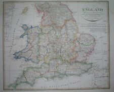
 "COUNTY MAP OF ENGLAND AND WALES" Antique authentic Mitchell's map 1876
-
$275.33 CAD
 ENGLAND WALES 1719 HENRI CHATELAIN LARGE ANTIQUE MAP 18TH CENTURY
-
$103.25 CAD
 1820 Europe Iberia to Russia antique map by Lavoisne ~ 21.8" x 17.4" hand color
-
$79.14 CAD
 1823 ORIGINAL MAP IRELAND UNITED KINGDOM ENGLAND WALES SCOTLAND DUBLIN LONDON
-
$68.82 CAD
 1845 Stieler Map England Wales London Liverpool Canterbury Cardiff Manchester UK
-
$68.82 CAD
 1814 John Cary Road Map Suffolk Ipswich Dunwich Newmarket Oxford Bury England
-
$55.05 CAD
 1814 John Cary Road Map South Wales De Cymru Cardiff Swansea Newport Glamorgan
-
$325.00 CAD
 TAVERNIER, M. (1642) Carte Generale des Royaume d'Angleterre Escosse et Irlande
-
$55.05 CAD
 1800 Wilkinson Map Ancient Britannica England Scotland Ireland Wales Roman Era
-
$509.36 CAD
 ENGLAND c. 1730 JB HOMANN LARGE ANTIQUE ENGRAVED MAP 18TH CENTURY
-
$34.40 CAD
 1831 Lewis Map Cambridgeshire Cambridge Linton Ely Caxton Wisbeach England UK
-
$82.59 CAD
 1814 John Cary Road Map Sussex Brighton Chichester Hastings Beachy Head England
-
$41.29 CAD
 1831 Lewis Map Radnorshire Rhayader Knighton Llandrindod Presteigne Wales UK
-
$55.05 CAD
 1830 Nathan Hale Map England & Wales London Bristol Oxford Salisbury Manchester
-
$48.17 CAD
 1814 John Cary Road Map Westmorland Brough Kendal Appleby Brougham England UK
-
$55.05 CAD
 1814 John Cary Road Map North Wales Anglesey Bangor Caernarfon Montgomery Bala
-
$41.29 CAD
 1831 Lewis Map Montgomeryshire Montgomery Maldwyn Bishop's Castle Wales UK
-
$34.40 CAD
 1831 Lewis Map Buckinghamshire Buckingham Stratford Aylesbury Olney England UK
-
$48.17 CAD
 1814 John Cary Road Map Wiltshire Bath Salisbury Wilton Stonehenge England UK
-
$41.29 CAD
 1814 John Cary Road Map Warwickshire Stratford on Avon Birmingham England UK
-
$82.59 CAD
 1834 Carey Map England & Wales London Bristol Liverpool Oxford Canterbury Bath
-
$103.25 CAD
 1820 Europe Barbarian Incursion antique map by Lavoisne 21.8" x 17.6" hand color
-
$825.99 CAD
 BRITISH ISLES 1696 NICOLAS SANSON/HUBERT JAILLOT ANTIQUE WALL MAP 17TH CENTURY
-
$68.82 CAD
 1814 Cary Road Map Wales Monmouthshire Monmouth County Usk Abergavenny Caerleon
-
$110.06 CAD
 Antique 1779 Map England & Wales - John Hamilton Moore - Voyages & Travels
-
$151.43 CAD
 ENGLAND 1771 BONNE / LATTRE LARGE ANTIQUE ENGRAVED MAP IN COLORS 18TH CENTURY
-
$1373.21 CAD
 Antique Print-SEA CHART-ENGLAND-CHANNEL-WALES-Bellin-Depot de la Marine-1765
-
$55.05 CAD
 1874 Colton Map England & Wales London Liverpool Lands End Bristol Cardif Bath
-
$521.64 CAD
 England Wales, old map.Geographica Angliae Et Walliae. Euler 1760
-
$825.99 CAD
 Glamorgan Shyre c1610s antique map by John Speed - Theatre empire Great Britaine
-
$399.21 CAD
 Original 1831 Baldwin & Cradock 5-Sheet SDUK Map of ENGLAND & WALES Complete Set
-
$185.85 CAD
 England and Wales Antique map L'Angleterre Philippe 1787
-
$344.15 CAD
 Original 1821 Map BRITISH EMPIRE England Scotland Ireland Wales Battles History
-
$158.31 CAD
 BRITISH ISLES 1780 RIGOBERT BONNE ANTIQUE ENGRAVED MAP IN COLORS 18TH CENTURY
-
$254.68 CAD
 England Wales, antique old map, L' Angleterre. Brian 1766
-
$1221.78 CAD
 Antique Print-SEA CHART-ENGLAND-WALES-ISLE OF MAN-Bellin-Depot de la Marine-1765
-
$302.86 CAD
 England Wales Antique map L’Angleterre Par J.D. Barbie 1783
-
$216.82 CAD
 Antique Map-MAP-ENGLAND-WALES-WALKER-Anonymous-1810
-
$450.85 CAD
 Antique Print-SEA CHART-WALES-HOLY ISLAND-SKERRIES-ANGLESEY-Collins-1693
-
$344.16 CAD
 BRITISH ISLES 1658 NICOLAS SANSON & TAVERNIER & MARIETTE LARGE ANTIQUE MAP
-
$96.37 CAD
 GREAT BRITAIN IRELAND 1837 ANDRIVEAU-GOUJON LARGE ANTIQUE MAP 19TH CENTURY
-
$61.95 CAD
 RARE, Saxton’s Map of England and Wales 1579, by Taylowe Limited 1969 Map Poster


