 Antiques (CA)
-
$25.96 CAD

 1930 ORIGINAL ANTIQUE PHYSICAL MAP OF EUROPE GERMANY AUSTRIA HUNGARY TURKEY
-
$24.68 CAD
 1900 ORIGINAL ANTIQUE MAP PHYSICAL EUROPE POLAND RUSSIA GERMANY AUSTRIA HUNGARY
-
$24.68 CAD
 1896 ORIGINAL ANTIQUE PHYSICAL MAP OF ALPS ITALY AUSTRIA ISTRIA TYROL
-
$34.27 CAD
 c. 1890 PHYSICAL MAP AUSTRIA HUNGARY Empire Antique Map
-
$4.11 CAD
 1897 Map of Tyrol aka Trentino antique print Austria Italy
-
$21.93 CAD
 1887 Andrees Map - Germany Austria Poland Holland Population & Physical Relief
-
$4.11 CAD
 1897 Map of STYRIA. antique print Austria
-
$32.20 CAD
 1908 ANTIQUE PHYSICAL MAP / VIEWS OF THE ALPS MOUNTAINS SWITZERLAND ITALY FRANCE
-
$38.80 CAD
 1937 VINTAGE PHYSICAL MAP OF ALPS MOUNTAINS / GERMANY AUSTRIA ITALY SWITZERLAND
-
$47.98 CAD
 1860 Austrian Empire Italian States & more antique map by Mitchell 15.3" x 12.3"
-
$22.76 CAD
 1930 Österreich vintage Brochure w MAP Austria; Pub. by Federal Ministry. Europe
-
$5.48 CAD
 1897 Map of KRAIN . antique print Slovenia Austria Italy
-
$27.42 CAD
 1864 Austria Turkey Greece by Johnson Ward beautiful antique map 26" x 17.8"
-
$42.67 CAD
 1847 Vuillemin Antique Map The Turkish Empire in Europe from Greece to Austria
-
$43.87 CAD
 1879 Map Europe Western And Central Victorian Geography 1st Edition DWAA9
-
$43.87 CAD
 1879 Map Europe Spain France Italy England Victorian Geography 1st Edition DWAA9
-
$21.92 CAD
 c 1885 Hartleben Map - German Reich - Physical C. Europe Germany Austria Bohemia
-
$54.82 CAD
 1839 Stieler Physical Map Europe River Basins Mountain Ranges Rhine Danube Seine
-
$239.90 CAD
 1735 Austria & more antique map by Homann ~ 24.8" x 21.1" beautiful color
-
$137.09 CAD
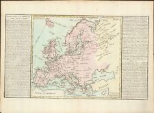
 1767 Europe's Lakes, Rivers & Mountains antique map by Clouet ~ 22.7" x 16.6"
-
$15.50 CAD
 AUSTRIA Gmunden City Plan - 1931 BAEDEKER MAP
-
$21.92 CAD
 1849 Bilder Atlas Map Austria Hungary Transylvania Serbia Venice Bohemia Europe
-
$61.69 CAD
 1795 Guthrie Poland Showing Claims 10.1" x 8.4" Authentic & original antique map
-
$27.42 CAD
 1860 Europe antique map by Mitchell 15.3" x 12.3" - hand colored
-
$27.40 CAD
 1881 Andrees Map Austrian Alps Austria Hungary Italy Salzburg Vienna Innsbrook
-
$61.69 CAD
 1780 Europe by Raynal / Bonne 14.1" x 9.75" authentic antique map
-
$41.13 CAD
 1876 Austria & Scandinavian Kingdoms antique map ~ 19.6" x 14.2" hand colored
-
$10.00 CAD
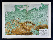
 Antique map. CENTRAL EUROPE, GERMANY. PHYSICAL MAP OF CENTRAL EUROPE. Circa 1905
-
$82.11 CAD
 1873 German Language Austrian Hungarian Monarch Historical 1800s Antique Map
-
$15.50 CAD
 AUSTRIA Tauern Alps St Johann Murau Badgastein & Environs - 1931 BAEDEKER MAP
-
$43.85 CAD
 1846 Stieler Map Germany Switzerland Austria Italy France Alps Mountain Summits
-
$27.40 CAD
 1880 Berghaus Map Physical Central Europe Germany Austria Switzerland Alps
-
$21.92 CAD
 1871 Guyot Physical Map Germany Austria Hungary Holland Polland Bohemia Russia
-
$239.90 CAD
 1845 Austria map by A.K. Johnston ~ 25.8" x 21.2" Antique Pastel Color Huge
-
$16.44 CAD
 1885 Drioux Map Physical Europe Germany Austria Hungary Empire Switzerland Alps
-
$137.09 CAD
 1767 Europe's Islands Capes & Seaports antique map by Clouet ~ 23" x 16.8"
-
$15.00 CAD
 Antique map. PHYSICAL MAP OF ALPS & LANDS AROUND. Circa 1905
-
$16.44 CAD
 1835 Map x 2 - Europe Political & Physical - Austria Italy Spain Britain
-
$38.37 CAD
 1887 Andrees Map - Austrian Alps Salzburg Tirol Austria Italy Venice Switzerland
-
$21.93 CAD
 1849 Bilder Atlas Physical Map - Central Europe Rivers & Mountains Alps Rhein
-
$16.44 CAD
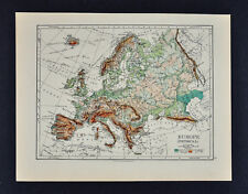 1895 Johnston Map - Physical Europe & Political England & Wales London Liverpool
-
$34.27 CAD
 1901 Tunison Europe & South America antique map ~ 22.8" x 14.6" nice color
-
$27.40 CAD
 1843 Woodbridge Map Germany Austria Bohemia Prussia Berlin Hamburg Switzerland
-
$13.69 CAD
 1880 Stieler Map Physical Europe Germany Austria Switzerland Italy France Alps
-
$13.69 CAD
 1865 Sydow Physical Map - Alpenland Europe Alps Switzerland Austria Italy France
-
$13.69 CAD
 1885 Cortambert Map - Physical Central Europe - Germany Austria Switzerland Alps
-
$34.27 CAD
 1901 Tunison Germany Austria Hungary antique map ~ 22.8" x 14.6" nice color
-
$27.40 CAD
 1843 Woodbridge Map Europe France Spain Germany Italy Sweden Norway Austria UK
-
$27.40 CAD
 1843 Woodbridge Physical Map Europe France Spain Germany Italy Sweden Austria UK
-
$102.81 CAD
 1849 Europe by Mitchell antique map ~ 17.4" x 13.8" hand colored
-
$41.13 CAD
 Map Austria Wanderkarte Krems 4665 Militärgeographisches Institut Wien
-
$16.44 CAD
 1900 Meyers Map Salzburg Austria Alps Germany Berchtesgaden Hallein Hallstatt
-
$102.81 CAD
 1820 Europe Iberia to Russia antique map by Lavoisne ~ 21.8" x 17.4" hand color
-
$89.11 CAD
 1767 Europe antique map by Clouet ~ 23.1" x 17.1" - hand color
-
$13.69 CAD
 1874 Stieler Map - Europe Alps - Austria Germany Munich Innsbruck Rattenburg
-
$171.36 CAD
 1840 Empire of Austria map by Greenleaf 14.2" x 11.9" scarce 1st edition
-
$34.26 CAD
 EUROPE GERMAN EMPIRE AUSTRIA FRANCE SPAIN RUSSIA +++ 1880 COLORED COLTON'S MAP
-
$102.81 CAD
 1876 Europe antique map ~ 27.5" x 19.5" hand colored - large - ships
-
$123.38 CAD
 1767 Lower Austria Tyrol antique map by Clouet ~ 23.1" x 16.6" - hand color
-
$34.27 CAD
 1856 Black's Europe map 17.2" x 12.6" beautiful antique with color
-
$24.68 CAD
 1885 Drioux Map Physical Europe Germany Switzerland Italy Austria Alps Mountains
-
$21.92 CAD
 1874 Stieler Map - Europe Alps - Austria Salzburg Berchtesgaden Wolfsberg
-
$102.81 CAD
 1820 Europe Barbarian Incursion antique map by Lavoisne 21.8" x 17.6" hand color
-
$34.27 CAD
 Topographical Map of Austria 1939 Vintage Print
-
$47.98 CAD
 1867 Johnson's Map of Austria, Turkey in Europe and Greece - original
-
$19.88 CAD
 1897 Antique physical map of THE ALPS. Italy. Switzerland. 123 years old chart


