 Antiques (CA)
-
$65.79 CAD

 Plat Book And Land Atlas Clark County Wisconsin Vintage 2013 4-H Ldrs Federation
-
$34.27 CAD
 Nice colored map of Minnesota or Wisconsin -1907 Universal Atlas of the World
-
$38.37 CAD
 Clark County Wisconsin Land Atlas And Plat Book Vintage 1994 4-H Ldrs Federation
-
$38.37 CAD
 Clark County Wisconsin Plat Book And Directory Vintage 2006 4-H Ldrs Federation
-
$274.17 CAD
 1916 Standard Atlas of Lafayette County Wisconsin Plat Book Ogle
-
$54.77 CAD
 1986 Historical Atlas Richland County WI Illustrated Taylor Publishing Co.- Good
-
$30.84 CAD
 1899 Map of Dane County Wisconsin Antique Color 17" x 28"
-
$2056.28 CAD
 Rare Complete 1890 Hand Colored Atlas: Dane County, Wisconsin Pub: C.M. Foote.
-
$308.44 CAD
 1916 Standard Atlas of Lafayette County Wisconsin Plat Book Ogle
-
$20.49 CAD
 Arkansas Vintage 1894 MAP ~Unique Atlas ~ Original Color Map
-
$21.87 CAD
 Wisconsin & Minnesota Vintage 1894 MAP ~Unique Atlas ~ Original Color Map
-
$37.68 CAD
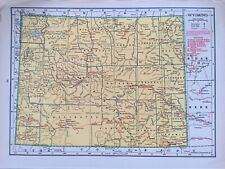 1945 Two-Sided Color Railroad Map of Wyoming/Wisconsin Hammond 9.25x12.25"
-
$308.43 CAD
 Antique Standard Jackson County Atlas 1901 Wisconsin
-
$44.73 CAD
 Clark County Wisconsin Land Atlas And Plat Book Vintage 1991 4-H Ldrs Federation
-
$44.73 CAD
 Clark County Wisconsin Land Atlas And Plat Book Vintage 1991 4-H Ldrs Federation
-
$38.37 CAD
 Clark County Wisconsin Plat Book And Directory Vintage 2003 4-H Ldrs Federation
-
$24.35 CAD
 1919 Vintage Map Minneapolis or Milwaukee B & W Original From Collier Atlas
-
$21.87 CAD
 Missouri & S. Dakota Vintage 1894 MAP ~Unique Atlas ~ Original Color Map
-
$20.55 CAD
 Vintage Map "Wisconsin" 1893 Columbian World's Fair Atlas Chicago
-
$27.35 CAD
 1988 Land Atlas & Plat Book Fond du Lac County Wisconsin MAPS ADS owners
-
$23.65 CAD
 1982 Land Atlas & Plat Book Fond du Lac County Wisconsin MAPS ADS owners
-
$205.56 CAD
 1906 atlas of Waushara County, Wisconsin
-
$20.56 CAD
 Antique 1889 Map MI WI IN and IL by George F Cram Unrivaled Family Atlas 13x20
-
$53.46 CAD
 Army Corps of Engineers River Maps Binder Mississippi Minn. St. Paul Dist. 1960s
-
$27.35 CAD
 1999 Land Atlas & Plat Book Fond du Lac County Wisconsin MAPS ADS owners COLOR
-
$34.27 CAD
 1891 Map of MILWAUKEE and BAY VIEW, WIS. ~ Reverse is Map of St. Louis ~ 11 x 14
-
$34.12 CAD
 Vintage 1937 Two-Sided Color Map of West Virginia & Wisconsin 11" x 14"
-
$13.71 CAD
 Vtg 1978 West Virginia & Wisconsin Map Rand McNally Atlas Vibrant Colors
-
$41.06 CAD
 1995 Land Atlas & Plat Book Price County Wisconsin Rockford Map Publishers
-
$40.44 CAD
 Vintage 1981 Burnett County Wisconsin Land Atlas & Plat Book WI
-
$17.11 CAD
 2003 POLK COUNTY WISCONSIN LAND ATLAS PLAT BOOK WI
-
$37.22 CAD
 Vtg Lot 1923 WAUPACA Co. WISCONSIN Illustrations, Land Owners, Homes & Buildings
-
$34.26 CAD
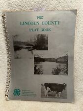 1987 Lincoln County WI Plat Book County Seat Is Merrill With Snowmobile Trails
-
$62.99 CAD
 Beautiful Old 1888 Cram Atlas County & Railroad Map ~ WISCONSIN ~ (XL17x23) #573
-
$16.38 CAD
 State of Wisconsin 1931 Antique Map from the Literary Digest Atlas of the World
-
$24.68 CAD
 Vintage 1979 Land Atlas & Plat Book PORTAGE County Wisconsin Genealogy
-
$33.91 CAD
Nice colored map of Minnesota or Wisconsin -1907 Universal Atlas of the World
-
$171.36 CAD
 Map Wisconsin 1873 Atlas History Railroad
-
$21.25 CAD
 1987 Land Atlas & Plat Book PRICE COUNTY Wisconsin -- spiral bound -- VINTAGE
-
$24.35 CAD
 1914 Vintage Map "Washington" or "Wisconsin" Color Original From Collier Atlas
-
$123.38 CAD
 Wisconsin Map 1881 Michigan Atlas History
-
$27.42 CAD
 Rock County Wisconsin Plat Book Atlas Janesville Beloit Milton Edgerton
-
$27.42 CAD
 1987 Dodge County Wisconsin Land Atlas & Plat Book soft covered
-
$43.81 CAD
 Wisconsin Waukesha County Map Oconomowoc Lake Dbl Side 1930 Q8#39
-
$75.38 CAD
 Antique Map #9 US 1853 Geography Michigan Wisconsin Daniel Burgess & Cath N.Y.
-
$43.81 CAD
 Wisconsin Waukesha County Map Oconomowoc Township 1930 Q8#50
-
$16.45 CAD
 1964 Zoning Ordenace for Washington County Wisconsin Booklet
-
$32.85 CAD
 Wisconsin Waukesha County Map Big Bend Brookfield Dbl Side 1930 Q8#31
-
$68.54 CAD
 Johnson's Family Atlas Wisconsin & Michigan
-
$38.37 CAD
 Sheboygan County Wisconsin Land Atlas Plat Book 1979
-
$41.06 CAD
 Vintage 1989 Land Atlas & Plat Book Price County Wisconsin Rockford Map Publish
-
$27.42 CAD
 1996 Dodge County Wisconsin Land Atlas & Plat Book soft covered
-
$27.42 CAD
 1994 Dodge County Wisconsin Land Atlas & Plat Book soft covered
-
$27.42 CAD
 2001 Dodge County Wisconsin Land Atlas & Plat Book soft covered
-
$27.42 CAD
 1991 Dodge County Wisconsin Land Atlas & Plat Book soft covered
-
$41.13 CAD
 1974 Washington County Wisconsin Plat Book & Directory
-
$21.88 CAD
 Wisconsin Waukesha County Map City of Waukesha Dbl Side 1930 Q8#45
-
$65.79 CAD
 City of Milwaukee, Wisconsin Mitchell's General Atlas 1874 R9#62
-
$137.07 CAD
 Milwaukee Wisconsin 1906 Geologic Atlas USGS Folio W/ All Map US
-
$43.81 CAD
 Wisconsin Waukesha County Map Phantom Lake Dbl Side 1930 Q8#35
-
$54.78 CAD
 Wisconsin Waukesha County Map Okauchee Lake Dbl Side 1930 Q8#38
-
$25.98 CAD
 Vintage 1889 Wisconsin Minnesota Map From Peerless Atlas of The World
-
$43.81 CAD
 Wisconsin Waukesha County Map Pewaukee Township 1930 Q8#47
-
$41.06 CAD
 1943 Wisconsin, New International Atlas of World, War Edition, Map
-
$43.81 CAD
 Wisconsin Waukesha County Map Broookfifeld Township 1930 Q8#61
-
$43.81 CAD
 Wisconsin Waukesha County Map Lisbon Township 1930 Q8#57


