 Antiques (CA)
-
$185.06 CAD

 1842 Large Map of Vermont & New Hampshire From Morse's North American Atlas
-
$61.69 CAD
 1869 Map BROOKLINE ATHENS Vermont (from Beers Atlas of Windham Co. VT.
-
$137.09 CAD
 Antique Colored MAP/Gray's - NEW HAMPSHIRE & VERMONT - The National Atlas 1893
-
$109.67 CAD
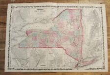 Antique Colored MAP - JOHNSON'S MAP OF NEW YORK / Johnson's Family Atlas 1863
-
$38.45 CAD
 1945 Two-Sided Color Railroad Map of Virginia/Vermont Hammond 9.25x12.25"
-
$41.11 CAD
 1849 Mitchell's Map New England States 17x11 Maine VT NH MA RI CT Antique Atlas
-
$45.24 CAD
 Town of Hancock Vermont 1871 Original Hand-colored Map from F W Beers Atlas
-
$47.98 CAD
 1869 Atlas of Chittenden County Vermont Reprint 1971
-
$16.38 CAD
 State of Vermont 1931 Antique Map from the Literary Digest Atlas of the World
-
$20.91 CAD
 Vintage 1937 Color Map of Vermont 11" x 14"
-
$41.11 CAD
 Vermont Road Atlas
-
$254.96 CAD
 Mitchell 1846 Map of New Hampshire & Vermont Pocket Folding Hand-Colored County
-
$6.85 CAD
 1869 ANTIQUE BEERS ATLAS TABLE-STATISTICS OF RUTLAND COUNTY, VERMONT
-
$109.67 CAD
 Antique Colored MAP - MASSACHUSETTS, CONN & RI / Johnson's Family Atlas 1863
-
$109.67 CAD
 Antique Colored MAP - NEW HAMPSHIRE & VERMONT / Johnson's Family Atlas 1863
-
$34.27 CAD
 Nice colored map of Vermont or Massachusetts -1907 Universal Atlas of the World
-
$28.79 CAD
 c1921 Vermont State Map RR from Rand McNally Commercial Atlas of America
-
$20.55 CAD
 Vintage Map "New Hampshire & Vermont" 1893 Columbian World's Fair Atlas Chicago
-
$47.98 CAD
 Town of Bridport and West Cornwall Vermont 1871 Original F W Beers Atlas
-
$16.45 CAD
 1902 Vermont & New Hampshire Map Vintage Atlas
-
$37.22 CAD
 Old Large (17 1/4"x23") 1889 Cram's Atlas Railroad & County Map ~ NEW HAMPSHIRE
-
$47.98 CAD
 Town of Granville Vermont 1871 Original Hand-colored Map from F W Beers Atlas
-
$47.98 CAD
 Town of Ferrisburgh and Monkton Vermont 1871 Original Map from F W Beers Atlas
-
$47.98 CAD
 Town of Bristol Vermont 1871 Hand-colored Original Map from F W Beers Atlas
-
$47.98 CAD
 Town of Chittenden Vermont 1871 Original Hand-colored Map from F W Beers Atlas
-
$32.06 CAD
 1863 Map ~ NEW HAMPSHIRE - VERMONT ~ from Johnson's Atlas (18x26) Free S&H -#001
-
$47.98 CAD
 Town of Shoreham & Richville Vermont 1871 Original Map from F W Beers Atlas
-
$41.13 CAD
 1969 Road Maps Rand McNally vacation guide Tourists and Travel soft cover usa
-
$47.98 CAD
 Town of Waltham Vermont 1871 Original Hand-colored Map from F W Beers Atlas
-
$135.62 CAD
Antique Colored MAP/Gray's - NEW HAMPSHIRE & VERMONT - The National Atlas 1893
-
$33.91 CAD
Nice colored map of Vermont or Massachusetts -1907 Universal Atlas of the World
-
$183.09 CAD
1842 Large Map of Vermont & New Hampshire From Morse's North American Atlas
-
$150.78 CAD
 Vermont New Hampshire State Map 1849 ORIGINAL Antique Mitchell Atlas 14" x 17.5"
-
$108.50 CAD
Antique Colored MAP - NEW HAMPSHIRE & VERMONT / Johnson's Family Atlas 1863
-
$108.50 CAD
Antique Colored MAP - MASSACHUSETTS, CONN & RI / Johnson's Family Atlas 1863
-
$108.50 CAD
Antique Colored MAP - JOHNSON'S map OF NEW YORK / JOHNSON'S Family Atlas 1863
-
$38.38 CAD
 1878 Lamoille County, Vermont, Business Notices from Beers' Atlas - interesting!
-
$43.81 CAD
 1874 Mitchell's New General Atlas, Single Page New Hampshire, Vermont R7#08
-
$18.64 CAD
 Antique 1915 Two-Sided Color Map of Vermont, New Hampshire & Nevada 10" x 15"
-
$6.85 CAD
 1869 ANTIQUE BEERS ATLAS TABLE OF AIR LINE DISTANCES-RUTLAND COUNTY, VERMONT


