 Antiques (CA)
-
$274.17 CAD

 Antique Colored MAP OF W.VIRGINIA/VIRGINIA/PA & DE- Johnson's Family Atlas 1863
-
$185.06 CAD
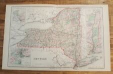
 1842 Large Map of New York From Morse's North American Atlas
-
$54.77 CAD
 Hagstrom FAIRFIELD COUNTY , CT Atlas Large Scale Easy To Read LAMINATED PAGES
-
$411.26 CAD
 Antique Hard Back Book William H Wanamaker's Standard Atlas Of The World 1893
-
$472.94 CAD
 antique UTICA NY ATLAS MAPS in 1899 sanborn ferris 1906-22 index 25.5x23" 116pg
-
$2734.85 CAD
 Antique 1873 Long Island New York Pocket Map J.B. Beers & Co. 54”x15” RARE
-
$1549.05 CAD
 Original 1867 ATLAS OF NEW YORK Brooklyn Westchester Putnam Dutchess Counties
-
$61.62 CAD
 Rare Rochester NY + Suburbs Large Planning District Map Book Atlas 1922 ?racist?
-
$171.29 CAD
 1927 antique ROAD ATLAS thos cooke AUTO ROUTE DISTANCE ATLAS ne ny nj pa md de
-
$171.36 CAD
 New York, New Century Atlas, 1874, Oneida County, Reprint #137/300. Complete
-
$19.00 CAD
 Antique 1915 Two-Sided Color Map of North Carolina & New York 10" x 15"
-
$2050.72 CAD
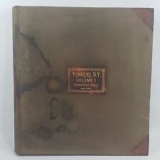 ANTIQUE SANBORN MAP COMPANY INSURANCE ATLAS MAPS YONKERS NEW YORK NY BOOK VOL 1
-
$125.01 CAD
 Original 1873 MAP BROOKLYN KINGS COUNTY New Lots East New York Jamaica Bay
-
$239.90 CAD
 Map from Beers Atlas 1874 Addison NY Steuben County NY Professionally Framed
-
$109.65 CAD
 1911 ATLAS COVER PAGE of WESTCHESTER COUNTY NEW YORK FROM ATLAS SURVEYS 22"x 17"
-
$1302.31 CAD
 ANTIQUE SANBORN MAP COMPANY INSURANCE ATLAS MAPS Chicago Volume 16
-
$27.42 CAD
 1925 Rand McNally Atlas of America NEWYORK /21"x29" Adjoining New Jersey Towns
-
$1268.04 CAD
 1876 ATLAS of ROCKLAND COUNTY NEW YORK exceedingly RARE hand color folio maps
-
$2050.72 CAD
 ANTIQUE SANBORN MAP COMPANY INSURANCE MAPS YONKERS NEW YORK NY ATLAS BOOK VOL 2
-
$822.50 CAD
 1929 V.4 Brooklyn 260 maps! CONEY ISLAND SHEEPSHEAD FLATLANDS CANARSIE MIDWOOD
-
$1233.75 CAD
 1929 Hyde Atlas V.1 200 Maps Brooklyn HEIGHTS CROWN PROSPECT PARK SLOPE DUMBO ++
-
$164.49 CAD
 State of New York 1849 Vintage ORIGINAL Antique Map Mitchell 14" x 17.5" USA
-
$73.96 CAD
 1875 BEERS ATLAS Hurley, Shokan & Samsonville NY Map
-
$609.08 CAD
 Rare New York maps atlas water supply 1909 (18 color maps)
-
$24.35 CAD
 1919 Vintage Map Kings Brooklyn Borough N.Y. B & W Original From Collier Atlas
-
$959.58 CAD
 1929 V2 Brooklyn ~400 MAPS ALL WILLIAMSBURG Greenpoint East New York Brownsville
-
$1233.77 CAD
 ANTIQUE SANBORN MAP COMPANY INSURANCE ATLAS MAPS Chicago Volume 25
-
$29.86 CAD
 Map of New York 1893, Description of New York on Reverse Side
-
$37.00 CAD
 Antique 1920s GW Bromley Maps New York NYC Desk Atlas First Second Third Avenue
-
$137.09 CAD
 Antique Colored MAP/Gray's - NEW YORK - The National Atlas 1893
-
$47.97 CAD
 Map Western New York 1938 Buffalo Rochester Atlas United States Print DWU7
-
$47.98 CAD
 1868 ANTIQUE MAP, F. W. BEERS, OTSEGO CO. ATLAS, "TOWN OF PITTSFIELD".
-
$20.56 CAD
 Antique 1889 Map New York State by George F Cram Unrivaled Family Atlas 13x20
-
$10.95 CAD
 National Geographic 1925 Map Of Washington DC. Approx 13 By 17 Inches. Frameable
-
$24.35 CAD
 1909 Vintage Map "Buffalo New York City" Color Original From Collier Atlas
-
$16.45 CAD
 1863 Cornell Map - New York City Jersey Pennsylvania Philadelphia Trenton Canada
-
$34.27 CAD
 1891 Color Map of NEW YORK State ~ Balch Bros. Atlas ~ 14-1/2 x 21
-
$24.35 CAD
 1919 Vintage Map Buffalo New York B & W Original From Collier Atlas
-
$150.78 CAD
 1867 antique map state of New York Mitchell Brothers Atlas hand-colored engraved
-
$80.88 CAD
 New York state NYC Rochester Buffalo Oswego1864 Johnson & Ward civil war era map
-
$411.24 CAD
 1929 V.3 Brooklyn 200+ MAPS BAY RIDGE BENSONHURST FLATBUSH BORO PARK KENSINGTON
-
$24.35 CAD
 1919 Vintage Map Manhattan & Bronx Boroughs B & W Original From Collier Atlas
-
$308.44 CAD
 Old World Map of New York From William Brown Abraham Lincoln Forgery History
-
$24.35 CAD
 1914 Vintage Map Rochester New York City B & W Original From Collier Atlas
-
$82.24 CAD
 Vintage Map Poundridge, NY., from the FW Beers Atlas of NY and Vicinity 1867 y
-
$47.97 CAD
 1895 Rand McNally Atlas of the World / NEW YORK / 21x29
-
$20.55 CAD
 Vintage Map "New York" 1893 Columbian World's Fair Atlas Chicago
-
$54.82 CAD
 Watkins Glen Catatonk New York 1909 Geologic Atlas USGS Folio W/ All Map US
-
$38.38 CAD
 Hagstrom Suffolk County Atlas
-
$40.78 CAD
 Antique 1920s Buffalo NY Chicago IL City Street Maps from Atlas 1921
-
$62.99 CAD
 1863 Map ~ NEW YORK STATE - LONG ISLAND from Johnson's Atlas (18x26)-#013
-
$342.71 CAD
 1950 ATLAS QUEENS NASSAU COUNTY OWNERSHIP OF LANDS SUBWAYS TRANSPORT LINES +
-
$23.30 CAD
 Warren, Pennsylvania-New York Folio Geologic Atlas of the United States, 1910
-
$13.71 CAD
 Vtg 1978 New York & New Mexico Map Rand McNally Atlas Vibrant Colors
-
$411.21 CAD
 Atlas State of New York; County of Chautauqua Map #52 - David H Burr, 1829
-
$24.35 CAD
 1919 Vintage Map Manhattan New York Southern B & W Original From Collier Atlas
-
$411.23 CAD
 Atlas of the State of New York; County of Seneca Map #41 - David H Burr, 1829
-
$411.23 CAD
 Atlas of the State of New York; County of Chenango Map #33 - David H Burr, 1829
-
$16.38 CAD
 State of New York Antique Map from the 1931 Literary Digest Atlas of the World
-
$24.35 CAD
 1914 Vintage Map Buffalo New York City B & W Original From Collier Atlas
-
$82.24 CAD
 Vintage Map Newcastle, NY., from the FW Beers Atlas of NY and Vicinity 1867 y
-
$6.85 CAD
 1954 New York Map Hammond's World Atlas
-
$27.40 CAD
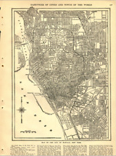
 1909 Atlas Of New York City 83rd To 89th Street Map Volume Four Modern Reprint
-
$54.83 CAD
 Map of Brooklyn 1889 from RAND McNALLY and COMPANY ATLAS
-
$34.20 CAD
 1899 Antique Map of Buffalo New York NY Vintage Atlas Page
-
$651.15 CAD
 Jamaica Queens LI NYC -BELCHER HYDE GIANT ATLAS- 1931 Book of Maps HUGE!
-
$41.13 CAD
 1969 Road Maps Rand McNally vacation guide Tourists and Travel soft cover usa
-
$137.07 CAD
 Niagara Falls New York 1913 Geologic Atlas USGS Folio W/ All Map US
-
$24.61 CAD
 1887 NEW YORK NEW JERSEY CONNECTICUT CRAMS MAPS NY NJ CT
-
$61.69 CAD
 1873 MAP WHITESTONE VILLAGE QUEENS ORIGINAL FROM BEERS ATLAS HAND COLORED
-
$27.35 CAD
 Street Map - CITY OF BUFFALO, NEW YORK - Antique 1897 Multicolor - CRAM'S ATLAS
-
$411.23 CAD
 Atlas of the State of New York; County of Saratoga Map #19 - David H Burr, 1829
-
$62.99 CAD
 Beautiful Old 1888 Cram Atlas County & Railroad Map PENNSYLVANIA (XL17x23) #575
-
$1370.85 CAD
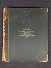 Original 1915 Atlas of the Ocean Shore Suffolk County Volume 1 E. Belcher Hyde
-
$62.99 CAD
 Beautiful Old 1888 Cram Atlas County & Railroad Map ~ NEW YORK ~ (XL17x23) #574
-
$95.95 CAD
 Richmond Hill, NY map from 1873 atlas
-
$274.17 CAD
 Antique American Hand Colored 1842 Map of The State of New York Atlas
-
$40.96 CAD
 1860 JOHNSON & BROWNING MAP OF NEW YORK AND SELECTED CITIES DOUBLE PAGE
-
$61.62 CAD
 1901 New York City Large 2-pg Dated Commercial Color Atlas Map* 123 Years-Old!
-
$190.71 CAD
 1863 Map ~ NEW YORK CITY - BROOKLYN, NY from Johnson's Atlas (18x26)-#012
-
$130.23 CAD
 Original 1867 Map - North East, New York from Beers County Atlas
-
$27.42 CAD
 Antique Original 1888 Rand McNally Atlas Of The World New York
-
$137.09 CAD
 1867 Antique County Map New York State Mitchell Atlas hand-colored engraved
-
$271.24 CAD
Antique Colored MAP OF W.VIRGINIA/Virginia/PA & DE- Johnson's Family Atlas 1863
-
$10966.81 CAD
 1902 Atlas of Suffolk County New York Volume 1 Ocean Shore E. Belcher Hyde
-
$54.82 CAD
 Nice 13" x 15-1/2" 1876 Atlas of Warren County, New York (1977 REPRINT) - USA NY
-
$61.69 CAD
 1873 MAP WOODHAVEN FREEPORT INGLEWOOD + ORIGINAL FROM BEERS ATLAS LONG ISLAND NY
-
$183.09 CAD
1842 Large Map of New York From Morse's North American Atlas
-
$135.62 CAD
Antique Colored MAP/Gray's - NEW YORK - The National Atlas 1893
-
$204.52 CAD
 Original 1873 MAP Long Island RICHMOND HILL Queens New York City 15.5 x 24"
-
$267.25 CAD
 1904 SUNSET PARK BROOKLYN NEW YORK 48TH ST TO 60TH ST & FIFTH AV TO EIGHTH AV
-
$137.09 CAD
 1874 Antique Map Philadelphia & Camden Mitchell Atlas hand-colored engraved
-
$685.43 CAD
 ANTIQUE 1757 FRENCH MAP- NOUVELLE ANGLETERRE
-
$27.35 CAD
 ANTIQUE MAP: NEW YORK STATE - 1897 - Cram's Universal Atlas - 13 1/2 x 17 1/2"
-
$40.96 CAD
 1873 F W BEERS MAP OF NEW YORK AND BRROKLY CITY BUSINESS NOTICES,, FRT & BACK
-
$68.47 CAD
 1885 NYC COPY ATLASMAP FROM 86TH ST TO TIP OF MANHATTAN WASHINGTON HEIGHTS 21X31
-
$548.31 CAD
 Atlas of the State of New York; County of Ulster Map #9 - David H Burr, 1829
-
$548.31 CAD
 Atlas of the State of New York; County of Monroe Map #45 - David H Burr, 1829
-
$95.95 CAD
 Nice 13" x 15-1/2" 1869 Atlas of Clinton County, New York (1977 REPRINT) - USA
-
$411.23 CAD
 Atlas State of New York; County of Livingston Map #44 - David H Burr, 1829


