 Antiques (CA)
Africa Maps
Asia Maps
Australia/Oceania Maps
Celestial Maps
Central America/Caribbean Maps
Curiosities Maps
Digital Maps
Europe Maps
Map & Globe Mixed Lots
Map & Globe Reproductions
North America Maps
South America Maps
World & Celestial Globes
World Maps

-
$47.97 CAD

 Map Oklahoma 1938 United States Print Atlas Antique Ephemera DWU7
-
$684.05 CAD
 Antique 1930 Standard ATLAS Polk County Minnesota Plat MAPS Large hardcover BOOK
-
$47.97 CAD
 Map Kentucky 1938 United States Print Atlas Antique Frankfort Ephemera DWU7
-
$104.17 CAD
 1873 Mitchell's Map Of North America Political Divisions Authentic Hand-colored
-
$274.16 CAD
 Ogle County Illinois Antique ATLAS & Plat Book Hand Colored Maps 1893
-
$644.30 CAD
 USGS geology of Lake Superior Region Spectacular many Maps and color plates 1911
-
$274.16 CAD
 La Salle County Illinois Antique ATLAS & Plat Book Hand Colored Maps 1929
-
$26.73 CAD
 1914 Plat Map Village of Chatham Sangamon County Illinois
-
$82.25 CAD
 Map Peking, China 1913; Forbidden City, Methodist Mission, Churches, Temples
-
$47.97 CAD
 Vintage Color Folio Geologic Atlases of the United States, 1894 - 1945 PICK ONE!
-
$69.50 CAD
 1830 Scripture Geography Atlas Biblical Maps Worcester's Outline Hillard Gray
-
$39.07 CAD
 1914 Antique Color Map of Sangamon County Illinois
-
$2734.85 CAD
 Antique 1873 Long Island New York Pocket Map J.B. Beers & Co. 54”x15” RARE
-
$38.37 CAD
 Antique Map Principal Cities Of The Old World 1891 Comparing Latitude America
-
$38.37 CAD
 Antique Map Denmark Faroe Island Schleswig Iceland Copenhagen Century Atlas 1897
-
$47.97 CAD
 Map 1938 United States Of America Print Antique Ephemera DWU8
-
$1549.05 CAD
 Original 1867 ATLAS OF NEW YORK Brooklyn Westchester Putnam Dutchess Counties
-
$41.06 CAD
 Vintage 1885 Map of Dakota Territory Old Antique Original Atlas 13.5" x 21.5"
-
$68.53 CAD
 Original 1912 WORLD ATLAS & GAZETTEER Color Maps City Plans Railroads Steamships
-
$82.25 CAD
 Map Tientsin, China 1913 Foreign Concessions, Imperialism, Drawn Crow's Handbook
-
$178.20 CAD
 Stieler's Hand Atlas on all Parts of the Earth 100 Maps by Justus Perthes 1911y
-
$41.13 CAD
 Map of Santa Clara, California April 1866 14" x 17" Santa Clara College, Streets
-
$342.71 CAD
 ANTIQUE NORDIC WORLD ATLAS "NORDISK VÄRLDSATLAS". 1926
-
$33.59 CAD
 1914 Plat Map Village of Riverton Sangamon County Illinois Clear Lake Township
-
$61.48 CAD
 HTF! 1978 Hap's Atlas Street Guide St Paul Minneapolis metropolitan area spiral
-
$16.26 CAD
 1920 Color Maps of Railways of Great Britain and Geological Rainfall & Tides Map
-
$16.26 CAD
 1920 Color Maps by John Bartholomew of Physical Europe Map
-
$26.73 CAD
 1914 Plat Map Village of Loami Sangamon County Illinois
-
$109.65 CAD
 1911 ATLAS COVER PAGE of WESTCHESTER COUNTY NEW YORK FROM ATLAS SURVEYS 22"x 17"
-
$47.97 CAD
 Map Nevada 1938 Western United States Print Atlas Antique Carson City DWU7
-
$47.97 CAD
 Map Western New York 1938 Buffalo Rochester Atlas United States Print DWU7
-
$54.82 CAD
 Map Of 13 Original Colonies 1938 Revolution History United States Print DWU7
-
$171.29 CAD
 1873 COVER PAGE ATLAS of HUNTERDON COUNTY NJ FW BEERS Contents Census & Charts
-
$109.65 CAD
 Antique Mexican MINI ATLAS DE LA REPUBLICA MEXICANA Geographic Maps from 1910s
-
$16.26 CAD
 1920 Color Maps Physical Indian Empire + Farther India and the East Indies Map
-
$19.00 CAD
 1920 Color Maps Physical Dominion of Canada and Political North America Map
-
$685.41 CAD
 Philippine Island ATLAS DE FILIPINAS 1899/1900, P. Jose Algue, S.J., 30 Maps
-
$27.42 CAD
 PALESTINE-JUDAICA old Rare City Map JERUSALEM by Details 1910s
-
$130.23 CAD
 1892 ANTIQUE ANTIQUUS 12 HUGE MAPS 18x14 ATLAS KIEPERT ROME TURKEY GREECE ITALY
-
$47.97 CAD
 Map Northern California 1938 United States Print Antique Pacific Coast DWU8
-
$54.82 CAD
 2 - 1877 Maps of Manchester in Carroll County, MD by Lake Griffing & Stevenson
-
$19.00 CAD
 1920 Color Maps Physical New Zealand & Tasmania, Old New Testament Palestine Map
-
$164.50 CAD
 1935 ATLAS MAPS BOOK ROMANIA PRE WW2 PRINTED IN BUCAREST I. POPA BURCA
-
$19.00 CAD
 1920 Color Maps Eastern Provinces of Canada and Physical North America Map
-
$20.55 CAD
 NORTH AMERICA, Canada, United States, Mexico - 1911 Map by Emery Walker
-
$30.84 CAD
 1914 Plat Map Villages of Auburn Lowder Thayer Sangamon County Illinois
-
$137.09 CAD
 China Map 1913 (13 x 16); Treaty Ports, Hong Kong, Shanghai; Drawn for Crow's
-
$13.69 CAD
 1877 Scenes - Westminster Court House Carroll County, MD Lake Griffing Stevenson
-
$16.26 CAD
 1920 Color Maps Political Features of France (no explanation of the colors!) Map
-
$26.73 CAD
 1914 Plat Map Villages of Curran Glenarm Cantrall Sherman Sangamon County IL
-
$26.73 CAD
 1914 Plat Map Village of Mechanicsburg Sangamon County Illinois
-
$19.18 CAD
 THE PACIFIC OCEAN - 1911 Map by Emery Walker
-
$19.00 CAD
 1920 Color Maps Physical/Political Italy Yugo Slavia and Balkans 2X pages Map
-
$26.73 CAD
 1914 Plat Map Village of Divernon Sangamon County Illinois
-
$7539.68 CAD
 COLORADO ATLAS Geological & Geographical Hayden Survey 2nd ed Julius Bien 1881
-
$30.13 CAD
 Vintage Color Folio Geologic Atlas of the United States Mercersburg Chambersburg
-
$12.34 CAD
 Small Map LOUGH SWILLY DISTRICT Donegal & N Ireland Black Walker & Boutall 1906
-
$13.64 CAD
 1923 Original Antique Hammond Map: Cuba and on reverse Porto Rico
-
$95.95 CAD
 2 - 1877 Maps - Westminster in Carroll County, MD by Lake Griffing & Stevenson
-
$411.26 CAD
![Rare G. M. Hopkins & Co. 1908 Atlas City of Nashville [Plate 03] SoBro District](https://i.ebayimg.com/thumbs/images/g/L5oAAOSwML1kI47A/s-l225.jpg) Rare G. M. Hopkins & Co. 1908 Atlas City of Nashville [Plate 03] SoBro District
Rare G. M. Hopkins & Co. 1908 Atlas City of Nashville [Plate 03] SoBro District
-
$26.73 CAD
 1914 Plat Map Village of Buffalo Sangamon County Illinois Mechanicsburg Township
-
$26.73 CAD
 1914 Plat Map Village of Williamsville & Barclay Sangamon County Illinois
-
$26.73 CAD
 1914 Plat Map Villages of Breckenridge Rochester Berry Sangamon County Illinois
-
$32.90 CAD
 1898. NORTH AMERICA. CANADA. Antique BIG SIZE map
-
$150.79 CAD
 Vtg - GLOBE HAND ATLAS by J. G. Bartholomew - 54 FULLY COLORED MAPS - London
-
$19.00 CAD
 1920 Color Maps Physical Features of Ireland and Scotland Map
-
$27.40 CAD
 1877 Hampstead Snydersburg Carroll County, MD Map by Lake Griffing & Stevenson
-
$54.77 CAD
 1877 MAP of TOWNAMENCIN & KULPSVILLE PA - MONTGOMERY COUNTY PA ATLAS JD SCOTT
-
$19.00 CAD
 1920 Color Maps Political United States and Physical South America Map
-
$34.26 CAD
 1877 Map - Freedom Finksburg in Carroll County, MD by Lake Griffing & Stevenson
-
$34.27 CAD
 Eastport, Maine Folio No. 192 Geologic Atlas of the United States, 1914
-
$16.26 CAD
 1920 Comparative Atlas by John Bartholomew Color Maps of Astronomical Geography
-
$26.73 CAD
 1902 The Century Atlas The North Pole Region Showing Route(Original Map, Color)
-
$47.97 CAD
 Map Michigan Northern Peninsula 1938 United States Print Atlas Antique DWU7
-
$23.30 CAD
 Map WICKLOW SECTION Howth Dublin to Arklow IRELAND Towns J Bartholomew ca 1900
-
$27.40 CAD
 1877 Map - New Windsor in Carroll County, MD by Lake Griffing & Stevenson
-
$32.90 CAD
 1898 NORTH AMERICA. USA. NORTH WEST STATES OF USA & CANADA. Antique BIG SIZE map
-
$38.38 CAD
 1960 Lunar Moon Map Photo Caucasus C2-e Pic Du Midi Observatory Crater Astronomy
-
$26.73 CAD
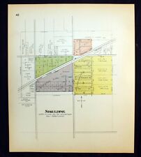 1914 Plat Map Village of Spaulding Sangamon County Illinois Clear Lake Township
-
$19.00 CAD
 1920 Color Maps Physical/Political Features Russia Finland Sweden Norway Denmark
-
$68.53 CAD
 1879 Original Map Towns Carver Mattapoisett Bryantville, Marion Ma Mass
-
$19.00 CAD
 1920 Color Maps Physical Africa and British South Africa Map
-
$27.42 CAD
 Original 1897 Color Map WEST INDIES CUBA HAITI PORTO RICO ANTILLES BAHAMA ISLAND
-
$102.81 CAD
 Antique ATLAS De COLOMBIA by Eduardo Acevedo Latorre, Agustin Codazzi, 1967, HC
-
$20.56 CAD
 Antique 1889 Map Dakota NC SC MN by George F Cram Unrivaled Family Atlas 13x20
-
$30.16 CAD
 Vintage War Edition WORLD ATLAS And GAZETTEER 1943
-
$34.20 CAD
 1895 Antique Map of Cleveland Ohio OH Vintage Atlas Page
-
$20.56 CAD
 Antique 1889 Map PA VA WV DEL by George F Cram Unrivaled Family Atlas 13x20
-
$27.40 CAD
 1877 Middleburg in Carroll County, MD Map by Lake Griffing & Stevenson
-
$45.24 CAD
 Town of Hancock Vermont 1871 Original Hand-colored Map from F W Beers Atlas
-
$19.00 CAD
 1920 Color Maps Political South America + Mexico Central America West Indies Map
-
$47.97 CAD
 Map Saskatchewan And Manitoba Canada 1938 Print Antique Ephemera DWU8
-
$27.35 CAD
 Antique 1897 Map Series of South America, 4 Century Atlas maps
-
$41.13 CAD
 Old map RUSSIA EUROPEA - G. Rodini Napoli 1854 - (Ukraine, West caucasian area)
-
$34.26 CAD
 1877 Union Bridge Carroll County, MD Map by Lake Griffing & Stevenson
-
$16.26 CAD
 1920 Maps by John Bartholomew of Jan/July Rainfall &Winds Races & Religion Map
-
$75.38 CAD
 1888 Maps (2 plates) of BROOKLINE, MASS - Removed from a big Atlas
-
$34.20 CAD
 1895 Antique Map of Philadelphia PA Vintage Atlas Page Pennsylvania
-
$157.65 CAD
 Kingdom Greece Ionian Islands Athens Pireos Stieler atlas 1861
-
$47.97 CAD
 Map Quebec Canada And Coastal Labrador 1938 Print Antique Ephemera DWU8


