 Antiques (CA)
-
$20.52 CAD

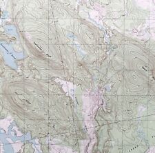 Map Northeast Bluff Maine 1990 Topographic Geo Survey 1:24000 27x22" TOPO10
-
$20.52 CAD
 Map Peaked Mountain Pond Maine 1990 Topographic Geo Survey 1:24000 27x22" TOPO6
-
$20.52 CAD
 Map Montegail Pond Maine USGS 1990 Topographic Geo 1:24000 27x22" TOPO17
-
$1.92 CAD
 Vintage 1992 National Geographic Map British Columbia The Making of Canada
-
$20.37 CAD
 Topographic Recreation Map of New Mexico
-
$34.19 CAD
 Rand-McNally state map: ALABAMA - ©1997 - paper - highway -
-
$38.23 CAD
 Rand-McNally state map: MISSOURI - c.1991 - paper - highway
-
$13.68 CAD
 1990's Map Brown County Ohio - Fayetteville - Mt Orab - Georgetown
-
$34.16 CAD
 Rand-McNally state map: SOUTH CAROLINA ©1997 - paper - highway - PLUS
-
$35.55 CAD
 Rand-McNally state map: OKLAHOMA - © 1993 - paper - highway -
-
$36.92 CAD
 Rand-McNally state map: DELAWARE - MARYLAND - c.1995 - paper - highway
-
$35.55 CAD
 Rand-McNally state map: NORTH DAKOTA & SOUTH DAKOTA - 1997 - paper - highway
-
$32.82 CAD
 Rand-McNally state map: INDIANA - 1998 - paper - highway -
-
$1.92 CAD
 Vintage 1992 National Geographic Map of Southwest USA The Land Of Open Sky
-
$34.19 CAD
 Rand-McNally state map: MISSISSIPPI - ©1998 - paper - highway -
-
$35.98 CAD
 Rand-McNally state map: KANSAS ©1998 - paper - highway -
-
$9.56 CAD
 NATIONAL GEOGRAPHIC SOCIETY MAGAZINE COASTAL CALIFORNIA MAP 1993 WILLIAM GRAVES


