 Antiques (CA)
-
$177.59 CAD

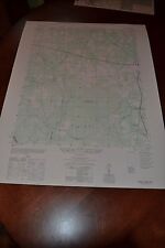
 Vintage 1948 (36" x 23") MARYLAND MAP - HARFORD COUNTY Topo & Election Districts
-
$172.08 CAD
 1948 - Map of the ZONING PLAN For VIERS MILL ROAD - Montgomery County, Maryland
-
$177.59 CAD
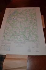
 Vintage 1949 LARGE MARYLAND MAP - HOWARD COUNTY Topography & Election Districts
-
$172.08 CAD
 1948 - Map of the HIGHWAY PLAN For VIERS MILL ROAD - Montgomery County, Maryland
-
$17.90 CAD
 1943 Vintage Map - The Thirteen Colonies - New York City Boston Charleston
-
$20.65 CAD
 c1949 Britannica Map Maryland Delaware Washington DC Baltimore Dover Annapolis
-
$26.09 CAD
 Vintage 1947 State Map Print Suitable For Framing Maine Maryland Delaware
-
$17.90 CAD
 1943 Vintage Map - The United States on March 4, 1861 - The Civil War
-
$34.40 CAD
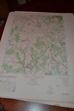
 1940's Army topographic map Reistertown Maryland -Sheet 5662 IV NE
-
$13.77 CAD
 VINTAGE ANTIQUE 1945 ANTIETAM Maryland Virginia West Virginia USGS Topo Map
-
$13.77 CAD
 East New Market / Secretary , Maryland 1944 Geological Topographical Map 27 x 22
-
$9.64 CAD
 USGS Topography Map Quadrangle Eastville, VA; NC; MD 1946 Rev 1969 1:250,000
-
$55.00 CAD
 Point Lookout Maryland 1943 Original Vintage USGS Topo Map
-
$185.85 CAD
 1947 - Map of the ZONING PLAN For ROCKVILLE PIKE - Montgomery County, Maryland
-
$34.42 CAD
 1942 Antique Map of Baltimore, Principal City and Port of Entry of Maryland
-
$55.00 CAD
 Saint George Island Maryland 1943 Original Vintage USGS Topo Map
-
$8.25 CAD
 L@@K! Vintage 1941 World Atlas Colored Maps of Maine, Maryland & Delaware WWII
-
$22.25 CAD
 1942 Antique BALTIMORE Maryland Street Map Vintage Baltimore City Map 1077
-
$41.29 CAD
 1940's Army (like USGS) topo map Wango Maryland-Sheet 5960 IV SW
-
$41.29 CAD
 1940's Army topographic map Trappe Maryland -Sheet 5761 II NE
-
$9.62 CAD
 Vintage 1940 World Atlas City Map Downtown Baltimore, Maryland MD World War WWII
-
$34.11 CAD
 1945 Two-Sided Color Railroad Map DE/MD/MA/RI Hammond 9.25x12.25"
-
$93.61 CAD
 Canton Company Baltimore City Maryland 1940 Large vintage map East Baltimore
-
$17.83 CAD
 Vintage BALTIMORE Map City Street Wall Art Decor Maryland Original Antique
-
$103.23 CAD
 1945 Map of Nanjemoy Maryland - Potomac River; Mallows Bay; Nanjemoy Creek
-
$10.32 CAD
 USGS Topography Map Quadrangle Salisbury, MD; DE; NJ; VA 1946 Rev '69 1:250,000
-
$41.30 CAD
 1941-53 UNITED STATES COAST GUARD GEODETIC SURVEY CHESAPEAKE MARYLAND MAP 44X36
-
$15.07 CAD
 Vintage MARYLAND Map of Delaware Wall Art Decor 1940s Original Ellicott City
-
$55.00 CAD
 Princess Anne Maryland 1943 Original Vintage USGS Topo Map
-
$55.00 CAD
 Hanesville Maryland 1949 Original Vintage USGS Topo Map
-
$55.00 CAD
 Rock Point Maryland 1943 Original Vintage USGS Topo Map
-
$13.77 CAD
 Large 28x22 1947 Topo Map Laurel, Maryland Patuxent Refuge Fort George G. Mead
-
$34.40 CAD
 1940's Army topographic map Hereford Maryland -Sheet 5663 II SW
-
$34.40 CAD
 1940's Army topographic map Hobbs Maryland -Sheet 5861 IV SE
-
$10.32 CAD
 Map Maine, Maryland and Delaware 1944
-
$34.40 CAD
 1940's Army topographic map Hebron Maryland -Sheet 5860 I NW
-
$17.83 CAD
 Maryland Vintage Pictorial Map (Small/Index Card size)
-
$41.29 CAD
 1940's Army topographic map Langford Creek Maryland -Sheet 5762 II SW
-
$13.77 CAD
 Large 28x22 1949 Topo Map Terrapin Sand Point, Maryland Little Deal Island Smith
-
$13.77 CAD
 Large 28x22 1949 Topo Map Kingston, Maryland Cypress Swamp Brinkleys Rehobeth
-
$103.23 CAD
 1944 WWII USCGS Restricted Map of La Plata, Maryland - Army Radio Station
-
$34.40 CAD
 1940's Army topographic map Norrisville Maryland PA -Sheet 5663 II NE
-
$20.64 CAD
 ELLICOTT MARYLAND - TOPOGRAPHIC MAP U.S. GEOLOGICAL SURVEY 1944
-
$34.40 CAD
 1940's Army topographic map East New Market Maryland -Sheet 5861 III SW
-
$34.40 CAD
 1940's Army topographic map Finksburg Maryland -Sheet 5662 IV NW
-
$34.40 CAD
 1940's Army topographic map Goldsboro Maryland -Sheet 5862 III SE
-
$41.29 CAD
 1940's Army topographic map (like USGS) Perryman Maryland -Sheet 5762 I NW
-
$13.75 CAD
 1940's Army topographic map Barren Island Maryland -Sheet 5760 IV SE
-
$34.40 CAD
 1940's Army topographic map Sudlersville Maryland -Sheet 5862 III NE
-
$24.45 CAD
 Baltimore Maryland Map 1947 Vintage Downtown ready to frame for art 11 x 14 inch
-
$27.52 CAD
 1940's Army topo map Great Fox Island Maryland Virginia-Sheet 5859 IV NW
-
$27.52 CAD
 1940's Army topographic map Terrapin Sand Point Maryland -Sheet 5860 III SW
-
$41.29 CAD
 1940's Army topographic map Point Lookout St Inigos Maryland -Sheet 5760 III SW
-
$41.29 CAD
 1940's Army (like USGS) topographic map Barclay Maryland -Sheet 5862 III
-
$34.40 CAD
 1940's Army topographic map Fowling Creek Maryland -Sheet 5861 IV SW
-
$41.29 CAD
 1940's Army (like USGS) topo map Ninepin Maryland-Sheet 5960 IV SE
-
$34.40 CAD
 1940's Army topographic map Laurel Maryland -Sheet 5662 III SE
-
$34.40 CAD
 1940's Army topographic map Salisbury Maryland -Sheet 5860 I SW
-
$41.29 CAD
 1940's Army topographic map Love Point Kent Island Maryland -Sheet 5762 III SE
-
$41.29 CAD
 1940's Army topographic map Betterton Maryland -Sheet 5762 I SE
-
$20.64 CAD
 TABEYTOWN MARYLAND / PA - TOPOGRAPHIC MAP U.S. GEOLOGICAL SURVEY 1944
-
$41.29 CAD
 1940's Army topographic map Relay Maryland -Sheet 5662 II NW
-
$34.40 CAD
 1940's Army topographic map Monie Maryland -Sheet 5860 III NE
-
$34.40 CAD
 1940's Army (like USGS) topographic map Price Maryland -Sheet 5862 III SW
-
$34.40 CAD
 1940's Army topographic map Princess Anne Maryland -Sheet 5860 II NW
-
$61.95 CAD
 CHESAPEAKE, MARYLAND MAP COVE POINT TO SANDY POINT 1943 5th Edition 36” X 42”
-
$34.40 CAD
 1940's Army topographic map Savage Maryland -Sheet 5662 III NE
-
$41.29 CAD
 1940's Army topographic map Swan Point Maryland -Sheet 5762 III NE
-
$34.40 CAD
 1940's Army topographic map Chicamocomico Maryland -Sheet 5860 IV NW
-
$34.40 CAD
 1940's Army topographic map Wetipquin Maryland -Sheet 5860 IV SE
-
$41.29 CAD
 1940's Army topographic map Naticoke Maryland -Sheet 5860 IV SW
-
$34.40 CAD
 1940's Army topographic map Earleville Maryland -Sheet 5862 IV NW
-
$34.40 CAD
 1940's Army topographic map Millington Maryland -Sheet 5862 IV SE
-
$27.52 CAD
 1940's Army topographic map Kedges Straits Maryland -Sheet 5760 II SE
-
$34.40 CAD
 1940's Army topographic map Cecilton Maryland -Sheet 5862 IV NE
-
$34.40 CAD
 1940's Army topographic map Church Hill Maryland -Sheet 5862 III NW
-
$41.29 CAD
 1940's Army topographic map Wye Mills Maryland -Sheet 5761 I NE
-
$34.40 CAD
 1940's Army topographic map Rhodesdale Maryland -Sheet 5861 III SE
-
$41.29 CAD
 1940's Army topographic map Taylors Island Maryland -Sheet 5760 IV NE
-
$41.29 CAD
 1940's Army topographic map Gunpowder Neck Maryland -Sheet 5762 IV SE
-
$103.23 CAD
 1944 USCGS Map of West River Maryland - Galesville, Cedarhurst, Mt. Zion
-
$34.40 CAD
 1940's Army topographic map Eden Maryland -Sheet 5860 I SW
-
$55.05 CAD
 1940's Army topographic map Savage Maryland -Sheet 5662 III NE - PHOTO MAP
-
$34.40 CAD
 1940's Army topographic map Marion Maryland -Sheet 5860 III SE
-
$68.82 CAD
 1940's Army topographic map Relay Maryland -Sheet 5662 II NW - PHOTO MAP
-
$34.40 CAD
 1940's Army topographic map Golden Hill Maryland -Sheet 5760 I NW
-
$34.40 CAD
 1940's Army topographic map Kingston Maryland -Sheet 5860 II SW
-
$41.29 CAD
 1940's Army topographic map Clairborne Maryland -Sheet 5761 IV SE
-
$41.29 CAD
 1940's Army topographic map Nanjemoy Maryland Edge Hill Virginia -Sheet 5560 I
-
$41.29 CAD
 1940's Army topographic map Centerville Maryland -Sheet 5762 II SE
-
$34.40 CAD
 1940's Army topographic map Point No Point Maryland -Sheet 5760 III NE
-
$41.29 CAD
 1940's Army topographic map Curtis Bay Maryland -Sheet 5662 II NE
-
$41.29 CAD
 1940's Army topographic map Sharps Island Maryland -Sheet 5761 III SE
-
$41.29 CAD
 1940's Army topographic map Hanesville Maryland -Sheet 5762 I SW
-
$34.40 CAD
 1940's Army topographic map Clarksville Maryland -Sheet 5662 III NW
-
$27.53 CAD
 1948 full states of Maryland and Delaware USGS Topographic map 35" x 22"
-
$2.74 CAD
 Cumberland Quadrangle Topographical MD-PA-WV
-
$48.17 CAD
 1940's Army topographic map Annapolis Maryland -Sheet 5761 IV NW
-
$16.52 CAD
 c. 1941 Maryland And Delaware Original Rand McNally Atlas Map


