 Antiques (CA)
-
$20.65 CAD

 Antique Ady Texas Original USGS Topographic Map 1936 16x20
-
$20.65 CAD
 Antique Laguna Atascosa Texas Map Original USGS Topographic Map 1936 16x20
-
$58.51 CAD
 Texas - Turkey Mountain Quadrangle (1938 survey) Original...
-
$76.06 CAD
 Texas Oklahoma New Mexico New Orleans 1930's large Italian color detailed map
-
$28.47 CAD
 1938 Colorful Pictorial Map ~ TEXAS by Norman Reeves for 1939 World's Fair
-
$20.65 CAD
 Vintage 1931 USGS Topo Map-Belton / Moffat, Texas 17X 20.75"
-
$20.65 CAD
 Vintage 1939 USGS Topo Map Coleman, Texas 16 1/2 X 20" Santa Anna Mountains
-
$24.09 CAD
 Texas North America Map 1935 United States 14 x 11" Southwest LGAD99
-
$20.65 CAD
 Vintage 1931 USGS Topo Map- Elm Mott / Waco, Texas 16.5X 20"
-
$30.29 CAD
 1937 McNally Map Texas Austin Houston Dallas San Antonio El Paso Galveston Waco
-
$63.26 CAD
 1938 "A GAY GEOGRAPHY" ~ TEXAS MAP ~ Colorful Pictorial by RUTH TAYLOR
-
$31.59 CAD
 Vintage LOUISIANA Railroad Map LARGE T&P RW Original Old Texas Pacific Railway
-
$41.29 CAD
 1937 US Air Commerce Map American Operated Airline Route Distances United States
-
$130.78 CAD
 Houston Ship Channel Alexander Island Carpenter Bayou Geodetic Survey Map 1937
-
$130.78 CAD
 Houston Ship Channel Geodetic Map Atkinson to Alexander Island 1937 42" x 32"
-
$34.40 CAD
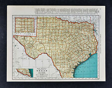
 c. 1935 Rand McNally Map Texas Austin Dallas Houston San Antonio Galveston Waco
-
$20.64 CAD
 1937 McNally Map Washington Seattle Tacoma Olympia Spokane Port Angeles Townsend
-
$34.42 CAD
 1943 WWII era Regional Aeronautical Chart (Map ) Texas/ Louisiana
-
$137.67 CAD
 TEXAS 1936 ROAD MAP, RAND McNLLY POCKET MAPS
-
$20.64 CAD
 1937 McNally Map Vermont Montpelier Burlington Rutland Lake Champlain Craftsbury
-
$27.52 CAD
 1937 McNally Map North America United States Canada Mexico Alaska Caribbean Cuba
-
$82.60 CAD
 LOUISIANA 1934 ROAD MAP, RAND McNLLY POCKET MAPS
-
$34.40 CAD
 c. 1935 McNally Map - Texas Austin Dallas Houston San Antonio Galveston El Paso
-
$27.52 CAD
 1937 McNally Map United States Auto Routes Distance Chart New York San Francisco
-
$41.29 CAD
 1938 McNally Map Texas Austin Houston Dallas San Antonio Beaumont Waco Galveston
-
$34.40 CAD
 1938 Rand McNally Map United States Railroad Distances Stations New York Chicago
-
$6.88 CAD
 1938 Collier's World Atlas & Gazetteer - 11 x 14 Map of S. Dakota & Texas
-
$653.91 CAD
 1935 New Finder Map of Greater San Antonio
-
$27.52 CAD
 1937 McNally Railroad Map United States Routes Distances New York San Francisco
-
$48.11 CAD
 Texas Landmarks Alamo Santa Anna San Jose Mission 1939 cartoon pictorial map
-
$34.42 CAD
 1943 WWII era US Plotting Chart Souther Texas
-
$11.01 CAD
 Topographic Map of Guadalupe Peak Quadrangle - Texas - 1933 - US Geo. Survey
-
$62.91 CAD
 1970's Artic Gas Map ORIGINAL Oil Fields Wildlife Corridor Alaskan Pipeline Book
-
$27.52 CAD
 GUADALUPE PEAK TEXAS USGS ORIGINAL 1933 QUADRANGLE 17X21 EXCELLENT CONDITION
-
$34.42 CAD
 1931 Hammond State Map (2 Sided) Texas Or Utah Railroads
-
$27.52 CAD
 TURKEY MOUNTAIN TEXAS ORIGINAL 1938 USGS QUADRANGLE 17X21 MAP EXCELLENT COND.
-
$82.60 CAD
 ALABAMA 1935 RAILROAD & AUTO ROAD MAP, RAND McNLLY POCKET MAPS
-
$148.75 CAD
 1933 MAP UNITED STATES ALASKA TEXAS CALIFORNIA UTAH IOWA WASHINGTON FLORIDA


