 Antiques (CA)
-
$1217.64 CAD

 1929 OFFICIAL REAL ESTATE ATLAS CITY OF DETROIT HEARNE BROTHERS LARGE RARE BOOK
-
$102.81 CAD
 1920 Main Line Atlas - Pennsylvania RR - NARBERTH/MERION TOWNSHIP
-
$274.10 CAD
 Original 1923 Boone County Illinois IL Atlas by Ogle & Co Plat Book
-
$239.83 CAD
 Original 1920 Schuyler County Illinois IL Atlas by Kenyon Co Plat Book
-
$274.16 CAD
 La Salle County Illinois Antique ATLAS & Plat Book Hand Colored Maps 1929
-
$34.27 CAD
 The Official Maps of New England L. Crocker Topographer, National Survey Co.
-
$308.44 CAD
 RARE 1929 Paved Road Atlas George F. Cram Co. USA Canada Maps Item-Tribune Vtg
-
$61.62 CAD
 Rare Rochester NY + Suburbs Large Planning District Map Book Atlas 1922 ?racist?
-
$171.29 CAD
 1927 antique ROAD ATLAS thos cooke AUTO ROUTE DISTANCE ATLAS ne ny nj pa md de
-
$259.09 CAD
 Vintage 1929 Dekalb County Illinois Atlas and Plat Book Surveys Public Records
-
$34.96 CAD
 Antique 1920s 1921 Cleveland Ohio City Street Map from Atlas
-
$137.09 CAD
 1920 Crawford COUNTY IOWA ATLAS PLAT BOOK Anderson Publishing Panama Canal info
-
$16.26 CAD
 1920 Color Maps of Railways of Great Britain and Geological Rainfall & Tides Map
-
$102.81 CAD
 1920 Main Line Atlas - Pennsylvania RR - TREDYFFRIN & UPPER MERION TOWNSHIP
-
$198.77 CAD
 Antique MAP OF THE WORLD - Atlas Of GRAND FORKS CO. N. DAKOTA - Ogle & Co. 1927
-
$68.54 CAD
 Antique Illust. (FARMS/HOMES) Atlas of Grand Forks, N. Dakota/Ogle & Co 1927
-
$16.26 CAD
 1920 Color Maps by John Bartholomew of Physical Europe Map
-
$2741.70 CAD
 PRINCETON, NJ - SANBORN INSURANCE MAPS & FRANKLIN SURVEY ATLAS Two Vol's 1927-30
-
$36.64 CAD
 1928 Map Philadelphia 36 Ward Moore Morris Tasker Dickinson Point Breeze Watkins
-
$16.26 CAD
 1920 Color Maps Physical Indian Empire + Farther India and the East Indies Map
-
$102.75 CAD
 Original 1923 Boone County Illinois IL Atlas by Ogle & Co Plat Book
-
$19.00 CAD
 1920 Color Maps Physical New Zealand & Tasmania, Old New Testament Palestine Map
-
$19.00 CAD
 1920 Color Maps Physical Dominion of Canada and Political North America Map
-
$34.96 CAD
 Antique 1921 Detroit Michigan City Street Map from Atlas
-
$20.56 CAD
 OFFICIAL MAPS OF NEW ENGLAND - National Survey Co Chester VT - 96 pgs complete
-
$19.00 CAD
 1920 Color Maps Eastern Provinces of Canada and Physical North America Map
-
$16.45 CAD
 1920 OGLE PLAT ATLAS OF SALINE COUNTY, KANSAS-MAP OF SPRING CREEK TOWNSHIP
-
$137.09 CAD
 Atlas of Marshall County Iowa 1924 Book plus Hammond's Atlas of the World 1914
-
$198.77 CAD
 Antique MAP OF NEBRASKA - Atlas Of Franklin County Nebraska - Ogle & Co. 1923
-
$198.77 CAD
 Antique MAP OF THE UNITED STATES - Atlas Of Harlan Co. Nebraska - Ogle & Co 1921
-
$82.25 CAD
 Antique Illustrations (HOMES) - Atlas/Franklin Co. Nebraska - Ogle & Co 1923
-
$198.77 CAD
 Antique MAP OF NEBRASKA - Atlas Of Harlan Co. Nebraska - Ogle & Co. 1921
-
$44.18 CAD
 1928 Map Philadelphia 36 Ward Lanier Park Tasker Morris Dickson St Gabriel's
-
$16.26 CAD
 1920 Color Maps Political Features of France (no explanation of the colors!) Map
-
$34.96 CAD
 Antique Vintage 1920s Denver Colorado City Street Map from Atlas 1921
-
$13.71 CAD
 1920 ANTIQUE OGLE PLAT ATLAS OF SALINE COUNTY, KANSAS-MAP OF FALUN TOWNSHIP
-
$19.00 CAD
 1920 Color Maps Physical/Political Italy Yugo Slavia and Balkans 2X pages Map
-
$27.42 CAD
 1925 Rand McNally Atlas of America NEWYORK /21"x29" Adjoining New Jersey Towns
-
$82.25 CAD
 Antique Illustrations (Homes) - Atlas Of Harlan Co. Nebraska - Ogle & Co. 1921
-
$205.63 CAD
 Antique MAP EAST GRAND FORKS - Atlas Of NORTH DAKOTA - Ogle & Co. 1927
-
$19.00 CAD
 1920 Color Maps Physical/Political Features Russia Finland Sweden Norway Denmark
-
$16.26 CAD
 1920 Comparative Atlas by John Bartholomew Color Maps of Astronomical Geography
-
$822.50 CAD
 1929 V.4 Brooklyn 260 maps! CONEY ISLAND SHEEPSHEAD FLATLANDS CANARSIE MIDWOOD
-
$1233.75 CAD
 1929 Hyde Atlas V.1 200 Maps Brooklyn HEIGHTS CROWN PROSPECT PARK SLOPE DUMBO ++
-
$40.73 CAD
 1928 Map Philly Schuylkill East Railroad Grays Ferry Wharton Dupont De Nemours
-
$19.00 CAD
 1920 Color Maps Physical Features of Ireland and Scotland Map
-
$19.00 CAD
 1920 Color Maps Political United States and Physical South America Map
-
$34.96 CAD
 Antique 1920s 1921 Pittsburgh Pennsylvania City Street Map from Atlas
-
$29.05 CAD
 Antique Minneapolis St Paul Street Map from Atlas 1920s 1921
-
$19.00 CAD
 1920 Color Maps Physical Africa and British South Africa Map
-
$959.58 CAD
 1929 V2 Brooklyn ~400 MAPS ALL WILLIAMSBURG Greenpoint East New York Brownsville
-
$56.93 CAD
 1928 Map Philadelphia RARE -26 36 & 48 Ward Index Hand Colored Schuylkill River
-
$10.95 CAD
 National Geographic 1925 Map Of Washington DC. Approx 13 By 17 Inches. Frameable
-
$19.00 CAD
 1920 Color Maps Political South America + Mexico Central America West Indies Map
-
$28.35 CAD
 Original 1929 Pictorial Map by L. Price ~ " FATHER ATLAS - VOLCANOES "
-
$16.26 CAD
 1920 Maps by John Bartholomew of Jan/July Rainfall &Winds Races & Religion Map
-
$29.05 CAD
 Antique 1921 Baltimore Maryland City Street Map from Atlas
-
$411.24 CAD
 1929 V.3 Brooklyn 200+ MAPS BAY RIDGE BENSONHURST FLATBUSH BORO PARK KENSINGTON
-
$16.26 CAD
 1920 Color Maps Physical Features of Switzerland and the Alps Map
-
$21.87 CAD
 Antique map, KANSAS in 1921, Great Shape. Ready to be Framed. 11” By 9”
-
$30.15 CAD
 Antique New Mexico and New Jersey Map from Atlas 1920s 1921
-
$19.00 CAD
 1920 Color Maps Density of Population Greater Britain Map
-
$39.07 CAD
 c1921 New York State Map East & West RR Rand McNally Commercial Atlas of America
-
$34.20 CAD
 1925 Canada Descriptive Atlas Home Seeker Brochure Immigration Colonization Maps
-
$19.00 CAD
 1920 Color Maps Political England & Wales + Physical Scotland 2X pages Map
-
$81.37 CAD
 Antique Illustrations (Homes/Farms) - Atlas/Harlan Co. Nebraska - Ogle & Co 1921
-
$81.37 CAD
 Antique Illustrations (PEOPLE) - Atlas/Harlan Co. Nebraska - Ogle & Co 1921
-
$81.37 CAD
 Antique Illustrations (FAMILIES) - Atlas/Franklin Co. Nebraska - Ogle & Co 1923
-
$81.37 CAD
 Antique Illustrations (PEOPLE) - Atlas/Franklin Co. Nebraska - Ogle & Co 1923
-
$81.37 CAD
Antique Illustrations (Homes) - Atlas Of Harlan Co. Nebraska - Ogle & co. 1921
-
$28.79 CAD
 c1921 Vermont State Map RR from Rand McNally Commercial Atlas of America
-
$20.56 CAD
 Antique Arizona from Atlas 1920s 1921
-
$81.37 CAD
 Antique Illustrations (FARMS) - Atlas/Franklin Co. Nebraska - Ogle & Co 1923
-
$19.00 CAD
 1920 Color Maps Physical Features Asia + North & South Polar Regions Map
-
$81.37 CAD
 Antique Illustrations (Farms) - Atlas Of Harlan Co. Nebraska - Ogle & co. 1921
-
$19.00 CAD
 1920 Color Maps Physical Australasia + Oceania Map
-
$81.37 CAD
 Antique Illustrations (Portraits) - Atlas/Harlan Co. Nebraska - Ogle & Co 1921
-
$16.26 CAD
 1920 Maps by John Bartholomew of Density Population & Commercial Development Map
-
$28.79 CAD
 c1921 West Virginia & Virginia-Western Section State Map RR Rand McNally Atlas
-
$16.45 CAD
 The New World Atlas and Gazetteer 1927 Edition
-
$37.22 CAD
 Vtg Lot 1923 WAUPACA Co. WISCONSIN Illustrations, Land Owners, Homes & Buildings
-
$40.78 CAD
 Antique 1920s Buffalo NY Chicago IL City Street Maps from Atlas 1921
-
$34.96 CAD
 Antique 1921 Memphis Tennessee City Street Map from Atlas
-
$28.79 CAD
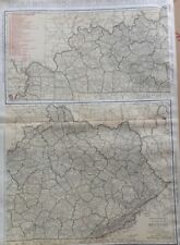 c1921 Kentucky State Map RR from Rand McNally Commercial Atlas of America
-
$19.00 CAD
 1920 Color Maps Political Australia + Oceania + Victoria New South Wales Map
-
$30.30 CAD
 Antique 1921 Boston Massachusetts City Street Map from Atlas Business Inset
-
$34.96 CAD
 Antique 1921 Central Los Angeles California City Street Map from Atlas
-
$34.96 CAD
 Antique 1920s 1921 Indianapolis Indiana City Street Map from Atlas
-
$541.49 CAD
 Vintage 1927 FRANKLIN MASSACHUSETTS Sanborn Insurance MAPS Atlas - DEAN College
-
$28.79 CAD
 c1921 New Hampshire State Map RR from Rand McNally Commercial Atlas of America
-
$28.79 CAD
 c1921 Alabama State Map RR from Rand McNally Commercial Atlas of America
-
$102.81 CAD
 1927-30 Rand McNally Cadillac La Sale Touring & Service Atlas Stamped Leather §
-
$753.97 CAD
 (41) Philadelphia Atlas 1929 Complete Book
-
$102.81 CAD
 Antique MAP OF UNION TOWNSHIP/Atlas Of GRAND FORKS CO. N. DAKOTA/Ogle & Co. 1927
-
$41.11 CAD
 Elkton Wilmington Maryland Delaware 1920 Geologic Atlas USGS Folio W/ All Map US
-
$40.78 CAD
 Antique Newark NJ New Orleans LA City Street Maps 1908 Gazetteer Page
-
$67.81 CAD
 Antique Illustrations (HOMES) Atlas of Grand Forks, N. Dakota/Ogle & Co 1927
-
$67.81 CAD
 Antique Illustrations (PLACES) Atlas of Grand Forks, N. Dakota/Ogle & Co 1927
-
$205.63 CAD
 Antique MAP SOUTH PART OF GRAND FORKS - Atlas Of NORTH DAKOTA - Ogle & Co. 1927
-
$409.88 CAD
 1920s Philadelphia Suburban Atlas Directory Main Line Real Estate Map


