 Antiques (CA)
Africa Maps
Asia Maps
Australia/Oceania Maps
Celestial Maps
Central America/Caribbean Maps
Curiosities Maps
Digital Maps
Europe Maps
Map & Globe Mixed Lots
Map & Globe Reproductions
North America Maps
South America Maps
World & Celestial Globes
World Maps

-
$86.34 CAD

 1839 Michigan J.H. Young engraved 17x22 Map vtg Antique United States Repro 1957
-
$183.75 CAD
 Antique Armillary Brass Desktop Globe Sphere Maritime Vintage Astrolabe Gift
-
$66.82 CAD
 Vintage Art Reproduction Map of 1843 London England 25.5" x 17" Canvas
-
$109.77 CAD
 Nautical Maritime Brass Armillary Table Top Marine Sphere Globe For Decor
-
$61.68 CAD
 1876 Illinois Atlas 1972 Re Print
-
$17.75 CAD
 Vito Corleone Fear Murdered Godfather Newspaper Headlines 12 x 18 Poster
-
$17.75 CAD
 Marilyn Monroe Dies Newspaper Headlines 12 x 18 Poster
-
$54.81 CAD
 1876 Beers Somerset County Atlas Pennsylvania PA 1994 Ltd Printing Repro New
-
$24.60 CAD
 Lonesome Dove Gus and Call Trail Map To Montana ON A Cattle Drive 12 x 18
-
$68.53 CAD
 Vintage Gold Ancient World Map Framed Nova Totivs Terrarvm Orbis Lithograph
-
$54.83 CAD
 1880 Atlas of Barnstable County Massachusetts Cape Cod's Earliest Atlas 1998 Ed.
-
$17.75 CAD
 Titanic Sinks 1500 Die Newspaper Headlines 12 x 18 Poster
-
$123.29 CAD
 Alabama & Georgia Indian Territory Map 1823 AL & GA RP 24x30" FREE SHIPPING!
-
$171.33 CAD
 Detroit - Grand Rapids Michigan - Yesterday Paper - Map 1899 Antique "Rare"
-
$57.28 CAD
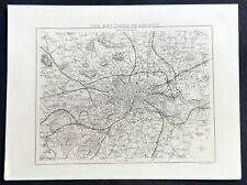 1836 Thomas Moule Antique Map of London & Environs, Barclays Dictionary
-
$34.94 CAD
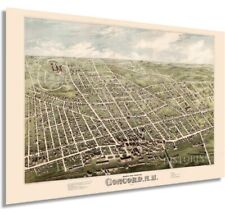 1875 H.H. BAILEY, BIRD'S EYE VIEW OF CONCORD, NEW HAMPSHIRE, COPY POSTER MAP
-
$105.54 CAD
 1978 VIEW OF CENTRAL PARK, MANHATTAN, NEW YORK The Runners Map Of Central Park
-
$20.49 CAD
 Prohibition End at last NY Newspaper Headlines 12 x 18 Poster
-
$7.81 CAD
 Map 1882 Virginia West Virginia Norfolk Richmond Charleston Population Railroads
-
$34.27 CAD
 Copy of a 1836 Map of the Seat of War in Florida by Major Genl. W. Scott, 1860
-
$123.29 CAD
 Russell Lee County Alabama Indian Territory Map 1832 RP 24x30" FREE SHIPPING!
-
$27.34 CAD
 Reprint Atlas of Somerset County New Jersey 1873 - F.W. Beers Vesey St. New York
-
$68.53 CAD
 ILLUSTRATED HISTORICAL ATLAS PROVINCE PRINCE EDWARD ISLAND 1880 Compact Edition
-
$54.76 CAD
 Vintage Atlas copy of 1870 Map Princeton New Jersey includes College D&R canal
-
$30.09 CAD
 Flat Earth Map 1892 Alexander Gleason 16"x23" New Standard Map of the World 1892
-
$34.25 CAD
 Canvas Color Reproduction 1851 New Map Of The Gold Region In California-C Gibbes
-
$30.09 CAD
 Flat Earth Map of the World by Alexander Gleason made 1892 Poster Size 16x23 in.
-
$409.82 CAD
 Antique French Navigational Sextant Hand Painted Nautical Lithograph Metal Heavy
-
$41.12 CAD
 Vintage Guilielmo Blaeuw America Nova Tabula Map Reproduction Framed
-
$47.96 CAD
 Vintage Guilielmo Blaeuw America Nova Tabula Map Reproduction Framed
-
$109.21 CAD
 Nautical Maritime Brass Armillary Table Top Marine Sphere Globe For Decor
-
$16.45 CAD
 Historic Map Of 1830 British America
-
$411.18 CAD
 Historical Atlas of Indiana 1876 reprinted 1968 rare Greenburg
-
$34.27 CAD
 CALIFORNIA GOLD RUSH MAP, 1850_SAN FRANCISCO_ PROFESSIONALLY REPRODUCED IN 1982.
-
$123.29 CAD
 Chambers County Alabama Indian Territory Map 1832 RP 24x30" FREE SHIPPING!
-
$38.31 CAD
 Kentucky Atlas of Bath & Fleming Counties D J Lake 1884 Reproduction 11" x 17"
-
$41.12 CAD
 CIVIL WAR BATTLEFIELDS 1861-1865 MAP Chronological 1961 Historical + Bonus 500
-
$50.65 CAD
 1884 Historical Fire Maps Tallahassee Florida 17" X 20" - 2 Maps VERY DETAILED
-
$137.00 CAD
 Armillary Globe Brass Celestial Globe Large Showpiece Handmade Nautical Decor
-
$28.05 CAD
 world map atlas globe earth compass art print photo rustic painting vintage
-
$134.31 CAD
 atlas of Illinois 1876 Mayhill COUNTY, CHICAGO REPRINTED 1972 108 PAGES
-
$171.33 CAD
 Neuestes Rhein Panorama ( von Köln-Mainz) --Circa 1880
-
$137.06 CAD
 1888 Map of San Jose, California (1972 Reprint)
-
$47.29 CAD
 Map of the Battlefield of Gettysburg Scale, Explanation, Notes 24x 18"
-
$34.27 CAD
 1852 Map of San Francisco, giclee print on 22.5" x 17" watercolor paper, $25.00
-
$133.64 CAD
 Atlas of Cumberland County, Pennsylvania F.W. Beers 1872 Reprint 1976
-
$41.12 CAD
 TOPOGRAPHICAL MAP OF THE ROAD FROM MISSOURI TO OREGON Reprint of 1846 - 25x16
-
$54.76 CAD
 1896 Historical Fire Map of Arcadia Indiana Two Maps 16" X 20" VERY DETAILED
-
$34.27 CAD
 Historical Map of Danube Swabian Donauschwaben Settlement NEW
-
$26.85 CAD
 VTG 1989 Reproduction 1892 Atlas of the German Empire Thomsen Genealogical PA21
-
$54.83 CAD
 Atlas of Cumberland County, Pennsylvania 1858 Reprint 1987 w/Name Index
-
$24.67 CAD
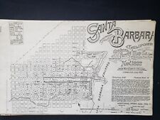 1892 Sanborn & Perris Map Structures by Street Santa Barbara Facsimile
-
$123.29 CAD
 Barbour County Alabama Indian Territory Map 1832 RP 24x30" FREE SHIPPING!
-
$102.80 CAD
 TOPOGRAPHICAL MAP OF THE ROAD FROM MISSOURI TO OREGON Mid-20thc Reprint of 1846
-
$17.54 CAD
 Carte Physique et Routiére de la Suisse, A Map of Switzerland 1844
-
$20.49 CAD
 Prohibition End at last CHICAGO TRIBUNE Newspaper Headlines 12 x 18 Poster
-
$13.71 CAD
 Reproduction Union County 1825 Map
-
$34.27 CAD
 Baltimore Maryland 1850 Map Liberty Street Repro Color Poster Unframed Historic
-
$40.76 CAD
 Framed 1850's Map Of Australia - Photolithographic Print produced in 1988
-
$19.64 CAD
 world map atlas globe earth compass art print photo rustic old vintage poster
-
$68.46 CAD
 Map of the American Civil War Battle of Antietam September 17, 1862 36x42 in
-
$68.46 CAD
 1899 SPRINGFIELD MA UNION STATION HAMPDEN PARK HARRISON TO ESSEX ST ATLAS MAP
-
$34.27 CAD
 1875 Everett Massachusetts B&W Reproduction Map Unframed 17” X 11”
-
$980.70 CAD
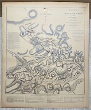 Antique 19th C FADEN 'Battle of Brandywine' American Revolution PHOTO MAP Copy
-
$34.20 CAD
 New Historic 1860 Map of Somerset County, Maine. 18in x 24in
-
$68.52 CAD
 Vintage Color Map of Italy Matted Map Copyright, 1897 & 1902, Century Co.
-
$41.05 CAD
 Vintage Reproduction of 1861 New Sharon Maine Map - 33.5x22 inches
-
$68.46 CAD
 1891 BUFFALO NY STATE ASYLUM FOREST LAWN CEMETERY GRANT ST-MAIN ST STA ATLAS MAP
-
$47.97 CAD
 1871 North Attleborough Massachusetts Map - Vintage Reprint
-
$54.83 CAD
 Atlas of Somerset County, Pennsylvania 1876 Reprint 1973
-
$68.46 CAD
 1889 HIGHLAND BEACH, MONMOUTH COUNTY, NEW JERSEY, NAVESINK LIGHTS COPY ATLAS MAP
-
$68.46 CAD
 1883 FAUBOURG ST. MARIE, NEW ORLEANS LOUISIANA CANAL ST TO GALLIOPE ST ATLAS MAP
-
$68.46 CAD
 1889 LONG BRANCH, MONMOUTH COUNTY, NEW JERSEY ELBERON STATION & CASINO ATLAS MAP
-
$25.70 CAD
 Wall Art Old Map of Vintage Mount Clemens Michigan Year 1881 11x14
-
$34.20 CAD
 1880 Historical Fire Map of BartowFlorida 16" X 20" VERY DETAILED Full Color
-
$47.97 CAD
 CALIFORNIA GOLD MAP_ 1850_SAN FRANCISCO_LAMINATED_ PROFESSIONAL REPRO. IN 1982.
-
$68.46 CAD
 1889 BRIELLE MANASQUAN MONMOUTH COUNTY NEW JERSEY STOCKTON LAKE PLAT ATLAS MAP
-
$52.07 CAD
 CIVIL WAR BATTLEFIELDS 1861-1865 MAP Chronological 1961 Historical + Bonus 500
-
$42.20 CAD
 1835 A H Dufour Antique Print The Length & Height of Worlds Rivers & Waterfalls
-
$68.46 CAD
 1890 ESSEX COUNTY NJ SOUTH ORANGE SETON HALL COLLEGE MAPLEWOOD STATION ATLAS MAP
-
$370.06 CAD
 RARE 24x34-inch 1850 Linen Survey Map ASTORIA NEWTOWN Long Island, printed later
-
$89.09 CAD
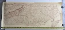 U.S. Coast Survey 1865 North Carolina W.P. Cumming Map Print 17 1/2 x 38
-
$411.19 CAD
 City Plan of Washington in 1800
-
$21.92 CAD
 Vintage Denver Colorado 1874 Reprint Map 25" x 17"
-
$124.72 CAD
 JASPER COUNTY IOWA PLAT BOOK 1887 MAPS SURVEY RECORDS FOOTE HOOD 1985 NEWTON IA
-
$13.69 CAD
 Antiquities of the City of Athens, Greece, 1885 Mackenzie Color Map
-
$75.39 CAD
 Professional Reproduction Map of the Village of Reading, Massachusetts, 1889
-
$68.46 CAD
 1883 FAUBOURG TREME NEW ORLEANS LOUISIANA ROMAN ST TO BURGUNDY STREET ATLAS MAP
-
$54.76 CAD
 LARGE Historic 1838 City of Cincinnati OHIO Street WALL Map BY JOSEPH GEST PRINT
-
$68.46 CAD
 1890 ESSEX COUNTY NJ SOUTH ORANGE LAWN TENNIS CLUB SETON HALL COLLEGE ATLAS MAP
-
$68.46 CAD
 1889 ATLANTIC HIGHLANDS MONMOUTH COUNTY NEW JERSEY SANDY HOOK BAY COPY ATLAS MAP
-
$68.46 CAD
 1889 MATAWAN, MONMOUTH COUNTY NEW JERSEY, GLENWOOD INSTITUTE COPY PLAT ATLAS MAP
-
$68.46 CAD
 1885 LOWER EAST SIDE MANHATTAN NY SOUTH ST-E3 ST & CLINTON TO EAST ST ATLAS MAP
-
$68.46 CAD
 1875 BIRD'S EYE VIEW OF CENTRAL PARK, MANHATTAN, NEW YORK COPY POSTER MAP
-
$68.46 CAD
 1885 SOUTH STREET SEAPORT THE BOWERY EAST SIDE MANHATTAN NEW YORK ATLAS MAP
-
$68.46 CAD
 1890 ESSEX COUNTY NEW JERSEY SOUTH ORANGE VAILSBURG, IRVINGTON VILLAGE ATLAS MAP
-
$68.46 CAD
 1898 FORT GREENE BROOKLYN NY WASHINGTON PARK BRIDGE ST - WASHINGTON AV ATLAS MAP
-
$68.46 CAD
 1885 LOWER MANHATTAN CITY HALL BATTERY PARK WALL ST. BROOKLYN BRIDGE ATLAS MAP
-
$109.27 CAD
 Antique brass armillary world globe Vintage handmade collectible tabletop decor
-
$78.11 CAD
 Nautical Maritime World Map Globe Sphere Celestial Globe Marine Tabletop Decor


