 Antiques (CA)
-
$342.71 CAD

 Antique Colored MAP - OFFICIAL TOPOGRAPHICAL MAP OF KANSAS - 1887 KANSAS ATLAS
-
$267.32 CAD
 ANTIQUE MAP - PART OF 7th WARD - BOSTON (PL I) - 1874/ATLAS OF SUFFOLK MASS
-
$185.06 CAD
 1842 Large Map of Virginia. From Morse's North American Atlas. Color
-
$349.57 CAD
 bradstreets pocket atlas 1879
-
$68.53 CAD
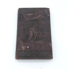 Antique 1889 Alden's Handy Atlas Of The World State Color Maps Pocket Book HC
-
$274.16 CAD
 Ogle County Illinois Antique ATLAS & Plat Book Hand Colored Maps 1893
-
$130.00 CAD
 1863 Map ~ FLORIDA from Johnsons Atlas (14x18)#021
-
$68.53 CAD
 Atlas of Peoria County, Illinois 1873 By A. T. Andreas
-
$27.33 CAD
 Page from 1892 Copyright Rand, McNally Atlas Idaho with Railroads, Pony Express
-
$472.94 CAD
 antique UTICA NY ATLAS MAPS in 1899 sanborn ferris 1906-22 index 25.5x23" 116pg
-
$34.27 CAD
 Original Beers 1873 MAP BROOKLYN KINGS COUNTY FLATLANDS - CANARSIE
-
$1233.61 CAD
 Vintage 1913 BROMLEY ATLAS Borough Manhattan New York City Pocket Desk Edition
-
$41.06 CAD
 Vintage 1885 Map of Dakota Territory Old Antique Original Atlas 13.5" x 21.5"
-
$130.23 CAD
 Antique Colored MAP - BAXTER SPRINGS or GALENA,EMPIRE CITY - 1887 KANSAS ATLAS
-
$205.63 CAD
 Antique Colored MAP OF RICHMOND AREA - (Civil War) - Johnson's Family Atlas 1863
-
$137.09 CAD
 1876 Antique MAP Co. of JOLIETTE, BERTHIER etc - Tackabury's Atlas of Canada
-
$13.71 CAD
 1891 MATTHEWS-NORTHRUP ANTIQUE ATLAS-WORLD'S COLUMBIAN EXPOSITION-BIRDS EYE VIEW
-
$205.42 CAD
 RARE 1899 HUGE Rand McNally Encyclopedia & Atlas Of The World Vol II Revised Ed.
-
$54.82 CAD
 1876 Beers Somerset County Atlas Pennsylvania PA 1994 Ltd Printing Repro New
-
$308.43 CAD
 1874 ANTIQUE ONTARIO COUNTY NY ATLAS GENEVA CANANDAIGUA VICTOR PHELPS CLIFTON+
-
$2734.85 CAD
 Antique 1873 Long Island New York Pocket Map J.B. Beers & Co. 54”x15” RARE
-
$1549.05 CAD
 Original 1867 ATLAS OF NEW YORK Brooklyn Westchester Putnam Dutchess Counties
-
$1370.85 CAD
 RARE 1892 22" X 16" HUGE COMPLETE* Rand McNally Indexed Atlas Of The World
-
$651.15 CAD
 1881 H. Belden Atlas of the Dominion of Canada, North-West Territories, Newfound
-
$1645.02 CAD
 Complete Rare 1874 Gray's Atlas Of The United States, IN VERY NICE CONDITION!
-
$30.84 CAD
 1899 Map of Dane County Wisconsin Antique Color 17" x 28"
-
$548.33 CAD
 Antique Original State Atlas Of Maine J.H. Stuart & Co 1898-1899
-
$342.64 CAD
 Original 1870 Atlas Clarke County Titus USA Ohio Railroad Maps Springfield
-
$185.06 CAD
 1842 Large Map of Alabama. From Morse's North American Atlas. Color
-
$226.19 CAD
 Antique, Colored MAP OF NEW HAMPSHIRE - 1892 ATLAS
-
$185.06 CAD
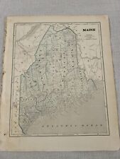 1842 Large Map of Maine. From Morse's North American Atlas. Color
-
$212.48 CAD
 Antique MAP - NICKERSON, AURORA, BARCLAY, ARVONIA & PENFIELD - 1887 KANSAS ATLAS
-
$13.71 CAD
 1890 CALDWELL ATLAS OF CAMBRIA COUNTY, PENNSYLVANIA-MAP OF PA TEMP & RAINFALL
-
$959.60 CAD
 RARE 1889 21" X 15" Large COMPLETE Rand McNally Indexed Business Atlas: 386 pp.
-
$2056.28 CAD
 Rare Complete 1890 Hand Colored Atlas: Dane County, Wisconsin Pub: C.M. Foote.
-
$2467.53 CAD
 Johnson's New Illustrated Family Atlas of the World
-
$12.05 CAD
 c1870s Hand Colored Whiteside County IL Atlas Page ~ Hume Township & Como Maps
-
$34.27 CAD
 Marysville California 1896 Geologic Atlas USGS Folio 4 Maps = Colusa Yuba City
-
$226.19 CAD
 Antique, Colored MAP - COOS COUNTY, NEW HAMPSHIRE - 1892 ATLAS
-
$212.48 CAD
 -Antique Colored MAP - ARKANSAS CITY + DALTON, SOUTH HAVEN - 1887 KANSAS ATLAS
-
$1198.47 CAD
 Original 1871 ATLAS of MASSACHUSETTS stedman, brown & lyon -- Complete --
-
$171.29 CAD
 1873 COVER PAGE ATLAS of HUNTERDON COUNTY NJ FW BEERS Contents Census & Charts
-
$54.83 CAD
 1880 Atlas of Barnstable County Massachusetts Cape Cod's Earliest Atlas 1998 Ed.
-
$1919.19 CAD
 Vintage 1892 Atlas Of Delaware County Pennsylvania,Delco,E. W. Smith & Co.,Comp.
-
$101.72 CAD
 1876 Antique MAP of NEWFOUNDLAND - Tackabury's Atlas of Canada
-
$62.99 CAD
 1888 Cram Atlas Indian Reservation & Railroad Map ARIZONA TERRITORY (XL17x23)546
-
$105.56 CAD
 1978 VIEW OF CENTRAL PARK, MANHATTAN, NEW YORK The Runners Map Of Central Park
-
$68.54 CAD
 ILLUSTRATED HISTORICAL ATLAS PROVINCE PRINCE EDWARD ISLAND 1880 Compact Edition
-
$61.67 CAD
 1891 Edison's HANDY ENCYCLOPEDIA OF INFORMATION AND UNIVERSAL ATLAS Antique book
-
$137.07 CAD
 Peoples Atlas Of The World 1894 Published by Mast Crowell Kirkpatrick Antique
-
$21.91 CAD
 State of Alabama AL Map 1897 Century Atlas Perfect for Framing
-
$1645.01 CAD
 Vintage 1875 Atlas Of Iowa
-
$61.69 CAD
 1876 Illinois Atlas 1972 Re Print
-
$411.26 CAD
 Antique Atlas of Morgan County Ohio 1875 Titus, Simmons & Titus
-
$75.40 CAD
 Antique MAP - STRATHAM or GREENLAND- ROCKINGHAM CO. - N.HAMPSHIRE - 1892 ATLAS
-
$137.07 CAD
 1876 McNally's System of Geography for Schools, Academies Atlas Drawings Tests
-
$24.61 CAD
 Original 1878 Long Branch map (from the Atlas of the New Jersey Coast)
-
$2056.28 CAD
 ORIGINAL 1881 Geo. Colby Atlas HANCOCK County Maine / IMMENSE RARITY
-
$10.95 CAD
 ANTIQUE 1876 YORK COUNTY PENNSYLANIA ATLAS TEXT HISTORY PAGES BOOK RARE NR
-
$685.43 CAD
 Rare Complete 1902 A.K. Johnston's Royal Atlas Of Modern Geography W/All 56 Maps
-
$68.54 CAD
 Antique Engraving - IOWA STATE PRISON + OTHER VIEWS - Andreas Atlas Co. 1875
-
$117.21 CAD
 1888 Map AVON CANTON NORWOOD STOUGUTON Massachusetts 20x30" from Antique Atlas
-
$20.56 CAD
 CITY OF DANBURY, CT., MAP FROM THE 1893 HURD ATLAS, NOT A REPRINT.
-
$41.13 CAD
 Peoples Atlas Of The World 1894 Published by Mast Crowell Kirkpatrick Antique
-
$27.35 CAD
 Reprint Atlas of Somerset County New Jersey 1873 - F.W. Beers Vesey St. New York
-
$20.49 CAD
 Louisiana & Mississippi Vintage 1894 MAP ~Unique Atlas ~ Original Color Map
-
$239.90 CAD
 1855 Antique Washington & Oregon Territories - Hand-Colored From Colton's Atlas
-
$54.83 CAD
 Antique Original 1890 Rand McNally Atlas Of The World Map Of California
-
$959.60 CAD
 RARE 1897 22" X 16" HUGE COMPLETE 2 Vol Rand McNally Indexed Atlas Of The World
-
$28.32 CAD
 1898 Antique COUNCIL BLUFFS Map of Council Bluffs Iowa George Cram Atlas 1411
-
$9.60 CAD
 1872 SANFORD & EVERTS-ATLAS OF YORK CO., MAINE MAP-SACCO & BIDDEFORD PLANS-W2-5
-
$1300.00 CAD
 Original 1877 ILLUSTRATED HISTORICAL ATLAS OF PEEL by J.H. Pope - Walker & Miles
-
$94.59 CAD
 1879 Original Mattapoisett Map,Sippican,Agawam,Carver,Mass MA,Old,Harbor,Vintage
-
$128.86 CAD
 1863 Map ~ OREGON & The TERRITORY of WASHINGTON from Johnsons Atlas (14x18)-#024
-
$50.71 CAD
 Antique 1874 Map of Hopkins County Illinois - Publishers Warner & Beers, Chicago
-
$50.71 CAD
 Antique 1874 Map of Ustick County Illinois - Publishers Warner & Beers, Chicago
-
$20.49 CAD
 Arkansas Vintage 1894 MAP ~Unique Atlas ~ Original Color Map
-
$19.77 CAD
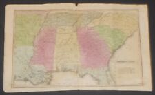
 1872 Antique Map Southern U.S. States Map Approx 8”x10.25” Drawing Instructions
-
$50.71 CAD
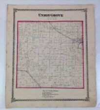 Antique 1874 Map of Union Grove County Illinois - by Warner & Beers, Chicago
-
$21.87 CAD
 Wisconsin & Minnesota Vintage 1894 MAP ~Unique Atlas ~ Original Color Map
-
$50.71 CAD
 Antique 1874 Map of Clyde County Illinois - Publishers Warner & Beers, Chicago
-
$57.58 CAD
 Original 1871 Norfolk County Map,Matted,Norwood,Dedham,Norwood,Walpole,Mass,MA
-
$47.97 CAD
 1895 Rand McNally Atlas of the World / CALIFORNIA / 21x29”
-
$30.15 CAD
 USGS Historic Trail Map of Leadville Colorado Ute Res Mining RR Wagon Trail
-
$50.71 CAD
 Antique 1874 Map of Montmorency County Illinois - Published by Warner & Beers
-
$32.56 CAD
 Antique Map Business Notice Fairmount Township from 1873 Atlas page 173 PA
-
$27.40 CAD
 1835 Bradford’s Atlas Distance Direction Places From New York
-
$50.71 CAD
 Antique 1874 Map of Jordan County Illinois - Publishers Warner & Beers, Chicago
-
$94.59 CAD
 1879 Original Brockton & Abington Map,Mass MA,Old,Vintage,Main Montello Streets
-
$3.96 CAD
 1873 Warner & Beers Illinois Atlas Pg ~ Pike Scott Morgan Greene Jersey Calhoun
-
$54.82 CAD
 2 - 1877 Maps of Manchester in Carroll County, MD by Lake Griffing & Stevenson
-
$13.71 CAD
 1835 Smith's Atlas W. Marshall & Co. Map of Southern U.S. Carolinas to Louisiana
-
$20.49 CAD
 71 Historic Nautical Atlases 1500's to 1800's North America Indies Cuba CD - B93
-
$34.27 CAD
 1872 RARE BEAUTIFUL ANTIQUE MCNALLY ATLAS CHART OF OCEAN BASINS -HANDCOLORED
-
$34.27 CAD
 Nice 1895 antique colored map of the city of Cleveland, Atlas of the World
-
$125.01 CAD
 Original 1873 MAP BROOKLYN KINGS COUNTY FLATLANDS CANARSIE Canarsee Kanawsee
-
$28.35 CAD
 Old 1889 Cram's Atlas Railroad & County Map ~ CONNECTICUT ~ Free S&H
-
$47.98 CAD
 1876 org. Plat Atlas pg. CANNONSBURG, CEDAR SPRINGS, GRANDVILLE, Kent Co. MI map
-
$212.48 CAD
 Antique MAP - BURLINGAME, MELVERN, PETERTON, OSAGE, CARBON - 1887 KANSAS ATLAS
-
$123.38 CAD
 Antique Map - LASALLE, OTTAWA Illinois - Warner & Beers/Union Atlas Co. 1876


