 Antiques (CA)
-
$6814.42 CAD

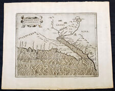 1597 Cornelis Wytfliet Rare Antique Map of California Texas & SW North America
-
$34.35 CAD
 C. 1873 Hand-Colored Atlas Map Of Wright Twp., Luzerne Co., PA 11.75 x 15.25”
-
$48.18 CAD
 C. 1869 Hand-Colored Atlas Map Of Burlington & W. Burlington, PA 11.75 x 15.25”
-
$68.76 CAD
 1898 - Map - Franklin County, Missouri -Cities of New Haven; Stanton; Beemont PO
-
$68.83 CAD
 C. 1864 Hand-Colored Atlas Map Of Warwick Twp., Lancaster Co., PA 15.75 x 15.25”
-
$48.18 CAD
 C. 1873 Hand-Colored Atlas Map Of Logan & Altoona, PA 12.75 x 15.25”
-
$48.18 CAD
 C. 1864 Hand-Colored Atlas Map Of Brecnock, Lancaster Co., PA 15.75 x 15.25”
-
$48.18 CAD
 C. 1870s Hand-Colored Atlas Map Of Covington, Lackawanna Co., PA 12.25 x 15.25”
-
$48.18 CAD
 C. 1870s Hand-Colored Atlas Map Of Bart Twp., Lancaster Co., PA, 15.25 x 15.25”
-
$68.83 CAD
 C. 1865 Hand-Colored Atlas Map Of The Erie Reserve Addition 15.25 x 15.25”
-
$68.83 CAD
 C. 1865 Hand-Colored Atlas Map Of Waterford, Erie County, PA 15.5 x 15.25”
-
$406.11 CAD
 Ortelius Pl. 2 – Map of Europe from the world’s first atlas
-
$68.83 CAD
 C. Hand-Colored Atlas Map Of Sugar Loaf Twp., Luzerne Co., PA 12.75 x 15.25”
-
$48.18 CAD
 C. 1873 Hand-Colored Atlas Map Of Buck Township, Luzerne Co., PA 12.5 x 15.25”
-
$48.18 CAD
 C. 1864 Hand-Colored Atlas Map Of Colerain, Lancaster Co., PA 15.75 x 15.25”
-
$48.18 CAD
 C. 1873 Hand-Colored Atlas Map Of Butler, Luzerne County, PA 12.25 x 15.25”
-
$68.83 CAD
 C. 1870s Hand-Colored Atlas Map Of Greenfield Twp., Erie Co., PA 14.75 x 15.25”
-
$61.95 CAD
 C. 1864 Hand-Colored Atlas Map Of Union Mills, Erie County, PA 15.25 x 15.25”
-
$68.83 CAD
 C. 1875 Hand-Colored Atlas Map Of Tioga County, PA Small Towns 23.75 x 15.75”
-
$68.83 CAD
 C. 1864 Hand-Colored Atlas Map Of Upper Leacock, Lancaster, PA 15.75 x 15.75”


