 Antiques (CA)
-
$383.99 CAD

 Antique English Nautical Charts 1787 + 1794 Shetland Islands North Sea 1812
-
$205.72 CAD
 1952 US ARMY LAKE SURVEY CHARTS OF NEW YORK CANALS Erie Canal Champlain Seneca
-
$34.12 CAD
 1989 Upper Mississippi River Navigation Charts U.S. Army Corps of Engineers
-
$80.92 CAD
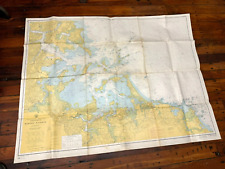
 RI Mass 1973 nautical Noaa chart narragansett bay  36 by 48 navigation map
-
$44.67 CAD
 NOAA Nautical Chart of Lake Huron # 14913 Lake Michigan Grand Traverse Bay
-
$34.29 CAD
 Army Corps of Engineers Barge Canal Navigation Charts NY State 1964
-
$41.06 CAD
 NAUTICAL CHART MAP #1124 WHITE HEAD ISLAND TO BERRY HEAD 1956-1967
-
$68.57 CAD
 LOT OF NAVIGATIONAL CHARTS FLORIDA KEYS BIMINI AND MIAMI
-
$26.87 CAD
 1859 Virginia and North Carolina Coast Survey Sketch D Section No. IV Progress
-
$14.39 CAD
 Sunken Buried Treasure Shipwreck Map Pirates Captain Kidd Blackbeard Calico Jack
-
$68.01 CAD
 1864 Coast Survey Chart, St. George's River and Muscle Ridge Channel Maine Map
-
$16.27 CAD
 Nautical Chart Florida 1997 St. Lucie To Ft. Myers Lake Okeechobee
-
$18.62 CAD
 Vintage Navigational Condition Report Chart Kieler Forde Germany Nautical Chart
-
$131.59 CAD
 Admiralty 1950 NORTH ATLANTIC OCEAN ARQUIPELAGO DOS ACORES Map Chart Maritime
-
$29.49 CAD
 Lot of 50+ VTG Lake Erie Fishing/Nautical Maps Chart Poster 29” x 23” See Pics
-
$274.28 CAD
 Key West Harbor NOAA Florida Keys Nautical Chart 37 X 44 Rare 1986 Vintage GC FS
-
$20.57 CAD
 Vintage 1960’s South Florida & Miami Area Fishing Charts 6 Maps Tackle Pub.
-
$19.13 CAD
 1639 Virginia and New England Historic Vintage Style Wall Map - 16x24
-
$27.42 CAD
 Vintage Hydrographic Chart Phoenix Islands South Pacific Ocean 1943 WW2
-
$34.27 CAD
 Nautical Map Hawaiian Islands North Pacific Ocean 1975 #19008 large 41" x 58"
-
$50.74 CAD
 Vintage 1928 Cape Hatteras Wimble Shoals Ocracoke Inlet Nautical Map - 44” x 36”
-
$24.62 CAD
 1583 Earliest European Sea Chart Historic Vintage Style Wall Map - 20x28
-
$17.27 CAD
 1856 Papeete Island of Tahiti Tidal Observations U.S. Coast Survey Moon Phases
-
$98.74 CAD
 1888 Chart of the Pacific Coast from San Diego to Pt. Buchon, Season of 1888-89
-
$27.36 CAD
 Vintage Nautical Map North Carolina Cape Hatteras, Cape Henry To Cape Fear
-
$41.13 CAD
 Lot of 4 Vintage Nautical Charts Maps - Sandy Hook, Chesapeake Bay
-
$34.29 CAD
 1986 Straits Of Florida & Approaches Chart Marine Soundings In Fathoms.43X36”
-
$27.42 CAD
 VTG Hydrographic Chart Enderbury Island to Christmas Island Pacific Ocean 1940s
-
$363.43 CAD
 1853 MAURY'S STORM and RAIN NAVIGATIONAL CHART ~ THE NORTH ATLANTIC ~ SERIES E
-
$105.53 CAD
 Admiralty 980 PHILIPPINE ISLANDS LUZON WEST COAST SUBIC BAY Map Chart Maritime
-
$253.72 CAD
 ORIGINAL ANTIQUE MAP NAUTICAL CHART Bahama Islands Exuma Sound Eastern Approach
-
$105.53 CAD
 Admiralty 4962 Approaches To/ Approches A Vancouver Harbour Vintage Ships Map
-
$25.00 CAD
 Antique Nautical Chart - Ca.1915 Nova Scotia Baccarro Point To Ram Island Map #3
-
$36.96 CAD
 1639 Island of Cuba Caribbean Ocean Exploration Map - 24x42
-
$46.90 CAD
 1965 Marine Geology 70 Pgs, Oceanographic Atlas North Atlantic, 18 Color Charts
-
$2537.18 CAD
 Antique 1926 Map of Nantucket by Tony Sarg
-
$54.86 CAD
 4 Canadian Nautical Charts Howe Sound to Cordero Channel
-
$145.00 CAD
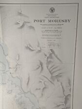 Vintage US Navy WWII Nautical Chart of Papua New Guinea - Port Moresby WW2 Naval
-
$54.86 CAD
 Recreational Chart Book 400 Detroit River, Lake St. Clair & St. Clair River
-
$226.29 CAD
 ORIGINAL ANTIQUE MAP NAUTICAL CHART Charleston Light to Cape Kennedy Hilton Head
-
$15.00 CAD
 GPS Garmin G2 chart card - GULF OF MEXICO VUS515L -BROWNSVILLE TX TO KEY LARGO
-
$24.69 CAD
 Chart Kit Norfolk VA to Jacksonville FL Intracoastal Cruising Sailing Map
-
$61.72 CAD
 Vintage Nautical Charts Maine Casco Bay • Large 46"x36"
-
$28.80 CAD
 NAVIGATIONAL CHART / MAP # 515 -MALI LOSINJ & PRIZNA TO ZADAR - YUGOSLAVIA
-
$41.13 CAD
 Rare Vintage 1949 United States US Navy Military North Pacific Pilot Chart Map
-
$32.91 CAD
 Vintage Nautical Chart # 14965 Lake Superior Redridge to Saxon Harbor 1976
-
$34.27 CAD
 Nautical Map Mexico & Central America 1940 US Navy large 33" x 48" H.O. 1007
-
$34.27 CAD
 Nautical Map Prince of Whales Channel & Approaches # 74292 1972 US Navy 36"x 53"
-
$75.42 CAD
 1930 Nautical Chart Map South Atlantic Ocean 1071 Map Feb 38th Ed. 54"x 36"
-
$34.27 CAD
 Nautical Map Fiji Islands Kandavu Island & Passage 1949 # H.O.2858 33" x 48"
-
$4.10 CAD
 Vtg Nautical Chart: C&GS 880/879 Louisiana Intracoastal Waterway
-
$34.27 CAD
 Nautical Map New Guinea Banda Sea to Solomon Island 1969 #630 large 36" x 54"
-
$5.49 CAD
 Chart of the Alaska Coast - 1593 - de Corneille - Navigational Map - 13”x9.75”
-
$47.99 CAD
 1955 West Indies Haiti Nautical Chart Map Ft Liberte to Ile Tortuga 465 Map
-
$19.13 CAD
 1650 Map of California shown as an Island! Unusual Error Map - 16x24
-
$4.10 CAD
 Vtg Nautical Chart: C&GS 1253 East Cape to Mormon Key
-
$19.13 CAD
Sea Chart of Europe 1583 Vintage Style Navigational Map - 18x24
-
$16.27 CAD
 Nautical Chart Florida 1995 Palm Shores To West Palm Beach
-
$20.57 CAD
 Vintage 1960-1961 Lake Winnipesaukee Navigation Chart
-
$46.63 CAD
 1964 Watch Hill Rhode Island to New Haven Connecticut Nautical Chart
-
$23.31 CAD
 Vintage Bahamas Nautical Sketch Chart Map - Elizabeth Harbour To Hog Cay - 11x17
-
$27.35 CAD
 NAUTICAL CHART MAP #1074 CANSO HARBOUR & APPROACHES 1955 TO 1965
-
$34.29 CAD
 Vintage Nautical Chart 12346 Hudson River Yonkers Piermont. NOAA 1984 24.5" x48
-
$19.13 CAD
 1639 “Atlantic Coast of North America” Vintage Style Early Land Map - 16x24
-
$23.31 CAD
 Vintage Bahamas Nautical Sketch Chart Map - Allan’s Highborne - 11x17
-
$13.58 CAD
 Vintage Vancouver Canada Washington Nautical Chart Map 1983 Haro Strait
-
$23.31 CAD
 Vintage 1987 Approaches To Andres Caribbean Sea Nautical Chart Map - 48”x35”
-
$45.26 CAD
 Vintage 1931 Approaches To Cape Fear River Nautical Chart Map - 45.5” x 35”
-
$45.26 CAD
 Vintage 1962 Massachusetts Woods Hole Nautical Chart Map - 30” x 45”
-
$1.36 CAD
 Vintage Nautical Chart 14851 Michigan Lake St Clair 4th ed Aug 1975 NOAA
-
$34.27 CAD
 Nautical Tracking Chart #5405-44M 1963 large 36" x 54"
-
$45.26 CAD
 Vintage 1929 Fenwick Island Light Chincoteague Inlet Nautical Chart Map -41”x35”
-
$71.30 CAD
 1897 Chart showing Light Stations in Long Island Sound - Darrow & Comstock Ad.
-
$56.78 CAD
 1959 Nautical Chart BOSTON HARBOR 45"W x 35"H Colored, Used, Points of Interest
-
$6.86 CAD
 NOAA Chart 11466 Jupiter Inlet To Flowley Rocks
-
$23.31 CAD
 NAUTICAL NAVIGATIONAL CHART # 11485 - TOLOMATO RIVER TO PALM SHORES - FLORIDA
-
$48.00 CAD
 1947 Tidal Current Charts Long Island Sound & Block Island Sound 6 Pgs/12 Charts
-
$50.74 CAD
 Vintage 1960 Deer Island Casco Passage Maine Nautical Chart Map - 35”x 22”
-
$25.99 CAD
 1650 Bahamas Caribbean Historic New World Map - 20x30
-
$20.57 CAD
 NAVIGATIONAL CHART # 3102 - TAKORADI & SEKONDI BAY W. COAST AFRICA GHANA - 1967
-
$41.14 CAD
 C&GS Coastal Map - Chesapeake Bay Entrance #1222, 1973, 37th Edition 35”X 45”
-
$28.80 CAD
 1855 USCS Map New Jersey, Long Island, New York, Connecticut, Hudson River
-
$376.46 CAD
 1950's Florida Intracoastal Waterway Nautical Charts, Group of 14
-
$32.91 CAD
 KNIGHT INLET Nautical Chart GILFORD ISLAND Map 46"x33" BRITISH COLUMBIA Canada
-
$22.60 CAD
 4 Pirate Wall Art Posters Treasure Chest Map Weapons Pistol Sword Gun Home Decor
-
$23.31 CAD
 Vintage Bahamas Nautical Sketch Chart Map - Hog Cay Cut - 11x17
-
$34.27 CAD
 Vintage Nautica Chart 837-SC, August 1971, SC Intracoastal Waterway.
-
$5.49 CAD
 Chart of the New World - 1526 - Juan Vespucci - Navigational Map - 13”x9.75”
-
$23.31 CAD
 Vintage Bahamas Nautical Sketch Chart Map - Rum Cay - 11x17
-
$26.06 CAD
 1854 USCS Coast Survey Diagram Sea Coast Tide Gauge Underwater View
-
$48.00 CAD
 Nautical Chart/Map of Rhode Island’s Point Judith Harbor
-
$27.43 CAD
 Nautical Chart Catalog 2 Pacific Coast Hawaii Guam April 1979
-
$25.99 CAD
 Vancouver Island British Columbia Nautical Chart 3001 1971
-
$32.91 CAD
 C&GS Coastal Map - Chesapeake Bay - Mobjack Bay To York River #494 18th Ed. 1973
-
$23.30 CAD
 Florida Soundings in Fathoms at mean low water Place mat Map Mercator projection
-
$61.70 CAD
 Rare Vintage 1945 United States US Navy Military North Atlantic Pilot Chart Map
-
$30.17 CAD
 C&GS Coastal Map - New Jersey/Delaware- Cape May To Fenwick #12244 28th Ed. 1975
-
$32.91 CAD
 Vintage 28 x 45 Nautical Map Port of Cairns 1970s
-
$118.56 CAD
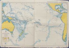 Admiralty 4007 A PLANNING CHART FOR THE SOUTH PACIFIC OCEAN Map Chart
-
$105.53 CAD
 Admiralty 3150 MOBILE BAY UNITED STATES - GULF OF MAXICO MARINE GENIUS Map Chart


