 Antiques (CA)
Africa Maps
Asia Maps
Australia/Oceania Maps
Celestial Maps
Central America/Caribbean Maps
Curiosities Maps
Digital Maps
Europe Maps
Map & Globe Mixed Lots
Map & Globe Reproductions
North America Maps
South America Maps
World & Celestial Globes
World Maps

-
$41.11 CAD

 1984 Lanai Hawaii Map by Defense Mapping Agency
-
$34.18 CAD
 1890s - Asia - Vintage Map ORIGINAL 11.5 x 9.5"- C11-2
-
$41.11 CAD
 1987 Oahu Hawaii Map by Defense Mapping Agency
-
$9.59 CAD
 Handsome Vintage Color World Map of Distribution of Volcanoes and Earthquakes
-
$16.24 CAD
 Venice California 1965 Original Vintage USGS Topography Map 22w X 27t
-
$75.49 CAD
 1951 City Map Of Central Tokyo
-
$4.12 CAD
 1897 Map of Tyrol aka Trentino antique print Austria Italy
-
$27.44 CAD
 Vintage 1956 Original Kentucky Map US Dept Of Interior 30x15
-
$6.86 CAD
 1897 MAP OF THE HISTORY OF EUROPEAN TURKEY Original antique Greece
-
$2.25 CAD
 BBC Alistair Cooke's America map 1972
-
$68.61 CAD
 Lot Of 10 Vintage Topographical Maps Of Ontario Canada, Fly In Fishing, Canoe,
-
$27.38 CAD
 Pelham, Georgia 1971 Original Vintage USGS Topo Map
-
$20.57 CAD
 KANSAS Ruth Taylor VINTAGE ORIG Cartoon Map 1935 Litho JAYHAWKS Exc Cond TOPEKA
-
$15.15 CAD
 USGS Topographic Map 1984 Survey 30"x60" VA Richmond 37077-E1-TM-100
-
$41.04 CAD
 1928 LIEPZIG BATTLE OF 181 Vintage Map Germany Europe ORIGINAL C11-6
-
$31.22 CAD
 Vintage 1954-55 Straights of Florida USC&GS #1002 Map
-
$27.38 CAD
 Whigham, Georgia 1974 Original Vintage USGS Topo Map
-
$27.38 CAD
 Thomasville, Georgia 1975 Original Vintage USGS Topo Map
-
$30.06 CAD
 Early 1900s - Antartic Maps - Original Vintage Geography Map - C13
-
$3.09 CAD
 Karte Des Kreises Rees Map Lindemann & Ludecke, Berlin-West Date Unkown
-
$30.06 CAD
 1910s KONIGSBERG VINTAGE MAP Prussia Kaliningrad City Russia ORIGINAL C10-1
-
$24.64 CAD
 Kent Conn. 1955 Original Vintage USGS Topo Map 27x22 inches
-
$9.61 CAD
 1896 MAP of AUSTRIA UNDER THE ENNS original antique print
-
$30.06 CAD
 1899 SOVIET EASTERN EUROPE Vintage Geographical Map Russia Soviet Original C11-9
-
$34.24 CAD
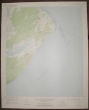
 Quinton Oregon and Washington 1971 Original USGS Topographical Topo Map
-
$27.44 CAD
 1957 CANADA AIRLINES MAP Scheduled & Non-Scheduled Routes / Trunk & Feeder Lines
-
$34.24 CAD
 Sundale NW Oregon and Washington 1971 Original USGS Topographical Topo Map
-
$192.15 CAD
 Vtg Lot of (7) California 1920s USGS Topographic Quad Map-Sierra Forest & Area
-
$171.56 CAD
 Original antique map of 1935 SAN DIEGO CALIFORNIA 25.5" x 18.5"
-
$41.11 CAD
 1982 Kahoolawe Hawaii Map by Defense Mapping Agency
-
$34.31 CAD
 6 VINTAGE PA. USGS TOPOGRAPHIC GEOLOGIC SURVEY MAPS Lehigh Co. Water Resources
-
$54.89 CAD
 North Creek, NY Topographical Map Thurman, Johnsburg, Warrensburg, Chestertown
-
$34.18 CAD
 1896 BERLIN Vintage MAP Germany City Surrounding ORIGINAL 11.5 x 9.5 Color C11-5
-
$34.24 CAD
 Esau Canyon Oregon 1969 Original USGS Topographical Topo Map John Day River
-
$16.47 CAD
 Vintage 1928 Elyria Oh. Zoning Map Street Council Officials Signed Amendments
-
$27.45 CAD
 Vintage 1913 USGS Topo Map San Jose California 16.5 X 20"
-
$34.18 CAD
 1906 AFRICA Vintage Map Cape Town Windhoek Morocco ORIGINAL 11.5 x 9.5"- C10-9
-
$4.12 CAD
 1897 Map of Plan of the old and new Syracuse Original antique print Italy Sicily
-
$46.67 CAD
 Indiana - Oolitic Quadrangle (1935 survey) Original...
-
$41.04 CAD
 1902 EUROPE CONTINENT Vintage Geographical Map Color 9.5 x 11.5 ORIGINAL C12-7
-
$8.24 CAD
 1896 Map of MOSCOW antique print Russia
-
$75.49 CAD
 Blondel Peltier Birds Eye View of Paris Plan du Centre du Paris a Vol Map 1981
-
$30.06 CAD
 1890-1920s ORIGINAL VINTAGE MAP - Stettin, Poland - C10-4
-
$4.12 CAD
 1897 Map of STYRIA. antique print Austria
-
$27.38 CAD
 Georgetown South, South Carolina 1943 Revised 1973 Original USGS Topo Map
-
$23.33 CAD
 1896 Map of CONSTANTINOPLE aka Istambul antique printTurkey Greece
-
$9.61 CAD
 1896 Map PLAN OF VIENNA. antique print Austria
-
$34.24 CAD
 McDonald Oregon 1964 Original USGS Topographical Topo Map John Day River
-
$27.38 CAD
 Lake Lucerne, Wisconsin Original Vintage 1965 USGS Topo Map 27" x 22"
-
$9.61 CAD
 1896 MAP of AUSTRIA-HUNGARY . original antique print
-
$41.04 CAD
 1946 ILLINOIS STATE Cultural Thematic Map Chromo Litography C13-2
-
$34.18 CAD
 1890 ISTRIA Vintage Map Croatia Italy Island ORIGINAL 11.5 x 9.5 Color C10-6
-
$27.38 CAD
 Mineral Bluff, Georgia- NC, Tenn. 1941 revised 1973 Original Vintage USGS Map
-
$34.18 CAD
 1905 SWEDEN Vintage Map Norway Scandinavia ORIGINAL 11.5 x 9.5 Color C10-6
-
$6.86 CAD
 1897 MAP OF SPAIN & PORTUGAL Original antique print
-
$10.23 CAD
 Kennebunk ME Maine 16.5" X 20" Vintage 1944 USGS Topographic Topo Map
-
$82.34 CAD
 1964 VINTAGE McCormick's & Co. PICTORIAL WORLD MAP Coffee~ Spice Trade Routes
-
$34.18 CAD
 1906 - ST. PETERSBURG Russia Vintage Geography Map ORIGINAL 11.5 x 9.5" - C11-4
-
$20.57 CAD
 VINTAGE MAMMOTH CAVE KY KENTUCKY ORIGINAL 1922 USGS 17X21 QUADRANGLE MAP
-
$20.57 CAD
 MISSOURI Ruth Taylor VINTAGE ORIGINAL Cartoon Map 1935 6 Color Litho EX COND
-
$61.76 CAD
 Vintage 1936 Map Walworth County WI Vote For Joseph A. Dorr For Sheriff
-
$343.13 CAD
 vintage 1949 SOUTHERN PACIFIC RAILROAD Division Maps Book ▪ Pacific Electric Ry
-
$34.30 CAD
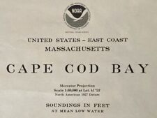 1977 Sea Chart Cape Cod Massachusetts USA Vintage Original Map Coastal Sailing
-
$23.32 CAD
 Vintage Telico Project Tennessee TVA Topographic Map 1965 Printed 1964 22x34
-
$65.88 CAD
 1998 California Map Newport Beach SAN DIEGO Los Angeles Santa Monica BEAUTIFUL
-
$32.94 CAD
 Lot of 3 Vintage USGS Topographic Maps Vermont 1957, 1966, '71, Series V813 GUC
-
$27.38 CAD
 Magnolia Beach, South Carolina 1943 Revised 1973 Original Vintage USGS Topo Map
-
$34.18 CAD
 1895 CHINA JAPAN Vintage Map Mongolia East Asia ORIGINAL 11.5 x 9.5 Color C10-8
-
$34.18 CAD
 1902 INDUSTRIAL MAP GERMANY Vintage Economical ORIGINAL 11.5 x 9.5" C11-8
-
$28.82 CAD
 1946 Original Classic B&W Litho Map ORCAS ISLAND, WA Ye Old Map Of Orcas Island
-
$823.50 CAD
 1807 Yorktown River Attack in Virginia by JOHN MARSHALL, Revolutionary War MAP
-
$27.44 CAD
 MAMMOTH ARIZONA ORIGINAL 1948 USGS QUADRANGLE 27X22 FOLDED MAP EXCELLENT
-
$20.57 CAD
 INDIANA Ruth Taylor VINTAGE ORIG Cartoon Map 1935 Litho EX COND Hoosiers PACERS
-
$27.44 CAD
 Vintage Aeronautical Chart La Grande Oregon Bordering Idaho Washington 1950s
-
$34.18 CAD
 1900 GERMANY GEOLOGICAL MAP Vintage Alps Bavaria ORIGINAL 11.5 x 9.5"- C11-3
-
$34.18 CAD
 1924 PRAGUE Czech Republic Vintage City Map ORIG Color 11.5 x 9.5 C13-3
-
$34.18 CAD
 1897 SLESIA BOHEMIA MORAVIA Czech Republic Vintage Map ORIG 11.5 x 9.5 C11-9
-
$13.71 CAD
 Vintage Columbus Georgia Topographic Map, by Defense Mapping Agency, MR7
-
$30.06 CAD
 Early 1900s - Antartic Maps - Original Vintage Geography Map - C10-3
-
$61.76 CAD
 Lot 10 Different Vintage USGS Arizona State Topographic Maps 1910-50's 2
-
$34.18 CAD
 1890 European Vintage Map Karten Register I ORIGINAL 11.5 x 9.5 Color C10-6
-
$164.69 CAD
 1937 Milwaukee Sentinel Wisconsin Map with Historical References 27 x 32 Bohlman
-
$9.61 CAD
 1896 Map OVERVIEW PLAN OF VIENNA. antique print Austria
-
$5.49 CAD
 1897 Map of KRAIN . antique print Slovenia Austria Italy
-
$30.06 CAD
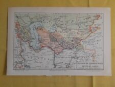 1904 RUSSIAN CONQUEST Central Asia Vintage Geographical Map ORIGINAL C11-6
-
$61.76 CAD
 Lot 10 Different Vintage USGS Washington State Topographic Maps 1910-50's 8
-
$308.81 CAD
 1936 EUROPE / N. ATLANTIC MAP with VARIOUS COUNTRIES ARMY & NAVY ARMAMENTS SHOWN
-
$34.18 CAD
 1890 THURINGIA GEOLOGICAL MAP Vintage Germany ORIGINAL 11.5 x 9.5"- C12
-
$27.38 CAD
 Clarksville South, Virginia- NC 1968 Photoinspected 1988 Original USGS Topo Map
-
$32.80 CAD
 1877 London United Kingdom - Vintage City Map ORIGINAL 11.5 x 9.5" - C12-9
-
$41.11 CAD
 Hilton Head, South Carolina 1956 Revised 1971 Original Vintage USGS Topo Map
-
$27.45 CAD
 Vintage 1904 USGS Kaiser, Shaver Lake California Topo Map - 16.5" x 20"
-
$34.31 CAD
 Vintage 1961 USGS Topo Map El Centro Calif. / Arizona 34 X 24" Yuma/ Sand Hill
-
$24.02 CAD
 1948 PHYSIOGRAPHIC PROVINCES & DIAGRAM 2-SIDED MAP OF NORTH AMERICA READ!!
-
$20.59 CAD
 Vintage 1964 USGS Topo Shadow Mountain, Moja Desert, California 17 X 21"
-
$548.99 CAD
 RARE original political 1918 MAP OF THE IRISH REPUBLIC in color wb
-
$61.76 CAD
 Florida Lake Jesup Seminole County 1940’s Map
-
$34.18 CAD
 1896 WORLD FOOD COMMERCIAL PRODUCTS Map Vintage Eng ORIGINAL 11.5 x 9.5" C11-5
-
$41.16 CAD
 Whitehall NY Topography Map Lake Champlain, Lake George, Putnam, Dresden, Benson
-
$34.31 CAD
 Antelope Valley Kern Country Los Angeles California Vintage Real Estates Map 60s


