 Antiques (CA)
Africa Maps
Asia Maps
Australia/Oceania Maps
Celestial Maps
Central America/Caribbean Maps
Curiosities Maps
Digital Maps
Europe Maps
Map & Globe Mixed Lots
Map & Globe Reproductions
North America Maps
South America Maps
World & Celestial Globes
World Maps

-
$47.68 CAD

 1878 Blackfoot Basin Idaho Map Soda Springs Georgetown Bear River EXPLORATION
-
$43.74 CAD
 1871 Tehuantepec Expedition River Map 52" x 22.5" Chart of Coatzacoalcos River
-
$79.28 CAD
 1877 WYOMING Map ORIGINAL Green River Basin Rocky Mountains Bitter Root
-
$16.40 CAD
 Large 1882 Antique Map: Mississipi River Delta to Memphis 13
-
$47.84 CAD
 RIO SAN GABRIEL, CALIFORNIA, FROM EMORY. 1848, MEXICAN WAR, CALIFORNIA.
-
$68.34 CAD
 SUDAN MAP OF WHITE NILE RIVER LANDS 1919 100 X 50 CM
-
$68.34 CAD
 SUDAN MAP GEBEL AULIA DAM 1918
-
$820.11 CAD
 1807 Yorktown River Attack in Virginia by JOHN MARSHALL, Revolutionary War MAP
-
$68.34 CAD
 SUDAN MAP KEY MAP OF THE RIVER NILE - AHGLO - EGYPTIAN 1920
-
$68.34 CAD
 SUDAN MAP GEZIRA IRRIGATION SCHEME 1918
-
$68.34 CAD
 SUDAN MAP GEZIRA IRRIGATION SCHEME 1918
-
$68.34 CAD
 SUDAN MAP GEZIRA IRRIGATION SCHEME 1920 .
-
$478.38 CAD
 3 - Potomac Anacostia Rivers & Rock Creek Maps Washington D.C. c. 1880s
-
$17.99 CAD
 Australian Fishing Network Hawkesbury River and Pittwater Fishing Map 29
-
$248.75 CAD
 VTG CIVIL WAR MAP! REBEL FORTIFICATIONS ON THE MISSISSIPPI RIVER AT NEW MADRID!
-
$17.99 CAD
 Highly Detailed Batemans Bay Fishing Map Including Clyde and Moruya River
-
$68.34 CAD
 SUDAN MAP VALLEY OF BLUE NILE FROM SINGA TO MAKWAR 1920
-
$68.34 CAD
 SUDAN MAP PROPSED SENNAR DAM SITE PLAN 1918
-
$23.24 CAD
 1892 Volga River near Saratov Plan, Antique Print Russia
-
$27.34 CAD
 Vintage 1936 USGS Seiad, California Klamath River Topo Map - 16.5" x 20"
-
$68.34 CAD
 SUDAN MAP CROSS SECTIONS OF WHITE NILE 1918
-
$23.24 CAD
 1892 Vyshny Volochyok Storage Reservoirs Plan, Antique Print Russia
-
$12.29 CAD
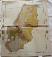
 Color Soil Survey Map Grand Island Sheet Nebraska Shelton Wood River Abbott 1903
-
$68.34 CAD
 SUDAN MAP PROPSED SENNAR DAM SITE PLAN 1918 ..
-
$34.03 CAD
 1903 Antique Map Nebraska Grand Island Alda Doniphan Wood River 30 X 20 #9968
-
$39.97 CAD
 1902 Antique Map Arizona Yuma Colorado River 15 X 18" #8804
-
$20.50 CAD
 Vintage 1931 USGS Topo Map Wellington, Nevada Walker River 16.5 X 20"
-
$102.50 CAD
 1945 Map of Nanjemoy Maryland - Potomac River; Mallows Bay; Nanjemoy Creek
-
$17.66 CAD
 Highly Detailed Batemans Bay Fishing Map Including Clyde and Moruya River
-
$19.12 CAD
 Australian Fishing Network Highly Detailed Macleay River/South West Rocks Map
-
$19.12 CAD
 Australian Fishing Network Hawkesbury River and Pittwater Fishing Map 29
-
$750.26 CAD
 1878-88 US Coast Survey 3 x Sheet Very Large Antique Map of The Delaware River
-
$32.80 CAD
 1856 Cape Florida to Tortugas Island MAP US Coast Survey Sketch F - 33"x 23"
-
$16.40 CAD
 1884 MAP Baedeker - GERMANY Boppart & St. Goar Rhine River
-
$41.01 CAD
 Maps Showing Location of Work Done in White River, Arkansas 1896
-
$61.44 CAD
 1855 Jeff Davis Map from Mississippi River to Pacific Ocean, R/R Route, Map #2
-
$38.26 CAD
 Original 1842 Arrowsmith Map SOURCES OF THE BLUE NILE Ankóber to Gédem Ethiopia
-
$16.40 CAD
 1884 MAP Baedeker - GERMANY Rhine River Between Koblenz Nassau Limburg Wetzlar
-
$17.66 CAD
 Australian Fishing Network Hawkesbury River and Pittwater Fishing Map 29
-
$17.66 CAD
 Australian Fishing Network Highly Detailed Macleay River/South West Rocks Map
-
$61.51 CAD
 Color Soil Survey Map Yuma Sheet Arizona California Gila Colorado River 1904
-
$34.03 CAD
 1902 Soil Map Vernon Texas Fargo Tolbert Doans Red RIver Approx 22 X 25 #10246
-
$60.14 CAD
 CAPE FEAR RIVER Map North Carolina Mercator Projection
-
$40.87 CAD
 1901 Antique Map Idaho Caldwell Nampa Roswell Snake River 30X20 #4695
-
$61.51 CAD
 Color Soil Survey Map Buckeye Sheet Arizona Powers Butte Evans Gila River 1900
-
$34.17 CAD
 MAP ASSUAN (Egypt), Insel Philae Isis-Tempel 15 X 20 cm
-
$20.49 CAD
 1940 St. Lawrence River Survey Map - Sheet #20 with Cornwall Highlights
-
$54.67 CAD
 1890 US Coast & Geodetic Survey Map #17 Mendocino to Umpqua River CA & OR
-
$54.67 CAD
 1890 US Coast & Geodetic Survey Map #4 St Croix & Hudson Rivers Lake Ontario
-
$47.84 CAD
 Improvement of Saint John's River, Florida, 1888
-
$47.84 CAD
 Nomini Creek and Lower Machodoc River, Virginia, 1889
-
$41.01 CAD
 Cape Fear River, North Carolina, Above Willmington - Shoals and Jetties 1889
-
$41.01 CAD
 Lockwoods Folly River, North Carolina, 1895
-
$80.81 CAD
 1891 MAP ~ PROVINCE OF QUEBEC ~ GULF OF ST LAWRENCE RIVER LAWRENCE ETC
-
$54.67 CAD
 1890 US Coast & Geodetic Survey Map #5 Between Atlantic Coast & Ohio River.
-
$54.67 CAD
 1890 US Coast & Geodetic Survey Map # 6 Between Ohio & Mississippi Rivers
-
$102.51 CAD
 ORIGINAL 1980's DEUTSCHE COLOR LITHO MAP "DIE WEINBEREGSLAGEN DES RHEINGAUS"
-
$47.84 CAD
 New Castle Ice Harbor, Showing Dredging of 1887
-
$47.84 CAD
 Mississippi River, Lower Part of Fort Chartres & Ste. Genevieve, June 30th 1896
-
$20.49 CAD
 1963 Iroquois Lock to Prescott St. Lawrence River Survey Map
-
$47.84 CAD
 Improvement of East River and Hell Gate New York, Removal of Flood Rock - 1886
-
$75.18 CAD
 Cape Fear River, N.C., Below Wilmington, Ocean Bar, 1893
-
$47.84 CAD
 Improvement of East River and Hell Gate New York, 1886
-
$54.67 CAD
 Potomac River at Washington D.C., Showing Condition of Work, June 30th, 1896
-
$47.84 CAD
 Brunswick Harbor, Georgia, Chart Showing Condition of Improvement to June 1886
-
$47.84 CAD
 Entrance to Port Jefferson Harbor, New York, Condition of Improvement 1886
-
$47.84 CAD
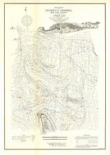
 Improvement of Gedney's Channel, New York Harbor 1886
-
$41.01 CAD
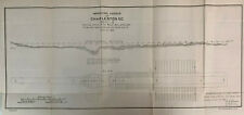 Improving Harbor at Charleston South Carolina, 1886 (sheet 3)
-
$54.67 CAD
 Map of York River in the Vicinity of West Point, Virginia, 1886
-
$47.84 CAD
 Mouth of Housatonic River, Connecticut, Condition of Improvement, 1886
-
$219.14 CAD
 1868 HAND COLOURED MAP ~ ENGLISH CHANNEL ~ FRANCE RIVER SOMME
-
$47.84 CAD
 Railroad Jetty at Macon Point, North Carolina 1889
-
$61.51 CAD
 Map of Mississippi River from Meramec River to Calico Isalnd, 1888
-
$47.84 CAD
 Map of East Chester Creek, New York, Condition of Improvement, 1886
-
$41.01 CAD
 Alabama River, Silver Creek Shoals, Before and After Improvement, 1893
-
$47.84 CAD
 Kanawha River Improvement, West Virginia, 1876
-
$47.84 CAD
 Rappahannock River, Virginia, Spottswood Bar 1886
-
$47.84 CAD
 Nanzatico Reach Rappahannock River, Virginia 1886
-
$47.84 CAD
 Nanzatico Reach, Rappahanncok River Virginia, 1886
-
$68.34 CAD
 Entrance to Sabine Pass Texas, Showing Progress of Improvement, 1886
-
$102.51 CAD
 1959 US Coast & Geodetic Survey Map Chart 311 Penobscot River MAINE 27x39 Poster
-
$68.34 CAD
 Improvement of Gedney's Channel New York Harbor, 1884
-
$47.84 CAD
 Hydrographical Survey of Savannah River, Georgia, Made 1889, 1890 & 1893
-
$47.84 CAD
 Map of Manitowoc Harbor Wisconsin, Soundings Taken in 1874
-
$47.84 CAD
 Map of the Upper Portion of Scuppernong River, North Carolina 1878
-
$47.84 CAD
 Chart of Jekyl Creek, Georgia, 1887
-
$47.84 CAD
 Atlantic City Harbor, New Jersey, 1887
-
$68.34 CAD
 Mount Vernon on the Potomac, 1889
-
$68.34 CAD
 Improvment of Gedney's Channel, Map of the Lower Bay New York Harbor, 1886
-
$68.34 CAD
 Map of the Potomac River at Washington D.C., Showing Progress of Work, 1886
-
$68.34 CAD
 Eastern Branch Bridge, Washington D.C. 1889
-
$34.17 CAD
 Improving Missouri River in Front of Sioux City, Iowa, with Pile Dikes - 1895
-
$47.84 CAD
 St. Jerome's Creek, MD Showing Enrance to Creek and Inner Channel 1886
-
$47.84 CAD
 Mouth of Housatonic River, Connecticut, Condition of Improvement, June 30,1886
-
$102.51 CAD
 Fox River and the Green Bay Channel, from Portier Street to Long Tail Pt., 1894
-
$68.34 CAD
 Examination of Apoon Mouth of Yukon River, Alaska from Pastol Bay, with Map 1912
-
$68.34 CAD
 Entrance to Cumberland Sound, GA. & FL., Chart Showing Condition of Improvement
-
$47.84 CAD
 Appomattox River, Virginia 1881
-
$54.67 CAD
 Map of North Branch of Shrewsbury River in Vicinity of Upper Rocky Point, 1890
-
$47.84 CAD
 Plan of Breakwater at Aschland Harbor, Wisconsin 1889


