-

$87.02 CAD
 London to Barnstable to Truro Cornwall 1775 Bowen engraved road map travel
-
$75.42 CAD
 England Wales Liverpool London Yorkshire Cornwall Sussex c. 1846-9 Mitchell map
-
$98.62 CAD
 British Isles England Wales Scotland Ireland London Dublin 1842 Tardieu map
-
$77.59 CAD
 Vintage 1900 LONDON ENGLAND Map 11"x14" ~ Old Antique Original BUCKINGHAM PALACE
-
$44.81 CAD
 1897 ORIGINAL ANTIQUE MAP OF VICINITY OF LONDON / ENGLAND
-
$49.09 CAD
 Vintage 1900 ENGLAND WALES Map 11"x14" ~ Old Antique Original UNITED KINGDOM
-
$27.25 CAD
 1879 Perron map: Kew & Richmond, London, #115
-
$42.90 CAD
 1955 VINTAGE MAP OF SOUTHERN ENGLAND LONDON / WALES / SCALE 1:850,000
-
$16.38 CAD
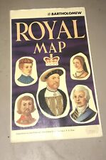 John Bartholomew Royal Map of England United Kingdom Scotland Kings and Queens
-
$63.83 CAD
 Vintage 1900 ENGLAND & WALES Map 14"x22" ~ Old Antique Original UNITED KINGDOM
-
$57.33 CAD
 Antique Map - South London in 1813
-
$38.21 CAD
 1838 Gilbert Antique Map England & Wales London Liverpool Oxford Great Britain
-
$34.13 CAD
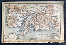 Antique Map of Plymouth Coastal England Great Britain UK
-
$57.05 CAD
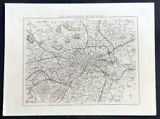 1836 Thomas Moule Antique Map of London & Environs, Barclays Dictionary
-
$1689.25 CAD
 1560 Sebastian Munster Antique Map of England Wales Parts Scotland, Ireland, 1st
-
$7.49 CAD
 Antique Ordnance Survey Folding Map Early 1900s - Sheffield, England Sheet 37
-
$23.42 CAD
 Vintage 1902 ENGLAND & WALES Map 11"x14" ~ Old Antique Original CAMBRIDGE OXFORD
-
$44.98 CAD
 Antique Map of Europe, Mitchell's School Atlas Hand Colored Print 1846 9x11.5"
-
$13.64 CAD
 1888 Mitchell Map Europe France Germany Austria Hungary Italy Greece Sweden
-
$111.91 CAD
 1790 Cary Road Map 3/4 Brentford Hounslow Belfont Staines Egham Virginia Water
-
$64.85 CAD
 1955 ORIGINAL VINTAGE MAP OF CITY OF LONDON AND VICINITY / ENGLAND
-
$784.90 CAD
 c. 1831, LARGE FOLDING MAP OF LONDON by G. CRUTCHLEY, with SLIPCASE
-
$67.15 CAD
 The ES&A Bank: Chichester's Picture Map of London - 1955 - Vintage Map
-
$38.63 CAD
 1894 ORIGINAL ANTIQUE MAP OF VICTORIA AND ALBERT MUSEUM SOUTH KENSINGTON LONDON
-
$95.54 CAD
 USSR 1939 Wall Map /Great Britain and Ireland/ Old Soviet Vintage POSTER 40"=1m
-
$27.29 CAD
 Vtg Book Central London Atlas Color Maps With Street Index Pocket-Size 1950s-60s
-
$8.18 CAD
 Vintage 1940 World Atlas City Map of Central London, England World War WWII OLD
-
$33.02 CAD
 1598 Munster Antique Print of German Double Headed Eagle, King Clovids I, Franks
-
$7.49 CAD
 Antique Ordnance Survey Folding Map Early 1900s - England & Whales Sheet 53
-
$7.49 CAD
 Antique Ordnance Survey Folding Map Early 1900s - England & Whales Sheet 27
-
$7.49 CAD
 Antique Ordnance Survey Folding Map Early 1900s - Warwick, England Sheet 184
-
$7.49 CAD
 Antique Ordnance Survey Folding Map Early 1900s - Bradford, England Sheet 69
-
$33.03 CAD
 1598 Munster Antique Print Charles IV Bohemia, Bavaria Coat of Arms, Christian
-
$13.64 CAD
 1892 Map of Europe in 912 Franks Saxony Cordoba Spain Italy Hungary Germany UK
-
$34.13 CAD
 Antique Map of Hereford England Great Britain UK
-
$23.21 CAD
 London & Vicinity - Original 1903 Dated Map by Dodd Mead & Company. Antique
-
$40.17 CAD
 1897 ANTIQUE DATED MAP OF SOUTHERN ENGLAND AND WALES / LONDON INSET MAP
-
$604.31 CAD
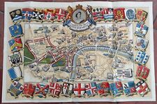 1953 Historic Queen Elizabeth II Royal Coronation Route Map London Pictorial
-
$136.50 CAD
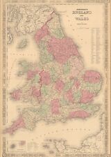
 Antique Johnson's Map Of England and Wales 1863 Civil War Era Old Map
-
$713.24 CAD
 1908 UERL Johnson & Riddle Antique London Underground Map Rare 2nd Map Published
-
$54.59 CAD
 Original 1835 LONDON Borough Maps ST. MARYLEBONE & FINSBURY England Paddington
-
$38.63 CAD
 1889 ANTIQUE MAP OF LONDON THE CITY FROM ST. PAUL'S TO THE TOWER / ENGLAND
-
$27.30 CAD
 1864 England & Wales by Johnson Ward beautiful antique map 25.8" x 17.6"
-
$88.73 CAD
 Vintage Lot of British Decor London Map, England/Scotland Road Atlas, Art Prints
-
$38.63 CAD
 1889 ORIGINAL ANTIQUE MAP OF BRITISH MUSEUM / LONDON / ENGLAND
-
$8.18 CAD
 Vintage 2 Pg 1924 Post WWI B&W City Map London England & Liverpool England L@@K!
-
$20.48 CAD
 1900'S CLEAR PRINT MAP LONDON BY GEO PHILIP & SON
-
$21.84 CAD
 Southern England & Wales - Original 1897 Map by The Century Company. Antique
-
$23.21 CAD
 Southern England & Wales - Original 1902 Map by The Century Company. Antique
-
$61.43 CAD
 18th century Surrey England Antique Map by Thomas Kitchin
-
$43.67 CAD
 1839 Boynton Map - British Islands England Scotland Wales Ireland London Dublin
-
$54.60 CAD
 Antique Map of British Museum London Great Britain UK
-
$33.99 CAD
 1885 - London United Kingdom - Vintage Geography Map ORIGINAL 11.5 x 9.5" - C11
-
$16.37 CAD
 1937 Map London England Thames Westminister Parliament Picadilly Circus Strand
-
$40.95 CAD
 Antique London National Gallery Plan 1903
-
$614.27 CAD
 1680 VISSCHER ANGLIAE REGNUM / ORIGINAL ANTIQUE MAP OF ENGLAND AND WALES
-
$33.99 CAD
 1900 London England City Vintage Geography Map ORIGINAL 11.5 x 9.5" C12-9
-
$17.73 CAD
 Original 1890 Shire Map MIDDLESEX England Uxbridge Hampstead London Greenwich
-
$102.38 CAD
 Antique 19th C London Map The Ecclesiastical Districts of Kennington Surrey
-
$27.29 CAD
 1921 Johnston Map Netherlands Belgium Luxemburg Holland Amsterdam Brussels Ghent
-
$37.88 CAD
 Vintage Color Map ~ BRITISH ISLES ~ ENGLAND IRELAND SCOTLAND WALES Printed 1883
-
$27.30 CAD
 1860 Europe antique map by Mitchell 15.3" x 12.3" - hand colored
-
$13.64 CAD
 1902 Century Map - South England Wales London Plan Stonehenge Cornwall Bristol
-
$27.29 CAD
 1880 Migeon Map - British Isles - England Wales Scotland London Great Britain UK
-
$28.00 CAD
 Vest Pocket Street Plan of Central London with Index to Streets (ca 1955)
-
$23.53 CAD
 Vintage 1901 ENGLAND WALES Map 11"x14" ~ Old Antique Original CARDIFF OXFORD
-
$47.76 CAD
 Vintage 1949 Map Of British Isles/London 4.5"Brass Plate/3.25" London Beer Stein
-
$27.29 CAD
 1879 Reclus map LONDON AND ESTUARY OF THAMES, ENGLAND, #4
-
$128.47 CAD
 1821 The PARISH OF CHRIST CHURCH SURREY Scarce Hand Coloured London Plan
-
$34.11 CAD
 1882 Antique COLOR Map / CENTRAL LONDON, ENGLAND
-
$47.78 CAD
 MAP OF LONDON, ca. 1920, plate 25 from "The Times Survey Atlas of the World."
-
$25.00 CAD
 IDEEN in STOFF 100% Silk Hand Rolled Hankerchief Le Centre De London Map ExC.
-
$34.13 CAD
 Antique Map of York England Great Britain UK
-
$13.64 CAD
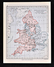 1892 Map England Wales Dec. 9, 1643 King & Parliament Districts London Original
-
$13.64 CAD
 1835 Levasseur Map - British Isles - Great Britain & Ireland - England Scotland
-
$54.59 CAD
 1810 Delalain Map British Isles Great Britain England Wales Scotland Ireland
-
$27.29 CAD
 1857 Findlay Map - Insulae Britannicae - England Scotland Ireland London Roman
-
$34.13 CAD
 Antique Map of Torquay Tor Bay England Great Britain UK
-
$70.97 CAD
 1818 D'Anville Map British Isles Roman Period Londinium Hadrians Wall England
-
$27.29 CAD
 1921 Johnston Physical Map British Isles Great Britain England Ireland Scotland
-
$34.13 CAD
 Antique Map of Worcester England Great Britain UK
-
$30.03 CAD
 Antique Map of Worcester Cathedral England Great Britain
-
$25.53 CAD
 1895 Original Color Map Europe and South America Historic 11 x 14 Map
-
$33.99 CAD
 1934 London United Kingdom - Vintage Geography Map ORIGINAL 11.5 x 9.5" - C11-9
-
$17.06 CAD
 England Wales United Kingdom 1935 Map Scotland London Europe 14 x 11" LGAD99
-
$32.62 CAD
 1899 London United Kingdom - Vintage City Map ORIGINAL 11.5 x 9.5" - C11-9
-
$51.74 CAD
 1896 London United Kingdom - Vintage Large City Map ORIGINAL 14.5 x 9.5" - C12-9
-
$29.01 CAD
 Ordinance Survey 1/4 Inch Map of Great Britain 1946 England South-West Sheet 10
-
$109.19 CAD
 1755 CITY OF LONDON MAP BY BENJAMIN COLE- CORDWAINER & BREAD STREET WARDS
-
$204.76 CAD
 LONDON CITY HALL c. 1760 LARGE ANTIQUE OPTICAL VIEW 18TH CENTURY
-
$27.29 CAD
 1881 Andrees Map Great Britain England Scotland Ireland London British Isles UK
-
$23.21 CAD
 Lot of 2 Antique Maps Americana Co 1904 England & Wales And London
-
$43.67 CAD
 1834 Carey Map British Isles England Wales Scotland Ireland London Britain UK
-
$44.98 CAD
 1794 ENGLAND & WALES ROBERT WILKINSON ORIGINAL HAND COLORED MAP EX. COND.
-
$38.22 CAD
 1877 Migeon Map - British Isles Great Britain England Scotland Ireland London UK
-
$51.74 CAD
 1896 London United Kingdom - Vintage Large City Map ORIGINAL 14.5 x 9.5" - C12-9
-
$34.13 CAD
 Antique Map of Bournemouth England Great Britain UK
-
$34.13 CAD
 Antique Map of Salisbury England Great Britain UK
-
$156.98 CAD
 1920s England Motor Tour Map Wales Great Britain Driving Car Cars Auto Road Map
-
$7.49 CAD
 Antique Ordnance Survey Folding Map Early 1900s - England & Whales Sheet 20


