 Antiques (CA)
-
$120.67 CAD

 1890 John Bartholomew Large Antique Map of the United States of America
-
$23.31 CAD
 Original 1909 Map of The Lower Provinces of Canada - Maritimes
-
$68.50 CAD
 1891 Map by John Bartholomew of China and Japan (front) and Farther India (rear)
-
$16.27 CAD
 1920 Comparative Atlas by John Bartholomew Color Maps of Astronomical Geography
-
$21.94 CAD
 Midwestern USA - Original 1909 Map by John Bartholomew. Antique
-
$16.27 CAD
 1920 Color Maps Political Features of France (no explanation of the colors!) Map
-
$16.27 CAD
 1920 Color Maps Physical Indian Empire + Farther India and the East Indies Map
-
$16.27 CAD
 1920 Color Maps of Railways of Great Britain and Geological Rainfall & Tides Map
-
$16.27 CAD
 1920 Color Maps by John Bartholomew of Physical Europe Map
-
$19.01 CAD
 1920 Color Maps Physical Africa and British South Africa Map
-
$17.82 CAD
 Original 1896 Map MEXICO Railroads Yucatan Nicaragua Canal Turrialba Volcano
-
$19.01 CAD
 1920 Color Maps Physical/Political Italy Yugo Slavia and Balkans 2X pages Map
-
$53.49 CAD
 ATLAS , MAPS A School Economic Atlas by John Bartholomew ©1912
-
$109.65 CAD
 1891 Map of Russia by John Bartholomew with St. Petersburg Insert
-
$82.96 CAD
 1870 John Bartholomew Large Antique Map of North America
-
$82.96 CAD
 1879 George Phillip & John Bartholomew Antique Map of North America
-
$13.70 CAD
 Antique Map of "New Mexico" 1888, by John Bartholomew
-
$75.00 CAD
 Bartholomew's General Map of North America, 1942
-
$19.01 CAD
 1920 Color Maps Physical/Political Features Russia Finland Sweden Norway Denmark
-
$57.31 CAD
 1890 John Bartholomew Large Antique Map of Canada
-
$19.01 CAD
 1920 Color Maps Political United States and Physical South America Map
-
$18.60 CAD
 Vintage CANADA Map Wall Art Old Original Dominion of Canada John Bartholomew
-
$30.17 CAD
 Dominion of Canada & Northern USA - Original 1883 Map by J. Bartholomew. Antique
-
$19.01 CAD
 1920 Color Maps Physical Features of Ireland and Scotland Map
-
$19.01 CAD
 1920 Color Maps Physical Dominion of Canada and Political North America Map
-
$49.77 CAD
 1890 John Bartholomew Large Antique Map of North America & Atlantic Ocean Travel
-
$19.01 CAD
 1920 Color Maps Political South America + Mexico Central America West Indies Map
-
$14.39 CAD
 WISCONSIN, United States - 1893 Antique Color Map Print - CLEARANCE ITEM
-
$82.96 CAD
 1870 John Bartholomew Large Antique Map The Western of Pacific States of America
-
$82.96 CAD
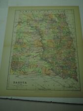
 1870 John Bartholomew Large Antique Map of The United States of America - Dakota
-
$82.96 CAD
 1870 John Bartholomew Large Antique Map of Ontario & Quebec, Canada
-
$49.77 CAD
 1890 John Bartholomew Large Antique Map North America & The Atlantic Ocean
-
$26.06 CAD
 Dominion of Canada - Eastern Part - Original Map by J. Bartholomew. C1877
-
$21.94 CAD
 Eastern USA - Original 1909 Physical Map by John Bartholomew. Antique
-
$16.27 CAD
 1920 Maps by John Bartholomew of Jan/July Rainfall &Winds Races & Religion Map
-
$16.27 CAD
 1920 Color Maps Physical Features of Switzerland and the Alps Map
-
$21.94 CAD
 Manitoba, Canada - Original 1909 Map by John Bartholomew. Antique
-
$49.77 CAD
 1890 John Bartholomew Large Antique Map of Brazil South America & Rio (41124)
-
$54.79 CAD
 1891 Map by John Bartholomew of United States (Front) and Canada (Rear)
-
$82.96 CAD
 1890 John Bartholomew Large Antique Map of The United States of America
-
$19.01 CAD
 1920 Color Maps Density of Population Greater Britain Map
-
$19.01 CAD
 1920 Color Maps Political England & Wales + Physical Scotland 2X pages Map
-
$19.01 CAD
 1920 Color Maps Physical Features Asia + North & South Polar Regions Map
-
$19.01 CAD
 1920 Color Maps Political Australia + Oceania + Victoria New South Wales Map
-
$49.77 CAD
 1890 John Bartholomew Large Antique Map North America Gulf of Mexico, Caribbean
-
$19.01 CAD
 1920 Color Maps Eastern Provinces of Canada and Physical North America Map
-
$16.27 CAD
 1920 Maps by John Bartholomew of Density Population & Commercial Development Map
-
$19.01 CAD
 1920 Color Maps Physical Australasia + Oceania Map
-
$49.77 CAD
 1890 John Bartholomew Large Antique Map of Canada Quebec & Ontario North America
-
$19.01 CAD
 1920 Color Maps Physical New Zealand & Tasmania, Old New Testament Palestine Map
-
$130.29 CAD
 1856 Black's New York VT NH RI MA CT 23.8" x 17.2" - beautiful antique color
-
$42.23 CAD
 1870 John Bartholomew Antique Map of The Bay of Naples, Italy & Gulf of Mexico
-
$16.27 CAD
 1920 Comparative Atlas by John Bartholomew Color Maps of Jan & July Temps Map
-
$42.23 CAD
 1890 John Bartholomew Large Antique Map of New England, United States of America
-
$49.77 CAD
 1890 John Bartholomew Large Antique Map of Canada Ontario & Quebec North America
-
$15.07 CAD
 VERMONT, United States - 1893 Antique Color Map Print - CLEARANCE ITEM
-
$49.77 CAD
 1890 John Bartholomew Large Antique Map Canada NFL, Manitoba & Western Provinces
-
$57.31 CAD
 1870 John Bartholomew Large Antique Map of New England, Great Lakes, Canada, NFL
-
$49.78 CAD
 1890 John Bartholomew Large Antique Map Canada Manitoba & Western Provinces, NFL
-
$8.91 CAD
 1900s Map Mexico, America 2 sided John Bartholomew Edinburgh Geographical Instit
-
$13.70 CAD
 Antique Map of "Dakota" 1888, by John Bartholomew
-
$13.70 CAD
 Antique Map of "Nevada" 1888, by John Bartholomew


