-

$153.89 CAD
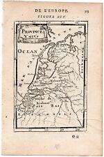
 Netherlands Nederland Low Countries Belgium Flanders Holland 1694 Mosting map
-
$58.14 CAD
 Low Countries Netherlands Holland Belgium 1861 Tardieu large hand color map
-
$177.83 CAD
 Map of Holland, Circa 1730
-
$119.70 CAD
 Gouda Netherlands Holland coat of arms detailed c.1740 de Leth old map city plan
-
$27.29 CAD
 Vintage 1895 Spain & Portugal or Holland / Belgium or Denmark Map Original Atlas
-
$27.35 CAD
 1835 Monin Fremin Antique Map Midieval Europe 800 AD Charlemagne Islamic Spain
-
$64.98 CAD
 North Holland Netherlands Nederland Friesland c.1750 de Lat miniature map
-
$51.49 CAD
 1955 VINTAGE MAP OF NETHERLANDS / HOLLAND / SCALE 1:500,000
-
$6.77 CAD
 Original 1797 George Kearsley Color Map Italy Sicily Corsica Italia Venice
-
$40.26 CAD
 1885 ANTIQUE CITY MAP OF DELFT / HOLLAND / NETHERLANDS
-
$136.79 CAD
 1696 J. Colom Map East Flanders Zeeland Netherlands Holland Bruges Damme Sluis
-
$54.70 CAD
 1779 Bonne Map C. Europe - Germany Prussia Poland Holland Austria Hungary Berlin
-
$38.11 CAD
 1908 ANTIQUE MAP OF FRANCE NETHERLANDS HOLLAND BELGIUM INDUSTRY TRANSPORTATION
-
$85.50 CAD
 United Provinces Netherlands Holland Zealand Utrecht Friesland 1700 Moll map
-
$51.30 CAD
 Kingdom of Holland Dutch Netherlands Amsterdam Rotterdam Utrecht 1809 Copper map
-
$51.30 CAD
 Netherlands Dutch Provinces Holland Utrtecht Friesland 1846 scarce map
-
$48.02 CAD
 1881 ANTIQUE CITY MAP OF ROTTERDAM / HOLLAND / NETHERLANDS
-
$32.82 CAD
 1902 Johnston Oxford Map Europe of Charles V in 1519 France Germany Spain Italy
-
$21.89 CAD
 Europe - Original 1903 Dated Physical Map by Dodd Mead & Company. Antique
-
$48.02 CAD
 1881 ANTIQUE MAP OF THE HAGUE DEN HAAG 'S‑GRAVENHAGE SCHEVENINGEN / NETHERLANDS
-
$44.46 CAD
 The Hague South Holland Den Haag La Haye c.1880 detailed tourist city plan map
-
$54.23 CAD
 1900 ORIGINAL ANTIQUE MAP OF ICELAND REYKJAVIK VERSO NETHERLAND BELGIUM DENMARK
-
$77.07 CAD
 1636 Count Earls Graf Earl Flanders Belgium Belgique Colom Holland Nederland
-
$38.30 CAD
 1830 Huntington Map Europe Spain France Austria Germany Italy Sweden Holland UK
-
$27.35 CAD
 1902 Oxford History Map Germania Sacra Middle Ages Medieval Germany Europe
-
$93.21 CAD
 Titelblatt Title Page Title Colom Holland Nederland Copperplate Engraving 1636
-
$19.84 CAD
 Vliegend Boven Nederland Flying Over Holland 1973
-
$13.67 CAD
 1887 Cowperthwait Map - Europe France Italy Germany Spain Britain Russia Norway
-
$270.17 CAD
 Holland Netherlands Provinces Luxembourg Low Countries c.1720 old color map
-
$102.60 CAD
 Amsterdam Haarlemmerpoort Holland c.1760-80 city view vue d'optique print
-
$51.30 CAD
 Holland Netherlands Amsterdam Rotterdam Utrecht Guelders c. 1856-72 Weller map
-
$85.50 CAD
 Amsterdam Holland c.1920's Vintage Europe City Plan cartoon style buildings
-
$13.67 CAD
 1882 Drioux Map Euorpe in 1715 after Louis XIV France
-
$17.71 CAD
 ORIGINL 1855 HAND-COLORD Colton Atlas Map:BRAZIL,GUYANA,RIVERS,COASTAL,Mts,TOWNS
-
$253.07 CAD
 Loevestein occupied by Herman de Ruiter Hogenberg 1573
-
$77.19 CAD
 Beemster Polder Noord-Holland Koog Nederland Map Card de La Feuille 1702
-
$273.59 CAD
 NETHERLANDS 1748 HOMANN HEIRS LARGE ANTIQUE MAP 18TH CENTURY
-
$21.87 CAD
 1896 Andrees Map - Netherlands Belgium Holland Europe Amsterdam Brussels
-
$51.30 CAD
 Low Countries Netherlands Belgium Luxembourg Holland 1821 Carey folio map
-
$101.23 CAD
 Alkmaar North Holland Netherlands City Plan Coat of Arms 1685 engraved map
-
$82.06 CAD
 1836 ORIGINAL MAP EUROPE PORTUGAL HUNGARY GERMANY HOLLAND FRANCE ROMANIA SPAIN
-
$108.34 CAD
 1696 Jacob Colom Map Gelders Duchy Arnhem Zwolle Maastricht Heusden Netherlands
-
$92.41 CAD
 Belgii Nederland Netherlands Holland Card Map Mercator 1651
-
$21.89 CAD
 Holland & Belgium - Original 1902 Dated Map by Dodd Mead & Company. Antique
-
$12.38 CAD
 Holland Deiche Deichkarte Netherlands Card Um 1898
-
$12.38 CAD
 View Of Dordrecht Grote Kerk Zuid-Holland Original Wood Engraving From 1878
-
$136.79 CAD
 1696 Jacob Colom Map Limburg Liege Belgium Maastricht Netherlands Aachen Germany
-
$77.48 CAD
 Groningen Plan Holland Nederland Netherlands Map Engraving Copperplate Engraving
-
$92.72 CAD
 1746 Medemblik Nederland Holland View Copperplate Antique Print
-
$54.70 CAD
 1839 Stieler Physical Map Europe River Basins Mountain Ranges Rhine Danube Seine
-
$102.60 CAD
 Magyarország politikai térképe On Cloth 1920-30 Hungary Map Gergely 16 X 11-1/2
-
$21.89 CAD
 1860 Johnson Map - Holland Belgium Amsterdam Brussells France Paris Netherlands
-
$108.34 CAD
 1696 Jacob Colom Map Bergen op Zoom Brabant Zeeland Netherlands Hulst Tolen EU
-
$42.58 CAD
 1830 Sydney Hall Antique Map of Holland & Belgium, The Netherlands, Luxembourg
-
$16.40 CAD
 1885 Drioux Map - Europe 1556-1648 Thirty Year War Charles V & Henry III France
-
$29.76 CAD
 1610 - Johann Banchemius Leiden Holland Portrait Copperplate Engraving
-
$170.73 CAD
 Holland Netherlands Belgium Map Card Mercator 1651
-
$65.65 CAD
 1696 Colom Map Groninga Groningen Dollard Ems Delfzijl Noordhorn Netherlands
-
$69.62 CAD
 1683 Mallet Antique Map "Pays Bas Catholiques" The Netherlands, Catholic Holland
-
$27.35 CAD
 c 1824 Hall Map - Europe - Spain France Germany Italy Austria Britain Russia
-
$54.70 CAD
 1847 Stieler Map Europe France Spain Italy Germany England Austria Sweden Norway
-
$69.62 CAD
 1683 Mallet Antique Map "Pays Bas Catholiques" Catholic Netherlands, Holland
-
$69.62 CAD
 1683 Manesson Mallet Antique Map "Provinces Unies" The Netherlands, Holland
-
$69.62 CAD
 1683 Manesson Mallet Antique Map "Provinces Unies" Holland, The Netherlands
-
$136.11 CAD
 Antique Map Grand Expedition Holland 1799 early paper
-
$46.51 CAD
 Netherlands Belgium Luxembourg Holland Flanders c. 1849 detailed Meyer map
-
$109.44 CAD
 Kollumerland Nieuw Kruisland Old map Holland Jacob Kuyper 1867
-
$29.69 CAD
 1610 Willebord Van Roijen Snell Leiden Holland Portrait Copperplate Engraving
-
$44.44 CAD
 1882 ORIGINAL MAP EUROPE POLAND HUNGARY LITHUANIA BULGARIA GERMANY FRANCE SPAIN
-
$38.29 CAD
 1855 Johnston Military Map - Napoleon Campaigns 1792 Netherlands Holland Belgium
-
$38.29 CAD
 1900 McNally Map - The Netherlands Belgium Luxembourg Holland Amsterdam Brussels
-
$67.03 CAD
 Seven United Provinces Netherlands Holland Utrecht Friesland 1790's Cary map
-
$61.34 CAD
 Valkenborg Maastricht Lounger Dalhem Holland Belgique Carte Map de La Feuille
-
$83.66 CAD
 1770 Thomas Kitchin Original Antique Map of The Seven United Provinces, Holland
-
$2051.92 CAD
 1676 ANTIQUE MAP OF JOHN SPEED A NEWE MAPE OF GERMANY / POLAND CENTRAL EUROPE
-
$77.07 CAD
 Delfland Schiedam Rotterdam Delft Den Haag Holland Map Card de La Feuille 1702
-
$61.54 CAD
 1846 ORIGINAL MAP EUROPE POLAND HUNGARY LITHUANIA ROMANIA SWEDEN IRELAND SPAIN
-
$13.68 CAD
 1832 RARE BEAUTIFUL TANNER ANTIQUE ATLAS MAP OF HOLLAND AND BELGIUM-HANDCOLORED
-
$43.76 CAD
 1845 Stieler Map Germany Holland Belgium Netherlands Amsterdam Frankfurt Brussel
-
$40.97 CAD
 Antique Map of the Netherlands - Gravenhage en Scheveningen - The Hague - Color
-
$47.86 CAD
 ANTIQUE 1859 COLTON'S ATLAS HAND COLORED ENGRAVING MAP OF HOLLAND & BELGIUM
-
$170.31 CAD
 Antique Map-Coat of arms-Province of Gelderland in 1855-Veelwaard-1855
-
$205.18 CAD
 Antique 17th Century Blaue Map England Holland Inundated Regions Norfolk ++
-
$27.36 CAD
 1864 France Holland Belgium by Johnson Ward beautiful antique map 24.8" x 17"
-
$44.46 CAD
 Low Countries Netherlands Belgium Holland Amsterdam c. 1840-45 decorative map
-
$77.22 CAD
 Veluwe Arnhem Apeldoorn Harderwijk Camping Zwolle Holland Map de La Feuille 1702
-
$21.80 CAD
 1650 - Wilhelm II V Bavaria Holland Copperplate Portrait Engraving
-
$41.04 CAD
 Netherlands Holland Zealand Brabant Flanders Amsterdam 1852 Philip engraved map
-
$51.30 CAD
 Netherlands & Belgium Amsterdam Brussels Holland Luxembourg Bruges 1858-59 map
-
$11.52 CAD
 Netherlands Nederland Holland Map From 1889 Brabant Friesland Drenthe
-
$61.34 CAD
 Bijlmermeer Amsterdam Bijlmer Noord-Holland Nederland de La Feuille 1702
-
$10.93 CAD
 ANTIQUE 1840 HOLLAND AMSTERDAM HANDCOLORED FRENCH MAP FINE SUPERB RARE DETAILED
-
$54.70 CAD
 1696 Colom Map Beemster Purmerend Amsterdam Holland Agriculture Field Tulip Plot
-
$13.67 CAD
 1853 Morse Map - Europe Austria France Germany Italy Spain Russia Great Britain
-
$24.62 CAD
 WWII Map Western Europe Allied Invasion Omaha Beach Normandy France June 6, 1944
-
$32.82 CAD
 1874 Colton Map Holland Belgium Amsterdam Brussels Utrecht Ghent Anvers Bruges
-
$15.05 CAD
 1932 Rhine River Delta Interpretive Map Print Van Loon Geography Art Pen and Ink
-
$17.51 CAD
 WWII Map Battle of Flanders Netherlands Belgium Holland Luxemburg Germany 1940
-
$85.50 CAD
 Seven United Provinces Netherlands Low Countries Holland 1780 Bonne engraved map
-
$85.50 CAD
 United Provinces Netherlands Holland 1701 by H. Moll engraved miniature map


